Category:Political maps of Portugal
Jump to navigation
Jump to search
Countries of Europe: Albania · Austria · Azerbaijan‡ · Belarus · Belgium · Bosnia and Herzegovina · Bulgaria · Croatia · Cyprus‡ · Czech Republic · Denmark · Estonia · Finland · France‡ · Georgia‡ · Germany · Greece · Hungary · Iceland · Republic of Ireland · Italy · Kazakhstan‡ · Latvia · Moldova · Montenegro · Netherlands‡ · Norway · Poland · Portugal‡ · Romania · Russia‡ · Serbia · Slovenia · Spain‡ · Sweden · Switzerland · Turkey‡ · Ukraine · United Kingdom
Specific status: Jersey – Limited recognition: Kosovo · South Ossetia‡
‡: partly located in Europe
Specific status: Jersey – Limited recognition: Kosovo · South Ossetia‡
‡: partly located in Europe
Português: Mapas políticos de Portugal
Subcategories
This category has the following 4 subcategories, out of 4 total.
Media in category "Political maps of Portugal"
The following 2 files are in this category, out of 2 total.
-
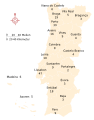
 Deputados por circulos eleitorais em Portugal Continental 2009.svg 474 × 684; 173 KB
-
 Wahlkreise von Portugal 2015.svg 545 × 693; 146 KB

