Category:Oregon Route 47
Jump to navigation
Jump to search
| 37 · 38 · 39 · 42 · 43 · 46 · 47 · 51 · 52 · 53 · 58 |
| I-5 · I-82 · I-84 · I-105 · I-205 · I-305 · I-405 · I-505 |
| US-20 · US-26 · US-30 · US-95 · US-97 · US-101 · US-197 · US-199 · US-395 · US-730 |
English: This category should contain files related to Oregon Route 47.
state highway in Oregon, United States    | |||||
| Upload media | |||||
| Instance of | |||||
|---|---|---|---|---|---|
| Location | Oregon | ||||
| Transport network | |||||
| Owned by | |||||
| Maintained by | |||||
| Inception |
| ||||
| Length |
| ||||
| |||||
Media in category "Oregon Route 47"
The following 34 files are in this category, out of 34 total.
-
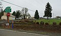
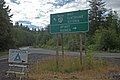 Apiaryjunction.jpg 1,613 × 1,080; 172 KB
-
 Banks High School Oregon.JPG 3,516 × 2,087; 2.59 MB
-
 Banks Sunset Park.jpg 5,472 × 3,648; 1.5 MB
-
 Banks, Oregon-1.jpg 4,444 × 2,963; 886 KB
-
 Banks, Oregon-2.jpg 5,472 × 3,648; 808 KB
-
 Banks, Oregon-3.jpg 4,823 × 3,215; 1.1 MB
-
 Banks-Vernonia State Trail.jpg 5,472 × 3,648; 2.92 MB
-
 Billiards Tavern (Banks, Oregon).jpg 5,472 × 3,648; 1.21 MB
-
 Cafe in Vernonia, Oregon.jpg 1,280 × 960; 202 KB
-
 Carlton Oregon Main Street - OR47.JPG 3,012 × 2,204; 2.36 MB
-
 Dairy Queen - Manning, Oregon.JPG 1,615 × 957; 614 KB
-
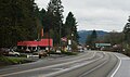
 Gaston Oregon.JPG 3,872 × 2,592; 4.02 MB
-
 Intersection of Greenville Road and OR47 - Greenville, Oregon.JPG 3,298 × 1,939; 2.26 MB
-
 Main Street in Carlton Oregon.JPG 3,872 × 2,592; 3.94 MB
-
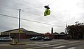
 Manning bus stop @ Dairy Queen - NorthWest POINT (5937373952).jpg 2,736 × 3,648; 2.06 MB
-
 Manning Oregon sign.jpg 4,370 × 2,939; 5.91 MB
-
 Manning, Oregon - NorthWest POINT (5937416082).jpg 3,648 × 2,736; 2.9 MB
-
 Mist-Clatskanie Highway 110.svg 1,152 × 640; 232 KB
-
 Natal Grange (Columbia County, Oregon scenic images) (colDA0001).jpg 324 × 488; 30 KB
-
 Natal Grange (Columbia County, Oregon scenic images) (colDA0002).jpg 488 × 324; 36 KB
-
 Nehalem Highway 102.svg 1,152 × 640; 402 KB
-
 OR 47 Mist collapse (51807237140).jpg 3,024 × 4,032; 3.09 MB
-
 OR 47.svg 600 × 600; 6 KB
-
 Oregon Route 47 at Banks-Vernonia Trail at Beaver Creek trailhead - Oregon.JPG 3,119 × 2,592; 2.75 MB
-
 Oregon Route 47 in Banks.JPG 3,307 × 2,412; 3.07 MB
-
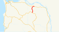
 Oregon Route 47.svg 1,152 × 640; 526 KB
-
 Start of Oregon Route 47 in Clatskanie, Oregon..JPG 4,320 × 3,240; 5.3 MB
-
 Sunset Laundry (Banks, Oregon).jpg 5,472 × 3,648; 1.5 MB
-
 Tualatin Valley Highway 29.svg 1,152 × 640; 217 KB
-
 Vernonia 1.jpg 3,577 × 2,385; 834 KB
-
 Vernonia, Oregon.jpg 5,472 × 3,648; 1.18 MB
-
 Welcome to Vernonia.jpg 5,472 × 3,648; 2.25 MB
-
 West Oregon Electric Co-op - Vernonia, Oregon.JPG 2,868 × 1,831; 1.62 MB
-
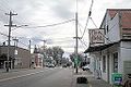
 Yamhill Oregon commerical district Maple Street.JPG 3,442 × 2,367; 2.52 MB


.jpg)


.jpg)

.jpg)

_(colDA0001).jpg)
_(colDA0002).jpg)

.jpg)


.jpg)


