Category:Old maps of Latvia
Jump to navigation
Jump to search
Countries of Europe: Albania · Andorra · Armenia‡ · Austria · Azerbaijan‡ · Belarus · Belgium · Bosnia and Herzegovina · Bulgaria · Croatia · Cyprus‡ · Czech Republic · Denmark · Estonia · Finland · France‡ · Georgia‡ · Germany · Greece · Hungary · Iceland · Republic of Ireland · Italy · Kazakhstan‡ · Latvia · Lithuania · Luxembourg · Malta · Moldova · Monaco · Montenegro · Netherlands‡ · Norway · Poland · Portugal‡ · Romania · Russia‡ · Serbia · Slovakia · Slovenia · Spain‡ · Sweden · Switzerland · Turkey‡ · Ukraine · United Kingdom · Vatican City
Specific status: Faroe Islands · Gibraltar · Bailiwick of Guernsey · Isle of Man · Jersey · Svalbard – Limited recognition: Kosovo · Transnistria
‡: partly located in Europe
Specific status: Faroe Islands · Gibraltar · Bailiwick of Guernsey · Isle of Man · Jersey · Svalbard – Limited recognition: Kosovo · Transnistria
‡: partly located in Europe
Use the appropriate category for maps showing all or a large part of Latvia. See subcategories for smaller areas:
| If the map shows | Category to use |
|---|---|
| Latvia on a recently created map | Category:Maps of Latvia or its subcategories |
| Latvia on a map created more than 70 years ago | Category:Old maps of Latvia or its subcategories |
| the history of Latvia on a recently created map | Category:Maps of the history of Latvia or its subcategories |
| the history of Latvia on a map created more than 70 years ago | Category:Old maps of the history of Latvia or its subcategories |
Subcategories
This category has the following 9 subcategories, out of 9 total.
Media in category "Old maps of Latvia"
The following 83 files are in this category, out of 83 total.
-
 Atlas Ortelius KB PPN369376781-082av-082br.jpg 3,000 × 2,194; 4.7 MB
-
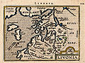
 Livonia sive Liefland.jpg 2,038 × 1,581; 4.83 MB
-
 Map - Special Collections University of Amsterdam - OTM- HB-KZL 31-07-30.tif 7,636 × 6,440; 140.69 MB
-
 Ducatuum Livoniæ et Curlandiæ Nova Tabula.jpg 4,089 × 3,400; 7.75 MB
-
 17ct map with current borders of Belarus.jpg 3,968 × 3,363; 4.43 MB
-
 KRUSE(1846) p655 Map.jpg 5,572 × 4,284; 5.76 MB
-
 LELEWEL(1846) Polen im Jahr 992.jpg 838 × 809; 622 KB
-
 1889. gada Latvijas karte.png 2,160 × 1,517; 8.4 MB
-
 SAPUNOV(1893) -37- p461.jpg 1,297 × 2,151; 1.31 MB
-
 SAPUNOV(1893) -70- p575.jpg 1,363 × 1,297; 949 KB
-
 SAPUNOV(1893) -71- p579.jpg 1,392 × 1,325; 958 KB
-
 SAPUNOV(1893) -77- p593.jpg 1,368 × 1,332; 938 KB
-
 SAPUNOV(1893) -81- p601.jpg 2,055 × 2,237; 2.22 MB
-
 SAPUNOV(1893) -82- p603.jpg 1,378 × 684; 435 KB
-
 SAPUNOV(1893) -83- p603.jpg 1,378 × 702; 497 KB
-
 BAEDEKER(1914) p127 Latvia, (Jelgava) Mitau.jpg 2,394 × 2,044; 558 KB
-
 BAEDEKER(1914) p127 Latvia, (Liepāja) Libau.jpg 2,382 × 1,524; 490 KB
-
 1937. gads.jpg 480 × 480; 72 KB
-

-

-
 Alte Gräber und Schlossberge bei dem Pastorate Ascheraden.png 6,664 × 3,488; 55.24 MB
-
 Atlas von Liefland 4.tif 1,428 × 1,024; 4.18 MB
-
 Blaeu 1645 - Livonia vulgo Lyefland.jpg 3,616 × 3,044; 1.13 MB
-
 Bm03036am.jpg 302 × 480; 42 KB
-
 Bm04066abm.jpg 640 × 589; 126 KB
-
 Bm04067abm.jpg 640 × 440; 115 KB
-
 Bm05042am.jpg 299 × 480; 57 KB
-
 Carte de la Livonie ou Lifland.jpg 2,198 × 1,985; 5.88 MB
-
 Carte historique de la Lettonie vue à Sigulda.jpg 3,454 × 2,489; 10.24 MB
-
 Cum privilegio.jpg 3,810 × 2,950; 5.66 MB
-
 Daugavas salas 17. gs. Broce.jpg 1,200 × 776; 227 KB
-
 Denikine decomposition4.jpg 489 × 344; 25 KB
-
 Deutsch-russische Grenzlande.jpg 2,701 × 4,000; 1.56 MB
-
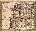
 Die Hertzogthümer Curland und Liefland.jpg 1,957 × 1,361; 4.24 MB
-
 Ducatuum Livoniae et Curlandiae Nova Tabula, 1705.jpg 4,089 × 3,400; 4.27 MB
-
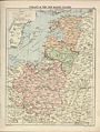
 Estonia and Livonia Governorates.jpg 3,335 × 2,481; 3.02 MB
-
 Island19x1024.jpg 1,024 × 786; 130 KB
-
 Jaunlatgale.jpg 1,038 × 1,017; 1.41 MB
-
 Koknese1625.jpg 1,794 × 2,428; 985 KB
-
 Kokneses pils 1700.jpg 640 × 493; 115 KB
-
 La Livonie avec les frontieres de Courlande et de Finlande.jpg 2,928 × 2,377; 3.42 MB
-
 Latv Kriev karte.jpg 1,081 × 1,754; 1.86 MB
-
 Latvia. LOC 99442668.jpg 2,532 × 3,276; 710 KB
-
 Latvia. LOC 99442668.tif 2,532 × 3,276; 23.73 MB
-
 Latvijas apriņķi 1924-1945.png 1,522 × 972; 1.18 MB
-
 Lettisches Sprachgebiet 1884 nach Bielenstein.jpg 4,661 × 3,943; 12.29 MB
-
 Livland 15jh.png 1,000 × 900; 2.23 MB
-
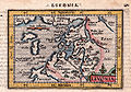
 Livonia Blaeu.jpg 3,166 × 2,449; 6.56 MB
-
 Livonia Islande.jpg 945 × 710; 1.05 MB
-
 Livonia Pomerania.jpg 1,093 × 764; 666 KB
-
 LIVONIA vulgo Lyefland-Joan Blaeu, 1662.jpg 3,968 × 3,094; 4.27 MB
-
 Livoniae descriptio.jpg 1,044 × 817; 1.34 MB
-
 Livonie, Curlande et Samogitie.jpg 1,608 × 1,407; 3.03 MB
-
 Livoniæ et Curlandiæ Tabula.jpg 3,224 × 2,728; 4.24 MB
-
 London-geographical-institute the-peoples-atlas 1920 poland-and-the-new-baltic-states.jpg 3,012 × 3,992; 2.02 MB
-
 London-geographical-institute the-peoples-atlas 1920 russian-battlefronts.jpg 3,012 × 3,992; 1.97 MB
-
 Lāčplēsis Schauplätze.jpg 1,708 × 1,710; 2.44 MB
-
 Map of European Russia in 1791 by Reilly 060.jpg 597 × 787; 215 KB
-
 Map of European Russia in 1791 by Reilly 064.jpg 1,226 × 867; 463 KB
-
 Map of European Russia in 1791 by Reilly 065.jpg 1,117 × 857; 441 KB
-
 Map of Kokenhusen (Koknese) in 1842.jpg 2,813 × 2,299; 2.19 MB
-
 Map of Koknese in 1701.jpg 988 × 765; 541 KB
-
 Map Of Samogitia, 1919.jpg 1,024 × 918; 216 KB
-
 Map of the partition of the Kingdom of Poland and the Grand Duchy of Lithuania from 1799.jpg 6,330 × 5,677; 6.83 MB
-
 Map of Valka County (colored, parish and estate borders) (1904).jpg 10,378 × 8,513; 22.92 MB
-
 Map of Valmiera County (colorless, parish and estate borders) (1903).png 9,836 × 13,936; 265.55 MB
-
 Merkel, Liefland im Anfange des 13ten Jahrhunderts.jpg 2,004 × 1,933; 612 KB
-
 Nova totius Livoniæ accurata descriptio.jpg 4,188 × 3,209; 8.16 MB
-
 Oldlibau.jpg 1,000 × 744; 285 KB
-
 Ortelius, Abraham Septentrionalivm regionvm descrip.jpg 6,044 × 4,506; 7.47 MB
-
 Pa etnogrāfisko Kursu, 18.jpg 1,177 × 1,810; 690 KB
-
 Poland & The New Baltic States.jpg 1,376 × 1,784; 1.22 MB
-

-
 Selburgische und Nerstsche Kirschpiel 1770.jpg 769 × 581; 277 KB
-
 Shubert map - R07L01.jpg 7,481 × 5,715; 12.38 MB
-
 Shubert map - R08L03v2.jpg 7,672 × 5,899; 16.5 MB
-
 Shubert map - R08L04v2.jpg 7,507 × 5,578; 13.46 MB
-
 Sw BalticPr 17cen.jpg 1,410 × 1,479; 1.4 MB
-
 USSR map NN 35-2 -verso- Daugavpils and Vicinity.jpg 2,455 × 2,431; 1.33 MB
-
 WIG Mapa Operacyjna Polski - 28 Głębokie-Dyneburg 1933.jpg 8,656 × 7,841; 14.82 MB
-
 Бебербекское мельничное озеро на 2-х верстовой карте.png 769 × 293; 526 KB
-
 Карта Рижскаго наместничества (1792).jpg 6,781 × 5,497; 6.86 MB
-
 Река Ланга на карте начала XX века.jpg 1,811 × 1,711; 720 KB


_p655_Map.jpg)
_Polen_im_Jahr_992.jpg)

_-37-_p461.jpg)
_-70-_p575.jpg)
_-71-_p579.jpg)
_-77-_p593.jpg)
_-81-_p601.jpg)
_-82-_p603.jpg)
_-83-_p603.jpg)
_p127_Latvia,_(Jelgava)_Mitau.jpg)
_p127_Latvia,_(Liep%C4%81ja)_Libau.jpg)

.jpg)
.jpg)


_in_1842.jpg)


_(1904).jpg)
_(1903).png)


.jpg)
