Category:Old maps of Czechia
Jump to navigation
Jump to search
Countries of Europe: Albania · Andorra · Armenia‡ · Austria · Azerbaijan‡ · Belarus · Belgium · Bosnia and Herzegovina · Bulgaria · Croatia · Cyprus‡ · Czech Republic · Denmark · Estonia · Finland · France‡ · Georgia‡ · Germany · Greece · Hungary · Iceland · Republic of Ireland · Italy · Kazakhstan‡ · Latvia · Lithuania · Luxembourg · Malta · Moldova · Monaco · Montenegro · Netherlands‡ · Norway · Poland · Portugal‡ · Romania · Russia‡ · Serbia · Slovakia · Slovenia · Spain‡ · Sweden · Switzerland · Turkey‡ · Ukraine · United Kingdom · Vatican City
Specific status: Faroe Islands · Gibraltar · Bailiwick of Guernsey · Isle of Man · Jersey · Svalbard – Limited recognition: Kosovo · Transnistria
‡: partly located in Europe
Specific status: Faroe Islands · Gibraltar · Bailiwick of Guernsey · Isle of Man · Jersey · Svalbard – Limited recognition: Kosovo · Transnistria
‡: partly located in Europe
Use the appropriate category for maps showing all or a large part of Czech Republic. See subcategories for smaller areas:
| If the map shows | Category to use |
|---|---|
| Czech Republic on a recently created map | Category:Maps of Czechia or its subcategories |
| Czech Republic on a map created more than 70 years ago | Category:Old maps of Czechia or its subcategories |
| the history of Czech Republic on a recently created map | Category:Maps of the history of Czechia or its subcategories |
| the history of Czech Republic on a map created more than 70 years ago | Category:Old maps of the history of Czechia or its subcategories |
Subcategories
This category has the following 16 subcategories, out of 16 total.
Media in category "Old maps of Czechia"
The following 63 files are in this category, out of 63 total.
-
 "Ducatus silesiae grotganus cum districtu episcopali nissensi" (21637713563).jpg 3,978 × 2,982; 2.6 MB
-
 Otradov na staré mapě.jpg 3,024 × 4,032; 2.6 MB
-

-
 1850 Perthes Map of Bohemia ( Czech Republic ) - Geographicus - Boheme-perthes-1850.jpg 4,000 × 3,304; 3.58 MB
-
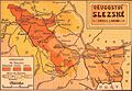 Duchy of Silesia 1912.jpg 2,043 × 1,417; 805 KB
-
 38 of 'Malebné cesty po Praze' (11166486286).jpg 2,676 × 1,200; 889 KB
-

-

-
 AustroPrussianWar NorthernBattlefield.png 1,508 × 1,131; 707 KB
-
 Bahnkarte Deutschland 1899.jpg 4,710 × 3,622; 17.63 MB
-
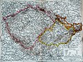 Böhmen Mähren Österreich Schlesien.jpg 2,537 × 1,906; 2.28 MB
-
 Carlsbadt ort.jpg 420 × 300; 34 KB
-
 Chotoun.jpg 995 × 843; 514 KB
-
 Czechs and Slovaks in Austria-Hungary, 1917.jpg 671 × 869; 451 KB
-
 Eisenbahnkarte Deutschland 1908-Wm05514a.jpg 5,732 × 4,488; 10.15 MB
-
 File-Spezialkarte 4154 Ledeč und Wlaschim 300 dpi frb klein.jpg 7,130 × 5,694; 12.22 MB
-
 Geological map prague bohemia 1877.jpg 3,882 × 2,856; 1.48 MB
-
 Geologische-Karte-von-Böhmen-II-Umgebung-von-Teplitz-bis-Reichenberg.jpg 8,464 × 6,492; 12.59 MB
-
 Graslitz Stadtplan 1924 (2).jpg 2,916 × 3,702; 2.34 MB
-
 Graslitz Stadtplan 1924 (3).jpg 2,000 × 3,232; 2.2 MB
-
 Graslitz Stadtplan 1924.jpg 2,880 × 3,918; 4.27 MB
-

-
 Kuks h ikonografie07.jpg 3,334 × 3,766; 1.75 MB
-
 Kuks h ikonografie07a.jpg 1,505 × 1,625; 499 KB
-
 Kuks h ikonografie07b.jpg 1,508 × 862; 252 KB
-
 Kuks h ikonografie07d.jpg 1,200 × 636; 161 KB
-
 Lager bey Nollendorf.jpg 3,260 × 2,529; 2.33 MB
-

-
 Lípy 1.JPG 574 × 460; 55 KB
-
 Mapa Československa 1935.jpg 3,208 × 1,489; 1.74 MB
-
 Mappa Králowstwí Českého.jpg 600 × 534; 211 KB
-
 Militärische Situationskarte.jpg 2,795 × 2,120; 1.5 MB
-
 Namnice pol. 19. století.jpg 1,116 × 1,620; 1.16 MB
-
 Největší rozmach české moci na rozhraní století XIII. a XIV.jpg 1,472 × 1,467; 534 KB
-
 Náběh Jana Lucemburského k založení české velmoci v druhé třetině století XIV.jpg 1,468 × 1,361; 456 KB
-
 Oleska3.jpg 844 × 874; 492 KB
-
 Panství habsburské v XVI. století.jpg 952 × 823; 191 KB
-

-

-
 Plan des Gefechtsterrains bei Gradlitz.jpg 4,953 × 6,251; 7.63 MB
-
 Plan des Schlachtfeldes bei Lobositz am 1ten October 1756.jpg 4,930 × 6,259; 6.2 MB
-
 Plan des Schlachtfeldes von Königgrätz - Nordwestliches Viertel.jpg 5,070 × 6,321; 9.21 MB
-
 Plan des Schlachtfeldes von Königgrätz - Nordöstliches Viertel.jpg 4,998 × 6,333; 9.31 MB
-
 Plan des Schlachtfeldes von Königgrätz - Südwestliches Viertel.jpg 5,061 × 6,275; 10 MB
-
 Plan des Schlachtfeldes von Königgrätz - Südöstliches Viertel.jpg 5,030 × 6,264; 7.78 MB
-
 Plan Hradu Kozi.jpg 1,762 × 1,551; 742 KB
-
 Propagační mapka v La Nation Tchèque.jpg 987 × 514; 119 KB
-
 Republika po Anschlussu.jpg 1,117 × 703; 182 KB
-
 Rozsah české moci na počátku války třicetileté.jpg 1,490 × 1,375; 460 KB
-
 Rozsah českého státu od polovice XVIII. století do světové války.jpg 613 × 420; 49 KB
-
 Spezialkarte 4251 Nepomuk und Horazdowitz.jpg 7,005 × 5,385; 30.28 MB
-
 Spezialkarte 4252 Pisek und Blatna mit Rahmen.jpg 6,886 × 5,383; 26.12 MB
-
 Stadtplan Reichenberg 1930 Liberec 1930.jpg 9,657 × 6,488; 10.53 MB
-
 Statistisch-topographische Finanz-Karte des Königreiches Boehmen.jpg 11,819 × 8,829; 13.47 MB
-
 Vetterova mapa Čech — výřez Klatovska.png 663 × 453; 444 KB
-
 Vojníkov polovina 19tého století.png 430 × 400; 441 KB
-
 Václav Skalník - úpravy v Mariánských Lázních.jpg 600 × 513; 62 KB
-
 Země Koruny české.jpg 2,847 × 2,260; 1.11 MB
-
 Zámek Veselí nad Moravou 04.jpg 671 × 960; 230 KB
-
 Polska a Czechy - porównanie produkcyi rolnej między Polską a Czechosłowacyą. (68904964).jpg 16,790 × 20,704; 54.81 MB
-
 Česká velmoc v druhé polovici století XIV.jpg 1,477 × 1,357; 459 KB
-

-

.jpg)

_-_Geographicus_-_Bohemia-cary-1801.jpg)
_-_Geographicus_-_Boheme-perthes-1850.jpg)

.jpg)
%27_(11048180674).jpg)
.jpg)


.jpg)
.jpg)


.jpg)

.jpg)
.jpg)