Category:November 2008 in the East Riding of Yorkshire
Jump to navigation
Jump to search
Ceremonial counties of England: Bedfordshire · Berkshire · Buckinghamshire · Cambridgeshire · Cheshire · Cornwall · Cumbria · Derbyshire · Devon · Dorset · Durham · East Riding of Yorkshire · East Sussex · Essex · Gloucestershire · Greater London · Greater Manchester · Hampshire · Herefordshire · Hertfordshire · Isle of Wight · Kent · Lancashire · Leicestershire · Lincolnshire · Merseyside · Norfolk · North Yorkshire · Northamptonshire · Northumberland · Nottinghamshire · Oxfordshire · Rutland · Shropshire · Somerset · South Yorkshire · Staffordshire · Suffolk · Surrey · Tyne and Wear · Warwickshire · West Midlands · West Sussex · West Yorkshire · Wiltshire · Worcestershire
City-counties: Bristol ·
Former historic counties:
Other former counties:
City-counties: Bristol ·
Former historic counties:
Other former counties:
Deutsch: Bilder, die im November 2008 in the East Riding of Yorkshire aufgenommen worden sind. Bitte beachten Sie, dass dies weder das Datum des Uploads noch das Datum des Scannens eines Fotos ist.
English: Images/pictures taken in the East Riding of Yorkshire during November 2008. Note this is not the date of the upload, nor the date a photo was scanned.
Español: Fotografías o imágenes tomadas en the East Riding of Yorkshire durante noviembre 2008. No es la fecha de subida ni escaneo, sino la fecha en que las fotografías o imágenes se crearon.
Esperanto: Bildoj faritaj en the East Riding of Yorkshire en novembro 2008. Tio ne estas la dato, kiam la bildoj estis alŝutitaj aŭ skanitaj.
Français : Photographies ou images prises en the East Riding of Yorkshire durant novembre 2008. Ce n'est pas la date du téléchargement ou du scan.
Galego: Fotografías ou imaxes tomadas en the East Riding of Yorkshire durante novembro 2008. Non é a data de subida nin escaneamento, senón a data na que se crearon as fotografías ou imaxes.
Italiano: Fotografie o immagini scattate a the East Riding of Yorkshire nel novembre 2008. Nota bene: la data non si riferisce né a quella di upload né a quella in cui la foto è stata digitalizzata.
Norsk bokmål: Bilder tatt i the East Riding of Yorkshire i løpet av november 2008. Merk at dette ikke er datoen for opplasting, eller når et bilde har blitt skannet.
Norsk nynorsk: Bilete teke i the East Riding of Yorkshire i løpet av november 2008. Merk at dette ikkje er datoen for opplasting, eller når eit bilete har vorte skanna.
Русский: Изображения, сделанные в the East Riding of Yorkshire в течение ноябрь 2008 (не дата загрузки изображения).
Українська: Зображення, зроблені в the East Riding of Yorkshire протягом листопад 2008. Зауважте, що це не дата завантаження чи дата сканування фотографії.
| November 2007 | ← | November 2008 | → | November 2009 | |||||||
| Jan | Feb | Mar | Apr | May | Jun | Jul | Aug | Sep | Oct | Nov | Dec |
| 269 | 503 | 525 | 507 | 737 | 327 | 436 | 406 | 149 | 154 | 319 | 181 |
|---|---|---|---|---|---|---|---|---|---|---|---|
Subcategories
This category has the following 2 subcategories, out of 2 total.
Media in category "November 2008 in the East Riding of Yorkshire"
The following 200 files are in this category, out of 317 total.
(previous page) (next page)-
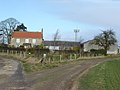
 South Cave1.jpg 3,264 × 2,038; 818 KB
-
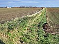 Footpath across Cawkeld Field - geograph.org.uk - 1043505.jpg 640 × 478; 500 KB
-
 Towards Cawkeld Chalk Pit - geograph.org.uk - 1043506.jpg 640 × 381; 302 KB
-

-
 A building near the warehouse - geograph.org.uk - 1053403.jpg 640 × 385; 303 KB
-
 A clear space on the Holiday Chalet site - geograph.org.uk - 1047968.jpg 640 × 427; 309 KB
-
 A corner house in Southburn - geograph.org.uk - 1052826.jpg 640 × 427; 477 KB
-
 A cottage near Eastburn.jpg 640 × 427; 382 KB
-
 A disused windmill Hutton Cranswick.jpg 640 × 427; 382 KB
-
 A driveway to Eastburn Farm - geograph.org.uk - 1052839.jpg 640 × 427; 524 KB
-
 A groyne on Withernsea beach - geograph.org.uk - 1050927.jpg 427 × 640; 403 KB
-
 A horse's house on Holmpton Road, Hollym - geograph.org.uk - 1055514.jpg 640 × 427; 325 KB
-
 A Misty Humber View - geograph.org.uk - 1035256.jpg 640 × 481; 44 KB
-
 A model pier - geograph.org.uk - 1049816.jpg 640 × 427; 289 KB
-
 A new building on the old aerodrome - geograph.org.uk - 1044313.jpg 640 × 378; 366 KB
-
 A track near Eastburn Lodge - geograph.org.uk - 1053402.jpg 640 × 427; 335 KB
-
 A wet field near Hutton Cranswick - geograph.org.uk - 1044337.jpg 640 × 427; 370 KB
-
 A white cottage on the junction, Burnby - geograph.org.uk - 1034621.jpg 640 × 396; 195 KB
-
 A white cottage, Watton Carrs - geograph.org.uk - 1043400.jpg 640 × 427; 386 KB
-
 A white house Hutton Cranswick.jpg 640 × 434; 286 KB
-
 A164 entering Cranswick.jpg 640 × 427; 275 KB
-
 A164 to Driffield - geograph.org.uk - 1042556.jpg 640 × 427; 308 KB
-
-
 Across the A164 towards Highfield Farm - geograph.org.uk - 1055637.jpg 640 × 427; 315 KB
-

-
 Airfield at Mount Airy - geograph.org.uk - 1069306.jpg 640 × 480; 54 KB
-
 All Saints Church Kilnwick 2.jpg 640 × 427; 348 KB
-
 All Saints Church Kilnwick Churchyard.jpg 640 × 427; 338 KB
-
 All Saints Church North Cave.jpg 640 × 480; 62 KB
-
 Anonymous lane through wheatfields - geograph.org.uk - 1042520.jpg 640 × 427; 388 KB
-
 Another Workday Begins - geograph.org.uk - 1051590.jpg 640 × 480; 36 KB
-
 Arras Wold Farm - geograph.org.uk - 1069158.jpg 640 × 480; 94 KB
-
 Autumnal Ivy Lane - geograph.org.uk - 1029518.jpg 511 × 640; 209 KB
-
 Autumnal Station Road - geograph.org.uk - 1051602.jpg 640 × 480; 155 KB
-
 Autumnal Station Road, Hedon - geograph.org.uk - 1042745.jpg 480 × 640; 159 KB
-
 Barges at Grovehill, Beverley - geograph.org.uk - 1039381.jpg 640 × 636; 206 KB
-
 Barmbyfield House - geograph.org.uk - 1048873.jpg 640 × 474; 79 KB
-
 Beach at Hollym.jpg 404 × 640; 277 KB
-
 Beach debris, Old Hive - geograph.org.uk - 1048596.jpg 640 × 427; 341 KB
-
 Beck Side from Spout Hall - geograph.org.uk - 1053408.jpg 640 × 405; 394 KB
-
 Beswick Hall - geograph.org.uk - 1042594.jpg 640 × 427; 364 KB
-
 Beswick Heads - geograph.org.uk - 1042613.jpg 640 × 427; 369 KB
-
 Beswick Heads - geograph.org.uk - 1042641.jpg 640 × 427; 310 KB
-
 Beverley 6 Driffield 7 - geograph.org.uk - 1042567.jpg 518 × 640; 578 KB
-
 Brantingham Church at Dusk - geograph.org.uk - 1056125.jpg 640 × 480; 77 KB
-
 Brantingham Pond - geograph.org.uk - 1056949.jpg 640 × 480; 105 KB
-
 Brantingham Village Hall - geograph.org.uk - 1056130.jpg 640 × 480; 66 KB
-
 Bridge Farm Hayton.jpg 640 × 427; 207 KB
-
 Burnbutts Lane - geograph.org.uk - 1044317.jpg 640 × 427; 333 KB
-
 Burnbutts Lane - geograph.org.uk - 1044326.jpg 640 × 427; 367 KB
-
 Burnbutts Lane - geograph.org.uk - 1044331.jpg 640 × 427; 354 KB
-
 Burstwick Drain - geograph.org.uk - 1052952.jpg 504 × 640; 90 KB
-
 By Cliffe Road, North Newbald - geograph.org.uk - 1048132.jpg 480 × 640; 195 KB
-
 Caravan sales Hutton Cranswick.jpg 640 × 427; 256 KB
-
 Cawkeld Field - geograph.org.uk - 1043498.jpg 640 × 427; 412 KB
-
 Cawkeld Field - geograph.org.uk - 1043500.jpg 640 × 427; 372 KB
-
 Church and Churchyard, St Giles, Burnby - geograph.org.uk - 1034619.jpg 640 × 381; 186 KB
-
 Church Lane Hutton.jpg 640 × 342; 231 KB
-
 Church Lane Kilnwick.jpg 640 × 427; 340 KB
-
 Cliffe Dales Farm - geograph.org.uk - 1069293.jpg 640 × 480; 67 KB
-
 Cliffs near Holmpton.jpg 640 × 427; 268 KB
-
 Clitheroe - geograph.org.uk - 1052911.jpg 640 × 480; 82 KB
-

-
 Coastal erosion south of Intack farm - geograph.org.uk - 1055483.jpg 640 × 427; 343 KB
-
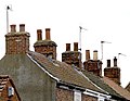 Cottage Chimneys in Baxtergate - geograph.org.uk - 1042748.jpg 640 × 494; 96 KB
-
 Cottam Church - geograph.org.uk - 1051958.jpg 640 × 480; 47 KB
-
 Cottam House Farm field entrance - geograph.org.uk - 1051951.jpg 640 × 480; 149 KB
-
 Cranswick Methodist Church.jpg 640 × 427; 288 KB
-
 Cranswick Post Office.jpg 640 × 427; 381 KB
-
 Cranswick War Memorial.jpg 640 × 427; 291 KB
-
 Crossing the Yorkshire Wolds Prairies - geograph.org.uk - 1043508.jpg 640 × 427; 335 KB
-
 Davenport Avenue, Hessle - geograph.org.uk - 1052676.jpg 640 × 481; 171 KB
-

-
 Drewton Farm Converted - geograph.org.uk - 1056978.jpg 640 × 480; 76 KB
-
 Drive to Poplar Grange, Wyton - geograph.org.uk - 1030391.jpg 640 × 480; 215 KB
-
 E VII R Postbox, Davenport Avenue - geograph.org.uk - 1051774.jpg 481 × 640; 142 KB
-
 Early Morning Tree - geograph.org.uk - 1063173.jpg 480 × 640; 51 KB
-
 Elmswell Wold Farm buildings - geograph.org.uk - 1052078.jpg 640 × 480; 59 KB
-
 Elmswell Wold Farmhouse - geograph.org.uk - 1052025.jpg 640 × 480; 138 KB
-

-
 Entering Barmby Moor from the east - geograph.org.uk - 1051617.jpg 640 × 427; 413 KB
-
 Entering Pocklington from the west - geograph.org.uk - 1053400.jpg 640 × 382; 281 KB
-
 Entrance to Carechair.jpg 640 × 377; 257 KB
-
 Entrance to re-used aerodrome - geograph.org.uk - 1053277.jpg 640 × 427; 301 KB
-
 Entrance to works area Danes Graves - geograph.org.uk - 1051867.jpg 640 × 480; 78 KB
-
 Farm track west of Rudston - geograph.org.uk - 1038759.jpg 640 × 480; 80 KB
-

-
 Farmland Drainage Channel - geograph.org.uk - 1042836.jpg 480 × 640; 166 KB
-
 Farmland south of Kilnwick - geograph.org.uk - 1042654.jpg 640 × 427; 379 KB
-
 Farmland south of Kilnwick - geograph.org.uk - 1042656.jpg 640 × 427; 346 KB
-
 Farmland south of South Dalton - geograph.org.uk - 1058379.jpg 640 × 501; 199 KB
-
 Fence Shadow on Autumnal Leaves - geograph.org.uk - 1029522.jpg 640 × 480; 203 KB
-
 Feoffee Common Farm - geograph.org.uk - 1049603.jpg 640 × 480; 150 KB
-
 Fields to the east of Bustard Nest Farm - geograph.org.uk - 1044322.jpg 640 × 427; 419 KB
-
 Footpath beside Beswick Heads Plantation - geograph.org.uk - 1042634.jpg 427 × 640; 510 KB
-
 Footpath by Etton West Wood - geograph.org.uk - 1058355.jpg 640 × 445; 167 KB
-
 Footpath to Lockington - geograph.org.uk - 1042608.jpg 640 × 417; 300 KB
-
 Footpath to Watton - geograph.org.uk - 1043264.jpg 640 × 427; 421 KB
-
 Four Winds Kelleythorpe.jpg 640 × 381; 322 KB
-
 From Beswick to Beverley - geograph.org.uk - 1042563.jpg 640 × 395; 283 KB
-
 From Mount Airy into Woo Dale - geograph.org.uk - 1069289.jpg 640 × 480; 110 KB
-
 From the A164 to Kilnwick - geograph.org.uk - 1043271.jpg 640 × 427; 327 KB
-
 Frosty Web - geograph.org.uk - 1063145.jpg 638 × 640; 164 KB
-
 Getting some air IMG 9074 - panoramio.jpg 1,240 × 1,400; 542 KB
-
 Gormary Hall lane end - geograph.org.uk - 1042517.jpg 640 × 374; 317 KB
-
 Gravestones at St Peters Hutton.jpg 640 × 427; 340 KB
-
 Grazing near South Newbald - geograph.org.uk - 1048010.jpg 640 × 448; 181 KB
-
 Great Houndale Farm - geograph.org.uk - 1051817.jpg 640 × 480; 93 KB
-
 Green Farm - geograph.org.uk - 1049597.jpg 640 × 297; 39 KB
-
 Groynes south of Withernsea - geograph.org.uk - 1050919.jpg 640 × 427; 224 KB
-
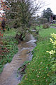 Hayton Beck.jpg 427 × 640; 242 KB
-

-
 Hedon Church from Station Lane - geograph.org.uk - 1042738.jpg 640 × 480; 189 KB
-
 Hedon Church's Tower Top - geograph.org.uk - 1042735.jpg 640 × 502; 72 KB
-
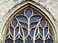 Hedon Church's West Window - geograph.org.uk - 1042733.jpg 640 × 480; 138 KB
-
 Here today, gone tomorrow - geograph.org.uk - 1055542.jpg 640 × 415; 332 KB
-
 Hessle Viewpoint - geograph.org.uk - 1035270.jpg 640 × 481; 59 KB
-
 High Wood, near Kilnwick - geograph.org.uk - 1042649.jpg 640 × 410; 425 KB
-
 Highfield Farm - geograph.org.uk - 1052763.jpg 640 × 427; 280 KB
-
 Holiday Chalets - geograph.org.uk - 1050934.jpg 640 × 427; 390 KB
-
 Holly Tree with berries - geograph.org.uk - 1052085.jpg 480 × 640; 116 KB
-
 Hornsea Mere near the Bullnose - geograph.org.uk - 1102635.jpg 640 × 252; 73 KB
-
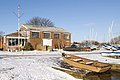 Hornsea Sailing Club - geograph.org.uk - 1102649.jpg 640 × 427; 86 KB
-
 Hotham Hall.jpg 640 × 480; 132 KB
-
 Hotham St Oswald Church - geograph.org.uk - 1069150.jpg 640 × 480; 53 KB
-
 Houses on Southburn - geograph.org.uk - 1052829.jpg 640 × 427; 404 KB
-
 Houses opposite the Methodist Church Hutton Cranswick.jpg 640 × 419; 280 KB
-
 Humber Bridge Toll Bar.jpg 640 × 348; 55 KB
-
 Hunsley Beacon - geograph.org.uk - 1069173.jpg 480 × 640; 41 KB
-
 Hutton Balk - geograph.org.uk - 1055630.jpg 640 × 427; 298 KB
-
 Intack Farm - geograph.org.uk - 1048412.jpg 640 × 427; 266 KB
-
 IRB Station - geograph.org.uk - 1047940.jpg 640 × 427; 242 KB
-
 Ivy Lane in the November Snow - geograph.org.uk - 1057340.jpg 640 × 480; 138 KB
-
 Ivy Lane, Hedon - geograph.org.uk - 1038411.jpg 640 × 480; 217 KB
-
 Ivy Lane, Hedon in the Winter - geograph.org.uk - 1057069.jpg 640 × 480; 132 KB
-
 J and GM Thompson Depot - geograph.org.uk - 1044406.jpg 640 × 427; 369 KB
-
 Johnson's Corner, Hedon - geograph.org.uk - 1057343.jpg 640 × 480; 118 KB
-
 Kilham Westfield Farm - geograph.org.uk - 1051885.jpg 640 × 480; 74 KB
-
 Kilham Westfield Farm building - geograph.org.uk - 1051900.jpg 640 × 480; 56 KB
-
 Kilham Westfield Farm Weather vane - geograph.org.uk - 1051913.jpg 640 × 480; 36 KB
-

-
 Lane near South Dalton Wold - geograph.org.uk - 1058311.jpg 469 × 640; 188 KB
-
 Left to Driffield right to Beverley - geograph.org.uk - 1042533.jpg 640 × 427; 300 KB
-
 Little Bustard Farm - geograph.org.uk - 1044315.jpg 640 × 379; 344 KB
-
 Little Houndale Farm - geograph.org.uk - 1051812.jpg 640 × 480; 78 KB
-
 Llamas at Nevilles Farm - geograph.org.uk - 1055520.jpg 640 × 427; 375 KB
-
 Lodge House entrance to the park.jpg 640 × 480; 102 KB
-
 Low down on the Footbridge - geograph.org.uk - 1040934.jpg 640 × 480; 144 KB
-
 Lower Garth Track to Cottam Warren - geograph.org.uk - 1052007.jpg 640 × 480; 116 KB
-
 Main Road, Wyton - geograph.org.uk - 1030404.jpg 489 × 640; 176 KB
-
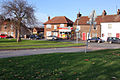
 Main Street Barmby Moor.jpg 640 × 427; 294 KB
-
 Main Street Kilnwick 1.jpg 640 × 427; 370 KB
-
 Main Street, Barmby Moor - geograph.org.uk - 1055568.jpg 640 × 427; 275 KB
-
 Main Street, Etton - geograph.org.uk - 1058217.jpg 640 × 426; 183 KB
-
 Main Street, Watton - geograph.org.uk - 1043435.jpg 640 × 427; 293 KB
-
 Manor Farm - geograph.org.uk - 1049594.jpg 640 × 473; 72 KB
-
 Mast at Cliffe Dales Farm - geograph.org.uk - 1069297.jpg 480 × 640; 44 KB
-
 Miles Lane near Leconfield - geograph.org.uk - 1042488.jpg 640 × 427; 389 KB
-
 Miles Lane, Leconfield - geograph.org.uk - 1042484.jpg 640 × 392; 347 KB
-
 Mill Pond South Newbald.jpg 640 × 497; 184 KB
-
 Morris Carr, near Weel - geograph.org.uk - 1038882.jpg 640 × 480; 179 KB
-
 Motocross track near North Newbald - geograph.org.uk - 1047479.jpg 528 × 640; 185 KB
-
 Mount Airy Farm - geograph.org.uk - 1056955.jpg 640 × 480; 110 KB
-
 Mowthorpe Farm ruin of - geograph.org.uk - 1051833.jpg 640 × 480; 101 KB
-
 Near Kenley House Farm - geograph.org.uk - 1038864.jpg 640 × 426; 183 KB
-
 Near Old Dale Plantation - geograph.org.uk - 1058340.jpg 640 × 579; 201 KB
-
 Nevilles Farm, Hollym - geograph.org.uk - 1048541.jpg 640 × 441; 448 KB
-
 New housing in Pocklington - geograph.org.uk - 1051647.jpg 640 × 427; 335 KB
-
 Newsham Gardens - geograph.org.uk - 1047974.jpg 640 × 427; 284 KB
-
 North of Weel - geograph.org.uk - 1038945.jpg 480 × 640; 195 KB
-
 Northside Road in Hollym - geograph.org.uk - 1042887.jpg 640 × 480; 153 KB
-
 Old Dale Plantation near South Dalton - geograph.org.uk - 1058323.jpg 426 × 640; 184 KB
-
 On the Kilnwick junction - geograph.org.uk - 1043277.jpg 640 × 427; 289 KB
-
 Pasture, and cliffs north of Holmpton - geograph.org.uk - 1048578.jpg 640 × 427; 365 KB
-
 Path into Eastdale - geograph.org.uk - 1069284.jpg 640 × 480; 131 KB
-

-
 Pig Farm Driffield Wold - geograph.org.uk - 1053027.jpg 640 × 480; 58 KB
-
 Plaque on the wall of lodge house.jpg 480 × 640; 83 KB
-
 Ploughed Farmland - geograph.org.uk - 1045761.jpg 640 × 411; 86 KB
-
 Pocklington Industrial Estate - geograph.org.uk - 1051668.jpg 640 × 344; 264 KB
-
 Pond south of Weel - geograph.org.uk - 1038907.jpg 480 × 640; 178 KB
-
 Potato field near Leconfield - geograph.org.uk - 1042513.jpg 640 × 427; 418 KB
-
 Primitive Methodist Chapel Beswick.jpg 640 × 427; 305 KB
-
 Prospect Farm - geograph.org.uk - 1049596.jpg 640 × 480; 99 KB
-

-
 Quarry on Little Wold - geograph.org.uk - 1056969.jpg 640 × 480; 72 KB
-
 Raventhorpe Nurseries - geograph.org.uk - 1042482.jpg 640 × 427; 409 KB
-
 Red House Farm - geograph.org.uk - 1048408.jpg 640 × 427; 301 KB
-
 Restored hand pump in Boynton village - geograph.org.uk - 1038762.jpg 640 × 480; 151 KB
-
 Richard Cooper Street - geograph.org.uk - 1095174.jpg 640 × 480; 71 KB
-
 Rowland Hill - geograph.org.uk - 1049601.jpg 640 × 480; 82 KB
-
 RSH Headquarters - geograph.org.uk - 1053404.jpg 640 × 427; 344 KB
-
 Sancton village and church - geograph.org.uk - 1069152.jpg 640 × 480; 71 KB
-
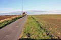
 Sand Lane near Wilberfoss - geograph.org.uk - 1049604.jpg 640 × 480; 114 KB
-
 Sea defences at Withernsea - geograph.org.uk - 1050914.jpg 640 × 417; 299 KB
-

-
 Sheriff Highway, Hedon in the Snow - geograph.org.uk - 1057118.jpg 640 × 480; 90 KB
-
 Signpost at Weedley Springs - geograph.org.uk - 1056972.jpg 640 × 480; 155 KB
-
 Site of Medieval Village Cottam - geograph.org.uk - 1051979.jpg 640 × 480; 67 KB
-
 Smylett Hall Farm - geograph.org.uk - 1048928.jpg 640 × 480; 86 KB


