Category:January 2008 in the East Riding of Yorkshire
Jump to navigation
Jump to search
Ceremonial counties of England: Bedfordshire · Berkshire · Buckinghamshire · Cambridgeshire · Cheshire · Cornwall · Cumbria · Derbyshire · Devon · Dorset · Durham · East Riding of Yorkshire · East Sussex · Essex · Gloucestershire · Greater London · Greater Manchester · Hampshire · Herefordshire · Hertfordshire · Isle of Wight · Kent · Lancashire · Leicestershire · Lincolnshire · Norfolk · North Yorkshire · Northamptonshire · Northumberland · Nottinghamshire · Oxfordshire · Rutland · Shropshire · Somerset · South Yorkshire · Staffordshire · Suffolk · Surrey · Tyne and Wear · Warwickshire · West Midlands · West Sussex · West Yorkshire · Wiltshire · Worcestershire
City-counties: Bristol ·
Former historic counties:
Other former counties:
City-counties: Bristol ·
Former historic counties:
Other former counties:
Deutsch: Bilder, die im Januar 2008 in the East Riding of Yorkshire aufgenommen worden sind. Bitte beachten Sie, dass dies weder das Datum des Uploads noch das Datum des Scannens eines Fotos ist.
English: Images/pictures taken in the East Riding of Yorkshire during January 2008. Note this is not the date of the upload, nor the date a photo was scanned.
Español: Fotografías o imágenes tomadas en the East Riding of Yorkshire durante enero 2008. No es la fecha de subida ni escaneo, sino la fecha en que las fotografías o imágenes se crearon.
Esperanto: Bildoj faritaj en the East Riding of Yorkshire en januaro 2008. Tio ne estas la dato, kiam la bildoj estis alŝutitaj aŭ skanitaj.
Français : Photographies ou images prises en the East Riding of Yorkshire durant janvier 2008. Ce n'est pas la date du téléchargement ou du scan.
Galego: Fotografías ou imaxes tomadas en the East Riding of Yorkshire durante xaneiro 2008. Non é a data de subida nin escaneamento, senón a data na que se crearon as fotografías ou imaxes.
Italiano: Fotografie o immagini scattate a the East Riding of Yorkshire nel gennaio 2008. Nota bene: la data non si riferisce né a quella di upload né a quella in cui la foto è stata digitalizzata.
Norsk bokmål: Bilder tatt i the East Riding of Yorkshire i løpet av januar 2008. Merk at dette ikke er datoen for opplasting, eller når et bilde har blitt skannet.
Norsk nynorsk: Bilete teke i the East Riding of Yorkshire i løpet av januar 2008. Merk at dette ikkje er datoen for opplasting, eller når eit bilete har vorte skanna.
Русский: Изображения, сделанные в the East Riding of Yorkshire в течение январь 2008 (не дата загрузки изображения).
Українська: Зображення, зроблені в the East Riding of Yorkshire протягом січень 2008. Зауважте, що це не дата завантаження чи дата сканування фотографії.
| January 2007 | ← | January 2008 | → | January 2009 | |||||||
| Jan | Feb | Mar | Apr | May | Jun | Jul | Aug | Sep | Oct | Nov | Dec |
| 269 | 503 | 525 | 507 | 737 | 327 | 436 | 406 | 149 | 154 | 319 | 181 |
|---|---|---|---|---|---|---|---|---|---|---|---|
Subcategories
This category has only the following subcategory.
Media in category "January 2008 in the East Riding of Yorkshire"
The following 200 files are in this category, out of 268 total.
(previous page) (next page)-
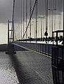
 Humber Bridge - geograph.org.uk - 646844.jpg 640 × 480; 92 KB
-
 68, 70 Park Lane, Cottingham - geograph.org.uk - 660865.jpg 640 × 480; 76 KB
-
 72, 74 Park Lane, Cottingham - geograph.org.uk - 660867.jpg 640 × 480; 65 KB
-
 A Detached Property, Cottingham - geograph.org.uk - 667876.jpg 480 × 640; 103 KB
-

-
 A House on Dunswell Road - geograph.org.uk - 668688.jpg 640 × 471; 76 KB
-
 A train line - geograph.org.uk - 1067894.jpg 640 × 480; 435 KB
-
 A typical Yorkshire Wolds field - geograph.org.uk - 649950.jpg 640 × 480; 96 KB
-
 A Yorkshire Wolds Bridleway - geograph.org.uk - 649949.jpg 640 × 480; 61 KB
-
 A Yorkshire Wolds farm track - geograph.org.uk - 649951.jpg 640 × 480; 82 KB
-
 A164 looking south - geograph.org.uk - 682121.jpg 640 × 480; 68 KB
-
 A165 North - geograph.org.uk - 652277.jpg 640 × 480; 112 KB
-
 A165 South - geograph.org.uk - 652286.jpg 640 × 480; 96 KB
-
 Access temporarily denied - geograph.org.uk - 664395.jpg 640 × 480; 309 KB
-
 Archway to the Courtyard - geograph.org.uk - 656435.jpg 640 × 473; 97 KB
-
 Barton Haven - geograph.org.uk - 669987.jpg 640 × 480; 84 KB
-
 Beech Grove - geograph.org.uk - 664648.jpg 640 × 480; 112 KB
-
 Bend around Gardener's Grounds - geograph.org.uk - 664295.jpg 640 × 480; 223 KB
-
 Beverley bypass - geograph.org.uk - 645639.jpg 640 × 426; 216 KB
-
 Beverley Minster - geograph.org.uk - 1351341.jpg 640 × 449; 69 KB
-
 Beverley Minster - geograph.org.uk - 1370018.jpg 640 × 440; 65 KB
-
 Beverley Minster interior.jpg 584 × 877; 652 KB
-
 Beverley North Bar Within - geograph.org.uk - 1369970.jpg 640 × 504; 85 KB
-
 Black Swan at Asselby.jpg 3,264 × 2,046; 999 KB
-
 Boats on Hedon Haven - geograph.org.uk - 676679.jpg 480 × 640; 69 KB
-
 Boats on River Derwent - geograph.org.uk - 722875.jpg 1,744 × 1,308; 1.12 MB
-
 Big boys' lego - geograph.org.uk - 1065664.jpg 640 × 483; 400 KB
-
 Bridlington Harbour - geograph.org.uk - 743360.jpg 640 × 474; 64 KB
-
 Bridlington Station - geograph.org.uk - 1067849.jpg 640 × 516; 464 KB
-
 Bridlington Station - geograph.org.uk - 656329.jpg 640 × 450; 62 KB
-
 Brough Haven Mudflats - geograph.org.uk - 669687.jpg 640 × 480; 110 KB
-
 Brough Haven next to the River Humber - geograph.org.uk - 669678.jpg 640 × 480; 70 KB
-
 Burn Park Cottages - geograph.org.uk - 661108.jpg 640 × 480; 60 KB
-
 Burstwick Drain - East - geograph.org.uk - 674229.jpg 640 × 427; 75 KB
-
 Burstwick Drain in Hedon - geograph.org.uk - 659050.jpg 640 × 480; 63 KB
-
 Burstwick Line across Magdalen Lane - geograph.org.uk - 670138.jpg 640 × 488; 76 KB
-
 Burstwick Station - geograph.org.uk - 670161.jpg 640 × 454; 85 KB
-
 Cassandra House Signage - geograph.org.uk - 667882.jpg 515 × 640; 91 KB
-
 Cassandra House, Cottingham - geograph.org.uk - 667878.jpg 640 × 464; 111 KB
-
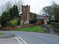
 Castle Hill (1) - geograph.org.uk - 651401.jpg 640 × 424; 68 KB
-
 Castle Hill, Swine (2) - geograph.org.uk - 651580.jpg 640 × 480; 67 KB
-
 Chemical Works at Dusk - geograph.org.uk - 663930.jpg 640 × 480; 60 KB
-
 Clay Hall Underpass, Cottingham - geograph.org.uk - 666979.jpg 640 × 447; 78 KB
-
 Cliff Road, Hessle - geograph.org.uk - 672515.jpg 640 × 478; 116 KB
-
 Cliff Road, Hessle - geograph.org.uk - 672521.jpg 640 × 482; 92 KB
-
 Coniston Lane, Swine - geograph.org.uk - 652052.jpg 640 × 480; 79 KB
-
 Cottage Garton-on-the-Wolds.jpg 640 × 480; 91 KB
-
 Cottages in Swine - geograph.org.uk - 652080.jpg 640 × 442; 83 KB
-
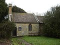
 Church at Cottam. (ruin) - geograph.org.uk - 1035872.jpg 640 × 480; 62 KB
-
 Cottingham Methodist Church - geograph.org.uk - 678957.jpg 480 × 547; 110 KB
-
 County boundary - geograph.org.uk - 664521.jpg 640 × 480; 236 KB
-
 Cows and Fields - geograph.org.uk - 674256.jpg 640 × 427; 70 KB
-
 Creyke Beck Electricity Substation - geograph.org.uk - 668658.jpg 640 × 480; 79 KB
-
 Dancing Lane into Swine - geograph.org.uk - 652223.jpg 640 × 480; 82 KB
-
 Dancing Lane to Kelwell Farm - geograph.org.uk - 652236.jpg 640 × 517; 78 KB
-
 Dancing Lane, Swine - geograph.org.uk - 652217.jpg 640 × 392; 66 KB
-
 Derelict house near Little Driffield - geograph.org.uk - 664663.jpg 640 × 442; 79 KB
-
 Dire Consequences - geograph.org.uk - 668670.jpg 640 × 420; 59 KB
-
 Disconsolate Woodpecker^ - geograph.org.uk - 660862.jpg 640 × 480; 140 KB
-
 Distant Sunset over Saltend - geograph.org.uk - 651125.jpg 640 × 480; 45 KB
-
 Downs Hall, The Lawns, Cottingham - geograph.org.uk - 661074.jpg 640 × 443; 114 KB
-
 Drainage in Hedon - geograph.org.uk - 667403.jpg 640 × 480; 127 KB
-
 Dredger on Hedon Haven - geograph.org.uk - 663926.jpg 640 × 480; 73 KB
-
 Dunflat Lane - geograph.org.uk - 655834.jpg 640 × 462; 171 KB
-
 Dunswell Road - geograph.org.uk - 662083.jpg 640 × 503; 159 KB
-
 Dunswell Road - geograph.org.uk - 668680.jpg 640 × 480; 63 KB
-

-
 England Springs crossing, Beverley - geograph.org.uk - 649396.jpg 640 × 480; 186 KB
-
 Entrance to Bridlington Harbour - geograph.org.uk - 1065672.jpg 640 × 466; 362 KB
-
 Entrance to Bridlington Harbour - geograph.org.uk - 1065677.jpg 640 × 427; 276 KB
-
 Fair Maid, Cottingham - geograph.org.uk - 682022.jpg 640 × 512; 71 KB
-

-
 Farm Track to Swine - geograph.org.uk - 651957.jpg 640 × 480; 97 KB
-
 Farmers Road behind Field Head Looking North - geograph.org.uk - 725806.jpg 1,744 × 1,308; 1.84 MB
-
 Fence and Rubbish - geograph.org.uk - 663924.jpg 640 × 480; 104 KB
-
 Ferry Lane - geograph.org.uk - 664015.jpg 640 × 480; 295 KB
-
 Figham Common, near Beverley - geograph.org.uk - 649502.jpg 640 × 480; 197 KB
-
 Fish or chips next^ - geograph.org.uk - 1065668.jpg 640 × 480; 265 KB
-
 Flooded field, near Dunswell - geograph.org.uk - 662077.jpg 640 × 614; 196 KB
-
 Floods January 2008 - geograph.org.uk - 722871.jpg 1,744 × 1,308; 1.11 MB
-
 Flow of Aire - geograph.org.uk - 663704.jpg 640 × 480; 262 KB
-
 Fodder Storage, Dunswell - geograph.org.uk - 668685.jpg 640 × 480; 102 KB
-
 Footpath and Drain, Hedon - geograph.org.uk - 667731.jpg 640 × 480; 130 KB
-
 From Birker Lane to St Oswald's Close - geograph.org.uk - 722970.jpg 1,744 × 1,308; 1.44 MB
-
 Fuel Storage Tanks, Cottingham - geograph.org.uk - 661083.jpg 640 × 480; 46 KB
-
 Get your tickets here - geograph.org.uk - 1067841.jpg 640 × 455; 405 KB
-
 Gravel Hill Farm - geograph.org.uk - 652020.jpg 640 × 480; 98 KB
-
 Grazing for Sheep - geograph.org.uk - 682155.jpg 640 × 480; 89 KB
-
 Green Lane - geograph.org.uk - 652241.jpg 640 × 480; 80 KB
-
 Green Lane to Swine - geograph.org.uk - 730802.jpg 640 × 480; 169 KB
-
 Half a Portacabin Post Office - geograph.org.uk - 682046.jpg 640 × 466; 93 KB
-
 Hall Ings, near Dunswell - geograph.org.uk - 662085.jpg 640 × 409; 179 KB
-
 Hallgate, Cottingham - geograph.org.uk - 678952.jpg 640 × 480; 78 KB
-
 Hedon Railway Station.jpg 640 × 480; 90 KB
-
 Hedon to Burstwick Line.jpg 640 × 480; 141 KB
-
 Hornsea Town Railway Station1.JPG 1,184 × 1,667; 122 KB
-
 House on the corner of Cliff Road - geograph.org.uk - 673857.jpg 640 × 478; 101 KB
-
 Humber Bridge from North Tower - geograph.org.uk - 657084.jpg 485 × 640; 84 KB
-
 Humber Footpath at Brough - geograph.org.uk - 669670.jpg 640 × 480; 99 KB
-
 Humber Foreshore - geograph.org.uk - 673865.jpg 640 × 482; 115 KB
-
 Humber Radar at Stone Creek - geograph.org.uk - 663702.jpg 640 × 480; 49 KB
-

-
 Kelwell Drain (East) - geograph.org.uk - 652268.jpg 640 × 480; 131 KB
-
 Kelwell Drain (West) - geograph.org.uk - 652263.jpg 520 × 640; 111 KB
-
 Keyingham Drain - geograph.org.uk - 670168.jpg 640 × 477; 113 KB
-
 Keyingham to Burstwick Line - geograph.org.uk - 670164.jpg 640 × 480; 133 KB
-
 Lamplugh Road - geograph.org.uk - 656375.jpg 640 × 480; 69 KB
-
 Lightning Tree Stump at Turtle Hill - geograph.org.uk - 649954.jpg 480 × 640; 65 KB
-
 Lightning Trees in the low winter sun - geograph.org.uk - 649953.jpg 640 × 480; 72 KB
-
 Limekiln Lane Railway Bridge - geograph.org.uk - 656400.jpg 640 × 418; 77 KB
-

-
 Long Lane, Woodmansey - geograph.org.uk - 645645.jpg 640 × 583; 168 KB
-
 Looking Across the Humber - geograph.org.uk - 666757.jpg 640 × 480; 103 KB
-
 Love Lane Bridleway Green Fence - geograph.org.uk - 659055.jpg 640 × 480; 123 KB
-
 Lowland heath at North Cliffe Woods - geograph.org.uk - 672137.jpg 640 × 480; 81 KB
-
 Main Street, Skidby - geograph.org.uk - 682058.jpg 640 × 480; 78 KB
-
 Main Street, Wawne.jpg 3,264 × 2,448; 1.07 MB
-
 Marshland Fence and Debris - geograph.org.uk - 663922.jpg 480 × 640; 126 KB
-
 Merryman Garth - geograph.org.uk - 667739.jpg 640 × 480; 98 KB
-
 Mill Beck - geograph.org.uk - 655224.jpg 640 × 480; 133 KB
-
 Mill Chase - geograph.org.uk - 664650.jpg 640 × 480; 81 KB
-
 Mill Lane, Swanland - geograph.org.uk - 668648.jpg 640 × 480; 196 KB
-
 Minor Land Drain in Hedon - geograph.org.uk - 659038.jpg 480 × 640; 120 KB
-
 Mock Tudor Houses - geograph.org.uk - 668675.jpg 640 × 454; 77 KB
-
 Mr Blue Sky - geograph.org.uk - 664333.jpg 640 × 480; 201 KB
-
 Near Bow Plantation, Welton - geograph.org.uk - 668036.jpg 640 × 480; 181 KB
-
 New Cut Drain - geograph.org.uk - 652044.jpg 480 × 640; 97 KB
-
 New Village Road, Cottingham - geograph.org.uk - 666945.jpg 640 × 480; 79 KB
-
 North Moor Lane, Cottingham - geograph.org.uk - 667874.jpg 640 × 458; 83 KB
-
 North Pier, Bridlington - geograph.org.uk - 1067892.jpg 640 × 471; 308 KB
-
 North Street - Nafferton - geograph.org.uk - 672158.jpg 640 × 480; 128 KB
-
 Northmoor School - geograph.org.uk - 666977.jpg 640 × 471; 70 KB
-
 Old course of River Derwent - geograph.org.uk - 655947.jpg 427 × 640; 66 KB
-
 On the Beaver Trail - geograph.org.uk - 645631.jpg 640 × 472; 170 KB
-
 Orchard Park playing fields, Hull - geograph.org.uk - 662038.jpg 640 × 438; 192 KB
-
 Park Lane, Cottingham - geograph.org.uk - 660855.jpg 640 × 372; 70 KB
-
 Park Lane, Cottingham - geograph.org.uk - 661079.jpg 640 × 480; 89 KB
-
 Paull Fort Museum Battery Gun - geograph.org.uk - 668852.jpg 640 × 480; 63 KB
-
 Paull's River Frontage at High Tide - geograph.org.uk - 668855.jpg 640 × 480; 81 KB
-
 Paull's Tidal Lagoon at High Tide - geograph.org.uk - 668850.jpg 640 × 447; 51 KB
-
 Pinkney Grunwells - geograph.org.uk - 656340.jpg 640 × 480; 87 KB
-
 Platwoods Fields - geograph.org.uk - 662061.jpg 640 × 442; 201 KB
-
 Platwoods Fields - geograph.org.uk - 662069.jpg 640 × 427; 179 KB
-
 Playing Fields, Cottingham - geograph.org.uk - 660861.jpg 640 × 480; 86 KB
-
 Poplar Farm, Cottingham - geograph.org.uk - 666971.jpg 640 × 480; 88 KB
-
 Poplars Way, Beverley - geograph.org.uk - 649377.jpg 640 × 453; 184 KB
-
 Power from Afar - geograph.org.uk - 657646.jpg 640 × 480; 65 KB
-
 Power of different types - geograph.org.uk - 655935.jpg 640 × 427; 33 KB
-
 Putting new piles in - geograph.org.uk - 650766.jpg 640 × 426; 61 KB
-
 Pylons and puddles - geograph.org.uk - 645625.jpg 478 × 640; 178 KB
-
 Quay Road level crossing, Bridlington - geograph.org.uk - 1067870.jpg 640 × 480; 364 KB
-
 Queensgate Quarry - eastern end - geograph.org.uk - 649355.jpg 640 × 452; 205 KB
-
 Railway Bridge, Dunswell - geograph.org.uk - 667245.jpg 640 × 474; 97 KB
-
 Reed Beds in Paull's Tidal Lagoon - geograph.org.uk - 676663.jpg 640 × 480; 116 KB
-
 Rifle Butts Quarry near Goodmanham - geograph.org.uk - 655235.jpg 640 × 480; 120 KB
-
 Rippled shallows - geograph.org.uk - 664516.jpg 640 × 480; 229 KB
-
 Risby fields - geograph.org.uk - 655840.jpg 640 × 457; 166 KB
-
 Risby Park Farm - geograph.org.uk - 655793.jpg 640 × 447; 158 KB
-
 Risby rainbow - geograph.org.uk - 655828.jpg 482 × 640; 199 KB
-
 Riverside Pond at Cherry Cobb Sands - geograph.org.uk - 663731.jpg 640 × 480; 101 KB
-
 Riverside Pool - geograph.org.uk - 663918.jpg 640 × 480; 40 KB
-
 Road to Spring Park Farm - geograph.org.uk - 661095.jpg 640 × 480; 79 KB
-
 Roadside Drain near Benningholme - geograph.org.uk - 663933.jpg 640 × 480; 101 KB
-
 Rust in peace - geograph.org.uk - 662033.jpg 486 × 640; 167 KB
-
 Ruston Parva - geograph.org.uk - 674423.jpg 640 × 480; 312 KB
-
 Ruston Parva - geograph.org.uk - 674431.jpg 640 × 248; 193 KB
-
 Seagate and the Ship Inn - geograph.org.uk - 656440.jpg 640 × 447; 89 KB
-
 Sewerby Hall, geograph.jpg 640 × 474; 81 KB
-
 Signpost to Dancing Lane - geograph.org.uk - 652111.jpg 640 × 485; 138 KB
-
 Silver Birch tree - geograph.org.uk - 672139.jpg 480 × 640; 115 KB
-

-
 Skidby Mill - geograph.org.uk - 657141.jpg 640 × 425; 50 KB
-
 Skidby Mill - geograph.org.uk - 657143.jpg 425 × 640; 40 KB
-
 Skidby Mill - geograph.org.uk - 657146.jpg 640 × 425; 28 KB
-
 Skidby Mill - geograph.org.uk - 657150.jpg 640 × 425; 53 KB
-
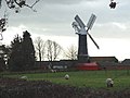 Skidby Windmill - geograph.org.uk - 673860.jpg 640 × 480; 58 KB
-
 Skidby Windmill - geograph.org.uk - 682206.jpg 503 × 640; 91 KB
-
 Slipway to the Beach - geograph.org.uk - 1263590.jpg 546 × 640; 312 KB
-
 Snow at Field Head - geograph.org.uk - 722778.jpg 1,744 × 1,308; 1.44 MB
-
 Snow at Town End Plantation - geograph.org.uk - 722788.jpg 1,744 × 1,308; 2.27 MB
-
 Snowdrops in the wood - geograph.org.uk - 668046.jpg 475 × 633; 210 KB
-
-
 South Beach - geograph.org.uk - 743350.jpg 640 × 480; 42 KB
-
 South Beach Looking Towards The Spa - geograph.org.uk - 743339.jpg 640 × 468; 61 KB
-
 South Beach Shells - geograph.org.uk - 743366.jpg 640 × 480; 115 KB
-
 South Dalton - geograph.org.uk - 1370295.jpg 640 × 437; 70 KB
-
 Souttergate in Hedon - geograph.org.uk - 659028.jpg 440 × 640; 75 KB
-
 St Augustine's Church, Hedon - geograph.org.uk - 667398.jpg 480 × 640; 56 KB
-
 St Jame's Church Fordon - geograph.org.uk - 1424196.jpg 640 × 480; 88 KB
-
 St Mary's Church Porch, Swine - geograph.org.uk - 776372.jpg 480 × 640; 227 KB
-
 St Michael's Church, Skidby - geograph.org.uk - 682094.jpg 640 × 480; 85 KB
-

-
 St. Mary's church, Beverley - geograph.org.uk - 1370126.jpg 640 × 458; 70 KB
-

-
 Stabling for Donkeys, Cottingham - geograph.org.uk - 666968.jpg 640 × 480; 88 KB
-
 Start of Footpath to Great Stanks - geograph.org.uk - 652230.jpg 640 × 480; 72 KB
-
 Station Approach, Bridlington - geograph.org.uk - 1067860.jpg 640 × 464; 320 KB
-
 Station House Keyingham.jpg 640 × 480; 103 KB
-
 Stone(y) Creek - geograph.org.uk - 663696.jpg 640 × 480; 81 KB
-
 Sweattyhill Plantation - geograph.org.uk - 669709.jpg 640 × 480; 47 KB


_-_geograph.org.uk_-_651401.jpg)
_-_geograph.org.uk_-_651580.jpg)


_-_geograph.org.uk_-_1035872.jpg)


_-_geograph.org.uk_-_652268.jpg)
_-_geograph.org.uk_-_652263.jpg)


_-_geograph.org.uk_-_663938.jpg)


_Creek_-_geograph.org.uk_-_663696.jpg)
