Category:Maps showing 1805
Jump to navigation
Jump to search
| ← 1800 1801 1802 1803 1804 1805 1806 1807 1808 1809→ |
English: Maps showing the year 1805 (i.e. history maps)
See also category: 1805 maps. and 1800s maps for old maps created in this time.
See also category: 1805 maps. and 1800s maps for old maps created in this time.
Subcategories
This category has only the following subcategory.
Media in category "Maps showing 1805"
The following 5 files are in this category, out of 5 total.
-
 Administrative Division of Rattanakosin Kingdom in 1805.jpg 10,000 × 15,000; 7.84 MB
-
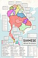 Siamese Territory and Dominion in 1805.jpg 5,000 × 7,500; 4.23 MB
-
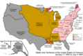 United States 1805-01-1805-07.png 1,000 × 677; 106 KB
-
 Österreich BV042513078.jpg 1,042 × 742; 113 KB
-
 Österreich BV043420481.jpg 1,559 × 904; 136 KB


