Category:Maps showing 1802
Jump to navigation
Jump to search
| ← 1800 1801 1802 1803 1804 1805 1806 1807 1808 1809→ |
English: Maps showing the year 1802 (i.e. history maps)
See also category: 1802 maps. and 1800s maps for old maps created in this time.
See also category: 1802 maps. and 1800s maps for old maps created in this time.
Subcategories
This category has only the following subcategory.
Media in category "Maps showing 1802"
The following 4 files are in this category, out of 4 total.
-
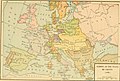
 Karte ErzbistumKoeln.png 2,713 × 2,391; 643 KB
-
-
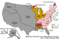 United States 1800-07-10-1802.png 1,000 × 677; 102 KB
-
 United States 1802-1803-03.png 1,000 × 677; 100 KB

_(14777961651).jpg)

