Category:Maps of the history of colonies of the United Kingdom
Jump to navigation
Jump to search
Countries of Europe: Belgium · Denmark · France‡ · Germany · Italy · Netherlands‡ · Portugal‡ · Spain‡ · Sweden · United Kingdom
‡: partly located in Europe
‡: partly located in Europe

Subcategories
This category has the following 6 subcategories, out of 6 total.
A
Media in category "Maps of the history of colonies of the United Kingdom"
The following 3 files are in this category, out of 3 total.
-
 Carolinacolony.png 1,000 × 1,048; 419 KB
-
 Colonies des Dominions en 1918.png 1,345 × 614; 48 KB
-
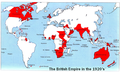 Map of the British Empire (1920's).png 720 × 432; 424 KB


.png)