Category:Maps of former colonies of the United Kingdom in Africa
Jump to navigation
Jump to search
Subcategories
This category has the following 23 subcategories, out of 23 total.
A
- Maps of Anglo-Egyptian Sudan (56 F)
B
- Maps of British Bechuanaland (4 F)
C
- Maps of British Cameroons (8 F)
E
G
K
- Maps of British Kaffraria (7 F)
N
- Maps of Natal Colony (38 F)
O
R
S
- Maps of British Somaliland (14 F)
T
- Maps of British Togo (8 F)
U
W
Media in category "Maps of former colonies of the United Kingdom in Africa"
The following 6 files are in this category, out of 6 total.
-
 Africa Australa - Colonizacion vèrs 1898.png 1,062 × 876; 234 KB
-
 British Decolonisation in Africa.png 2,000 × 2,000; 406 KB
-
 British Ogadenia.gif 418 × 399; 15 KB
-
 Carte détaillée du Wituland.png 4,372 × 2,167; 1.72 MB
-
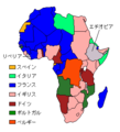 ColonialAfrica ja.png 300 × 330; 8 KB
-
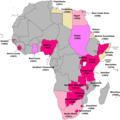
 영국 아프리카 식민지.png 513 × 505; 21 KB


