Category:Maps of Houston
Jump to navigation
Jump to search
- 100 most populous cities of the United States
- 1–25
- Austin
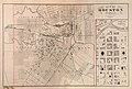
- Boston
- Charlotte
- Chicago
- Columbus
- Dallas
- Denver
- El Paso
- Fort Worth
- Houston
- Indianapolis
- Jacksonville
- Los Angeles
- Nashville
- New York City
- Oklahoma City
- Philadelphia
- Phoenix
- Portland
- San Antonio
- San Diego
- San Francisco
- San Jose
- Seattle
- Washington, D.C.
- 26–50
- Arlington
- Atlanta
- Bakersfield
- Colorado Springs
- Detroit
- Fresno
- Kansas City
- Las Vegas
- Long Beach
- Louisville
- Memphis
- Miami
- Minneapolis
- Oakland
- Omaha
- Raleigh
- Sacramento
- Tucson
- Tulsa
- 51–75
- Anaheim
- Anchorage
- Cincinnati
- Cleveland
- Corpus Christi
- Durham
- Greensboro
- Honolulu
- Irvine
- Jersey City
- Lexington
- Lincoln
- Newark
- New Orleans
- Orlando
- Pittsburgh
- Plano
- Saint Paul
- Santa Ana
- St. Louis
- Tampa
- 76–100
- Boise
- Buffalo
- Chesapeake
- Chula Vista
- Fort Wayne
- Laredo
- Lubbock
- Madison
- Norfolk
- Richmond
- Santa Clarita
- Scottsdale
- St. Petersburg
- Spokane
- Toledo
- Winston-Salem
Wikimedia category | |||||
| Upload media | |||||
| Instance of | |||||
|---|---|---|---|---|---|
| Category combines topics | |||||
| Houston | |||||
city in Harris, Fort Bend, and Montgomery counties in Texas, United States, and the county seat of Harris County      | |||||
| Instance of | |||||
| Part of |
| ||||
| Named after | |||||
| Location |
| ||||
| Legislative body |
| ||||
| Head of government |
| ||||
| Founded by |
| ||||
| Inception |
| ||||
| Population |
| ||||
| Area |
| ||||
| Elevation above sea level |
| ||||
| Different from | |||||
| official website | |||||
 | |||||
English: Maps of the City of Houston
Español: Mapas de la Ciudad de Houston
Subcategories
This category has the following 4 subcategories, out of 4 total.
Media in category "Maps of Houston"
The following 63 files are in this category, out of 63 total.
-
 001 camp logan map.jpg 597 × 313; 35 KB
-
-
 003 Map of Buffalo Bayou area - Camp Logan Riots.jpg 597 × 324; 40 KB
-
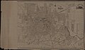
 O. W. Gray & Son City of Houston 1884 UTA.jpg 7,809 × 5,272; 17.09 MB
-
 2010 Median Family Income and Industrial Site Locations in Houston, Texas.png 2,229 × 1,632; 3.88 MB
-
 Aldine Ninth Grade Boundary Map.png 1,146 × 880; 768 KB
-
 Ashburn's Houston City Map.jpg 748 × 562; 197 KB
-
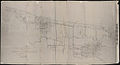
 Buffalo Bayou map 1869.jpg 599 × 419; 118 KB
-
 City of Houston.jpg 598 × 355; 53 KB
-
 Conti1844.jpg 400 × 563; 177 KB
-
 Downtowntunnelmap.jpg 375 × 500; 193 KB
-
 Galveston 1970.jpeg 538 × 406; 166 KB
-
 Galveston Bay Area Locator.gif 840 × 559; 15 KB
-
 GulftonAreaCensusTract.PNG 522 × 509; 65 KB
-
 GulftonAreaCensusTract0.PNG 522 × 509; 65 KB
-
 GulftonMap.png 798 × 465; 114 KB
-
-
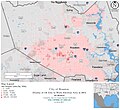
 Home Owners' Loan Corp. (HOLC) Neighborhood Redlining Grade in Houston, Texas.png 2,371 × 1,679; 4.05 MB
-
 Houston City Council districts map (2014–2024).svg 800 × 655; 2.44 MB
-
 Houston City Council districts map (2024–).svg 800 × 655; 296 KB
-
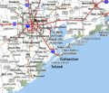 Houston Galveston area towns roadmap.gif 399 × 342; 35 KB
-
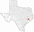 Houston in Texas.png 303 × 286; 20 KB
-
 Houston Jobs Density 2014.jpg 1,040 × 950; 298 KB
-
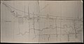
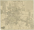
 Houston map 1912.png 245 × 394; 239 KB
-
 Houston printable tourist attractions map.jpg 2,105 × 1,488; 1.74 MB
-
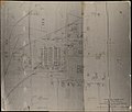
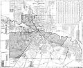
 Houston, Texas - town plan with superimposed information.jpg 598 × 432; 71 KB
-
 Houston, Texas 1955 Yellow Book.jpg 497 × 451; 222 KB
-
 Houston-map.jpg 1,654 × 1,165; 313 KB
-
 HoustoninTexas.PNG 303 × 286; 12 KB
-
 HoustoninTexas2.png 303 × 286; 35 KB
-
 Houstonmap.gif 575 × 425; 73 KB
-
 HoustonmapGulfton.PNG 575 × 425; 64 KB
-
 HoustonmapRiverOaks.PNG 575 × 425; 64 KB
-
 Houstonpopulationdensity.PNG 1,764 × 1,246; 394 KB
-
 Houstonpopulationdensityhighlightgulfton.PNG 1,764 × 1,246; 395 KB
-
 HoustonWards1920.jpg 5,756 × 4,680; 7.46 MB
-
 Magnolia Park and Central Park subdivisions, Houston, Texas.jpg 597 × 412; 84 KB
-
 Map Houston.jpg 1,988 × 1,950; 1.17 MB
-
 Map of Houston Heights.jpg 748 × 997; 279 KB
-
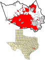
 Map of the USA highlighting Greater Houston.gif 4,200 × 3,105; 1.61 MB
-
 MapHouston1913.jpg 4,800 × 4,237; 2.54 MB
-
 Morrison & Fourmy's 1882 Map of City of Houston.jpg 5,563 × 6,000; 61.65 MB
-
 Nottingham Forest, Houston.png 1,669 × 762; 582 KB
-
 Old map-Houston-1873.jpg 9,255 × 7,194; 17.95 MB
-
 Old map-Houston-1891.jpg 12,344 × 7,603; 18.3 MB
-
 PasadenaTownSquareMallOldMapHoustonChronicleNov28,1985.jpg 6,592 × 8,579; 7.04 MB
-
 Race and ethnicity 2010- Houston.png 3,009 × 3,009; 2.44 MB
-
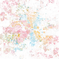 Race and ethnicity Houston.png 3,009 × 3,009; 3.77 MB
-
 Rice Court.jpg 600 × 600; 74 KB
-
 Sanborn1907 McK Travis Hou.png 1,141 × 617; 764 KB
-
 Shadow Lawn.jpg 598 × 600; 70 KB
-
 SISDBoundaries.jpg 1,079 × 636; 458 KB
-
 Southampton Place Extension.jpg 600 × 600; 83 KB
-
 Southampton Place.jpg 598 × 553; 92 KB
-
 Southern District of Texas map.png 445 × 406; 97 KB
-
 TX18 109.gif 758 × 383; 38 KB
-
 USstcou2010 HOUSTON.png 5,996 × 4,455; 5.68 MB
-
 West End Park on MapHouston1913 (cropped).jpg 192 × 192; 49 KB
-
 West End Park on MapHouston1913.jpg 288 × 264; 65 KB
-
 Wikivoyage Houston district map PNG (cropped).png 469 × 399; 40 KB
-
 Wikivoyage Houston district map PNG.png 843 × 754; 76 KB
-
 Wikivoyage Houston district map.svg 843 × 754; 432 KB
-
 Розположення могили Андрія Макаренка на кладовищі Форест Парк.jpg 2,281 × 3,103; 1.33 MB


_Neighborhood_Redlining_Grade_in_Houston,_Texas.png)
.svg)
.svg)


.jpg)

.png)


