Category:Location maps of Iran
Jump to navigation
Jump to search
Countries of Asia: Afghanistan · Armenia‡ · Azerbaijan‡ · Bahrain · Bangladesh · Bhutan · Brunei Darussalam · Cambodia · People's Republic of China · Cyprus‡ · East Timor · Egypt‡ · Georgia‡ · India · Indonesia‡ · Iran · Iraq · Israel · Japan · Jordan · Kazakhstan‡ · Kuwait · Kyrgyzstan · Laos · Lebanon · Malaysia · Maldives · Mongolia · Myanmar · Nepal · North Korea · Oman · Pakistan · Philippines · Qatar · Russia‡ · Saudi Arabia · Singapore · South Korea · Sri Lanka · Syria · Tajikistan · Thailand · Turkey‡ · Turkmenistan · United Arab Emirates · Uzbekistan · Vietnam · Yemen
Limited recognition: Abkhazia‡ · Taiwan · State of Palestine
‡: partly located in Asia
Limited recognition: Abkhazia‡ · Taiwan · State of Palestine
‡: partly located in Asia
 |
This category should only contain blank "Location maps" created for geo-location purposes which follow a same uniform standard, and have been created with a Geographic information system (GIS) software program using a compatible equirectangular or conical projection and for which the geographic coordinate system is known. For more information or questions see the wikiproject: German Wikipedia:Kartenwerkstatt/Positionskarten and this discussion page. |
Media in category "Location maps of Iran"
The following 8 files are in this category, out of 8 total.
-
 Ilam Province, Iran location map.svg 678 × 678; 627 KB
-
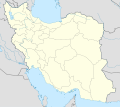 Iran location map.svg 1,200 × 1,071; 299 KB
-
 Iran Region Azerbaijan location map.svg 629 × 618; 1.89 MB
-
 Iran relief location light map.jpg 1,200 × 1,071; 165 KB
-
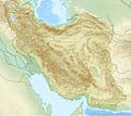 Iran relief location map.jpg 1,200 × 1,071; 941 KB
-
 Iran Yazd adm location map.svg 512 × 540; 38 KB
-
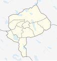
 Kurdistan Province Location Map.svg 718 × 601; 359 KB
-
 Mesopotamia location map2.svg 1,998 × 1,265; 320 KB


