Commons talk:Project Mapmaking Wiki Standards
- Archive of discussions: Commons talk:Project Mapmaking Wiki Standards/Archive01
 Discussion closed ! Discussion closed !
|
|---|
| This discussion is now closed by lack of participation, No convention has been set, and will be remove soon. Please, replace link targetting this page by en:Wikipedia:WikiProject_Maps/Conventions. |
Overview of the needs[edit]
| Recommendation need | Aim | Background, Style & Tools | Current status, Various notes, and current emerging proposal. |
|---|---|---|---|
| Basis | |||
| World projection | Display the world in the most suitable projection for wp use. Ease both the creation and the reading of World maps. |
BlankMap-World6.svg (Robinson) ? Adopt the Winkel tripel ? the Mollweide projection ? |
The current BlankMap is in Robinson projection : a/ do we keep it or change for an other one ? (-> Winkel ? Plate carree ?) b/ Do we display Antartic ? |
| Introduction: Upload and Legend advices |
General advices for mapmakers: Font, Naming conventions, License, Legend, Category. Map-relate wiki technologies-introduction (Template {Legende}, others) |
{{Maplegend}}, {{Mapcolor}}, {{Légende cartographique}}, further SVG tools & technologies welcome. |  New global and medium proposal, waiting comments before approval. |
| Color theory: Research for optimized colors |
General advices to set optimized palets : web safe colors, attractives, non-aggressive but clearly distinguishable. | en:Color theory, en:Web colors, web tools to harmonize colors (such this one). | |
| Very last review: | Review by some color blind users, coherence between naming conventions, etc. | ||
| Maps' types | |||
| Basis | |||
| Standard Wikimaps background | World: Display all current Countries on a neutral color World map. | Style: wikimaps. Borders: administrative ones. Labels: no. Projection : ? |
 Note: far and close up views will be allow. Close up will be « position » maps displaying the area and it's 1st level administrative divisions. The Far view will be the « locator » view, puting the country in its continent. |
| Small area: to later display an area on its geographic context (i.e: Wales out of the Britanic Islands ; neutral color map). | |||
| Easy types (all the following maps will have background colors according to previous "Wikimaps background" colors) | |||
| Location maps |
Mainly for geolocation purposes. Just display the subject (most of time a country) in its geographic close context |
Style: wikimaps Projection: equirectangular (conical for higher latitudes). Borders: subject ones + it's sub-divions. Labels: no. |

Use the Position map + georeference template to add the dozen of label. Example: old practice (depreciated) ; new practice using georeference-templates.
The question is here to choice suitable + neutral + serious + soft colors. |
| Simple CIA maps | Display a country or region with the dozen of very importants things to notice | Will be replaced by better ones in time. |
|
| Gradiant maps | Display Wikimaps background + the area need colorated according to their % (rate) or rank. | Style and projection: wikimaps. Borders: subjects ones. Labels and legend: if necessary. Color set: under construction (Yug+LoH) | |
| Locator maps (area) * Country locator * Bio-locator etc. |
Ease the localisation of a subject on its continent and on the earth | Style: basic topo style (4 positive, 3 negative levels). Borders: continental and subject ones. Labels: no. Projection: ? Color set: need 1 recommended color for the subject + some other |

Find suitable colors for vegetal/walking/swimming/flying |
| Expert types | |||
| Geopolitical maps | The common, multi-purpose map in an article page. Display most stratigical informations such railroads, highspeed, harbors, etc. |
Improved French standard style. | 
|
| Exchanges maps | Display roads, train, planes lines, economic exchanges, etc. with numeral values | Put on the geopolitical maps ? or on topographic ones ?. Which color /icone set ? |
|
| Physical maps (relief / topographic) | Display topo-hydro(-human?) datas. | will likely follow the improved French standard style. | 
|
| Historical maps | Display territories, contested area, wars and battles, extensions and move of armies | Which color /icone set ? | |
| Currently cancelled | |||
| Biosphere maps | Display bio datas (forest of *,*,* ; human's created forest ; fields of *,*,* ; human habitat ; ). | Which color /icone set ? | |
| Geologic maps | Canceled (not manageable with current knowledge.) | need advices from a geologist | |

Choice for the world map projection(s)[edit]
| Discussion closed !
|
|---|
| This discussion is now closed by lack of participation. No convention has been set. |
I initiate here a discussion to try to establish a common Wikimedia recommendation about which type of world map projection should preferably be used by Wikicartographers for their creations depending the subject depicted.
In cartography I think we should be modern and raise our degree of quality and leave behind the old-fashioned representations of the Earth so widely spread but misused in low quality magazines or atlas. For these I think mostly about the equi-rectangular and Mercator projections, taking a high percentage of the maps we find here in Commons. These are hundreds or even thousands years old representations. Fortunately, better projections have been made since. On the other hand I think also we shouldn't innovate here by our own. I mean that many specialized cartographers and institutions have already thought about the difficult problem of the projection so we don't have to choose a peculiar one. In this way, taking a look at what reliable institutions use gives us a guide-line of what we should do here.
Proposition 1[edit]
- General purpose world map:

This would be the most commonly used type which can apply to many subjects depicted.
Here the main factor would be to avoid as much as possible the distortions and preserve the general shapes. No need here to be conformal, equal-area or with other properties, what imports is the general aspect of the land. Also, it must be easy to create (widely available in GIS software) and of course, non-interrupted.
Better than the Robinson's one imo is the one chosen by the famous National Geographic Society: the Winkel tripel projection. It's a good compromise that gives an overall quiet correct aspect of the Earth, so it's the one I propose here.
- Specific uses:

One type of projection can not serve all of our needs and one of these is an equal-area map which is needed for example to show the distribution of population and things like that. An other interesting property would be to have strait parallels which can be used to show easier for example the mean temperatures on Earth as this data depends also greatly of the latitude. In addition of these two points, if we can have a projection that doesn't put too many deformations, it would be better.
I think one projection follows the previous points enough to be proposed here: the Mollweide projection which gives a much better representation of the shapes than for example the Lambert cylindrical equal-area one. Together with this second projection, I think most of our needs will be satisfied. If a specific property in the map is required in an other case, the cartographer will have to choose it by his own.
These are the propositions I make here. Thank you to give your opinion with arguments and, if you think mine aren't good enough, to make your own ones. Sting (talk) 04:13, 22 June 2008 (UTC)
Discussion[edit]
I made last year a quick research (about 3 hours) reading all articles of all major projection. This overview let me the felling that the best world projection was the Winkel tripel projection, which is follow by the National geographic. If I remember well, they made a mathematical study to see the rate of shape distorsion + area distortion, they eventually conclude mathematically that the Winkel tripel projection was the one with the lower rate of global distortion. So, with this projection, we have :
- a mathematically proved lowest rate of distortion ;
- the support of a HYPER prestigious National geographic ;
so, my first choice is -after reading of a dozen of wikipedia articles- also this Winkel tripel projection.
For the second purpose, I haven't study this issue to state an opinion. --Yug (talk) 15:07, 4 July 2008 (UTC)
Choice for a common convention on geographic and topographic maps[edit]
| Discussion closed !
|
|---|
| This discussion is now closed. No general convention on Wikimedia has been set. |
Introduction[edit]
When one visits in Commons the categories related to maps he can see there is very few coordination regarding the color scheme used by the map makers. There are maps using light colors, others with saturated ones and others dark colors that need white labels. Among this, we have “independent” map makers who use more or less their own scheme and groups using local WP conventions when they exist.
As more and more maps are created, a common Wikimedia convention is imo greatly needed so we will finally all work in a same direction. This will also ease the inter-wiki (translations and/or modifications) as there will be no more need to adapt the color scheme of a map to the local WP scheme.
There are two main types of maps which serve as base for most of other thematic ones created here: the geographic (geopolitical/administrative) and relief/topographic types, so I think these should be discussed here first as the other ones will be mainly adapted from them and will make the object of a later discussion. Note that the subject in matter here is about general maps (continental, countries, regional) and not about city plans which are peculiar.
One important thing imo is to keep an harmony of the scheme between the geopolitical and topographic map and ease the connections between them. I mean trying to keep each time it's possible the same colors, labels aspect, additional data, etc. like for example a same color for the shore line and text, using in a geopolitical map for the sea the same color than one of a bathymetric level of the topo map, a same aspect for the roads. This will also ease the transformation of an existing SVG topo map into a geopolitical one only by deleting the depths/elevations information.
This said, we can take a look at the different schemes used locally (for those I had knowledge) and show why no one of them can pretend to become a standard as it will not be accepted by several others WPs:
- WP-fr:
- This local WP seems to be the only one to have a global convention on maps (geopolitical as well as topographic and transportation) used by all their Wikicartographers for about one and half year now.
- The geopolitical colors (initially a derivate from the CIA WFB ones) are clear which eases the reading of the labels but are sometimes considered drab for the Web. The sea color is the same that the first level of the bathymetry but the one of the shore line and sea labels is different from the topo map, which is less practical.
- Topo maps : the bathymetry is a bit too magenta while it could be a little more vivid, but it is in good balance with the colors of the elevations and have satisfied most of the users there. The elevation scale, which goes from light to dark when climbing, displays in general a bright map that eases the reading.
- WP-en:
- Conventions are to be found at en:Wikipedia:WikiProject_Maps/Conventions
- French concentions are more or less the same
Richardprins (talk) 17:26, 12 July 2010 (UTC)
- WP-de:
- No convention has been set there, but their location map project (location, not locator) has decided (or is under way to decide) a color scheme derivate from the WP-fr one.
- No convention neither for topo maps. Some creators use the GMT pattern, others the WP-fr one.
- WP-pt:
- No global convention, but their project of maps of Brazil use usually a standard which has a simple scheme, something between the WP-fr and WP-en ones. The color of the sea is too magenta imo.
- WP-ru:
- No global convention. There are locator maps, taken from CIA and some self-created.
Reminder: local Graphic lab links: AR – DE (map specific) – EN – ES – FR (map specific) – IT – LB – PT
Sting (talk) 20:51, 23 June 2008 (UTC)
Proposition 1[edit]
These points set, I make here a proposition which has already been discussed on WP-fr for a global standard trying to keep the best from the several local graphic labs so it has chances to be accepted by most of us.
I propose also that the location maps follow the same convention as they can be considered as simple blank geopolitical (or relief) maps, even if they follow specific projections. Sting (talk) 20:51, 23 June 2008 (UTC)
| Examples | ||

|
|
|
| Template to ease the map creation | Geopolitical map | Topographic map |
Note that the template for maps is at this stage only in French, translation would be made after deciding a common standard. This template contains the most commonly used elements in maps of general use. In order to keep it light, thematic maps elements (for example units icons for maps of battles) as well as specific color schemes (gradients, distribution, historical maps, etc.) should be discussed separately and later and be the object of a specific additional template.
| The purpose of the proposition of convention discussed here (at least in my mind) is not to set strict rules on cartography creation but guide-lines to help Wiki-cartographers draw maps in a general harmonized style.
Harmonization starts with the colors which give the first sight impression, so these should be followed as close as possible (do not try to 'invent' a new color far different from the ones in the template). The same for boundaries, transportation and cities icons which carry high visual signification. After that, the elements in the template should be taken as recommendations, not objects that must obligatory and exactly be used as they are shown. That means for example that when creating a physical map the cartographer will choose which and how many colors of the elevations/depths he will use, what will be the value(s) between each contour line accordingly to the relief of the covered area. In the same way, while 'DejaVu' font-style (Edit) should preferably be used as it is well supported by the SVG rendering engine of Wikimedia, he may need to increase their size (compared to the one used in the template) in order to emphasize important features and decrease it for elements less relevant or, he may want to show on the map the difference between an international airport and one making only national flights using for the first an icon with a four-engines airplane or/and not display the white background of the airport/airfield icons. In conclusion, the template is a collection of ready-to-use objects for general maps. You may need or want to use other objects : what is asked is that you follow the general style that will be (and if) decided here in order to keep the harmony with the maps created using the template alone. Edit: Since October 2008 'Arial' and 'Times New Roman' aren't supported anymore. |
General discussion[edit]
Everybody is welcome to participate here and make suggestions. If you want to make a new proposition, do so but please, think carefully to the points indicated in the introduction before posting it here so we can limit the discussion only around strong propositions and be more productive.
Thank you. Sting (talk) 20:51, 23 June 2008 (UTC)
- I still not agree that the intensiv color-saturation (+/-4500m ASL) contributes to a better readabilty. The ranges from 750 to 1000 and from 1250 to 1500 does not make sense. How would you represent depressions?Visi-on (talk) 21:54, 23 June 2008 (UTC)
- Understand that this big elevations color scale is not intended to be used as a whole and as it is in the template because it's impossible to make a fixed color scale for all the types of maps we can create here (of world, country, region or local level). My own experience showed that usually you cannot put more than 9 to 11 elevation ranges (more for very simple relief) in a topo map on screen without being unreadable: over that the difficulty to distinguish the different colors and so the altitudes limits will be too great. The template is made to give to cartographers a general color scheme for their maps, but each creator will have to make his own choices:
- the number of colors he will use
- which ones from the template depending the elevation range on his map and its location (the colors of the highest elevations won't be the same for the Alps than for a mountain in Saudi Arabia)
- the size of the range between two colors (50m ? 100m ? 500m ? etc. : it's up to him depending on how he will arrange these layers for a best representation of the relief)
- The valors of the elevations and depths in the scale of the template are indicative. Seeing the confusion, I will delete this information in it.
- To resume, if one wants to make a map of a small region where there are only low hills, he will for example use six colors, mainly among the first ones from the template. If after that he creates a map of a large area with mountains but where six colors are also sufficient for a good representation of the relief, he will make a new choice of colors. Some of them may be present in both maps but with a range completely different: where in the first map a color may represent the 150 to 200m range, it may show in the second one the 1,000 to 1,500m range.
- A tip about the size of the range for each elevation: usually the slope of a mountain is lower at the bottom and increases near the top, so a good pattern would be for example 50m, 100m, 250m, 500m, 750m, 1,000m, 1,500m, 2,000m, 3,000m, 4,000m, etc. (it's just an example, it depends on your relief), as the distance on the ground between the 50 and 100m limits may be great while the limit between 1,000, 1,250 and 1,500 may be really close. The 1,250m limit is in this case useless and brings nothing more to the representation of the relief.
- Representing depressions ? I don't understand your question. It's the same than a flat area surrounded by mountains but at a smaller scale, the lower part of the depression will show the color assigned to that elevation. In a SVG file with layers for each range of altitudes, the upper ones will have a hole to let see the lower layer. Sting (talk) 00:14, 24 June 2008 (UTC)
- Thanks for your explanation. About the depression, I suppose that Visi-on is speaking of the lands under the sea-level, like near the Dead Sea for example. The shores of this lake are at -417 m, but it's still the ground. I have already encountered this particular sort of elevation, and for that I had choosen a green-blue colour, like #93DFD7 ███, more saturated than the first sea-levels, to see the difference. We may try this way. Sémhur 12:10, 24 June 2008 (UTC)
- Understand that this big elevations color scale is not intended to be used as a whole and as it is in the template because it's impossible to make a fixed color scale for all the types of maps we can create here (of world, country, region or local level). My own experience showed that usually you cannot put more than 9 to 11 elevation ranges (more for very simple relief) in a topo map on screen without being unreadable: over that the difficulty to distinguish the different colors and so the altitudes limits will be too great. The template is made to give to cartographers a general color scheme for their maps, but each creator will have to make his own choices:
- Has someone color blinded confimed that these colors are OK? I have heard that in Commons is many maps that aren't clorblind-friendly, so I ask you to take account of this issue when thinking standard colors. --QWerk (talk) 09:01, 27 June 2008 (UTC)
- Answering to myself: One color blinded reported that he or she could not distinguish colors accept the colors in top of altitude scale (white and gray). Talk in Finnish Wikipedia: [1]. --QWerk (talk) 13:24, 27 June 2008 (UTC)
- The problem of color blind people with the topographic scale is a difficult one. The best would be to represent the elevations by contour lines but it would be unreadable on screen. It tried along the color scale to change also each time the luminosity to increase the B&W contrast between two ranges but it might not be perfect as I have a 'normal' vision. I don't even know if it can be sufficiently satisfactory for these people with such a wide scale. Sting (talk) 15:41, 27 June 2008 (UTC)
- Please delete the windroses. People will use them because they might think they look pretty but in cartography they are useless (usually maps show to N and then they can have a grid) and – even more important – wrong. A windrose and a scale on one map only works in a Discworld, not on Earth or any other planet.
- Why does the size of the town names only differ when the town is a capital? In the Scotland map Aberdeen is written as small as any small town somewhere in the Highlands. It would be better to show the numbers of inhabitants. Capitals can be small, other cities in a country much bigger and more important (e.g. Myanmar).
- I think it's senseless to use determined sizes for names of landscapes, islands, lakes, oceans etc. The bigger the object the bigger the font size, that shows what's important and what's not. A small range of hills written in majuscules gets more graphical importance than it has in reality.
- Each topic should have its own font. Why are golfs and bays in Arial, oceans in Times? That's inconsequent.
- Why is there a mile scale in the Crete map? Miles are used only in a few countries and not in Greece. To be fair not only to Anglo-Saxon users will there be another scale for Chinese users if they have their own measure? I fear it won't... Btw: Only three countries have not adopted the International System of Units. --NordNordWest (talk) 10:12, 27 June 2008 (UTC)
- Of course grid lines are the most precise but depending the purpose of the map you may want not represent them. In these cases, specifically with a cylindrical projections, a compass rose or North arrow has its use and can be exact. All maps should have their North on top, unfortunately you still find maps for which it's not the case...
- Yes, a linear scale is usually only exact at a specific latitude. So, to be as close as possible to reality I agree a variable N-S scale should be used (which btw you seldom find even in good quality commercial maps). This is particularly true for maps with great N-S extend like world maps, but as it greatly depends on the type of projection used the model will be difficult to modify. If you want I can put an example in the template. Btw, you can also use a second or third scale in the map indicating for which latitude it works.
- Again: the template... is a template. My purpose is not to make rigid rules but to give Wiki-cartographers a guide-line for their work, at last common to the whole project. There will always be a reasonable part of self-decision when creating a map. If the cartographer needs or wants to highlight for example the different size of the cities, he may need to vary the size of the dots and font according to this data but he will use the recommended style. Same for other geographic features which may be smaller if of lesser importance.
- Gulf, bay and lake: these features are usually smaller. I used Arial because small font-size is easier to read on screen in this font that in Times and to separate them better from major features like seas and oceans, but if most of the participants here think it's better to keep the same font, no problem.
- Double linear scale: you don't make a map of Crete only for Greeks, do you ? Most of the Occidental world uses the metric system but Anglo-Saxons are still used to count in imperial units. Take this double-unit scale in the template as a 'plus', but if you don't want it in your maps, just don't use the mile scale. Again: the template is only a guide-line for a better internationalization, except for the colors which should be respected as close as possible as they give the first-looking aspect of the map. Many maps through Wikipedia are used untranslated. If you find in an article of your local WP-de a map created by an U.S. contributor, you will appreciate to have at least a metric scale. The opposite may also be true. I don't know which unit is usually used in Eastern Asia, but if a template like this one is widely adopted, the necessary changes will be made during its translation (as well as the labels which may not use Latin fonts). Sting (talk) 15:41, 27 June 2008 (UTC)
- Answering to myself: One color blinded reported that he or she could not distinguish colors accept the colors in top of altitude scale (white and gray). Talk in Finnish Wikipedia: [1]. --QWerk (talk) 13:24, 27 June 2008 (UTC)
- Well, I know how to use a scale and when (and in a Mercator projection, too) but I think of the mapmakers in WP who are not well-known to cartographic problems, the vast majority. They will see the template and might think that these are the elements which have to be shown in a map. So if you want to keep the windroses you should set a link to a page or an article where those problems are explained and discussed. For creating quality knowledge is important. I fear that only very few people here are able to manage it. In the end maps are more than a bunch of lines and areas and some names which can be drawn by anyone using Inkscape or even Gimp. But I like to be surprised. --NordNordWest (talk) 10:55, 28 June 2008 (UTC)
- I see I should have made this first version of the template in English for a better inter-wiki understanding. Your comment is the purpose of the note bellow the compass roses I added because I saw few months ago people who had put grid lines and a compass rose together on a map. I agree with your latest comment but I'd like to say that, even if we always should create maps as precise and exact as possible, our work here is not intended to compete with commercial maps made by specialized institutions. Sting (talk) 13:59, 28 June 2008 (UTC)
- Thanks QWerk for your really important note about color-blind users (O.o) and thanks NordNordWest for your valuable professional comments. After what, I agree with Sting : we have to set pretty good (factual) standard, but we have limits, and so I completly agree with Sting « our work here is not intended to compete with commercial maps made by specialized institutions ».
- If wikimedia in 10 (20? 30?) years wish to hire a team of 15 professional cartographers working day and night to manage and redraw the thousands of wikimaps in a such high quality, then such hyper-professional standard will be welcome. Now, pretty good (but not perfect) standards are need, and are our aim. --Yug (talk) 15:18, 4 July 2008 (UTC)
- Well, I know how to use a scale and when (and in a Mercator projection, too) but I think of the mapmakers in WP who are not well-known to cartographic problems, the vast majority. They will see the template and might think that these are the elements which have to be shown in a map. So if you want to keep the windroses you should set a link to a page or an article where those problems are explained and discussed. For creating quality knowledge is important. I fear that only very few people here are able to manage it. In the end maps are more than a bunch of lines and areas and some names which can be drawn by anyone using Inkscape or even Gimp. But I like to be surprised. --NordNordWest (talk) 10:55, 28 June 2008 (UTC)
- Perhaps of interest (particularly to GMT users), the colour schemes of the proposal can now be found in several format on the
cpt-city site. [Unsigned]
- Sting, I like the color scale for the topographic maps, but then again I don't make topographic maps so it's easy for me to agree with the proposal! :)
- I've been thinking about the "cartes géographiques" proposal for several weeks and I still find I like the English proposed colors for "terres: sujet principal" and "océans et mers". I like the brightness of the present English semi-standard ffffd0 and I believe that it contrasts nicely with the relatively darker English "océans et mers" (9ec7f3ff).
- For my latest map, I used your km/mi scale, although I changed the colors to match the color scheme for the map. I will use this device whenever possible.
- Sorry for the delay in voicing my opinion. Thanks, MapMaster (talk) 05:06, 16 July 2008 (UTC)
- 1. Changing the color of the scale is -in my opinion- perfectly acceptable : you are adapting the recommended scale to your map colors, that's good ! Same for icons, etc. Cartographer should have some freedom untill that keep a good readibility. I mean, we should have the spreading of dozen of icon colors. For your case of « Historical map », black, silver and brown should be enough.
- 2. for the colors, I have no strong opinion (I like both).
- Yug (talk) 19:37, 20 July 2008 (UTC)
- Summary
1. Wikistyle area color: Mapmaster appreciate more the brightness of EN style (land = #ffffd0 ███ ; waters = #9ec7f3 ███. Yug have no opinion.
2. Icons' color: Mapmaster note that mapmakers should be free to adapt icons' color to the map style. Example: scale on this map. Yug agree "untill that stay easily readable", which need to keep all icons the same color, with a good contrast, but note that such icon color change should be keep under control, suggesting that for historical maps, black, silver and brown should be enough.
Yug (talk) 19:37, 20 July 2008 (UTC)
Locator maps[edit]
1. Location / Locator maps : Style when blank[edit]

All of the map proposals I see focus on actual maps; what about locator maps? Specifically, subnational ones, ones that show the location of a state or province within its country? Ones where we don't need much text, or what not; all we need are five colors decided:
- The color of the borders
- The color of other countries
- The color of the other states/provinces of the country
- The color of the state/province/whatever that the map is focused on (see following section #Locator map : Colored areas )
- Water
I don't think the current solutions fit the needs of locator maps. On the English wikipedia, they have generally been done (admittedly, furthered by me) with pink as the other states, and red as the pertinent one. I'm willing to change, but I would like a unified standard first. Other questions that need to be standardized:
- Do we always include other countries, or only when dealing with a country with exclaves (Angola, Azerbaijan, United States, Brunei, etc.), made up of islands near other countries (Indonesia, Malaysia, Solomon Islands) or which share an island? (United Kingdom, Papua New Guinea)?
- What thickness of borders do we use? In the example, I used thicker for international borders, but thinner for internal and islands (since thicker would overrule the islands).
Thoughts? --Golbez (talk) 18:12, 15 July 2008 (UTC)
- This issue is planned, see Overview_of_the_needs (table), there are 3 kind of Locator maps with styles which will probably be merge (colors for sea, background, borders) + specific colors for the area to display/locate.
- There are several old proposals, and one recent "Universalist" proposal : Sting new proposal Image:Maps_template-fr.svg (display on the right). But this proposal is now waiting approval or comments, and will be improve accordingly.
- Wiki colors: For your questions, point by point :
- The color of the borders
- The color of the other states/provinces of the country
- The color of other countries
- Water
- Areas' colors:If we follow the Sting proposal, we have black borders, yellow for the subject; orange for other regions of your country; grey for other countries.
- Borders: For thicker and Thinnner borders, Sting propose some rate such as 2/1 : 2 for international borders, 1 internal province-to-province borders, with specific style themselves (intertnl: line ; internal: dashed).\
- Neighbor countries: For countries, Sting and myself (very active on this Map standard creation) both think that maps should be as much of possible neutral and factual, and so display neighbor countries. ("do not wipe your neighbors out of the maps..."). Countries' borders are State-centered. We, people, have not to support such blind visions who cut roads as soon as then leave the country.
- If you have better ideas, please say them, if you think this proposal is good, please say it : we need support to be able to move forward. Yug (talk) 21:00, 20 July 2008 (UTC)
- Summary
1. Golbez ask precision : do we have conventions for each aspect of blank wiki locator maps.
2. Yug answer : we have some local/old, and one new and Sting-global proposal who wait comments and approval. The Sting-global proposal give color recommendations (yellow/orange/grey/blue), and borders recommendations (black ; thickness rate: 2/1/0.5 ; style: line/dashed).
3. Neighbor countries: are to display on a map, remember to « do not wipe your neighbors out of the maps » (since it's impolite :] )
Yug (talk) 21:00, 20 July 2008 (UTC)
-
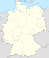
 Location map - regional level
 -
 Location map - country level according to German conventions. Color one area, you get a Locator map.
 -
 ...according to german convention.
 -
 Locator map - help to localise a subject on the map.


- That might be nice for a map showing all of the divisions, but what about my example where we only want to focus on a single division? --Golbez (talk) 18:15, 17 July 2008 (UTC)
- Recommendations are not yet set for this but they will likely follow newly established german conventions (see here) (German conventions which, actually, seems to have pick upt their colors from the French convention (see Image:Maps_template-fr.svg) ) + 1 recommended color for the concerned region to get a locator map. The German team is currently creating such standard maps for many coutries, a really good pro-uniformization initiative :]
- Yug (talk) 18:58, 17 July 2008 (UTC)
I still prefer the semi-standard EN colors. See example below. It's not bland but it's not too bright either. --seav (talk) 13:00, 18 July 2008 (UTC)
- First, I want to notice that we are still facing several proposals, we still are talking. I added the German images to the overview table to give an idea of what we can eventually get.
- Afterwhat, for the differences between English, French, and German styles :
- The light-yellow is -anyway- the same or really REALLY close.
- The light orange (from EN) is close from the light-orange proposed by Sting. German just skip this color.
- The grey (from Germans) is close(/same?) than Sting's proposal. EN just skip this color.
- The sea-blue (from EN) is « a bit » brighter than the Sting-German proposal.
- Here, I want notice that we are now all supporting really close proposals, and we now have to harmonize the whole.
- I understand than Mapmaster and Seav [you] prefer the brighter EN style. On the other side, German graphists preferred soft colours. Two be honest, these proposals are now so close that we talk here about personal preferences (either from you or from German or from French) which imply no clear advantages. With such so close proposals, we [who?] will have to make almost-arbitrary choices. We can't start votes or long talks which will be time consuming for no or really tiny benefices.
- I think we now have no way to choice scientifically between such really close proposals. I honestly think we here face our limits : we can continue to talk = impasse ; we can call a leader to make the final [almost-arbitrary] choice(s) quickly.
- If nobody oppose, I suggest Sting, who already submitted a complete medium proposal, this one: Image:Maps_template-fr.svg, which is a medium way between English style and former soft French style
- Yug encourage the following solution : hire back Sting as the final judge (we need someone) ; and restate clearly :
- We, we have to restate to ourselves and remember :
- _a/ the current Sting's medium proposal is there: Image:Maps_template-fr.svg , it's a medium way between English and Old French styles.
- But this keep us free to restate to Sting the following comments and facts:
- _a/ English proposal (Planemad), Mapmaster and Seav are supporting stronger colors such Image:Map of USA ME.svg (SVG);
- _b/ English have no centralised team of SVG cartographers (or I'm not aware of it)
- _c/ Germans proposal (Chumwa) are supporting soft colours such here (SVG);
- _d/ Germans have a team of SVG cartographers who currently create a full set of maps according to their style (here [same page].) ;
- _e/ French old proposal (STyx) preferred soft colours (Image:Palette_pour_la_cartographie.svg) ;
- _f/ French have a team of SVG cartographers ready to work.
- We can trust Sting, we can't do more. Yug (talk) 21:31, 18 July 2008 (UTC)
Correct, the English pedia has no centralized team of cartographers. It's generally been done by an individual in waves; first Morwen made her maps, then I made mine, now others are making new ones over mine. My main desire now is for a color for the focused area (i.e. in an article on Bavaria, this is the color Bavaria should be in the locator map). I don't mind the other colors (though I have no opinion on which ones are better at present), and certainly agree that we should include other countries, so we're down to just that issue now. The Germans, based on what I can see, haven't gotten to this issue yet. --Golbez (talk) 06:12, 21 July 2008 (UTC)
- Note: A talk have took place on Wiki-fr. The conclusion of the talk (here): the French cartographers all agree to leave their French conventions for country to switch to the German styles : country in soft-yellow/other country grey. The ideas have been supported by Sting and Sémhur (2 of the 3 best FR-cartographers), by myself, and by an other cartographer. Yug (talk) 13:11, 26 July 2008 (UTC)
- Summary
1. Convergence of FR & DE conventions for POSITION-LOCATION maps: Following a recent talk on the FR (jul. 2008), French cartographers all agree to make switch their LOCATION maps to the German style. Advantages : less colours ; ease the black&white printing ; create a true wiki-style (non-CIA) ... recognizable as non-professionnal (that's also need) to cross-check with provided sources (in the image's page).
2. Golbez question: "what is the Conventional enlighting color for LOCATOR maps ?" have no yet clear answer. Yug proposal is : soft-red (i.e. #FF0000;opacity=60%) for small area out of a big map ; soft-green for a big area on a small map.
3. Prefered colours: English mapmakers prefer brighter colours, such the English semi-convention ; French and German prefer softer colors.
Has of not a Map lab: BUT. also to notice, EN has no centralized team of cartographers ; while both FR and DE have centralized teams.
4. Current medium-proposal: The current Sting's medium proposal there: Image:Maps_template-fr.svg is already a medium way between English style and old French (soft) style, waiting comments for futur approval.
5. IMPORTANT: LOCATION maps VS LOCATOR maps : it seems now need to differentiate clearly LOCATION maps, need for geolocation using red dots ; and LOCATOR maps, need to localize an area. (do we keep the same conventions)
Yug (talk) 23:18, 26 July 2008 (UTC)
2. Locator map : Colored areas[edit]
- Past practice
- #40A040 ███ (green), ex: Ecuador
- #E08020 ███ (orange), ex: Colombia (orange)
- #0000B0 ███ (blue), ex: Venezuela (blue)
- #ff4040 ███ (soft red), ex: Enlighted area
- the Existing_prevalent_style_of_locator_maps_in_EN_Wikipedia show that the red with partial opacity is commonly used to enlight efficiently an area.
- Introduction
For colored areas [to put on Wikimaps etc.], I will soon contact user:LadyofHats to request him a set of 5 basic colors such blue-green-orange-brown-purple + 2 derivated color for each (by example : green + [light green + VERY light green]). LadyofHat being a professional graphist, and having already seen his svg drawings, I really think he is the most able to provide such set with good visual result. Yug 11:30, 16 July 2008 (UTC)
- First real test
I finaly made a really basic test like you can see below :

Note: This test is according to 2 needs :
a/ very basic locator maps : background + 1 to 3 colors, no labels (the 3 firsts)
b/ complex locator maps such historical maps, which need to be display on complex topographic background and with many labels (the last one is one such example).
Further test would be welcome with more colors such as greens, reds, purples, browns, etc.
My understanding of color theories and my artistic abilities being really basic, I give the hand to better graphists such Sémhur and LadyofHats, who have stronger "instinct" for color choices. Yug (talk) 17:43, 17 July 2008 (UTC)
- Summary
- Colored area: Past practices for basic wiki maps: Color with opacity=100% need.
To enlight one area : Green and Red were preferentially used, will likely switch to the soft red.
To enlight several areas equaly: need a set of 3 to 6 complementary colors, for the moment we have the team "Green/Orange/Blue", which need expansion. Colors need: Yellow, Purple, etc. ?? Need LadyofHats advices to expand this set. - Colored area: for complex maps: the recent test (Yug) lead to think that the same color with a opacity=25% should be good.
Yug (talk) 12:11, 24 July 2008 (UTC)
Colours for colour blind[edit]
Hi! When you decide about colours, I hope you keep in mind us colour blind people (ca. 7 % of the human population). I know it's difficult because just like I can't see the way you see, you can't see the way I see, but if there is anything you want to ask, feel free to ask me anything, anytime. Regards, Samulili (talk) 19:45, 17 July 2008 (UTC)
- Ok, I keep this in mind.
- In the last stages, it will be need to set up a Color blind review. Accordingly, I keep your pseudo in mind :] Yug (talk) 19:51, 17 July 2008 (UTC) PS: do you know some other color-blind wikipedian ?
- I know that User:Marmelad is, and also en:User:Mwalcoff. You might also want to try this at some point: http://colororacle.cartography.ch/ I have no experience of it and I don't know if it can replace human scrutiny. Samulili (talk) 13:21, 18 July 2008 (UTC)
- Summary
- 1. Color blind volunteer: User:Samulili, User:Marmelad, and en:User:Mwalcoff are color blind, and may help for the final review.
- 2. Color blind soft: http://colororacle.cartography.ch/ can be helpful (need to learn how to use it)
- Yug (talk) 19:13, 20 July 2008 (UTC)
User W:User talk:Quiddity put me onto a web page http://colorfilter.wickline.org/ which has all kinds of filter options, and I would advise asking him to get involved in any color standardization efforts here. In any event, Red-Green color deficiencies and blindness types are likely the most troublesome, and that filter also graduates and displays contrasts seen, which should help speed color selections, for in the end, color blindness is best managaged by providing sufficient contrasts, as I understand it. // FrankB 23:05, 25 July 2008 (UTC)
- Linked this to Quiddity, and he had some comments you all might find useful:
- "(The thing that sprang to mind first, upon glancing at that (HERE!) page, was the Four color theorem (Which I think I learned about from the cartographer in The Secret of Monkey Island...) and everyone there is certainly familiar with. ;) [Quiddity is making a joke... this was an EGA era video game with long lifespan.]
Other good color-blind testing sites are this Australian gov page and vischeck. More here. I almost always just advocate "clean" and "simple" aesthetics, with a side of patience.
When in doubt, consult Tufte or the experts (there is a distinct lack of references in that commons discussion to international/government/corporate cartographic standards & styleguides, which it would be nice to have...) Good luck :) -- Quiddity (talk) 00:41, 26 July 2008 (UTC)"
- "(The thing that sprang to mind first, upon glancing at that (HERE!) page, was the Four color theorem (Which I think I learned about from the cartographer in The Secret of Monkey Island...) and everyone there is certainly familiar with. ;) [Quiddity is making a joke... this was an EGA era video game with long lifespan.]
I have to echo his point on not reinventing the wheel... building on existing expertise has it's attractions. Since I'm a map filer, not a map builder, I wish you all well. // FrankB 05:06, 26 July 2008 (UTC)