Category:Location maps of Africa
Jump to navigation
Jump to search
 |
This category should only contain blank "Location maps" created for geo-location purposes which follow a same uniform standard, and have been created with a Geographic information system (GIS) software program using a compatible equirectangular or conical projection and for which the geographic coordinate system is known. For more information or questions see the wikiproject: German Wikipedia:Kartenwerkstatt/Positionskarten and this discussion page. |
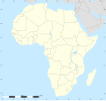
proposed country in Southern Africa   | |||||
| Upload media | |||||
| Instance of | |||||
|---|---|---|---|---|---|
| Location | Southern Africa, Africa, Southern Hemisphere | ||||
| Capital | |||||
| |||||
Subcategories
This category has the following 60 subcategories, out of 60 total.
+
- Location maps of Mayotte (7 F)
- Location maps of Réunion (5 F)
A
- Location maps of Angola (2 F)
B
- Location maps of Benin (4 F)
- Location maps of Botswana (3 F)
- Location maps of Burundi (6 F)
C
- Location maps of Cape Verde (4 F)
- Location maps of Chad (3 F)
- Location maps of the Comoros (3 F)
E
- Location maps of Egypt (16 F)
- Location maps of Eswatini (4 F)
G
- Location maps of Gabon (3 F)
- Location maps of the Gambia (4 F)
- Location maps of Ghana (4 F)
- Location maps of Guinea (4 F)
I
- Location maps of Ivory Coast (4 F)
K
- Location maps of Kenya (6 F)
L
- Location maps of Lesotho (5 F)
- Location maps of Liberia (2 F)
- Location maps of Libya (2 F)
M
- Location maps of Madagascar (4 F)
- Location maps of Malawi (8 F)
- Location maps of Mali (5 F)
- Location maps of Mauritania (2 F)
- Location maps of Mauritius (4 F)
- Location maps of Morocco (4 F)
- Location maps of Mozambique (5 F)
N
- Location maps of Namibia (2 F)
- Location maps of Niger (2 F)
- Location maps of Nigeria (3 F)
R
- Location maps of Rwanda (3 F)
S
- Location maps of Senegal (3 F)
- Location maps of Seychelles (2 F)
- Location maps of Somalia (19 F)
- Location maps of Somaliland (25 F)
T
- Location maps of Tanzania (2 F)
- Location maps of Togo (2 F)
- Location maps of Tunisia (3 F)
U
- Location maps of Uganda (3 F)
W
- Location maps of Western Sahara (11 F)
Z
- Location maps of Zambia (11 F)
- Location maps of Zimbabwe (4 F)
Media in category "Location maps of Africa"
The following 37 files are in this category, out of 37 total.
-
 Africa land cover location map.jpg 1,525 × 1,440; 523 KB
-
 Africa location map without rivers.svg 1,525 × 1,440; 529 KB
-
 Africa location map.svg 1,525 × 1,440; 774 KB
-
 Africa relief location map-no borders.jpg 1,525 × 1,440; 549 KB
-
 Africa relief location map.jpg 1,525 × 1,440; 522 KB
-
 Mediterranean Sea East location map.svg 957 × 765; 186 KB
-
 Mediterranean Sea location map.svg 1,754 × 862; 1.19 MB
-
 Relief Map of Mediterranean Sea (cropped).png 655 × 520; 590 KB
-
 Relief Map of Mediterranean Sea.png 1,754 × 862; 2.06 MB
-
 Africa land cover location mamba map with borders.jpg 1,525 × 1,440; 928 KB
-
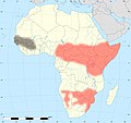
 Africa location map black mamba distribution.svg 1,525 × 1,440; 45 KB
-
 Africa Zambezi Location Map.svg 937 × 610; 1.19 MB
-
 Africa Zambezi Relief Location Map.jpg 1,561 × 1,016; 233 KB
-
 Arab world location map.svg 1,524 × 1,082; 547 KB
-
 Arcipelago siciliano nel Mar Mediterraneo.svg 1,754 × 862; 1.2 MB
-
 CEDEAO location map.svg 1,600 × 1,000; 148 KB
-
 CEDEAO relief location map.svg 1,600 × 1,000; 130 KB
-
 Horn of Africa adm location map (1).svg 1,087 × 1,132; 375 KB
-
 Horn of Africa relief location map.jpg 1,380 × 1,438; 383 KB
-
 Map of Arabian & Gulf of Aden.png 1,344 × 848; 1.81 MB
-
 Mediterranean Sea location map (blank) 2.svg 1,754 × 862; 1.02 MB
-
 Mediterranean Sea location map (blank).svg 1,754 × 862; 1.01 MB
-
 Mediterranean Sea location map islands-de.svg 1,576 × 794; 1.57 MB
-
 Mediterranean Sea location map with blue Sicily.svg 1,754 × 862; 1.2 MB
-
 Mediterranean Sea location map-2.png 480 × 499; 71 KB
-
 Mozambique Channel location map.svg 1,525 × 1,440; 775 KB
-
 North Africa location map.svg 160 × 131; 105 KB
-
 North Africa OpenStreetMap.png 2,748 × 1,452; 816 KB
-
 Outline map of Middle East 2.svg 667 × 633; 2.16 MB
-
 Outline map of Middle East.svg 1,000 × 654; 2.71 MB
-
 Relief Map of Middle East 2.jpg 1,000 × 950; 280 KB
-
 Relief Map of Middle East.jpg 1,500 × 982; 330 KB
-
 Spain Canary Islands location map with Spain.png 1,474 × 655; 56 KB
-
 Spain Canary Islands location map.svg 1,475 × 655; 29 KB
-
 Struthio camelus distribution with key.svg 687 × 701; 859 KB
-
 Struthio camelus distribution.svg 687 × 701; 778 KB
-
 Zambesia location map.svg 524 × 333; 787 KB


.png)


.svg)


_2.svg)
.svg)