Category:Interstate 5 in Washington (state)
Jump to navigation
Jump to search
section of Interstate Highway in Washington, United States .svg)  | |||||
| Upload media | |||||
| Instance of | |||||
|---|---|---|---|---|---|
| Location | Washington, Pacific Northwest, Washington, Pacific States Region | ||||
| Transport network | |||||
| Connects with | |||||
| Owned by | |||||
| Maintained by | |||||
| Inception |
| ||||
| Length |
| ||||
| Terminus | |||||
| |||||
| 3 · 4 · 5 · 6 · 7 · 8 · 9 · 10 · 11 · 14 · 16 · Last » |
| I-5 · I-82 · I-90 · I-182 · I-205 · I-405 · I-605 · I-705 |
| US-2 · US-10 · US-12 · US-95 · US-97 · US-99 · US-101 · US-195 · US-197 · US-295 · US-395 · US-730 · US-830 |
English: This category should contain files related to Interstate 5 in Washington. (State route number 5 in Washington per RCW 47.17.020)
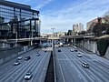
English: Media related to Interstate 5 in Washington (state), a 276.62-mile (445.18 km) section of Interstate Highway in Washington (state), United States.
Subcategories
This category has the following 13 subcategories, out of 13 total.
4
- Interstate 405 (Washington) (38 F)
6
- Interstate 605 (Washington) (2 F)
7
C
I
K
M
- Mountlake Terrace Transit Center (15 F)
S
U
- Uncle Sam billboard (4 F)
Media in category "Interstate 5 in Washington (state)"
The following 139 files are in this category, out of 139 total.
-

-

-
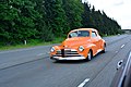 1947 Chevrolet spotted on Interstate 5 in Snohomish County, WA 2020-05-23.jpg 6,000 × 4,000; 10.23 MB
-
 2017 Cascades derailment aerial view from NTSB preliminary report.jpg 1,091 × 613; 238 KB
-
 2017 Washington train derailment detour routes.png 1,989 × 2,412; 2.03 MB
-
 2017WashingtonDerailmentSchematicSiteOverview a en.png 1,024 × 852; 79 KB
-
 511 at the MLT Freeway Station (5551694803).jpg 5,184 × 3,456; 4.19 MB
-
 Aerial view of 172nd Street NE (WA-531) in Smokey Point (16541316773).jpg 4,320 × 3,240; 3.2 MB
-
 Amtrak Cascades in I-5 median, April 2010.jpg 3,415 × 2,276; 1.98 MB
-
 Baist Seattle 1905 plate 7 - E - raw.jpg 1,944 × 2,592; 697 KB
-
 Bellingham, WA Alabama Street 1.JPG 4,000 × 3,000; 3.18 MB
-
 Bellingham, WA Alabama Street 2.JPG 4,000 × 3,000; 4.29 MB
-
 Boeing Field Apartments, circa 1980 (51086290756).jpg 2,466 × 1,701; 2.22 MB
-
 Canada USA Border - panoramio.jpg 3,376 × 1,717; 1.97 MB
-
 Canadian Pacific intermodal refrigerated container - Whatcom County, WA.jpg 3,524 × 1,982; 1.27 MB
-
 COVID-19 stay home PSA on Interstate 5 in Seattle - 01.jpg 3,456 × 2,304; 2.9 MB
-
 Curving overpass over I-5 in south Everett (6111017547).jpg 1,824 × 1,368; 533 KB
-
 Downtown Tacoma, Washington from Interstate 5 - 01.jpg 5,800 × 2,471; 5.49 MB
-
 Duwamish near Codiga Farms 01.jpg 3,264 × 2,448; 1.89 MB
-
 East of I-5, north of Conway, Washington 01.jpg 4,288 × 2,848; 4.08 MB
-
 East of I-5, north of Conway, Washington 02.jpg 4,288 × 2,848; 4.16 MB
-
 East of I-5, north of Conway, Washington 03.jpg 4,288 × 2,848; 4.07 MB
-
 East of I-5, north of Conway, Washington 04.jpg 4,288 × 2,848; 4.19 MB
-
 Emergency repairs to Interstate 5 in Shoreline, WA due to heat wave.jpg 3,444 × 2,286; 2.97 MB
-
 Everett, WA - Dagmar's Marina from Interstate 5 - 01.jpg 6,000 × 4,000; 7.44 MB
-
 Everett, WA - Snohomish River looking east from Interstate 5 - 01.jpg 6,000 × 3,584; 6.69 MB
-
 Everett, WA - Steamboat Slough looking east from Interstate 5 - 01.jpg 5,723 × 2,968; 5.82 MB
-
 Everett, WA - Steamboat Slough looking east from Interstate 5 - 02.jpg 5,810 × 2,211; 4.56 MB
-
 Everett, WA - Union Slough looking east from Interstate 5 - 01.jpg 5,713 × 2,802; 6.03 MB
-
 Everett, WA - Union Slough looking west from Interstate 5 - 01.jpg 6,000 × 4,000; 7.78 MB
-
 Everett, WA - Union Slough looking west from Interstate 5 - 02.jpg 6,000 × 4,000; 6.48 MB
-
 Everett, WA - Union Slough looking west from Interstate 5 - 03.jpg 5,895 × 2,782; 5.48 MB
-
 February 2024, Seattle, WA - 106.jpg 4,032 × 3,024; 3.16 MB
-
 Fort Lewis Military Museum from Interstate 5 - 01.jpg 4,928 × 3,032; 7.43 MB
-
 Fort Lewis Military Museum from Interstate 5 - 02.jpg 5,472 × 3,536; 9.06 MB
-
 Fort Lewis Military Museum from Interstate 5 - 03.jpg 4,528 × 2,736; 6.77 MB
-
 Gospodor Monument Park, WA, 2016.jpg 5,312 × 2,988; 4.2 MB
-
 Green Hill School 2023 01.jpg 4,608 × 2,592; 3.14 MB
-
 I-405 North - Becoming WA518 West at I-5 Exit (39642918821).jpg 2,400 × 1,600; 2.1 MB
-
 I-5 (WA) Metric.svg 601 × 601; 20 KB
-
 I-5 (WA).svg 601 × 601; 20 KB
-
 I-5 and WA-516 interchange aerial.jpg 2,970 × 1,882; 1.45 MB
-
 I-5 at Longview WyeWA-432.jpg 1,024 × 768; 141 KB
-
 I-5 at Swamp Creek Interchange, 1967.jpg 400 × 466; 110 KB
-
 I-5 at WA-518, Tukwila.jpg 1,280 × 960; 121 KB
-
 I-5 Business Loop in Castle Rock, WA.jpg 3,430 × 2,264; 3.49 MB
-
 I-5 construction near Tacoma, southbound - June 2021.jpg 3,450 × 2,296; 2.28 MB
-
 I-5 entering Washington, Interstate Bridge.jpg 3,072 × 2,304; 889 KB
-
 I-5 exit 39, SR 4 in Kelso.jpg 1,024 × 768; 146 KB
-
 I-5 exit 59 - SR 506 near Toledo.jpg 1,024 × 768; 161 KB
-
 I-5 exit 60 - SR 506 (Toledo-Vader Road) near Toledo.jpg 1,024 × 768; 140 KB
-
 I-5 exit 63 - SR 505 near Toledo.jpg 1,024 × 768; 138 KB
-
 I-5 Lacey.JPG 1,600 × 1,200; 338 KB
-
 I-5 northbound at SR 512 in Lakewood, WA.jpg 3,368 × 2,164; 2.52 MB
-
 I-5 northbound at SR 539, Bellingham.jpg 4,696 × 3,084; 4.09 MB
-
 I-5 Ship Canal Bridge (4833566368).jpg 5,184 × 3,456; 6.05 MB
-
 I-5 south at WA-18, Federal Way.jpg 1,280 × 960; 116 KB
-
 I-5 south at WA-516, Kent.jpg 1,280 × 960; 137 KB
-
 I-5 South Everett.jpg 1,600 × 1,200; 505 KB
-
 I-5 southbound at I-205 in Salmon Creek, WA.jpg 3,430 × 2,264; 2.12 MB
-
 I-5 southbound from 75th Street in Everett (18345043233).jpg 4,752 × 3,168; 3.64 MB
-
 I-5 southbound from McKinley Way in Tacoma (20248941025).jpg 4,752 × 3,168; 5.34 MB
-
 I-5 southbound from McKinley Way, Tacoma (20240715702).jpg 4,752 × 3,168; 5.87 MB
-
 I-5 southbound from S Yakima Avenue, Tacoma (20062541909).jpg 4,752 × 3,168; 5.12 MB
-
 I-5 southbound from WA-531, Lakewood.jpg 4,320 × 3,240; 2.33 MB
-
 I-5 Tacoma, Washington.jpg 3,538 × 1,990; 825 KB
-
 I5betSeattleVancouver.jpg 3,264 × 2,448; 1.42 MB
-
 I5LewisFlooding.jpg 700 × 525; 50 KB
-
 I90 and I5 intersection.JPG 3,056 × 2,296; 2.7 MB
-
 Int5nRoad-Exit154AB-Int405nWA518w (39642911561).jpg 2,400 × 1,600; 1.71 MB
-
 Int5nRoad-Exit163-Exit164-Int90e (31618891423).jpg 2,400 × 1,600; 1.79 MB
-
 Int5nRoad-Exit181A-WA524-Exit182-WA525 (32279308262).jpg 2,400 × 1,600; 1.72 MB
-
 Int5nRoadSign-MM156 (32279302892).jpg 2,400 × 1,600; 1.71 MB
-
 Int5sRoad-Exit127-WA512e (39642906801).jpg 2,400 × 1,600; 1.64 MB
-
 Int5sRoad-Exit13-Int705nWA7s (39642926501).jpg 2,400 × 1,600; 1.8 MB
-
 Int5sRoad-Exit137-WA99nHM (39642919681).jpg 2,400 × 1,600; 2.04 MB
-
 Int5sRoadWA-Exit132AB-WA16w (39642906541).jpg 2,400 × 1,600; 1.58 MB
-
 Int5sRoadWA-Exit133-Int705nWA7s (39642906091).jpg 2,400 × 1,600; 1.43 MB
-
 Int5sRoadWA-Exit135-WA167-1.5miles (39612789082).jpg 2,400 × 1,600; 1.5 MB
-
 Int5sRoadWA-MM136 (39642905711).jpg 2,400 × 1,600; 1.66 MB
-
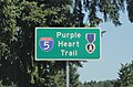 Interstate 5 - Purple Heart Trail sign near Maytown, WA.jpg 2,907 × 1,903; 1.81 MB
-
 Interstate 5 approaching the Tacoma Dome from the north.jpg 3,896 × 2,472; 4.38 MB
-
 Interstate 5 from Pickering Viewpoint 01.jpg 6,000 × 4,000; 10.25 MB
-
 Interstate 5 in Washington state.JPG 4,224 × 2,376; 4.78 MB
-
 Interstate 5 Mount Rainier 2008-02-26.jpg 3,000 × 2,089; 1.26 MB
-
 Interstate 5 northbound in Lynnwood, WA.jpg 4,750 × 3,166; 5.73 MB
-
 Interstate 5 northbound near Shoreline, WA - HOV and VMS.jpg 4,752 × 3,166; 4.58 MB
-
 Interstate 5 southbound - Stillaguamish River bridge.jpg 6,000 × 4,000; 8.83 MB
-
 Interstate 5 southbound, south of Bellingham, WA near Lake Padden 01.jpg 6,000 × 4,000; 10.27 MB
-
 Interstate 5 southbound, south of Bellingham, WA near Lake Padden 02.jpg 6,000 × 4,000; 11.08 MB
-
 Interstate 5 under construction, 1963 (46535962192).jpg 700 × 454; 93 KB
-
 Interstate 5 Washington01 2008-02-22.jpg 2,592 × 1,944; 1.08 MB
-
 Interstate 5 Washington02 2008-02-22.jpg 2,592 × 1,944; 1.19 MB
-
 John Lewis Memorial Bridge at Northgate Station - view from center span.jpg 4,780 × 3,054; 5.13 MB
-
 John Lewis Memorial Bridge at Northgate Station - view from station platform.jpg 4,858 × 3,180; 5.32 MB
-
 Lakewood Crossing-map.png 408 × 417; 6 KB
-
 Lakewood, WA - BNSF bridge over Interstate 5 (cropped).jpg 4,858 × 2,648; 4.53 MB
-
 Lakewood, WA - BNSF bridge over Interstate 5.jpg 6,000 × 4,000; 8.82 MB
-
 Link Light Rail seen from Interstate 5 near Tukwila, Washington.jpg 6,000 × 4,000; 10.8 MB
-
 Midget racer being transported on Interstate 5 in Snohomish County, WA 01.jpg 6,000 × 4,000; 9.7 MB
-

-
 Midget racer being transported on Interstate 5 in Snohomish County, WA 02.jpg 6,000 × 4,000; 7.89 MB
-
 Mount Rainier at dawn from Seattle.png 3,918 × 2,938; 12.78 MB
-
 Mount Rainier looming over I-5 southbound near SR 900 in Seattle.jpg 3,418 × 2,246; 2.44 MB
-
 Mount Vernon, WA - Old Town Grainery 01.jpg 4,288 × 2,848; 4.3 MB
-
 Mt. Rainier-1.jpg 3,373 × 2,249; 1.69 MB
-
 Mt. Rainier-2.jpg 3,082 × 2,055; 1.81 MB
-
 Nisqually Delta from Interstate 5 - 01.jpg 5,832 × 3,056; 6.03 MB
-
 Nisqually Delta from Interstate 5 - 02.jpg 5,856 × 3,336; 7.52 MB
-
 North Lake Samish Drive overpass over southbound Interstate 5.jpg 6,000 × 4,000; 11.52 MB
-
 Paradise Point, WA.jpg 4,032 × 3,024; 4.41 MB
-
 Skagit River from Interstate 5.jpg 4,288 × 2,848; 3.82 MB
-
 Solid Waste with a View - Flickr - brewbooks.jpg 3,264 × 2,448; 3.2 MB
-
 South Sound Speedway Sign I5.jpg 3,648 × 2,432; 2.7 MB
-
 South5.jpg 250 × 186; 40 KB
-
 SR 526 and SR 527 terminus in Everett, WA.jpg 4,752 × 3,168; 3.64 MB
-
 Stay Home banner Interstate 5 in Seattle.jpg 3,150 × 450; 628 KB
-
 Tacoma Dome 2497.jpg 4,544 × 2,964; 1.08 MB
-
 Tacoma Dome 2499.jpg 4,608 × 3,072; 3.23 MB
-
 Tacoma Dome from Interstate 5.jpg 6,000 × 4,000; 10.41 MB
-
 Tacoma, WA - Tower of Holy Rosary Parish Church seen from Interstate 5.jpg 6,000 × 4,000; 7.29 MB
-

-
 The I-5 artery - Flickr - brewbooks.jpg 1,920 × 1,080; 920 KB
-
 Tukwila - Green River Trail looking northwest under Interstate 5 - 01.jpg 6,000 × 4,000; 13.82 MB
-
 Tukwila - looking under Interstate 5 from Green River Trail.jpg 3,264 × 2,448; 1.79 MB
-
 Tukwila - S 129th Street bridge over Interstate 5 - 01.jpg 6,000 × 4,000; 13.67 MB
-
 Tukwila - S 129th Street bridge over Interstate 5 - 02.jpg 6,000 × 4,000; 12.49 MB
-
 Tukwila - S 159 St crosses Interstate 5.jpg 3,264 × 2,448; 1.9 MB
-
 Tukwila, WA - Sound Transit Link Light Rail from Interstate 5.jpg 5,632 × 3,768; 10.63 MB
-
 Two Bandidos on the road - cropped, Gaussian blur on license plates.jpg 4,336 × 3,008; 5.02 MB
-
 Unidentified building at Fort Lewis.jpg 4,680 × 3,016; 6.19 MB
-

-

-
-

-
 WA-531 at Oliver Punks Smith Bridge.jpg 4,320 × 3,240; 2.58 MB
-
 Washington I-5 lanes.png 334 × 7,887; 68 KB
-
 Washington Interstate 5.svg 1,152 × 640; 1.17 MB
-
 Wild Waves Theme Park - Federal Way WA.jpg 2,848 × 2,136; 1.97 MB


.jpg)
_in_Smokey_Point_(16541316773).jpg)


.jpg)


.jpg)


.jpg)
_Metric.svg)


_near_Toledo.jpg)


.jpg)


.jpg)
.jpg)
.jpg)
.jpg)


.jpg)
.jpg)
.jpg)
.jpg)
.jpg)
.jpg)
.jpg)
.jpg)
.jpg)
.jpg)
.jpg)


.jpg)


.jpg)


.jpg)


_Aviation_Ordnance_Association_clean_a_stretch_of_Interstate_I-5_that_they_have_adopted.jpg)
_Aviation_Ordnance_Association_clean_a_stretch_of_Interstate_I-5_that_they_have_adopted.jpg)


.jpg)