Category:Friedhof Wahn (Hümmling)
Jump to navigation
Jump to search
| Object location | | View all coordinates using: OpenStreetMap |
|---|
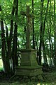
Media in category "Friedhof Wahn (Hümmling)"
The following 21 files are in this category, out of 21 total.
-
 Sögel - Wahn - Friedhof 01 ies.jpg 5,616 × 3,744; 30.99 MB
-
 Sögel - Wahn - Friedhof 02 ies.jpg 5,616 × 3,744; 24.94 MB
-
 Sögel - Wahn - Friedhof 03 ies.jpg 3,743 × 5,616; 15.57 MB
-
 Sögel - Wahn - Friedhof 04 ies.jpg 5,616 × 3,743; 25.8 MB
-
 Sögel - Wahn - Friedhof 05 ies.jpg 5,616 × 3,742; 24.46 MB
-
 Sögel - Wahn - Friedhof 06 ies.jpg 5,616 × 3,743; 26.21 MB
-
 Sögel - Wahn - Friedhof 07 ies.jpg 3,744 × 5,616; 18.43 MB
-
 Sögel - Wahn - Friedhof 08 ies.jpg 3,744 × 5,616; 26.35 MB
-
 Sögel - Wahn - Friedhof 09 ies.jpg 3,743 × 5,616; 19.27 MB
-
 Sögel - Wahn - Friedhof 10 ies.jpg 3,744 × 5,616; 25.84 MB
-
 Sögel - Wahn - Friedhof 11 ies.jpg 5,616 × 3,744; 25.33 MB
-
 Sögel - Wahn - Friedhof 12 ies.jpg 5,616 × 3,744; 24.49 MB
-
 Sögel - Wahn - Friedhof 13 ies.jpg 3,744 × 5,616; 20.4 MB
-
 Sögel - Wahn - Friedhof 14 ies.jpg 3,744 × 5,616; 18.41 MB
-
 Sögel - Wahn - Friedhof 15 ies.jpg 5,616 × 3,746; 23.79 MB
-
 Sögel - Wahn - Friedhof 16 ies.jpg 5,616 × 3,743; 20.62 MB
-
 Sögel - Wahn - Friedhof 17 ies.jpg 3,744 × 5,616; 20.78 MB
-
 Sögel - Wahn - Friedhof 18 ies.jpg 3,744 × 5,616; 27.88 MB
-
 Sögel - Wahn - Friedhof 19 ies.jpg 5,616 × 3,744; 24.36 MB
-
 Wahn Friedhof Eingang.JPG 1,800 × 1,200; 1.04 MB
-
 Wahn Friedhof.JPG 1,800 × 1,200; 907 KB


