Category:French-language maps showing history
Jump to navigation
Jump to search
Subcategories
This category has the following 4 subcategories, out of 4 total.
Media in category "French-language maps showing history"
The following 135 files are in this category, out of 135 total.
-
 10 Afr Est -700 png élargi.png 2,001 × 1,830; 589 KB
-
 11-2 Afr Est -600 png élargi.png 2,002 × 1,830; 603 KB
-
 12-2 Afr Est -500 png élargi.png 1,998 × 1,830; 635 KB
-
 1770 Hemisphere de l'Isle.jpg 1,400 × 1,185; 1.29 MB
-
 ACW Chattanooga2Carolinas-fr.svg 1,862 × 992; 160 KB
-
 Africa1913 fr.png 281 × 315; 11 KB
-
 Alger algiers map plan villeneuve 1840.jpg 657 × 460; 94 KB
-
 Amerique Meridionale 1783.jpg 9,048 × 6,498; 41.69 MB
-
 Anachronous map of the All French Empire (1534 -1970).png 2,000 × 1,015; 505 KB
-
 Andree expedition-fr.png 2,222 × 1,833; 813 KB
-
 Azerbaijan Democratic Republic Map2.jpg 945 × 700; 1.09 MB
-
 Bataille de Carthagène.png 1,124 × 802; 32 KB
-
 Bataille de Grèce09041941.PNG 1,257 × 950; 156 KB
-
 Bataille de Shanhaiguan.png 735 × 947; 175 KB
-
 BatailledeGrèce15041941.JPG 1,052 × 1,116; 161 KB
-
 Byzantium1230.png 764 × 533; 85 KB
-
 Carte Carie.png 483 × 444; 52 KB
-
 Carte de l'Empire romain en 118 après J.-C.jpg 1,485 × 1,120; 798 KB
-
 Carte Distribution des villages d'Empire.png 2,853 × 1,747; 1.32 MB
-

-
 Carte du voïage des Israëlites. xviie siècle.JPG 2,690 × 2,023; 825 KB
-
 Carte empire achéménide.png 1,766 × 914; 549 KB
-
 Carte ethnographique de la Péninsule balkanique, cropped.jpg 436 × 394; 305 KB
-
 Carte Ionie.png 483 × 444; 51 KB
-
 Carte Iran 1000.png 1,093 × 727; 262 KB
-
 Carte Isaurie.png 483 × 444; 56 KB
-
 Carte Lycaonie.png 483 × 444; 56 KB
-
 Carte Lycie.png 483 × 444; 48 KB
-
 Carte Lydie.png 483 × 444; 49 KB
-
 Carte micronesie.png 1,012 × 628; 65 KB
-
 Carte Mysie.png 483 × 444; 60 KB
-
 Carte Paphlagonie.png 483 × 444; 54 KB
-
 Carte Phrygie.png 483 × 444; 59 KB
-
 Carte Pisidie.png 483 × 444; 57 KB
-
 Carte Routes de Postes-1632-Tavernier.jpg 8,608 × 6,701; 10.32 MB
-
 Carte Routes de Postes-1695-Jaillot.jpg 7,732 × 8,204; 11.1 MB
-
 Carte Troade.png 483 × 444; 75 KB
-
 Carte Éolide.png 483 × 444; 49 KB
-
 Carte-Empire néo-assyrien.png 931 × 800; 233 KB
-
 Carte-Routes-de-Postes-1731-Jaillot.jpg 8,609 × 6,995; 13.39 MB
-
 CastillaLeon 1360-fr.svg 1,927 × 1,426; 406 KB
-
 Chattanooga Campaign Nov 24-25.svg 683 × 599; 199 KB
-
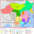
 Chine 1911-1916.png 4,000 × 4,000; 3.29 MB
-
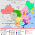
 Chine 1921-1922.png 4,000 × 4,000; 2.7 MB
-
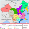
 Chine 1923-1924.png 4,000 × 4,000; 2.62 MB
-
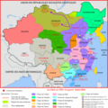
 Chine 1925-1926.png 4,000 × 4,000; 2.66 MB
-
 Chine 1927-1928.png 4,000 × 4,000; 2.62 MB
-
 Chine 1929-1930.png 4,000 × 4,000; 2.6 MB
-
 Chine de 1917 à 1920.png 3,500 × 3,500; 3.2 MB
-
 Chine Ming - provinces Yongle.svg 628 × 641; 641 KB
-
 Cimbrians and Teutons-fr.jpg 806 × 524; 184 KB
-
 Conquête de Majorque par Jacques Ier d’Aragon 01.jpg 1,200 × 800; 120 KB
-
 County of Soissons (1180).png 427 × 398; 107 KB
-
 Croissant fertile carte.png 1,988 × 2,443; 763 KB
-
 Crètevénitienne.png 702 × 320; 51 KB
-

-
 Dakar map plan 1863.jpg 450 × 333; 34 KB
-
 DiffusionAlphabet XIIIe-VIIIe Siecle.jpg 754 × 1,006; 161 KB
-
 Division of Gaul - 561.jpg 1,250 × 1,157; 365 KB
-
 Dobrogea-Bugeac harta etnica (1861).JPG 1,722 × 1,516; 505 KB
-
 Dobroudja (carte ethnographique).JPG 1,996 × 2,408; 1.27 MB
-
 Dobrouja 1878.JPG 4,672 × 928; 937 KB
-
 Dodona valley.png 336 × 709; 454 KB
-
 Empire almoravide.PNG 1,000 × 1,220; 13 KB
-
 Empire Autricien au XVIII. siecle.jpg 2,880 × 2,139; 1.69 MB
-
 Empire carolingien 880.png 622 × 599; 99 KB
-
 EpireDuNOrd1913.jpg 820 × 1,233; 145 KB
-
 Ernst-Ravenstein-Balkans-Ethnic-Map-1880.jpg 716 × 563; 160 KB
-
 Ethnic map Northern Dobruja 1861.jpg 1,086 × 645; 237 KB
-
 Ethnographic map Ami Boué, 1847.jpg 2,364 × 2,348; 1.83 MB
-
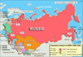
 Expansion territoriale de la Russie.svg 2,074 × 1,612; 948 KB
-
 Expansion-Russie-et-URSS.png 1,851 × 1,261; 161 KB
-
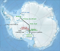
 First Russian Antarctic Expedition route - fr.svg 1,451 × 2,098; 1.65 MB
-
 Guerre sino-soviétique.png 1,000 × 872; 183 KB
-
 Hanoi quartier administratif petit lac map plan 1886.jpg 845 × 960; 490 KB
-
 Henry Worsley's journey 2016 - fr.svg 1,256 × 1,079; 2.75 MB
-
 Carte empire Sassanide.png 1,200 × 716; 184 KB
-
 Kamianets-Podilskyi map 1691.jpg 2,296 × 1,680; 1.58 MB
-

-
 LatinEmpire-fr.png 2,941 × 1,631; 1.01 MB
-

-
 Libération de l'Albanie (1918).png 1,920 × 1,080; 614 KB
-
 LocalisationIndochine.png 247 × 154; 6 KB
-
 LouisianaPurchase-fr.png 1,480 × 1,003; 322 KB
-
 Manuel'sEmpire-fr.png 550 × 375; 39 KB
-
 Map Akrotiri 1600 BC-fr.png 2,075 × 3,345; 635 KB
-
 Map Byzantine Empire 1076-fr.jpg 5,333 × 3,000; 550 KB
-
 Map Diadochs-fr.png 1,730 × 809; 393 KB
-
 Map Iran 1900-fr.png 1,098 × 911; 367 KB
-
 Map of Hanoi, 1873, Phạm Đình Bách.jpg 7,200 × 8,391; 12.43 MB
-
 Map Parthian Empire-fr.png 1,766 × 914; 351 KB
-
 Map Safavid Persia-fr.png 1,033 × 717; 299 KB
-
 Map Thirty Years War fr.png 2,000 × 2,593; 574 KB
-
 Migraciones austronesias.png 1,012 × 628; 104 KB
-
 Migrations austronésiennes.png 1,012 × 628; 77 KB
-
 Missolonghi siege general map-fr.jpg 1,400 × 1,680; 632 KB
-
 Natchez settlement map.jpg 701 × 651; 63 KB
-
 Neuvième croisade.JPG 559 × 672; 363 KB
-
 Nouvellefrance-V2.jpg 1,530 × 1,090; 1.04 MB
-
 NouvelleFrance-Vraie-Version.png 1,530 × 1,090; 1.38 MB
-
 Operation PamphletFRENCH.png 2,265 × 2,148; 255 KB
-
 Orléansville algérie map plan tripier 1844.jpg 345 × 294; 22 KB
-
 Ottoman Empire 1914 fr.PNG 530 × 615; 147 KB
-
 P-tés slaves orientales du Sud-Ouest et vassaux en 1300.png 537 × 754; 170 KB
-
 Peuples antiques du Caucase-fr.png 1,187 × 1,328; 330 KB
-
 Plan de la bataille de Nancy.png 1,546 × 1,708; 130 KB
-
 Plan temple Aphaïa.jpg 1,753 × 2,783; 1.26 MB
-
 Plan temple olympie.jpg 2,500 × 1,580; 61 KB
-
 Pre Adoua.jpg 377 × 409; 44 KB
-
 Roman empire 14 AD (provinces) fr.png 2,000 × 1,183; 490 KB
-
 Russia ethnic.JPG 1,017 × 1,253; 501 KB
-
 Scission des lignées zirides, Hammadides-Badicides-Zawides.PNG 596 × 430; 16 KB
-
 Scythes et Parthes 100 av JC.png 1,494 × 856; 2.08 MB
-
 Second world war asia 1943-1945 map fr-1.png 3,296 × 2,535; 621 KB
-
 SinoFrenchWar1884-1885-fr.png 1,200 × 800; 988 KB
-
 Sites Mayas.png 1,074 × 789; 1.25 MB
-
 Siège Tripolizza.jpg 1,962 × 1,580; 2.29 MB
-
 Sparta territory.jpg 743 × 681; 201 KB
-
 Taiping2.PNG 910 × 675; 307 KB
-
 TBTQ2(edit).png 910 × 675; 362 KB
-
 Temple zeus olympie.jpg 359 × 164; 35 KB
-
 Territoire du mandat britannique.png 689 × 1,280; 146 KB
-
 Territoires finlandais cédés en 1940.png 619 × 800; 92 KB
-
 Territoires finlandais cédés en 1944.png 619 × 800; 91 KB
-
 The French invasion of Russia.gif 1,570 × 1,017; 2.68 MB
-
 Tunis map plan 1881.jpg 649 × 504; 100 KB
-
 U.S. territorial acquisitions-fr.png 1,029 × 697; 183 KB
-
 Valley 1864 campaigns 1 Fr.svg 1,200 × 1,500; 153 KB
-
 Valley 1864 campaigns 2 Fr.svg 1,200 × 1,500; 136 KB
-
 Welschinger-La Protestation-3.jpg 4,180 × 6,039; 8.99 MB
-
 Zirides et Hammadides après les invasion hilaliennes.PNG 678 × 411; 20 KB
-
 Zirides et Hammadides.PNG 603 × 393; 16 KB
-
 Zirides v.980.png 3,864 × 2,081; 706 KB
-
 État actuel de l'occupation du Maroc, Mai 1913.jpg 640 × 489; 102 KB
-


.png)


.png)


.jpg)


.JPG)
.JPG)


_-_Fort_Bayard_-_P%C3%A9ninsule_de_Leizhou.png)


.png)


_fr.png)


.png)


