User talk:Chipmunkdavis
|
Our first steps tour and our frequently asked questions will help you a lot after registration. They explain how to customize the interface (for example the language), how to upload files and our basic licensing policy (Wikimedia Commons only accepts free content). You don't need technical skills in order to contribute here. Be bold when contributing and assume good faith when interacting with others. This is a wiki. More information is available at the community portal. You may ask questions at the help desk, village pump or on IRC channel #wikimedia-commons (webchat). You can also contact an administrator on their talk page. If you have a specific copyright question, ask at the copyright village pump. |
|
Feel free to contact me at my english wikipedia page, where I am most active! Even with just a note that I have a message here. Chipmunkdavis (talk) 11:57, 16 February 2011 (UTC)
Heads up[edit]
Venezuela map[edit]
.svg)

Hi!, well, the source where I took the limits are different (Natural Earth), the file corresponds to the conventions colors and has not been discussed about replacing the maps with darker colors. --Addicted04 (talk) 22:49, 6 September 2011 (UTC)
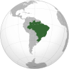
- Hello. I think that the colours in the news maps looks better, see the dark map of Brazil, do you can see The Bahamas, the Falkland Islands or the Galápagos Islands?, the Lesser Antilles are not visibles, even with a giant image (maybe becuase the coast are in the same color of the ocean). The the latitudinal and longitudinal lines are in the same color in both maps (#00000077) and the light gray in the land contrast with the dark coasts, I think that the colors may be discussed in the WikiProject Maps or the Projet:Cartographie. --Addicted04 (talk) 21:13, 25 October 2011 (UTC)
- I change the Brazil maps by Chile maps in the right. See the maps, is exactly the same map but the colours are differents. Can you see the islands mentioned above? Even New Zealand at the left is less visible. In addition, the country does not contrast with the land. See the maps at 1000px (old map, new map). --Addicted04 (talk) 20:16, 28 October 2011 (UTC)
- The islands are there, but its borders is on white. Ok, what shade of gray is better?, the current is #E0E0E0 and the current borders are on #646464. What do you think to change the land to #AAAAAA? Do you have another colour?. --Addicted04 (talk) 22:13, 31 October 2011 (UTC)
- The layers can be unlocked clicking the padlock in yellow, on the bottom of the Inskcape window.
-
 dark map (land on #b9b9b9).
 -
new map with land on #cdcdcd and borders on #666666.
-
 new map (land on #e0e0e0).
.svg)

.svg)
.svg)
.svg)
There are the colours of the dark maps:
- b9b9b9 Land.
- 346733 Territory.
- 24d000 Claimed territory.
The colours of the new maps:
- e0e0e0 Land.
- 336733 Territory.
- 73CD73 Claimed territory.
See the land colours:
- 666666.
- aaaaaa too dark (is not a good idea).
- b9b9b9 dark maps.
- cdcdcd I propose (middle grey).
- e0e0e0 new maps.
- The new (fantastically named, if I say so myself) map with cdcdcd seems much better to me, much more substance. I think that b9b9b9 with darker black borders would be a good touch, but I don't feel as strongly now that there's a clearer difference between land and water. I'd suggest again that you upload over the current maps, as there is no point having a whole collection of maps which have been superseded just lying around commons. Chipmunkdavis (talk) 17:47, 2 November 2011 (UTC)
- I'm changing the colors, thanks for helping to improve the maps. --Addicted04 (talk) 23:36, 11 November 2011 (UTC)
- I reverted the changes, I think that is better to leave the maps as they are, I will upload new maps with dark colors, and the maps with light colors will leave them there; we must to talk about them in the discussion of each article until it matures the proposal. In Argentina's article in the Spanish Wikipedia the light colors were accepted, I suggest you discuss the use of maps in each article separately. --Addicted04 (talk) 23:55, 11 November 2011 (UTC)
- That's dissapointing. I'm not discussing 204+ maps on 204+ different articles, that's gross inefficiency. Chipmunkdavis (talk) 01:37, 13 November 2011 (UTC)
Tip: Categorizing images[edit]

Thanks a lot for contributing to the Wikimedia Commons! Here's a tip to make your uploads more useful: Why not add some categories to describe them? This will help more people to find and use them.
Here's how:
1) If you're using the UploadWizard, you can add categories to each file when you describe it. Just click "more options" for the file and add the categories which make sense:

2) You can also pick the file from your list of uploads, edit the file description page, and manually add the category code at the end of the page.
[[Category:Category name]]
For example, if you are uploading a diagram showing the orbits of comets, you add the following code:
[[Category:Astronomical diagrams]][[Category:Comets]]
This will make the diagram show up in the categories "Astronomical diagrams" and "Comets".
When picking categories, try to choose a specific category ("Astronomical diagrams") over a generic one ("Illustrations").
Thanks again for your uploads! More information about categorization can be found in Commons:Categories, and don't hesitate to leave a note on the help desk.CategorizationBot (talk) 11:42, 21 November 2011 (UTC)
- Image:Customs Union of Belarus, Kazakhstan, and Russia (orthographic projection).svg was uncategorized on 20 November 2011 CategorizationBot (talk) 11:42, 21 November 2011 (UTC)
.svg)
Map of Samalia[edit]
Hello. Viewing the criteria used for the map of Mali and other examples you mentioned, could you modify the map of Somalia? I hope your answer. MauriManya (talk) 22:51, 5 May 2012 (UTC)
- I could try, but I probably couldn't do it well at all. Azawad was an easy cross cut across a tiny point (and as can be seen in that file's history I still didn't get it exactly right). Furthermore, I don't know to what extent Somaliland controls the territory it claims. Puntland, which claims to be Somalia, controls some of Somaliland's claimed territory (as far as I know). Chipmunkdavis (talk) 12:42, 6 May 2012 (UTC)
- Maybe you could take as a guide this map [1]. Do you think? MauriManya (talk) 23:51, 6 May 2012 (UTC)
- Wow, that map has changed since I last looked at it. The Somaliland line is very jagged, and I'm not sure I can pull that off with my rather mundane inkscape powers, but I'll play around on my computer to at least try. Chipmunkdavis (talk) 12:14, 7 May 2012 (UTC)
- Maybe you could take as a guide this map [1]. Do you think? MauriManya (talk) 23:51, 6 May 2012 (UTC)
![[1]](https://commons.wikimedia.org/wiki/File:Somalia_map_states_regions_districts.png)
File names[edit]
Yo no pienso en Nada más que en ubicar los archivos que ya se encontraban en File:Eritrea (Africa orthographic projection).svg y File:Eritrea (Africa orthographic projection).svg. Debido a que faltaban en la lista de Template:Grey-green orthographic projections maps. Si tiene algún otro reclamo injustificado tendrá que hacérselo al editor que incluyo África en el nombre del archivo, NO a mí. En ningún momento renombre archivo alguno. La próxima vez modere su tono de reclamo.--Ninrouter (talk) 01:16, 31 May 2012 (UTC)
.svg)
Schengen_Area.svg[edit]
Hello, can you exclude Romania Bulgaria and Cyprus from the map File:Schengen_Area.svg please. (because I don't know how to edit svg files :) --Camoka4 (talk) 14:59, 6 June 2012 (UTC)
United Nations Members.svg[edit]
I am not satisfied with this picture, Taiwan is not the part of China and we are hoping to join the UN with the name of ROC.--Sponge123 (talk) 10:57, 19 September 2012 (UTC)
I am from Taiwan you see.
- The UN map reflects the UN viewpoint. Otherwise there are quite a few areas that aren't under the control of claimant states that would need to be noted. Chipmunkdavis (talk) 22:39, 20 September 2012 (UTC)
Orthographic projection: Papua[edit]
Hi, I see that you have removed en:Papua, Indonesia, i.e. the western half of New Guinea island, from File:Asia (orthographic projection).svg, to which it had recently been added. This means that Papua is once again omitted from all the maps in this group. If Papua does not belong on the Asia map, please could you add it to File:Oceania (orthographic projection).svg, since en:Papua New Guinea (which is the eastern half of the same island) is on this map. --Redrose64 (talk) 11:55, 21 September 2012 (UTC)
.svg)
.svg)
- Oceania is a very fluid concept. The orthographic picture you point to is the geopolitical one. You'll find the Papua and more in File:Oceania, broad (orthographic projection).svg, for example. Chipmunkdavis (talk) 13:17, 25 September 2012 (UTC)
.svg)
United Nations Members.svg[edit]
Okay, I know that UN thinks that China has Taiwan.But is NOT! I can get along with this if you change this picture.--Sponge123 (talk) 04:25, 5 November 2012 (UTC)
- The picture is based on what the UN thinks, rather than the situation on the ground. Otherwise places like Palestine and Somaliland would also be excluded. Chipmunkdavis (talk) 22:04, 5 November 2012 (UTC)
Re: UN Map[edit]
Hello, Listen, to the truth, I'm a Taiwanese. I know Chinese and Taiwan history. R.O.C. is once the create member of the UN, but this dosen't mean that Taiwan (R.O.C.) is considered PRC(Hello, PRC! Not China!).I may say that PRC is the Mainland China, but Taiwan is not the part of PRC. It has never been PRC's territory. You can't connect the dots of the other country that maybe has national identity disputes.This is a global respect.
I'm gonna change the UN picture, no matter what.
--Sponge123|留言 08:09, 17 November 2012 (UTC)
A correction is needed in your File:Recognition of Israel.svg map[edit]
Hi! In your map File:Recognition of Israel.svg, Iran needs to be colored in pink, because from the establishment of the State of Israel in 1948 until the Iranian Revolution and the fall of the Pahlavi dynasty in 1979, Iran did recognize Israel and in addition had diplomatic relations.
- Thank you, this is now done. Chipmunkdavis (talk) 16:41, 29 November 2012 (UTC)
Colours of Eritrea (Africa orthographic projection).svg[edit]
Hello Chipmunkdavis,
I have noticed your changes in this map, and I will revert it for the second - and I hope, the last - time, for the following reasons:
- Before you change a file, it is more respectful to ask to the file maker, to find a consensus. You didn't do that.
- The colours are now following the conventions for orthographic maps
- The darker colours are better in your point of view. But not mine: I think the dark green is more visible if the background is clear, and that's the same for dark boundaries.
- If it ain't broke, don't fix it.
Please do not change version again. Regards, Sémhur (talk) 17:35, 13 December 2012 (UTC)
.svg)
- The original colours, which you first uploaded, are the ones which are actually used. See the various maps at Grey-green orthographic projections maps. The en.wiki page clearly doesn't show the actual conventions. There is a huge contrast between the green and the grey either way, but the washed out background does not contrast well with water. And by you, as the original wasn't broken, I don't know why you were fixing it. Chipmunkdavis (talk) 07:44, 14 December 2012 (UTC)
- If you look in Category:SVG locator maps of countries of Africa (green and grey globe scheme), you can see there are both grey and light-grey scheme colours. So "the ones" is not exists. If you think that the en.wiki page is not good, feel free to launch a talk there. For the contrast, one more time it's your pov, but not mine. And about the "original wasn't broken", yes it was. And it's because it was (South Sudan border to add, and some mistakes to correct) that I took the opportunity to change the colours. If I did not have to change it, I would have left it as is. Sémhur (talk) 10:02, 14 December 2012 (UTC)
- The majority in that category are of the normal grey colour schemes. Furthermore, quite often the light ones in that category have darker grey counterparts that for some reason aren't included that cateogry. File:Angola (orthographic projection).svg and File:Democratic Republic of the Congo (orthographic projection).svg for example. That the borders in some areas are seriously in need of an update does not mean that the colours should be changed as well. The border issue actually exists in quite a few maps, and at the moment I take File:Algeria (orthographic projection).svg as the standard for that angle, as it seems to be more or less up to date. Tangentially, do you know why many of the light grey maps are over 1MB in size? Chipmunkdavis (talk) 12:39, 14 December 2012 (UTC)
- I don't know why quite few maps are not included in the category. If you find other ones, please categorise them. I am agree that a lot of maps have to be cleaned up, but Algeria (orthographic projection).svg is not the better one: the corrected borders are more white than others, Lebanon is missing, some lakes or part of lakes are missing, the "3D" shadow is missing. It's better to take the Eritrean map for standard
 , and it's weight is lighter too (143 ko, of course in the light-grey version). And, one more thing about the contrast: as the light-grey maps have dark coastlines, the limit of the lands is still visible. And small islands are more visible than in the dark-grey version. I hope that my arguments have convinced you and that this little dispute will stops there. About the >1 Mo size of some maps, I don't know. I suppose Addicted04 had generated them automatically, and not cleaned them after. Sémhur (talk) 16:27, 14 December 2012 (UTC)
- I had a long discussion with Addicted04 actually, just above and on their page, also discussing the colours. We'd come to a mutual agreement which solved our problems as the time, but they decided it wasn't a good idea at that ended that. The Algeria svg is the best I've found that comes from the same base map, which means the borders can easily be transferred between maps. I haven't created these maps from scratch. My weight comment wasn't about your Eritrean map specifically, it was just odd to see all the MB files. The black borders work at a large map, but they're hardly perceptible in smaller scales, which these maps are often used at. I don't think lakes should be as prominent as you've made them (which seems to be the same as islands). The Congo river for example, looks like a huge gash through the DRC, and I've not seen another map portray rivers quite so prominently before. It works for islands though, and you are right that the small islands are immensely more visible, which is a very valuable asset. Hmm. Perhaps read over the conversation with Addicted04 above, and tell me your thoughts? I'm going to see if I can get opinions and ideas from people I know with poorer vision than myself. Chipmunkdavis (talk) 17:13, 14 December 2012 (UTC)
- I read your conversation with Addicted04, but I'm still not convinced by your arguments. I think the dark gray borders stand out better in small size than white ones. And the map of Algeria is not the best: about lakes, it shows only half of Lake Victoria! It should display all or nothing, but not only half ... By cons, you're right about the Congo River, it was disproportionate. I removed it in the uploaded map, which is in the light-grey version, but I ask you not to change it again. Thank you, Sémhur (talk) 20:26, 16 December 2012 (UTC)
- Lake Victoria is there in the code, so the entities are fine, someone just hid it when they added South Sudan. The entire body of land stands out less in the lighter grey, along with borders. Removing one river does not fix the entire river issue, the rest remain overly prominent. Chipmunkdavis (talk) 04:26, 17 December 2012 (UTC)
- I read your conversation with Addicted04, but I'm still not convinced by your arguments. I think the dark gray borders stand out better in small size than white ones. And the map of Algeria is not the best: about lakes, it shows only half of Lake Victoria! It should display all or nothing, but not only half ... By cons, you're right about the Congo River, it was disproportionate. I removed it in the uploaded map, which is in the light-grey version, but I ask you not to change it again. Thank you, Sémhur (talk) 20:26, 16 December 2012 (UTC)
- I had a long discussion with Addicted04 actually, just above and on their page, also discussing the colours. We'd come to a mutual agreement which solved our problems as the time, but they decided it wasn't a good idea at that ended that. The Algeria svg is the best I've found that comes from the same base map, which means the borders can easily be transferred between maps. I haven't created these maps from scratch. My weight comment wasn't about your Eritrean map specifically, it was just odd to see all the MB files. The black borders work at a large map, but they're hardly perceptible in smaller scales, which these maps are often used at. I don't think lakes should be as prominent as you've made them (which seems to be the same as islands). The Congo river for example, looks like a huge gash through the DRC, and I've not seen another map portray rivers quite so prominently before. It works for islands though, and you are right that the small islands are immensely more visible, which is a very valuable asset. Hmm. Perhaps read over the conversation with Addicted04 above, and tell me your thoughts? I'm going to see if I can get opinions and ideas from people I know with poorer vision than myself. Chipmunkdavis (talk) 17:13, 14 December 2012 (UTC)
- I don't know why quite few maps are not included in the category. If you find other ones, please categorise them. I am agree that a lot of maps have to be cleaned up, but Algeria (orthographic projection).svg is not the better one: the corrected borders are more white than others, Lebanon is missing, some lakes or part of lakes are missing, the "3D" shadow is missing. It's better to take the Eritrean map for standard
- The majority in that category are of the normal grey colour schemes. Furthermore, quite often the light ones in that category have darker grey counterparts that for some reason aren't included that cateogry. File:Angola (orthographic projection).svg and File:Democratic Republic of the Congo (orthographic projection).svg for example. That the borders in some areas are seriously in need of an update does not mean that the colours should be changed as well. The border issue actually exists in quite a few maps, and at the moment I take File:Algeria (orthographic projection).svg as the standard for that angle, as it seems to be more or less up to date. Tangentially, do you know why many of the light grey maps are over 1MB in size? Chipmunkdavis (talk) 12:39, 14 December 2012 (UTC)
- If you look in Category:SVG locator maps of countries of Africa (green and grey globe scheme), you can see there are both grey and light-grey scheme colours. So "the ones" is not exists. If you think that the en.wiki page is not good, feel free to launch a talk there. For the contrast, one more time it's your pov, but not mine. And about the "original wasn't broken", yes it was. And it's because it was (South Sudan border to add, and some mistakes to correct) that I took the opportunity to change the colours. If I did not have to change it, I would have left it as is. Sémhur (talk) 10:02, 14 December 2012 (UTC)
.svg)
.svg)
.svg)

|
File:World marriage-equality laws.svg has been listed at Commons:Deletion requests so that the community can discuss whether it should be kept or not. We would appreciate it if you could go to voice your opinion about this at its entry.
If you created this file, please note that the fact that it has been proposed for deletion does not necessarily mean that we do not value your kind contribution. It simply means that one person believes that there is some specific problem with it, such as a copyright issue. Please see Commons:But it's my own work! for a guide on how to address these issues. |
Ajfweb (talk) 03:51, 27 April 2013 (UTC)
Maps dealing with same-sex unions[edit]
Hello. This maps are out of date. Uruguay approve same-sex marriage at 10th of April, 2013, and It will come into force 90 days after, New Zealand do the same at 23th of April, 2013. Denmark approve at 2012. Situation of Brasil is complex and by judicial sentence it had been a few same-sex marriages. Can you help with this? If you can, please answer in esWikipedia. Thank you in advance. --Hiperfelix (talk) 03:46, 5 May 2013 (UTC)
Template:Grey-green orthographic projections maps[edit]
![]() This is the last time of your intervention [2], there's a reliable source and much more, Ross Hassig, and this is not an encyclopedia, this is not your template, so please stop of reverting or I'll report you immediately. This is COMMONS not an article of Wikipedia. Best Regards. --Giggette (talk) 23:08, 7 May 2013 (UTC)
This is the last time of your intervention [2], there's a reliable source and much more, Ross Hassig, and this is not an encyclopedia, this is not your template, so please stop of reverting or I'll report you immediately. This is COMMONS not an article of Wikipedia. Best Regards. --Giggette (talk) 23:08, 7 May 2013 (UTC)
- So you've been warned about edit warring twice already, and now have the nerve to continue and threaten someone else with a report on it? No-one has said this is wikipedia, but dispute resolution procedures remain, and shifting the focus of your global edit war is not a way to edit anywhere. Chipmunkdavis (talk) 00:09, 8 May 2013 (UTC)
- Any report has been closed, the arguments of your friends are not sustainable on COMMONS, only in EN Wikipedia, but if you continue with this, then I will report you for "third time" as you said, probably you do not know how COMMONS works. --Giggette (talk) 00:21, 8 May 2013 (UTC)
- I don't have friends arguing on this topic in en.wikipedia, everything I've said here has been based completely on commons. You'd be reporting me for the first time, not the third. At no point have you even tried discussing this on the talkpage. Keep in mind that edit warring goes both ways, and that you have a past history of it on this topic. Consider discussion as an alternative? Chipmunkdavis (talk) 09:11, 8 May 2013 (UTC)
- Any report has been closed, the arguments of your friends are not sustainable on COMMONS, only in EN Wikipedia, but if you continue with this, then I will report you for "third time" as you said, probably you do not know how COMMONS works. --Giggette (talk) 00:21, 8 May 2013 (UTC)
Please do not edit war[edit]
--Giggette (talk) 00:18, 8 May 2013 (UTC)
- Signature added Chipmunkdavis (talk) 09:12, 8 May 2013 (UTC)
List of subnational monarchs[edit]
Hello! According to this article List of current constituent African monarchs these maps should be modified File:World Monarchies.png File:World Monarchies.svg, you could do it? MauriManya (talk) 22:31, 8 May 2013 (UTC)
- I can do the svg easily enough. As there's no information on which locality they are recognised to rule in, I'll just have to colour the entire state in for many. Chipmunkdavis (talk) 20:24, 9 May 2013 (UTC)
- Svg updated, quite a big update. It's quite hard to get all that on a map. I feel that perhaps the subnational circles should be smaller than those representing states. Chipmunkdavis (talk) 23:42, 11 May 2013 (UTC)
OK. I agree with your pose. MauriManya (talk) 21:45, 13 May 2013 (UTC)
File:World marriage-equality laws.svg[edit]
Info por favor (talk) 00:38, 22 May 2013 (UTC)
|
Hello, Chipmunkdavis. You have new messages on another wiki at en:File talk:World marriage-equality laws.svg#The borders.
You may remove this notice at any time by removing the {{Talkback}} or {{Tb}} template.
|
World homosexuality laws map[edit]
Hello. I see that you are interested in maps. I was wondering if you would be interested in modifying this map [3] (or creating a new map), so that propaganda laws and anti-discrimination laws can also be included such as this map [4]. The green colour for de jure penalty that is de facto not enforced is also problematic. Such a map would be very useful and could be used in non-English wikipedia's as well. Cavann (talk) 01:19, 24 May 2013 (UTC)
![[3]](https://commons.wikimedia.org/wiki/File:World_homosexuality_laws.svg)
- That's a lot of information for just one map. I suggest asking others on the talkpage of that map. I don't understand how the ILGA have ended up with different colours for metropolitan France and French Guiana though. Chipmunkdavis (talk) 17:36, 25 May 2013 (UTC)
- Maybe we can just add "propaganda" laws then? That would be easy but I also want to change the colour scheme, starting with black for capital punishment, red for heavy penalty. Yellow would be the "least serious" one (for propaganda laws).Cavann (talk) 17:51, 25 May 2013 (UTC)
- What source are you using for "propaganda laws"? It seems unnecessary for a map about whether or not homosexuality is allowed, so if you want this it should be made in a new map. Chipmunkdavis (talk) 20:46, 25 May 2013 (UTC)
- ILGA map I linked before. The only country seems to be Russia. So adding those laws wouldn't be too much of an issue. And I want the green colour gone cause of colour blindness issues and that it is a rather "positive" colour. I came to your page cause I thought you were interested in making maps. Cavann (talk) 21:43, 26 May 2013 (UTC)
- I am interested in maps, however unfortunately I don't have much time at the moment, and it looks difficult to implement the laws on the map in an effective manner. I agree with you on the colouring issues. I suggest again taking this to a wider page; there are far far better mapmakers than myself. Chipmunkdavis (talk) 22:54, 26 May 2013 (UTC)
- What do you think of this colour scheme: Commons:Graphic_Lab/Map_workshop#LGBT_rights_in_the_world ? Cavann (talk) 00:25, 27 May 2013 (UTC)
- If you intend to keep the legal colours, black could very easily be confused with dark blue. Chipmunkdavis (talk) 00:51, 29 May 2013 (UTC)
- What would be a good alternative? Cavann (talk) 02:00, 29 May 2013 (UTC)
- I suggest less detail, for example combining both imprisonment categories rather than dividing them arbitrarily. Chipmunkdavis (talk) 22:00, 30 May 2013 (UTC)
- It's not random, it's how the source divides it. Any other suggestions? Cavann (talk) 01:28, 7 June 2013 (UTC)
- Does the source give a reason for the division? We don't have to follow it exactly. If you want the map made, you'll just have to find a colour scheme that works. Perhaps use a third range of colours. Chipmunkdavis (talk) 15:20, 7 June 2013 (UTC)
- So, green is out (and neutral). Lower wavelengths [5] is for recognition. Higher wavelengths (yellow, orange, red) are for persecution. '1 year' and '30 years' are quite different, so dividing jail sentences make sense to me. How about this? Cavann (talk) 22:32, 8 June 2013 (UTC)
- Does the source give a reason for the division? We don't have to follow it exactly. If you want the map made, you'll just have to find a colour scheme that works. Perhaps use a third range of colours. Chipmunkdavis (talk) 15:20, 7 June 2013 (UTC)
- It's not random, it's how the source divides it. Any other suggestions? Cavann (talk) 01:28, 7 June 2013 (UTC)
- I suggest less detail, for example combining both imprisonment categories rather than dividing them arbitrarily. Chipmunkdavis (talk) 22:00, 30 May 2013 (UTC)
- What would be a good alternative? Cavann (talk) 02:00, 29 May 2013 (UTC)
- If you intend to keep the legal colours, black could very easily be confused with dark blue. Chipmunkdavis (talk) 00:51, 29 May 2013 (UTC)
- What do you think of this colour scheme: Commons:Graphic_Lab/Map_workshop#LGBT_rights_in_the_world ? Cavann (talk) 00:25, 27 May 2013 (UTC)
- I am interested in maps, however unfortunately I don't have much time at the moment, and it looks difficult to implement the laws on the map in an effective manner. I agree with you on the colouring issues. I suggest again taking this to a wider page; there are far far better mapmakers than myself. Chipmunkdavis (talk) 22:54, 26 May 2013 (UTC)
- ILGA map I linked before. The only country seems to be Russia. So adding those laws wouldn't be too much of an issue. And I want the green colour gone cause of colour blindness issues and that it is a rather "positive" colour. I came to your page cause I thought you were interested in making maps. Cavann (talk) 21:43, 26 May 2013 (UTC)
- What source are you using for "propaganda laws"? It seems unnecessary for a map about whether or not homosexuality is allowed, so if you want this it should be made in a new map. Chipmunkdavis (talk) 20:46, 25 May 2013 (UTC)
- Maybe we can just add "propaganda" laws then? That would be easy but I also want to change the colour scheme, starting with black for capital punishment, red for heavy penalty. Yellow would be the "least serious" one (for propaganda laws).Cavann (talk) 17:51, 25 May 2013 (UTC)
|
Laws restricting freedom of expression and association
Imprisonment without precise indication of the length / unclear / other
Imprisonment up to 14 years
Imprisonment from 14 years to a life-long sentence
Death penalty
|
Actually the easiest thing seems to be use the same colour format except the green colour.
|
Laws restricting freedom of expression and association
Imprisonment without precise indication of the length / unclear / other
Imprisonment up to 14 years
Imprisonment from 14 years to a life-long sentence
Up to death (ring = local judges)
|
- That's definitely an improvement. Chipmunkdavis (talk) 08:42, 9 June 2013 (UTC)
Are you the custodian of this template?. --Giggette (talk) 17:55, 1 June 2013 (UTC)
- Many other users have made changes to this template, including yourself; that Spanish speakers in the Americas template image wouldn't be there without you. Like all users, if I propose something and it's rejected, I can use the discussion tab to discuss the issue. Why not try that? Chipmunkdavis (talk) 20:38, 1 June 2013 (UTC)
- I know, but you didn't answer my question, I'd like to know. Are you the custodian of this template?. --Giggette (talk) 19:54, 2 June 2013 (UTC)
- As far as I'm aware, commons has no custodian positions, so no, I am not one. I do however keep a watch on it, and revert the vandalism which somehow reaches it, on a volunteer basis. Chipmunkdavis (talk) 00:14, 3 June 2013 (UTC)
- I know, but you didn't answer my question, I'd like to know. Are you the custodian of this template?. --Giggette (talk) 19:54, 2 June 2013 (UTC)
Aztec map[edit]
Thank you, well, first I did not still resist starting a discussion on the talkpage because this discussion started here weeks ago, and not only on the talkpage of this map, and it was finally closed there and on Commons:Administrators' noticeboard, and yes the only differente of these maps is the dominance between two areas, that's all. Both maps have sources but some more reliable sources than others, only the Wikipedias should choose to use for the articles. And this map was firstly created than the other. --Giggette (talk) 01:52, 4 June 2013 (UTC)
.svg)
.svg)
.svg)
- Supposedly it is the only difference, the map was created basing from the following sources.
- 1.- [6] by the Department of History by Ian Mladjov, University of Michigan.
- 2.- Aztec Warfare: Imperial Expansion and Political Control by Ross Hassig, University of Oklahoma Press, according a user with his map on COMMONS in use
- 3.- [7] Encyclopædia Britannica 1994
- 4.- As such more sources [8], [9], [10], [11], [12], [13], [14], [15], [16]
- The template must have the two versions without distinction. --Giggette (talk) 19:01, 4 June 2013 (UTC)
![[6]](http://sitemaker.umich.edu/mladjov/files/aztecs1518.jpg)
![[7]](http://www.crystalinks.com/mayanmap2.gif)
![[8]](http://usuarios.multimania.es/superjulio/IMPERIOS%20DE%20NORTAMERICA/Mapas%20Imperiales%20Imperio%20Azteca%20(La%20Triple%20Alianza)1.gif)
![[9]](http://www.laguia2000.com/wp-content/uploads/2006/10/el-imperio-azteca.gif)
![[10]](http://1.bp.blogspot.com/_pAD6aRGu6j0/SwtJj1PoZfI/AAAAAAAAAAg/yXQH48z5tOg/s1600/Diapositiva1.JPG)
![[11]](http://3.bp.blogspot.com/_tTFdYezGXMQ/S0POeIIBfoI/AAAAAAAAITo/zgaWe02qNMQ/s320/mapa-azteca.gif)
![[12]](http://www.xenciclopedia.com/upload/03-08/mapa_mesoamerica665.gif)
![[13]](https://upload.wikimedia.org/wikipedia/commons/thumb/4/4b/Aztecempirelocation.png/300px-Aztecempirelocation.png)
![[14]](http://4.bp.blogspot.com/-AvudZolKzMQ/UCMD3auKixI/AAAAAAAACfI/o6fYn-DCasU/s1600/LA+CULTURA+AZTECA.jpg)
![[15]](http://www.angelfire.com/jazz/bernaldiaz/dibujo/mesoam.jpg)
![[16]](http://www.angelfire.com/jazz/bernaldiaz/dibujo/arte1.jpg)
Mapa de la Unasur[edit]
Hola Chipmunkdavis me he contactado con tigo porque hace tiempo que e visto un error en tu mapa de la Unasur, el cual no ha sido corregido, Se trata de que las provincias argentinas de Corrientes y Misiones aparecen unidas, espero mejores este exelente trabajo y gracias por el mapa. -LeinadCQ (talk) 02:07, 5 June 2013 (UTC)
 Comment Chipmunkdavis no entiende español. --Giggette (talk) 05:36, 5 June 2013 (UTC)
- Done, thanks Giggette and Wsiegmund. Chipmunkdavis (talk) 19:54, 5 June 2013 (UTC)
Orthographic maps[edit]
Hi ! Well, I don't make politics while mapping. ;) I use Natural Earth's data to make orthographic projections. I guess they chose to recognize some countries and not some others. --Flappiefh (talk) 21:08, 4 August 2013 (UTC)
.svg)
|
|
File:Mali (orthographic projection).svg has been listed at Commons:Deletion requests so that the community can discuss whether it should be kept or not. We would appreciate it if you could go to voice your opinion about this at its entry.
If you created this file, please note that the fact that it has been proposed for deletion does not necessarily mean that we do not value your kind contribution. It simply means that one person believes that there is some specific problem with it, such as a copyright issue. Please see Commons:But it's my own work! for a guide on how to address these issues. |
.svg)
84.1.151.233 23:56, 11 February 2014 (UTC)
.svg)
EEZ redux[edit]
Is this the deletion request that you seek? Linked image is here . Cheers! Ellin Beltz (talk) 19:08, 5 March 2014 (UTC)
- No, the previous page wasn't deleted via a request, but via a very simple alert on the page that there was a copyright violation. It is a now deleted upload of Alexyflemming that was almost identical to File:Iskele Long Beach AirBNB.png. Chipmunkdavis (talk) 19:50, 5 March 2014 (UTC)
- Someone tagged that image with a license needed. I found the source at this site. I've nommed some of his other images. Thanks for keeping your eyes out! Ellin Beltz (talk) 18:17, 6 March 2014 (UTC)
- User:Ellin Beltz there was an English language version of that site with that picture somewhere, which explicitly stated in the T&C that all pictures were copyrighted. In his previous upload, Alexyflemming had claimed that the picture was released under public domain citing the website which explicitly said it wasn't. It is the link to the T&C that I was hoping someone could find. Chipmunkdavis (talk) 13:11, 7 March 2014 (UTC)
- Another admin suggested perhaps you were looking for this? Ellin Beltz (talk) 19:14, 9 March 2014 (UTC)
- Yeah that's it, thanks. Chipmunkdavis (talk) 18:42, 10 March 2014 (UTC)
- Another admin suggested perhaps you were looking for this? Ellin Beltz (talk) 19:14, 9 March 2014 (UTC)
- User:Ellin Beltz there was an English language version of that site with that picture somewhere, which explicitly stated in the T&C that all pictures were copyrighted. In his previous upload, Alexyflemming had claimed that the picture was released under public domain citing the website which explicitly said it wasn't. It is the link to the T&C that I was hoping someone could find. Chipmunkdavis (talk) 13:11, 7 March 2014 (UTC)
- Someone tagged that image with a license needed. I found the source at this site. I've nommed some of his other images. Thanks for keeping your eyes out! Ellin Beltz (talk) 18:17, 6 March 2014 (UTC)
.svg)
|
|
File:Arab League (orthographic projection).svg has been listed at Commons:Deletion requests so that the community can discuss whether it should be kept or not. We would appreciate it if you could go to voice your opinion about this at its entry.
If you created this file, please note that the fact that it has been proposed for deletion does not necessarily mean that we do not value your kind contribution. It simply means that one person believes that there is some specific problem with it, such as a copyright issue. Please see Commons:But it's my own work! for a guide on how to address these issues. |
.svg)
109.238.80.60 14:37, 15 October 2017 (UTC)
.svg)
Further discussion[edit]
Further discussion is available at File_talk:Somalia_map_states_regions_districts.png#There_is_nuance_with_regards_to_control. Regards and thanks. Meelpringthusss (talk) 17:18, 20 June 2020 (UTC)
|
|
File:Official United Nations World Map - 20 February 2020.svg has been listed at Commons:Deletion requests so that the community can discuss whether it should be kept or not. We would appreciate it if you could go to voice your opinion about this at its entry.
If you created this file, please note that the fact that it has been proposed for deletion does not necessarily mean that we do not value your kind contribution. It simply means that one person believes that there is some specific problem with it, such as a copyright issue. Please see Commons:But it's my own work! for a guide on how to address these issues. |
Psiĥedelisto (talk) 17:14, 3 July 2020 (UTC)
Nominated image since June 12th[edit]
This image here
https://commons.wikimedia.org/wiki/File:Somaliland_clan_map2.jpg
which say own work but is actually work of UN and not sure if it's public domain.
Can it get removed. Cheers --AlaskaLava (talk) 01:01, 9 July 2020 (UTC)
Other versions of a deleted image[edit]
Hey! I just noticed the deletion at Commons:Deletion requests/File:East Turkistan Government in Exile Emblem.png. It seems that the WP articles where that image was used have now just replaced it with what appears to be the same image. I can't see the deleted image so I cannot be sure, but if it is the same image then it probably has the same copyright issues: File:ETGE Emblem.webp. MarkH21 (talk) 03:41, 21 March 2021 (UTC)
- Pinging Thuresson, who deleted File:East Turkistan Government in Exile Emblem.png the day before it was re-uploaded. Also, there are three other non-identical versions at File:East Turkistan COA.jpg, File:Emblem of East Turkistan islamic republic.jpg, and File:The East Turkistan COA.png. MarkH21 (talk) 03:45, 21 March 2021 (UTC)
- The specific File:East Turkistan Government in Exile Emblem.png is clearly a copyvio, I am less clear about the other images. I don't know if a tughra and geometric shapes passes the creativity criteria or not. I would lean towards also deleting them as well. Chipmunkdavis (talk) 06:18, 21 March 2021 (UTC)
- @Thuresson and Túrelio: The same copyrighted image from File:East Turkistan Government in Exile Emblem.png was reuploaded twice at File:ETGE Emblem.webp and File:ETGE Emblem.png by the same user. Are there preventative measures available to stop the repeated copyvio? MarkH21 (talk) 04:07, 24 March 2021 (UTC)
- Sorry for the pings and repeated talk page posts, CMD! After the third deletion, the user managed to get the website to change their copyright notice with their latest reupload. This is a bit moot now. MarkH21 (talk) 22:57, 24 March 2021 (UTC)
- No problem, that's what talk pages are for. Rather than moot, it's real world impact from a discussion here. "All materials" is quite broad! Chipmunkdavis (talk) 01:51, 25 March 2021 (UTC)
- Sorry for the pings and repeated talk page posts, CMD! After the third deletion, the user managed to get the website to change their copyright notice with their latest reupload. This is a bit moot now. MarkH21 (talk) 22:57, 24 March 2021 (UTC)
- @Thuresson and Túrelio: The same copyrighted image from File:East Turkistan Government in Exile Emblem.png was reuploaded twice at File:ETGE Emblem.webp and File:ETGE Emblem.png by the same user. Are there preventative measures available to stop the repeated copyvio? MarkH21 (talk) 04:07, 24 March 2021 (UTC)
- The specific File:East Turkistan Government in Exile Emblem.png is clearly a copyvio, I am less clear about the other images. I don't know if a tughra and geometric shapes passes the creativity criteria or not. I would lean towards also deleting them as well. Chipmunkdavis (talk) 06:18, 21 March 2021 (UTC)
Why did you reverted File:GUY orthographic.svg; what is your criteria that exents Guyana from highlight an international border dispute that is still an unfinished court case at the International Criminal Court[edit]
Why did you reverted File:GUY orthographic.svg; what is your criteria that exents Guyana from highlight an international border dispute that is still an unfinished court case at the International Criminal Court
Since your criteria of "Guyana has control over these territories" should then be applied to maps like Ukraine where Crimea is light green but should be gray since Russia has control over it. So we have a lot of work to be done in not only this map of Ukraine but in all countries that have territorial claims, since according to you Wikipedia only recognizes the country that has control over such lands. Thanks if you answer.
And please define "control" so it can be clear to all wikipedia users like me that are confused over these matters, is it political or military control? and if this concept of control stands above historical events of border disputes and takes sides on unfinished court cases of the International Courts, and does that complies with the neutrality of Wikipedia? thanks. — Preceding unsigned comment added by IuioPe (talk • contribs) 21:06, 12 September 2021 (UTC)
--IuioPe (talk) 20:55, 12 September 2021 (UTC)
- Hi IuioPe, please see en:Wikipedia:WikiProject Maps/Conventions/Orthographic maps. Unsure how exactly you want to differentiate political and military control, but certainly showing the area controlled by a country is defensibly neutral, and is not a practice unique to Wikipedia. The Russia map is the current exception to all the other maps. Chipmunkdavis (talk) 04:10, 13 September 2021 (UTC)
- I see, thereby I will no longer revert changes made on the map if the preceding version is re-established, for the sake of the common reader comprehension.--IuioPe (talk) 09:13, 13 September 2021 (UTC)
A barnstar for you![edit]

|
The Tireless Contributor Barnstar |
For patience and notice for help.
Рагин1987 (talk) 16:18, 16 November 2022 (UTC) |
- And to you for stepping in with a helpful edit! Chipmunkdavis (talk) 01:07, 17 November 2022 (UTC)