File:Wegkreuz Meschach 1.JPG
Original file (2,816 × 4,224 pixels, file size: 3.09 MB, MIME type: image/jpeg)
Captions
DescriptionWegkreuz Meschach 1.JPG |
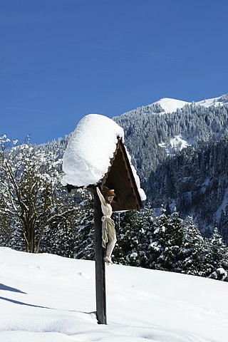
Deutsch: Ein Flurkreuz an der Meschacherstraße in Meschach bei Götzis. Im Hintergrund sieht man das Gipfelkreuz der Hohen Kugel. |
Date | |
Source | Own work |
Author | böhringer friedrich |
Permission (Reusing this file) |
I, the copyright holder of this work, hereby publish it under the following license: This file is licensed under the Creative Commons Attribution-Share Alike 2.5 Generic license.
|
Other versions |
|
This Photo was taken by Böhringer Friedrich.
|
Feel free to use my photos, but please mention me as the author and if you want send me a message. or (rufre@lenz-nenning.at)
|
Camera location | 47° 19′ 55.97″ N, 9° 40′ 52.98″ E | View this and other nearby images on: OpenStreetMap | 47.332214; 9.681383 |
---|
This image has been assessed using the Quality image guidelines and is considered a Quality image.
العربية ∙ جازايرية ∙ беларуская ∙ беларуская (тарашкевіца) ∙ български ∙ বাংলা ∙ català ∙ čeština ∙ Cymraeg ∙ Deutsch ∙ Schweizer Hochdeutsch ∙ Zazaki ∙ Ελληνικά ∙ English ∙ Esperanto ∙ español ∙ eesti ∙ euskara ∙ فارسی ∙ suomi ∙ français ∙ galego ∙ עברית ∙ हिन्दी ∙ hrvatski ∙ magyar ∙ հայերեն ∙ Bahasa Indonesia ∙ italiano ∙ 日本語 ∙ Jawa ∙ ქართული ∙ 한국어 ∙ kurdî ∙ Lëtzebuergesch ∙ lietuvių ∙ македонски ∙ മലയാളം ∙ मराठी ∙ Bahasa Melayu ∙ Nederlands ∙ Norfuk / Pitkern ∙ polski ∙ português ∙ português do Brasil ∙ rumantsch ∙ română ∙ русский ∙ sicilianu ∙ slovenčina ∙ slovenščina ∙ shqip ∙ српски / srpski ∙ svenska ∙ தமிழ் ∙ తెలుగు ∙ ไทย ∙ Tagalog ∙ Türkçe ∙ toki pona ∙ українська ∙ vèneto ∙ Tiếng Việt ∙ 中文 ∙ 中文(简体) ∙ 中文(繁體) ∙ +/− |
Annotations InfoField | This image is annotated: View the annotations at Commons |
Hohe Kugel
File history
Click on a date/time to view the file as it appeared at that time.
Date/Time | Thumbnail | Dimensions | User | Comment | |
---|---|---|---|---|---|
current | 16:15, 7 February 2010 | 2,816 × 4,224 (3.09 MB) | Berthold Werner (talk | contribs) | 0,4° rotated | |
19:57, 3 March 2009 | 2,848 × 4,272 (1.66 MB) | Böhringer (talk | contribs) | {{Information |Description= {{de| Ein Flurkreuz am Spaltenweg in Meschach bei Götzis.}} |Source= own work |Date= 2009-02-25 |Author= böhringer friedrich |Permission={{self|cc-by-sa-2.5}} |other_versi |
You cannot overwrite this file.
File usage on Commons
The following 4 pages use this file:
File usage on other wikis
The following other wikis use this file:
- Usage on fr.wikipedia.org
Metadata
This file contains additional information such as Exif metadata which may have been added by the digital camera, scanner, or software program used to create or digitize it. If the file has been modified from its original state, some details such as the timestamp may not fully reflect those of the original file. The timestamp is only as accurate as the clock in the camera, and it may be completely wrong.
Image title | SONY DSC |
---|---|
Camera manufacturer | SONY |
Camera model | DSLR-A700 |
Exposure time | 1/320 sec (0.003125) |
F-number | f/11 |
ISO speed rating | 100 |
Date and time of data generation | 12:24, 25 February 2009 |
Lens focal length | 75 mm |
Horizontal resolution | 96 dpi |
Vertical resolution | 96 dpi |
Software used | DSLR-A700 v01 |
File change date and time | 12:24, 25 February 2009 |
Y and C positioning | Co-sited |
Exposure Program | Manual |
Exif version | 2.21 |
Date and time of digitizing | 12:24, 25 February 2009 |
Meaning of each component |
|
Image compression mode | 8 |
APEX brightness | 8.37 |
APEX exposure bias | 0 |
Maximum land aperture | 4.34 APEX (f/4.5) |
Metering mode | Spot |
Light source | Unknown |
Flash | Flash did not fire, compulsory flash suppression |
Supported Flashpix version | 1 |
Color space | sRGB |
File source | Digital still camera |
Scene type | A directly photographed image |
Custom image processing | Normal process |
Exposure mode | Manual exposure |
White balance | Auto white balance |
Digital zoom ratio | 0 |
Focal length in 35 mm film | 112 mm |
Scene capture type | Standard |
Contrast | Normal |
Saturation | Normal |
Sharpness | Normal |
Structured data
Items portrayed in this file
depicts
some value
25 February 2009
47°19'55.970"N, 9°40'52.979"E
0.003125 second
11
75 millimetre
100
image/jpeg
- CC-BY-SA-2.5
- Self-published work
- Photos by Böhringer
- Files with coordinates missing SDC location of creation
- Quality images
- Quality images missing SDC depicts
- Images with annotations
- User:Böhringer - Quality images Gallery
- Quality images of Vorarlberg
- Quality images of wayside crosses in Austria
- Pages with maps