File:Sakitatenami kohungun aerial 1.jpg
Jump to navigation
Jump to search

Size of this preview: 724 × 599 pixels. Other resolutions: 290 × 240 pixels | 580 × 480 pixels | 928 × 768 pixels | 1,237 × 1,024 pixels | 1,302 × 1,078 pixels.
Original file (1,302 × 1,078 pixels, file size: 1.52 MB, MIME type: image/jpeg)
Captions
Captions
Add a one-line explanation of what this file represents
Summary[edit]
| Description | |
| Date | |
| Source | 国土画像情報(カラー空中写真)国土交通省撮影の空中写真CKK853-C10-8を使用。 |
| Author | 国土交通省 |
| Permission (Reusing this file) |
国土交通省 国土画像情報(カラー空中写真)を基に作成 |
| Other versions | Sakitatanamikofungun.jpg |
| Camera location | | View this and other nearby images on: OpenStreetMap |
|---|
Licensing[edit]

|
The copyright holder of this file, the Ministry of Land, Infrastructure, Transport and Tourism of Japan, allows anyone to use it for any purpose, provided that the copyright holder is properly attributed. Redistribution, derivative work, commercial use, and all other use is permitted. |
Attribution:
Copyright © National Land Image Information (Color Aerial Photographs), Ministry of Land, Infrastructure, Transport and Tourism
|
 |
This image is copyrighted by the Ministry of Land, Infrastructure, Transport and Tourism of Japan. For terms of use, see the stipulation to use of National Land Information (in Japanese) and message from MLIT (in Japanese and English). When you display this image on an article, include the following phrase in the description: "Made based on National Land Image Information (Color Aerial Photographs), Ministry of Land, Infrastructure, Transport and Tourism".
|
File history
Click on a date/time to view the file as it appeared at that time.
| Date/Time | Thumbnail | Dimensions | User | Comment | |
|---|---|---|---|---|---|
| current | 14:35, 3 November 2021 | | 1,302 × 1,078 (1.52 MB) | 名古屋太郎 (talk | contribs) | 明るさ等変更 |
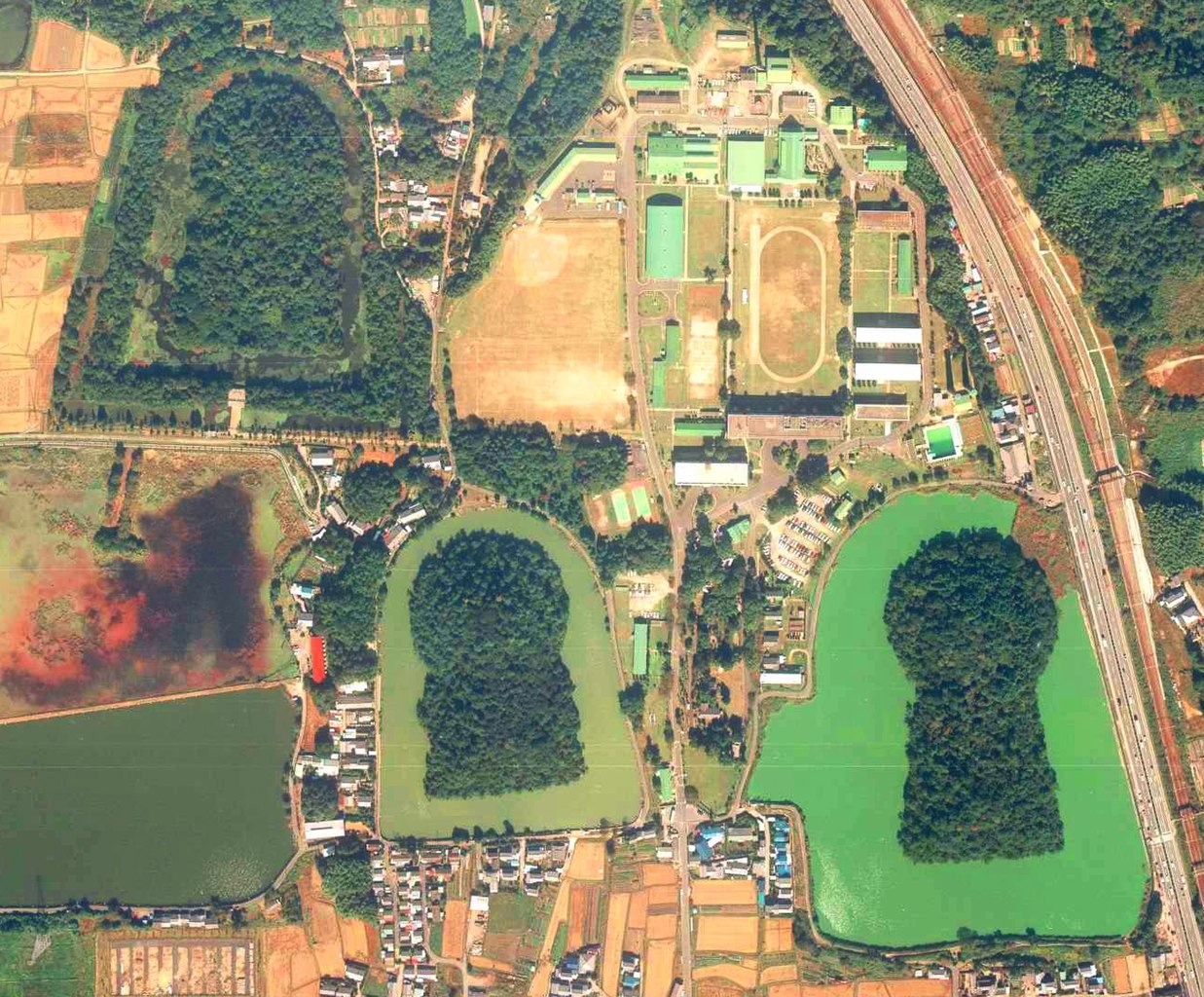
| 22:05, 27 December 2009 |  | 1,110 × 920 (140 KB) | Weatherman2009 (talk | contribs) | {{Information |Description=佐紀盾列古墳群:ヒシアゲ古墳(伝磐之媛命陵)(左上)・コナベ古墳(小奈辺陵墓参考地)(下中)・ウワナベ古墳(宇和奈辺陵墓参考地)(右下)([ |
You cannot overwrite this file.
File usage on Commons
There are no pages that use this file.