File:Kurdish lands 92.jpg
Jump to navigation
Jump to search

Size of this preview: 562 × 600 pixels. Other resolutions: 225 × 240 pixels | 450 × 480 pixels | 719 × 768 pixels | 1,066 × 1,138 pixels.
Original file (1,066 × 1,138 pixels, file size: 230 KB, MIME type: image/jpeg)
Captions
Captions
Add a one-line explanation of what this file represents
Summary[edit]
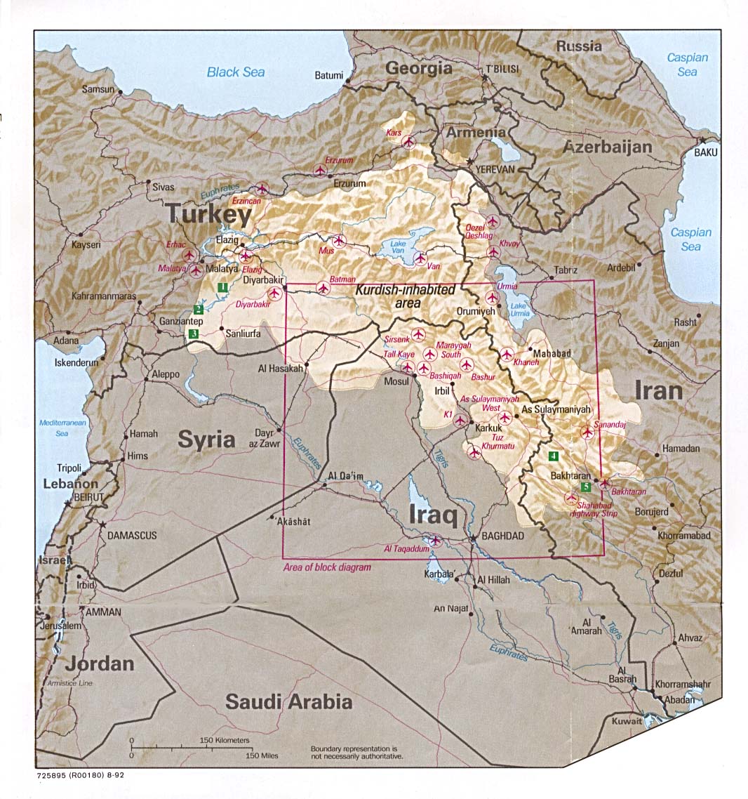
Perry-Castañeda Library Map Collection at The University of Texas at Austin [1]
http://www.lib.utexas.edu/maps/middle_east_and_asia/kurdish_lands_92.jpg
See also Kurdish-inhabited area by CIA (1992).jpg, a cropped version of another image of the same map.
.jpg)
.jpg)
Licensing[edit]
| This image is a work of a Central Intelligence Agency employee, taken or made as part of that person's official duties. As a Work of the United States Government, this image or media is in the public domain in the United States.
|

|
File history
Click on a date/time to view the file as it appeared at that time.
| Date/Time | Thumbnail | Dimensions | User | Comment | |
|---|---|---|---|---|---|
| current | 23:37, 23 May 2021 | | 1,066 × 1,138 (230 KB) | GPinkerton (talk | contribs) | Full image |
| 14:31, 17 March 2011 |  | 975 × 1,047 (688 KB) | Ras67 (talk | contribs) | cropped from original | |
| 04:30, 8 September 2007 |  | 550 × 592 (103 KB) | BetacommandBot (talk | contribs) | Transwiki approved by: w:en:User:Dmcdevit This image was copied from wikipedia:en. The original description was: This is apparently a CIA map, thus: {{PD-USGov-CIA}} This is available at http://www.ciaonet.org/special_section/iraq/maps/kurdish_lan |
You cannot overwrite this file.
File usage on Commons
The following 3 pages use this file:
_box_inset_removed.jpg)
File usage on other wikis
The following other wikis use this file:
- Usage on sc.wikipedia.org