Category:Maps of Kurdish-inhabited regions in Iraq
Jump to navigation
Jump to search
Subcategories
This category has only the following subcategory.
M
Media in category "Maps of Kurdish-inhabited regions in Iraq"
The following 9 files are in this category, out of 9 total.
-
 Ethnographical Map of the contested territory (1922-1924) (Mosul vilayet).jpg 1,851 × 1,443; 323 KB
-
 Iraq ethno 2003.jpg 1,044 × 1,555; 215 KB
-
 Iraqi Kurdistan.jpg 447 × 466; 20 KB
-
 Kurdish lands 92 (margins cropped).jpg 988 × 1,073; 387 KB
-
 Kurdish lands 92.jpg 1,066 × 1,138; 230 KB
-
 Kurdish-inhabited area by CIA (1992) box inset removed.jpg 975 × 795; 556 KB
-
 Kurdish-inhabited area by CIA (1992).jpg 982 × 802; 630 KB
-
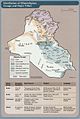
 Kurdish-inhabited area by CIA (2002).jpg 500 × 448; 38 KB
-
 Sian tribe Kurd.jpg 774 × 626; 370 KB
_(Mosul_vilayet).jpg)


.jpg)

_box_inset_removed.jpg)
.jpg)
.jpg)
