File:Aerial photograph of Asaji interchange.jpg
Jump to navigation
Jump to search

Size of this preview: 800 × 571 pixels. Other resolutions: 320 × 229 pixels | 640 × 457 pixels | 1,024 × 731 pixels | 1,280 × 914 pixels | 2,100 × 1,500 pixels.
Original file (2,100 × 1,500 pixels, file size: 2.22 MB, MIME type: image/jpeg)
Captions
Captions
Add a one-line explanation of what this file represents
Summary[edit]
| Description |
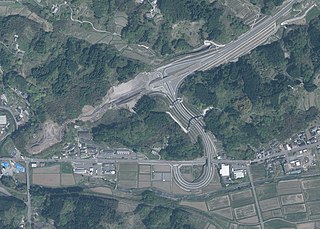
日本語: 朝地インターチェンジ(大分県豊後大野市)の航空写真。撮影当時は竹田方面が未開通。 |
| Date | |
| Source | https://mapps.gsi.go.jp/maplibSearch.do?specificationId=1683386 |
| Author | 国土地理院 |
Licensing[edit]

|
The copyright holder of this file, the Ministry of Land, Infrastructure, Transport and Tourism of Japan, allows anyone to use it for any purpose, provided that the copyright holder is properly attributed. Redistribution, derivative work, commercial use, and all other use is permitted. |
Attribution:
Copyright © National Land Image Information (Color Aerial Photographs), Ministry of Land, Infrastructure, Transport and Tourism
|
 |
This image is copyrighted by the Ministry of Land, Infrastructure, Transport and Tourism of Japan. For terms of use, see the stipulation to use of National Land Information (in Japanese) and message from MLIT (in Japanese and English). When you display this image on an article, include the following phrase in the description: "Made based on National Land Image Information (Color Aerial Photographs), Ministry of Land, Infrastructure, Transport and Tourism".
|
File history
Click on a date/time to view the file as it appeared at that time.
| Date/Time | Thumbnail | Dimensions | User | Comment | |
|---|---|---|---|---|---|
| current | 22:01, 14 November 2022 | | 2,100 × 1,500 (2.22 MB) | 運動会プロテインパワー (talk | contribs) | トリミングしたものに変更 |
| 22:00, 14 November 2022 |  | 3,140 × 4,810 (1.54 MB) | 運動会プロテインパワー (talk | contribs) | Uploaded a work by 国土地理院 from https://mapps.gsi.go.jp/maplibSearch.do?specificationId=1683386 with UploadWizard |
You cannot overwrite this file.
File usage on Commons
There are no pages that use this file.
File usage on other wikis
The following other wikis use this file:
- Usage on ja.wikipedia.org