| №
|
Name
|
Upload
|
Photo
|
Category
|
Type[1]
|
Region(s)
|
Wikidata
|
Location
|
| -
|
Killarney National Park
|

|
yes
|
Killarney National Park
|
NP, BIS
|
County Kerry
|
Q1573866
|
51°59′35″N 9°33′25″W / 51.993°N 9.557°W / 51.993; -9.557
|
| -
|
The Burren
|
|
yes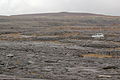
|
Burren
|
NP
|
County Clare
|
Q917858
|
53°00′29″N 9°00′07″W / 53.008°N 9.002°W / 53.008; -9.002
|
| Ireland/6619
|
Burren and Cliffs of Moher Geopark
|
|
yes
|
Burren and Cliffs of Moher Geopark
|
GP
|
County Clare
|
Q5000424
|
52°56′10″N 9°28′16″W / 52.936°N 9.471°W / 52.936; -9.471
|
| Ireland/6445
|
Copper Coast Geopark
|
|
yes
|
Copper Coast Geopark
|
GP
|
County Waterford
|
Q5168708
|
52°08′31″N 7°21′54″W / 52.142°N 7.365°W / 52.142; -7.365
|
| S.I. No. 418/1986, IE0000994
|
Ballyteigue/Ballyteige
|
|
yes
|
Ballyteigue
|
NR, SAC
|
County Clare
|
Q99194392
|
53°01′34″N 9°15′58″W / 53.026°N 9.266°W / 53.026; -9.266
|
| S.I. No. 387/1980
|
Cahermurphy
|
|
|
Cahermurphy
|
NR
|
County Clare
|
Q104856311
|
53°00′00″N 8°38′31″W / 53.000°N 8.642°W / 53.000; -8.642
|
| S.I. No. 379/1985
|
Dromore
|
|
yes
|
Dromore, County Clare
|
NR, SAC
|
County Clare
|
Q13574469
|
52°55′52″N 8°57′25″W / 52.931°N 8.957°W / 52.931; -8.957
|
| S.I. No. 346/1986
|
Keelhilla, Slieve Carron
|
|
yes
|
Keelhilla, Slieve Carron
|
NR
|
County Clare
|
Q104851849
|
53°05′10″N 8°59′49″W / 53.086°N 8.997°W / 53.086; -8.997
|
| S.I. No. 381/1985, S.I. No. 384/1985
|
Capel Island and Knockadoon Head
|
|
yes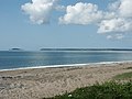
|
Capel Island and Knockadoon Head
|
NR
|
County Cork
|
Q99239726
|
51°52′48″N 7°51′40″W / 51.880°N 7.861°W / 51.880; -7.861
|
| S.I. No. 172/1991
|
Glengarriff Wood
|
|
yes
|
Glengarriff Wood
|
NR
|
County Cork
|
Q98105915
|
51°45′07″N 9°34′30″W / 51.752°N 9.575°W / 51.752; -9.575
|
| S.I. No. 314/1993, S.I. No. 315/1993
|
Kilcolman Bog
|
|
|
Kilcolman Bog
|
NR
|
County Cork
|
Q104856630
|
52°14′49″N 8°36′47″W / 52.247°N 8.613°W / 52.247; -8.613
|
| S.I. No. 107/1989
|
Knockomagh Wood
|
|
|
Knockomagh Wood
|
NR
|
County Cork
|
Q104856774
|
51°30′22″N 9°18′36″W / 51.506°N 9.310°W / 51.506; -9.310
|
| S.I. No. 206/1981
|
Lough Hyne
|
|
yes
|
Lough Hyne
|
NR, SAC
|
County Cork
|
Q3777053
|
51°30′07″N 9°18′14″W / 51.502°N 9.304°W / 51.502; -9.304
|
| S.I. No. 231/1987
|
The Gearagh
|
|
yes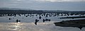
|
The Gearagh
|
NR, RS, SAC
|
County Cork
|
Q24196938
|
51°53′06″N 8°59′56″W / 51.885°N 8.999°W / 51.885; -8.999
|
| S.I. No. 10/1990, 470
|
Castlemaine Harbour
|
|
yes
|
Castlemaine Harbour
|
NR, RS
|
County Kerry
|
Q104856992
|
52°07′41″N 9°56′38″W / 52.128°N 9.944°W / 52.128; -9.944
|
| S.I. No. 116/1994
|
Cummeragh River Bog
|
|
|
Cummeragh River Bog
|
NR
|
County Kerry
|
Q104857259
|
51°52′16″N 10°03′54″W / 51.871°N 10.065°W / 51.871; -10.065
|
| S.I. No. 111/1989
|
Derrycunnihy Wood
|
|
yes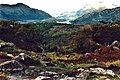
|
Derrycunihy Wood
|
NR
|
County Kerry
|
Q99438625
|
51°58′16″N 9°35′38″W / 51.971°N 9.594°W / 51.971; -9.594
|
| S.I. No. 110/1989
|
Derrymore Island
|
|
|
Derrymore Island
|
NR
|
County Kerry
|
|
52°15′18″N 9°49′48″W / 52.255°N 9.830°W / 52.255; -9.830
|
| S.I. No. 419/1986
|
Eirk Bog
|
|
yes
|
Eirk Bog
|
NR
|
County Kerry
|
Q98104561
|
51°56′46″N 9°39′58″W / 51.946°N 9.666°W / 51.946; -9.666
|
| S.I. No. 235/1988
|
Great Skellig
|
|
yes
|
Skellig Michael
|
NR
|
County Kerry
|
Q207193
|
51°46′16″N 10°32′24″W / 51.771°N 10.540°W / 51.771; -10.540
|
| S.I. No. 236/1988
|
Little Skellig
|
|
yes
|
Little Skellig
|
NR
|
County Kerry
|
Q2360976
|
51°46′55″N 10°30′32″W / 51.782°N 10.509°W / 51.782; -10.509
|
| S.I. No. 73/1988
|
Lough Nambrackdarrig
|
|
yes
|
Lough Nambrackdarrig
|
NR
|
County Kerry
|
Q6686142
|
52°04′55″N 9°53′53″W / 52.082°N 9.898°W / 52.082; -9.898
|
| S.I. No. 72/1988
|
Lough Yganavan
|
|
yes
|
Lough Yganavan
|
NR
|
County Kerry
|
Q6686142
|
52°05′35″N 9°53′35″W / 52.093°N 9.893°W / 52.093; -9.893
|
| S.I. No. 420/1986
|
Mount Brandon
|
|
yes
|
Mount Brandon
|
NR
|
County Kerry
|
Q1478911
|
52°16′05″N 10°14′13″W / 52.268°N 10.237°W / 52.268; -10.237
|
| S.I. No. 228/1987, S.I. No. 229/1987
|
Puffin Island
|
|
yes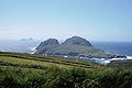
|
Puffin Island (Ireland)
|
NR
|
County Kerry
|
Q2733571
|
51°50′13″N 10°24′29″W / 51.837°N 10.408°W / 51.837; -10.408
|
| S.I. No. 7/1990
|
Sheheree Bog
|
|
|
Sheheree Bog
|
NR
|
County Kerry
|
Q26718912
|
52°02′24″N 9°28′52″W / 52.040°N 9.481°W / 52.040; -9.481
|
| S.I. No. 108/1989, S.I. No. 109/1989
|
Tearaght Island
|
|
yes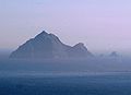
|
Tearaght Island
|
NR
|
County Kerry
|
Q2662514
|
52°04′30″N 10°39′54″W / 52.075°N 10.665°W / 52.075; -10.665
|
| S.I. No. 106/1989, 440
|
Tralee Bay
|
|
yes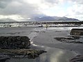
|
Tralee Bay
|
NR, RS
|
County Kerry
|
Q1091161
|
52°15′18″N 9°48′04″W / 52.255°N 9.801°W / 52.255; -9.801
|
| S.I. No. 380/1982
|
Uragh Wood
|
|
yes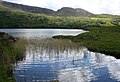
|
Uragh Wood
|
NR
|
County Kerry
|
Q7899562
|
51°48′14″N 9°41′10″W / 51.804°N 9.686°W / 51.804; -9.686
|
| S.I. No. 173/1991 IE0002353
|
Redwood Bog
|
|
|
Redwood Bog
|
NR, SAC
|
County Tipperary
|
Q99521505
|
53°09′14″N 8°04′41″W / 53.154°N 8.078°W / 53.154; -8.078
|
| S.I. No. 86/2004
|
Fenor Bog
|
|
yes
|
Fenor Bog
|
NR
|
County Waterford
|
Q98106414
|
52°09′54″N 7°13′30″W / 52.165°N 7.225°W / 52.165; -7.225
|
| IE0000014
|
Ballyallia Lake
|
|
|
Ballyallia Lake
|
SAC, RS
|
County Clare
|
Q61676998
|
52°52′26″N 8°58′59″W / 52.874°N 8.983°W / 52.874; -8.983
|
| IE0000016
|
Ballycullinan Lake
|
|
|
Ballycullinan Lake
|
SAC
|
County Clare
|
|
52°55′16″N 9°03′25″W / 52.921°N 9.057°W / 52.921; -9.057
|
| IE0000019
|
Ballyogan Lough
|
|
|
Ballyogan Lough
|
SAC
|
County Clare
|
|
52°57′58″N 8°56′10″W / 52.966°N 8.936°W / 52.966; -8.936
|
| IE0000996
|
Ballyvaughan Turlough
|
|
|
Ballyvaughan Turlough
|
SAC
|
County Clare
|
|
53°06′36″N 9°09′40″W / 53.110°N 9.161°W / 53.110; -9.161
|
| IE0000020
|
Black Head-Poulsallagh Complex
|
|
|
Black Head-Poulsallagh Complex
|
SAC
|
County Clare
|
|
53°06′04″N 9°16′05″W / 53.101°N 9.268°W / 53.101; -9.268
|
| IE0002250
|
Carrowmore Dunes (Doonbeg dunes)
|
|
yes
|
Carrowmore Dunes
|
SAC
|
County Clare
|
Q98104456
|
52°45′18″N 9°30′36″W / 52.755°N 9.510°W / 52.755; -9.510
|
| IE0001021
|
Carrowmore Point to Spanish Point and Islands
|
|
|
Carrowmore Point to Spanish Point and Islands
|
SAC
|
County Clare
|
|
52°48′36″N 9°30′18″W / 52.810°N 9.505°W / 52.810; -9.505
|
| IE0001926
|
East Burren Complex
|
|
|
East Burren Complex
|
SAC
|
County Clare
County Galway
|
|
53°01′52″N 9°00′14″W / 53.031°N 9.004°W / 53.031; -9.004
|
| IE0000268
|
Galway Bay Complex
|
|
|
Galway Bay Complex
|
SAC
|
County Clare
County Galway
|
|
53°12′00″N 9°02′17″W / 53.200°N 9.038°W / 53.200; -9.038
|
| IE0001912
|
Glendree Bog
|
|
|
Glendree Bog
|
SAC
|
County Clare
|
|
52°56′38″N 8°43′59″W / 52.944°N 8.733°W / 52.944; -8.733
|
| IE0001013
|
Glenomra Wood
|
|
|
Glenomra Wood
|
SAC
|
County Clare
|
|
52°45′32″N 8°34′41″W / 52.759°N 8.578°W / 52.759; -8.578
|
| IE0000036
|
Inagh River Estuary
|
|
|
Inagh River Estuary
|
SAC
|
County Clare
|
|
52°56′42″N 9°20′13″W / 52.945°N 9.337°W / 52.945; -9.337
|
| IE0002264
|
Kilkee Reefs
|
|
|
Kilkee Reefs
|
SAC
|
County Clare
|
|
52°41′49″N 9°40′34″W / 52.697°N 9.676°W / 52.697; -9.676
|
| IE0000308
|
Loughatorick South Bog
|
|
|
Loughatorick South Bog
|
SAC
|
County Clare
County Galway
|
|
52°59′13″N 8°28′08″W / 52.987°N 8.469°W / 52.987; -8.469
|
| IE0000051
|
Lough Gash Turlough
|
|
|
Lough Gash Turlough
|
SAC
|
County Clare
|
|
52°45′29″N 8°54′04″W / 52.758°N 8.901°W / 52.758; -8.901
|
| IE0002165
|
Lower River Shannon
|
|
|
Lower River Shannon
|
SAC
|
Munster
|
|
52°35′02″N 9°25′37″W / 52.584°N 9.427°W / 52.584; -9.427
|
| IE0000054
|
Moneen Mountain
|
|
yes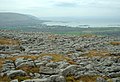
|
Moneen Mountain
|
SAC
|
County Clare
|
Q26717043
|
53°03′36″N 9°07′48″W / 53.060°N 9.130°W / 53.060; -9.130
|
| IE0000057
|
Moyree River System
|
|
|
Moyree River System
|
SAC
|
County Clare
|
|
52°57′29″N 8°55′08″W / 52.958°N 8.919°W / 52.958; -8.919
|
| IE0002126
|
Pollagoona Bog
|
|
|
Pollagoona Bog
|
SAC
|
County Clare
County Galway
|
|
53°00′54″N 8°32′06″W / 53.015°N 8.535°W / 53.015; -8.535
|
| IE0002312
|
Slieve Bernagh Bog
|
|
|
Slieve Bernagh Bog
|
SAC
|
County Clare
|
|
52°50′20″N 8°33′07″W / 52.839°N 8.552°W / 52.839; -8.552
|
| IE0001321
|
Termon Lough
|
|
|
Termon Lough
|
SAC
|
County Clare
|
|
53°01′48″N 8°52′19″W / 53.030°N 8.872°W / 53.030; -8.872
|
| IE0002343
|
Tullaher Lough and Bog
|
|
|
Tullaher Lough and Bog
|
SAC
|
County Clare
|
|
52°42′22″N 9°33′32″W / 52.706°N 9.559°W / 52.706; -9.559
|
| IE0000077, 831
|
Ballymacoda (Clonpriest and Pillmore)
|
|
|
Ballymacoda
|
SAC, RS
|
County Cork
|
Q56055354
|
51°54′18″N 7°54′25″W / 51.905°N 7.907°W / 51.905; -7.907
|
| IE0001040
|
Barley Cove to Ballyrisode Point
|
|
|
Barley Cove to Ballyrisode Point
|
SAC
|
County Cork
|
|
51°28′26″N 9°44′10″W / 51.474°N 9.736°W / 51.474; -9.736
|
| IE0002171
|
Bandon River
|
|
yes
|
Bandon River
|
SAC
|
County Cork
|
Q2155474
|
51°44′31″N 9°05′49″W / 51.742°N 9.097°W / 51.742; -9.097
|
| IE0002036
|
Ballyhoura Mountains
|
|
yes
|
Ballyhoura Mountains
|
SAC
|
County Cork
County Limerick
|
Q805411
|
52°18′25″N 8°31′37″W / 52.307°N 8.527°W / 52.307; -8.527
|
| IE0002170, 836
|
Blackwater River (Cork/Waterford)
|
|
yes
|
River Blackwater, Cork
|
SAC, RS
|
Munster
|
Q1464482
|
52°08′28″N 8°23′53″W / 52.141°N 8.398°W / 52.141; -8.398
|
| IE0000093
|
Caha Mountains
|
|
yes
|
Caha Mountains
|
SAC
|
County Cork
County Kerry
|
Q1764408
|
51°44′56″N 9°40′16″W / 51.749°N 9.671°W / 51.749; -9.671
|
| IE0002037
|
Carrigeenamronety Hill
|
|
|
Carrigeenamronety Hill
|
SAC
|
County Cork
County Limerick
|
|
52°17′38″N 8°26′13″W / 52.294°N 8.437°W / 52.294; -8.437
|
| IE0001547
|
Castletownshend SAC
|
|
|
Castletownshend SAC
|
SAC
|
County Cork
|
|
51°32′13″N 9°10′16″W / 51.537°N 9.171°W / 51.537; -9.171
|
| IE0001043
|
Cleanderry Wood
|
|
|
Cleanderry Wood
|
SAC
|
County Cork
|
|
51°44′17″N 9°56′02″W / 51.738°N 9.934°W / 51.738; -9.934
|
| IE0000091
|
Clonakilty Bay
|
|
yes
|
Clonakilty Bay
|
SAC
|
County Cork
|
Q26716064
|
51°36′11″N 8°52′19″W / 51.603°N 8.872°W / 51.603; -8.872
|
| IE0001230
|
Courtmacsherry Estuary
|
|
|
Courtmacsherry Estuary
|
SAC
|
County Cork
|
|
51°38′35″N 8°42′29″W / 51.643°N 8.708°W / 51.643; -8.708
|
| IE0001873
|
Derryclogher (Knockboy)
|
|
|
Derryclogher (Knockboy)
|
SAC
|
County Cork
|
|
51°48′14″N 9°25′37″W / 51.804°N 9.427°W / 51.804; -9.427
|
| IE0002280
|
Dunbeacon Shingle
|
|
|
Dunbeacon Shingle
|
SAC
|
County Cork
|
|
51°36′04″N 9°33′54″W / 51.601°N 9.565°W / 51.601; -9.565
|
| IE0000090
|
Glengarriff Harbour and Woodland
|
|
yes
|
Glengarriff Harbour and Woodland
|
SAC
|
County Cork
|
Q98105754
|
51°45′11″N 9°33′36″W / 51.753°N 9.560°W / 51.753; -9.560
|
| IE0001879
|
Glanmore Bog
|
|
|
Glanmore Bog
|
SAC
|
County Cork
County Kerry
|
|
51°42′47″N 9°51′11″W / 51.713°N 9.853°W / 51.713; -9.853
|
| IE0001058
|
Great Island Channel
|
|
yes
|
Great Island Channel
|
SAC
|
County Cork
|
Q98072233
|
51°53′24″N 8°15′43″W / 51.890°N 8.262°W / 51.890; -8.262
|
| IE0001058
|
Farranamanagh Lough
|
|
yes
|
Farranamanagh Lough
|
SAC
|
County Cork
|
|
51°34′44″N 9°41′24″W / 51.579°N 9.690°W / 51.579; -9.690
|
| IE0002158
|
Kenmare River
|
|
yes
|
Kenmare River
|
SAC
|
County Cork
County Kerry
|
Q3814571
|
51°43′12″N 10°03′14″W / 51.720°N 10.054°W / 51.720; -10.054
|
| IE0001061
|
Kilkeran Lake and Castlefreke Dunes
|
|
|
Kilkeran Lake and Castlefreke Dunes
|
SAC
|
County Cork
|
|
51°33′36″N 8°57′22″W / 51.560°N 8.956°W / 51.560; -8.956
|
| IE0001070
|
Myross Wood
|
|
|
Myross Wood
|
SAC
|
County Cork
|
|
51°34′23″N 9°08′49″W / 51.573°N 9.147°W / 51.573; -9.147
|
| IE0002281
|
Reen Point Shingle
|
|
|
Reen Point Shingle
|
SAC
|
County Cork
|
|
51°36′04″N 9°36′25″W / 51.601°N 9.607°W / 51.601; -9.607
|
| IE0000101
|
Roaringwater Bay and Islands
|
|
yes
|
Roaringwater Bay and Islands
|
SAC
|
County Cork
|
|
51°28′52″N 9°29′42″W / 51.481°N 9.495°W / 51.481; -9.495
|
| IE0000102
|
Sheep's Head
|
|
yes
|
Sheep's Head peninsula
|
SAC
|
County Cork
|
Q2707869
|
51°35′24″N 9°43′01″W / 51.590°N 9.717°W / 51.590; -9.717
|
| IE0000106
|
St. Gobnet's Wood
|
|
|
St. Gobnet's Wood
|
SAC
|
County Cork
|
Q7588267
|
51°56′38″N 9°10′01″W / 51.944°N 9.167°W / 51.944; -9.167
|
| IE0000109
|
Three Castle Head to Mizen Head
|
|
yes
|
Three Castle Head
|
SAC
|
County Cork
|
Q26715345
|
51°28′34″N 9°48′58″W / 51.476°N 9.816°W / 51.476; -9.816
|
| IE0000332
|
Akeragh, Banna and Barrow Harbour
|
|
|
Akeragh Harbour
|
SAC
|
County Kerry
|
|
52°19′12″N 9°50′42″W / 52.320°N 9.845°W / 52.320; -9.845
|
| IE0000332
|
Akeragh, Banna and Barrow Harbour
|
|
|
Banna Harbour
|
SAC
|
County Kerry
|
|
52°19′12″N 9°50′42″W / 52.320°N 9.845°W / 52.320; -9.845
|
| IE0000332
|
Akeragh, Banna and Barrow Harbour
|
|
yes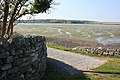
|
Barrow Harbour
|
SAC
|
County Kerry
|
Q4863874
|
52°19′12″N 9°50′42″W / 52.320°N 9.845°W / 52.320; -9.845
|
| IE0000335
|
Ballinskelligs Bay and Inny Estuary
|
|
yes
|
Ballinskelligs Bay
|
SAC
|
County Kerry
|
Q3633036
|
51°49′48″N 10°12′36″W / 51.830°N 10.210°W / 51.830; -10.210
|
| IE0000335
|
Ballinskelligs Bay and Inny Estuary
|
|
|
Inny Estuary
|
SAC
|
County Kerry
|
|
51°49′48″N 10°12′36″W / 51.830°N 10.210°W / 51.830; -10.210
|
| IE0002112
|
Ballyseedy Wood
|
|
|
Ballyseedy Wood
|
SAC
|
County Kerry
|
|
52°15′18″N 9°39′25″W / 52.255°N 9.657°W / 52.255; -9.657
|
| IE0002173
|
Blackwater River (Kerry)
|
|
yes
|
Kerry Blackwater
|
SAC
|
County Kerry
|
Q945892
|
51°53′35″N 9°45′25″W / 51.893°N 9.757°W / 51.893; -9.757
|
| IE0002172
|
Blasket Islands
|
|
yes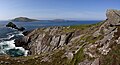
|
Blasket Islands
|
SAC
|
County Kerry
|
Q881960
|
52°05′10″N 10°34′34″W / 52.086°N 10.576°W / 52.086; -10.576
|
| IE0001342
|
Cloonee and Inchiquin Loughs, Uragh Wood
|
|
|
Cloonee and Inchiquin Loughs, Uragh Wood
|
SAC
|
County Kerry
|
Q5135099
|
51°48′14″N 9°41′49″W / 51.804°N 9.697°W / 51.804; -9.697
|
| IE0002187
|
Drongawn Lough
|
|
|
Drongawn Lough
|
SAC
|
County Kerry
|
|
51°48′54″N 9°50′31″W / 51.815°N 9.842°W / 51.815; -9.842
|
| IE0002315
|
Glanlough Woods
|
|
|
Glanlough Woods
|
SAC
|
County Kerry
|
|
51°52′12″N 9°26′28″W / 51.870°N 9.441°W / 51.870; -9.441
|
| IE0002263
|
Kerry Head Shoal
|
|
|
Kerry Head Shoal
|
SAC
|
County Kerry
|
Q34798398
|
52°26′46″N 10°03′47″W / 52.446°N 10.063°W / 52.446; -10.063
|
| IE0000365
|
Killarney National Park, MacGillycuddy's Reeks and Caragh River Catchment
|
|
yes
|
MacGillycuddy's Reeks
|
SAC
|
County Kerry
|
Q1366878
|
51°57′54″N 9°44′38″W / 51.965°N 9.744°W / 51.965; -9.744
|
| IE0000365
|
Killarney National Park, MacGillycuddy's Reeks and Caragh River Catchment
|
|
|
Caragh River
|
SAC
|
County Kerry
|
Q5037626
|
51°57′54″N 9°44′38″W / 51.965°N 9.744°W / 51.965; -9.744
|
| IE0002261
|
Magharee Islands
|
|
yes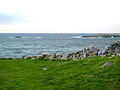
|
Magharee Islands
|
SAC
|
County Kerry
|
Q691618
|
52°19′55″N 10°00′18″W / 52.332°N 10.005°W / 52.332; -10.005
|
| IE0001881
|
Maulagowna Bog
|
|
|
Maulagowna Bog
|
SAC
|
County Kerry
|
|
51°48′50″N 9°37′55″W / 51.814°N 9.632°W / 51.814; -9.632
|
| IE0002351
|
Moanveanlagh Bog
|
|
|
Moanveanlagh Bog
|
SAC
|
County Kerry
|
|
52°27′18″N 9°24′36″W / 52.455°N 9.410°W / 52.455; -9.410
|
| IE0001371
|
Mucksna Wood
|
|
|
Mucksna Wood
|
SAC
|
County Kerry
|
|
51°52′05″N 9°35′28″W / 51.868°N 9.591°W / 51.868; -9.591
|
| IE0001890
|
Mullaghanish Bog
|
|
|
Mullaghanish Bog
|
SAC
|
County Kerry
|
|
51°59′02″N 9°08′38″W / 51.984°N 9.144°W / 51.984; -9.144
|
| IE0000382
|
Sheheree (Ardagh) Bog
|
|
|
Sheheree (Ardagh) Bog
|
SAC
|
County Kerry
|
|
52°02′24″N 9°28′52″W / 52.040°N 9.481°W / 52.040; -9.481
|
| IE0002185
|
Slieve Mish Mountains
|
|
yes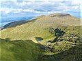
|
Slieve Mish Mountains
|
SAC
|
County Kerry
|
Q2294156
|
52°12′11″N 9°48′36″W / 52.203°N 9.810°W / 52.203; -9.810
|
| IE0002070
|
Tralee Bay and Magharees Peninsula, West to Cloghane
|
|
yes
|
Tralee Bay
|
SAC
|
County Kerry
|
Q1091161
|
52°16′05″N 9°56′31″W / 52.268°N 9.942°W / 52.268; -9.942
|
| IE0002070
|
Tralee Bay and Magharees Peninsula, West to Cloghane
|
|
yes
|
Magharees Peninsula
|
SAC
|
County Kerry
|
|
52°16′05″N 9°56′31″W / 52.268°N 9.942°W / 52.268; -9.942
|
| IE0002262
|
Valencia Harbour/Portmagee Channel
|
|
|
Valencia Harbour
|
SAC
|
County Kerry
|
|
51°55′30″N 10°19′01″W / 51.925°N 10.317°W / 51.925; -10.317
|
| IE0002262
|
Valencia Harbour/Portmagee Channel
|
|
yes
|
Portmagee Channel
|
SAC
|
County Kerry
|
Q33129744
|
51°55′30″N 10°19′01″W / 51.925°N 10.317°W / 51.925; -10.317
|
| IE0002279
|
Askeaton Fen Complex
|
|
|
Askeaton Fen Complex
|
SAC
|
County Limerick
|
|
52°34′55″N 8°55′08″W / 52.582°N 8.919°W / 52.582; -8.919
|
| IE0000432
|
Barrigone
|
|
|
Barrigone
|
SAC
|
County Limerick
|
|
52°36′04″N 9°02′13″W / 52.601°N 9.037°W / 52.601; -9.037
|
| IE0000930
|
Clare Glen
|
|
yes
|
Clare Glen
|
SAC
|
County Limerick
County Tipperary
|
Q5126172
|
52°41′06″N 8°23′13″W / 52.685°N 8.387°W / 52.685; -8.387
|
| IE0000174
|
Curraghchase Woods
|
|
|
Curraghchase Woods
|
SAC
|
County Limerick
|
|
52°35′46″N 8°52′19″W / 52.596°N 8.872°W / 52.596; -8.872
|
| IE0000646
|
Galtee Mountains
|
|
yes
|
Galtee Mountains
|
SAC
|
County Limerick
County Tipperary
|
Q1492751
|
52°22′01″N 8°08′42″W / 52.367°N 8.145°W / 52.367; -8.145
|
| IE0001430
|
Glen Bog
|
|
|
Glen Bog
|
SAC
|
County Limerick
|
|
52°29′38″N 8°30′25″W / 52.494°N 8.507°W / 52.494; -8.507
|
| IE0001432
|
Glenstal Wood
|
|
|
Glenstal Wood
|
SAC
|
County Limerick
|
|
52°40′01″N 8°23′02″W / 52.667°N 8.384°W / 52.667; -8.384
|
| IE0000439
|
Tory Hill
|
|
|
Tory Hill
|
SAC
|
County Limerick
|
Q26717977
|
52°32′17″N 8°41′10″W / 52.538°N 8.686°W / 52.538; -8.686
|
| IE0002125
|
Anglesey Road SAC
|
|
|
Anglesey Road SAC
|
SAC
|
County Tipperary
|
|
52°39′11″N 8°05′46″W / 52.653°N 8.096°W / 52.653; -8.096
|
| IE0000641
|
Ballyduff/Clonfinane Bog
|
|
|
Ballyduff/Clonfinane Bog
|
SAC
|
County Tipperary
|
|
53°04′52″N 8°00′11″W / 53.081°N 8.003°W / 53.081; -8.003
|
| IE0002124
|
Bolingbrook Hill
|
|
|
Bolingbrook Hill
|
SAC
|
County Tipperary
|
|
52°45′54″N 8°11′10″W / 52.765°N 8.186°W / 52.765; -8.186
|
| IE0001197
|
Keeper Hill
|
|
yes
|
Keeper Hill
|
SAC
|
County Tipperary
|
Q3778335
|
52°45′04″N 8°16′01″W / 52.751°N 8.267°W / 52.751; -8.267
|
| IE0000647
|
Kilcarren-Firville Bog
|
|
|
Kilcarren-Firville Bog
|
SAC
|
County Tipperary
|
|
53°03′54″N 8°05′17″W / 53.065°N 8.088°W / 53.065; -8.088
|
| IE0000934
|
Kilduff Mountain
|
|
|
Kilduff Mountain
|
SAC
|
County Tipperary
|
Q26717276
|
52°49′34″N 7°54′29″W / 52.826°N 7.908°W / 52.826; -7.908
|
| IE0001683
|
Liskeenan Fen
|
|
|
Liskeenan Fen
|
SAC
|
County Tipperary
|
|
53°02′10″N 8°03′11″W / 53.036°N 8.053°W / 53.036; -8.053
|
| IE0002241
|
Lough Derg (North-east Shore)
|
|
yes
|
Lough Derg (Munster)
|
SAC
|
County Tipperary
County Galway
|
Q918349
|
53°02′10″N 8°15′22″W / 53.036°N 8.256°W / 53.036; -8.256
|
| IE0002257
|
Moanour Mountain
|
|
|
Moanour Mountain
|
SAC
|
County Tipperary
|
|
52°25′30″N 8°14′53″W / 52.425°N 8.248°W / 52.425; -8.248
|
| IE0001847
|
Philipston Marsh
|
|
|
Philipston Marsh
|
SAC
|
County Tipperary
|
|
52°34′01″N 8°09′54″W / 52.567°N 8.165°W / 52.567; -8.165
|
| IE0000939 IE0002258
|
Silvermine Mountains
|
|
yes
|
Silvermine Mountains
|
SAC
|
County Tipperary
|
Q3862462
|
52°46′44″N 8°13′48″W / 52.779°N 8.230°W / 52.779; -8.230
|
| IE0002123
|
Ardmore Head
|
|
|
Ardmore Head
|
SAC
|
County Waterford
|
Q26717542
|
51°56′38″N 7°42′36″W / 51.944°N 7.710°W / 51.944; -7.710
|
| IE0001952
|
Comeragh Mountains
|
|
yes
|
Comeragh Mountains
|
SAC
|
County Waterford
|
Q1762938
|
52°14′13″N 7°34′01″W / 52.237°N 7.567°W / 52.237; -7.567
|
| IE0002324
|
Glendine Wood
|
|
|
Glendine Wood
|
SAC
|
County Waterford
|
|
52°07′12″N 7°35′10″W / 52.120°N 7.586°W / 52.120; -7.586
|
| IE0000665
|
Helvick Head
|
|
yes
|
Helvick Head
|
SAC
|
County Waterford
|
Q85766195
|
52°02′53″N 7°32′31″W / 52.048°N 7.542°W / 52.048; -7.542
|
| IE0000668
|
Nier Valley Woodlands
|
|
|
Nier Valley Woodlands
|
SAC
|
County Waterford
|
|
52°16′26″N 7°38′35″W / 52.274°N 7.643°W / 52.274; -7.643
|
| IE0000671, 835
|
Tramore Dunes and Backstrand
|
|
yes
|
Tramore Dunes and Backstrand
|
SAC, RS
|
County Waterford
|
Q98106493
|
52°09′29″N 7°06′11″W / 52.158°N 7.103°W / 52.158; -7.103
|
| 830
|
Ballycotton Bay
|
|
|
Ballycotton Bay
|
RS
|
County Cork
|
Q26716352
|
51°49′59″N 8°00′00″W / 51.833°N 8.000°W / 51.833; -8.000
|
| 837
|
Cork Harbour
|
|
yes
|
Cork Harbour
|
RS
|
County Cork
|
Q932369
|
51°49′59″N 8°15′00″W / 51.833°N 8.250°W / 51.833; -8.250
|
| 839
|
Dungarvan Harbour
|
|
yes
|
Dungarvan Harbour
|
RS
|
County Waterford
|
|
51°49′59″N 8°15′00″W / 51.833°N 8.250°W / 51.833; -8.250
|


.jpg)
.jpg)


.jpg)


.jpg)

