Commons:Graphic Lab/Map workshop/Archive/2020
 | This is an archive of past discussions. Do not edit the contents of this page. If you wish to start a new discussion or revive an old one, please do so on the current talk page. |
Historical Moldovan regions in Ukraine

Article(s): (not relevant)
- Request
- In the map's legend, please replace "actual" with "current". "actual" in Romanian is a false friend of „actual” in English. Gikü (talk) 11:22, 23 January 2020 (UTC)
- Graphist opinion(s)
@Gikü: ![]() Done, if you want something more, let me know. Mr. Fulano! Talk 02:47, 26 January 2020 (UTC)
Done, if you want something more, let me know. Mr. Fulano! Talk 02:47, 26 January 2020 (UTC)
- This section was archived on a request by: Mr. Fulano! Talk 02:47, 26 January 2020 (UTC)
Rock Land SVG needing internal cleanup
-
 A County in New York

Article(s): en:Rockland County, New York and ors.
- Request
- There is some inexplicable huge embedded image raster in this SVG for no clear reason. Please remove it and overwrite the current 5.55 MB file. --161.11.160.20 15:21, 14 January 2020 (UTC)
- Graphist opinion(s)
161.11.160.20: ![]() Done Fixed and reuploaded. Rcsprinter123 (talk) 20:37, 14 January 2020 (UTC)
Done Fixed and reuploaded. Rcsprinter123 (talk) 20:37, 14 January 2020 (UTC)
- This section was archived on a request by: Minoraxtalk (formerly 大诺史) 06:51, 14 March 2020 (UTC)
Stitching 5 parts of an old map into one map.
-
Kaart van de Vliet 1556, C. Oelensz., SA Delft, inv.nr. 119501
-
Kaart van de Vliet 1556, C. Oelensz., SA Delft, inv.nr. 119502
-
Kaart van de Vliet 1556, C. Oelensz., SA Delft, inv.nr. 119503
-
Kaart van de Vliet 1556, C. Oelensz., SA Delft, inv.nr. 119504
-
Kaart van de Vliet 1556, C. Oelensz., SA Delft, inv.nr. 119505
Article(s): [[]]
- Request
- Sorry, accidentely made this request twice, see other request for details ;-) Beeld&Geluid Stadsarchief Delft (talk) 11:57, 21 April 2020 (UTC)
- Graphist opinion(s)
This is a duplicate
Stitching 5 parts of old map into one map.
-

Kaart van de Vliet 1556, C. Oelensz., SA Delft, inv.nr. 119501 -

Kaart van de Vliet 1556, C. Oelensz., SA Delft, inv.nr. 119502 -

Kaart van de Vliet 1556, C. Oelensz., SA Delft, inv.nr. 119503 -

Kaart van de Vliet 1556, C. Oelensz., SA Delft, inv.nr. 119504 -

Kaart van de Vliet 1556, C. Oelensz., SA Delft, inv.nr. 119505
Article(s): yet to be made: an article and a Wikidata-item of this map
- Request
These 5 scans are of a big map which is made 1556 on 5 pieces of paper of about one meter each. The scans are rectangular but the maps should be stitched according to the diagonal and vertical cuttings of the paper, and the end result should be something like a zigzag. Thank you so much in advance! (btw in the gallery above I used the thumbs as examples, because the maps to be used are rather big, hope that's okay;) & Sorry for requesting twice by accident!) Beeld&Geluid Stadsarchief Delft (talk) 12:12, 21 April 2020 (UTC)
- Graphist opinion(s)
Beeld&Geluid Stadsarchief Delft I have looked at this and I think I can help you but it would be very helpful if you could show me a complete image of the finished map. It doesn't have to be perfect or high resolution, just so I can see which peace should go where, thanks. Please ping me. --Goran tek-en (talk) 17:48, 1 May 2020 (UTC)
Goran tek-en & Beeld&Geluid Stadsarchief Delft I propose the orientation for these five segments as:
- 119501 - horizontal, upper left corner of canvas
- 119502 - vertical, starts at right side of 119501
- 119503 - vertical, below 119502
- 119504 - vertical, below 119503
- 119505 - vertical, slightly right at bottom of 119504, lower right corner of canvas
I worked this out by looking at the lower-res versions and attempting to match up the pieces. The 119503 piece needs special attention because the scale is larger then 11902 above and 11904 below. - DutchTreat (talk) 16:33, 10 May 2020 (UTC)
I created the following guide for stitching the five maps. [[

- DutchTreat (talk) 16:44, 10 May 2020 (UTC)
![]() Request taken by Goran tek-en (talk) 18:16, 10 May 2020 (UTC)
Request taken by Goran tek-en (talk) 18:16, 10 May 2020 (UTC)
- DutchTreat Thanks for great info and guide. I didn't find any scale difference for 119503, matched perfectly. But for 119505 it's different it doesn't fit. The river is much more narrow on 505 than on 504 and the way they are drawn doesn't look the same, meeting 4-5. If you are sure it should go there I will continue but I need your feedback, thanks. --Goran tek-en (talk) 18:15, 10 May 2020 (UTC)
- I am not sure what to say. I'm doing a visual inspection like you. For me, the 4-5 looked like a match. When I look at your version, I see what you mean. It doesn't match. - DutchTreat (talk) 18:31, 10 May 2020 (UTC)
- Do you get a match if you use the left side of 119505? Beeld&Geluid Stadsarchief Delft said the layout would be 'Z' shaped. - DutchTreat (talk) 18:38, 10 May 2020 (UTC)
- DutchTreat, Beeld&Geluid Stadsarchief Delft I hoped you had some knowledge about this map but I found the right position now, perfect match.
- I will have two versions, 1 were the joints are as the are, raw. 2 were I have made the joints more smooth.
- I will have two versions, 1 were the joints are as the are, raw. 2 were I have made the joints more smooth.
- I will need the following;
- Name of the file
- Description (/language)
- Captions/s (/language)
- Category/ies at commons
- to be able to upload it at commons. If you don'y know about Captions read here.--Goran tek-en (talk) 14:15, 11 May 2020 (UTC)
- DutchTreat, Beeld&Geluid Stadsarchief Delft I hoped you had some knowledge about this map but I found the right position now, perfect match.
- Do you get a match if you use the left side of 119505? Beeld&Geluid Stadsarchief Delft said the layout would be 'Z' shaped. - DutchTreat (talk) 18:38, 10 May 2020 (UTC)
I'm very greatfull for all you help already :-) Indeed, i think so too: because Delft is in the South of Leiden and 'de Sijl' is in the north east of Leiden, so the city of Leiden should be attached tot the 4th map, we think. (mentioned as the ' left side' of 119505 above indeed) Unfortunately the map maker didnt make marks where tot stitch nor used a sign to mark the North. Are you helped if we would upload a map of the South of Holland from arond the same time (not so detailed however) or can i insert an image as exemple? Beeld&Geluid Stadsarchief Delft (talk) 14:21, 11 May 2020 (UTC)

This tiny file from 2013 I found shows how the maps supposed to be stitched according to a restaurator, only Low Res. For the final stitched version the information can be as follows: Name: Map of De Vliet by Coenraet Oelensz., 1556, SA Delft, stitched. Description: Map of De Vliet, stitched from maps 119501, 119502, 119503, 119504 and 119505, made bij Coenraet Oelensz in 1556. Further info I can add after the upload. Beeld&Geluid Stadsarchief Delft (talk) 14:39, 11 May 2020 (UTC)
- Beeld&Geluid Stadsarchief Delft Thanks for the map. Yes It would help me with that map "South of Holland from around the same time" so I can find the position of Leiden. Do you want all the surrounding area to be transparent on the map or have a background color? --Goran tek-en (talk) 08:25, 12 May 2020 (UTC)
- Great work! Goran tek-en I would recommend a transparent background. This offers more flexibility. Since, adding color later would be easy. We welcome your input: Beeld&Geluid Stadsarchief Delft - DutchTreat (talk) 09:55, 15 May 2020 (UTC)
Beeld&Geluid Stadsarchief Delft, DutchTreat Now you can find it here file:Map of De Vliet by Coenraet Oelensz_1556_SA Delft_stitched.png. This file is with transparent background. If you want another version just contact me.
This is a very large file in px and I understand you want this high resolution but for most purposes I would think it's to big. Commons create smaller versions but often when you down scale an image like that you have to sharpen it to look good. So if you need smaller versions just contact me. If you are happy with this please put the code {{section resolved|1=~~~~}} on this request so it can be archived, thanks. ![]() Done --Goran tek-en (talk) 19:29, 16 May 2020 (UTC)
Done --Goran tek-en (talk) 19:29, 16 May 2020 (UTC)
- Beeld&Geluid Stadsarchief Delft Now I have uploaded new versions except for the one above. I don't have the rights to upload a new version of such a big file but I will get help. This are all the files;
- Map of De Vliet by Coenraet Oelensz 1556 SA Delft stitched I will upload a new version soon.
- Map of De Vliet, stitched from maps 119501, 119502, 119503, 119504 and 119505, made bij Coenraet Oelensz in 1556.
- Map of De Vliet, stitched from maps 119501, 119502, 119503, 119504 and 119505, made bij Coenraet Oelensz in 1556.
- Map of De Vliet, stitched from maps 119501, 119502, 119503, 119504 and 119505, made bij Coenraet Oelensz in 1556.
- If you are happy with this please put the code
{{section resolved|1=~~~~}}on this request so it can be archived, thanks. --Goran tek-en (talk) 18:45, 18 May 2020 (UTC)
- Many thanks to Goran tek-en! You did a wonderful job, very happy with the result, and I hope many people may enjoy the map. Beeld&Geluid Stadsarchief Delft (talk) 07:38, 19 May 2020 (UTC)
Cyprus seashore

Article(s): en:Cyprus
- Request
- Details of your request go here… please clean up edges where the water meets the land-clearly this was originally a white background attempted to be colored blue, the choppy angles need smoothed out-png or svg better, thank you--Kintetsubuffalo (talk) 06:42, 29 June 2020 (UTC)
- Graphist opinion(s)
![]() Request taken by DutchTreat (talk) 10:32, 11 July 2020 (UTC)
Request taken by DutchTreat (talk) 10:32, 11 July 2020 (UTC)
 Done Kintetsubuffalo Corrected the white boarder using the existing file and uploaded a new version. Please mark with {{Section resolved}} or provide more feedback. - DutchTreat (
talk) 10:27, 12 July 2020 (UTC)
Done Kintetsubuffalo Corrected the white boarder using the existing file and uploaded a new version. Please mark with {{Section resolved}} or provide more feedback. - DutchTreat (
talk) 10:27, 12 July 2020 (UTC)
- Much better, thank you so much DutchTreat!
Yim Tin Tsai (Sai Kung District)
-
 Base map of Hong Kong
 -
 map need to be retired.


Article(s): en:Yim Tin Tsai (Sai Kung District)
- Request
- I need to retire a map which 1. Incorrect that missing an island Tai Tau Chau (Sai Kung). 2. It is not SVG map but a PNG map. So, may i request someone using the same caption (Yim Tin Tsai, Sai Kung District; 鹽田仔 (西貢區) ) or longer (location of Yim Tin Tsai (Sai Kung) in Hong Kong; 西貢鹽田仔在香港的位置) and highlight the island Yim Tin Tsai in red as per the png map. Note: There is another Yim Tin Tsai in Tai Po District.
--Matthew hk (talk) 11:28, 31 January 2020 (UTC)
- Graphist opinion(s)
Need a not-so-jarring version of Map of El Salvador's indigenous peoples

Article(s): en:Kuzshkatán (Cuzcatlan)
- Request
- Could someone create a version of File:NATIVE AMERICAN INDIGENOUS PEOPLE OF EL SALVADOR IN CENTRAL AMERICA ISTHMUS.png where the names "Lenca" and "Pipil", as well as the words "NATIVE AMERICAN INDIGENOUS PEOPLE OF EL SALVADOR" are not oversized, using a font that is not so jarring as the present version? Thanks. Carlstak (talk) 17:36, 9 February 2020 (UTC)
- Graphist opinion(s)
Projection identification
-
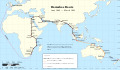
 Polynesian migration map

Article(s): Polynesia etc
- Request
- The map was originally in equirectangular projection, as in its description, but has since been changed to what looks like orthographic projection. Can someone please confirm what projection this is so that the description can be updated? Thanks!
- Graphist opinion(s)
- Done Yes, this is an orthographic projection. I've updated the description; thanks for pointing it out. Gringer (talk) 05:24, 21 April 2020 (UTC)
- This section was archived on a request by: Minoraxtalk (formerly 大诺史) 06:10, 8 August 2020 (UTC)
Cropping
Article(s): en:File:Txu-pclmaps-oclc-22834566 g-7c.jpg
- Request
- Cropping
- This scanned map is so large/detailed that I can't crop this image myself. --Geographyinitiative (talk) 03:10, 26 May 2020 (UTC)
- Graphist opinion(s)
Hi Geographyinitiative, I could use more information about your intent use of the resulting image. Not sure if you noticed, the map projection causes the central body of the images to be non-rectangular: the edges are not straight. The cropped image would not be rectangular, so a file format like PNG with a transparency layer might be better than JPEG. Would this still suit your needs? If the objective is to stitch this image with any other map images, then a GIS program may be needed to handle the projection. If this is the case, then a GeoTIFF image with embedded coordinates would be even better suited. Please let me know your thoughts on file formats related to how the cropped image will be utilized. - DutchTreat (talk) 10:38, 5 June 2020 (UTC)
- My old computer was not able to crop an image of this size and I forgot that I wanted to crop this image. I may do this next week on a better computer. My only goal is to remove the white areas around the edge. If there is more that can be done, by all means do it! I don't understand all the things you said, but this map is a little known and sparsely populated region of north Tibet that deserves a little closer examination. Thanks for your reply. Geographyinitiative (talk) 12:42, 5 June 2020 (UTC)
- Geographyinitiative Nice to hear that you are looking to feature unique areas of north Tibet. Instead of creating a new file that is cropped, you may prefer to use a Wikipedia template to create the needed cropping from the original source image. See more details and an example on the English Wikipedia w:Template:Annotated image. I hope this method will allow you to be productive. - DutchTreat (talk) 13:07, 6 June 2020 (UTC)
- Geographyinitiative I provided two samples of cropping using the template with your map as input: w:User:DutchTreat/Projects/Maps#Tibet. To clarify my statement about the non-rectangular image, this is caused by creating a flat map from the round shape of the Earth. This is further explained in the article w:Map projection. - DutchTreat (talk) 17:38, 6 June 2020 (UTC)
- I added one of your cropped images to the Janne Corax page. Geographyinitiative (talk) 08:33, 8 June 2020 (UTC)
![]() Done Geographyinitiative Good to see how you applied the cropped image to Janne Corax. If you do not need any more help, please mark this entry {{Section resolved|1=~~~~}} - DutchTreat (talk) 10:20, 28 June 2020 (UTC)
Done Geographyinitiative Good to see how you applied the cropped image to Janne Corax. If you do not need any more help, please mark this entry {{Section resolved|1=~~~~}} - DutchTreat (talk) 10:20, 28 June 2020 (UTC)
- This section was archived on a request by: Minoraxtalk (formerly 大诺史) 06:11, 8 August 2020 (UTC)
Atlantic Sun Conference membership change

Article(s): en:Atlantic Sun Conference
- Request
- New Jersey needs to be removed and Kentucky needs to be added, NJIT is leaving the conference and Bellarmine is joining. Thank you! --Lsw2472 (talk) 22:47, 15 June 2020 (UTC)
- Graphist opinion(s)
@Lsw2472: ![]() Done KCVelaga (talk · mail) 22:52, 4 July 2020 (UTC)
Done KCVelaga (talk · mail) 22:52, 4 July 2020 (UTC)
- This section was archived on a request by: Minoraxtalk (formerly 大诺史) 06:11, 8 August 2020 (UTC)
Summit League membership changes

Article(s): en:Summit League
- Request
- Indiana needs to be removed and Missouri needs to be added. Purdue Fort Wayne is leaving the conference and Kansas City is joining. --Lsw2472 (talk) 23:53, 15 June 2020 (UTC)
- Graphist opinion(s)
@Lsw2472: ![]() Done KCVelaga (talk · mail) 22:58, 4 July 2020 (UTC)
Done KCVelaga (talk · mail) 22:58, 4 July 2020 (UTC)
- This section was archived on a request by: Minoraxtalk (formerly 大诺史) 06:11, 8 August 2020 (UTC)

Article(s): A lot of articles around a lot of wikis
- Request
- Hello, can someone please update this animated map? Source you can use. --Patriccck (talk) 19:00, 1 March 2020 (UTC)
- Ping @Metropolitan: Map is not currently updated. --Patriccck (talk) 12:28, 7 March 2020 (UTC)
- Graphist opinion(s)
- Ping @Patriccck: Unfortunately, this is getting impossible at this stage. Nearly all European countries have confirmed cases, including San Marino, Monaco, Andorra and Vatican City. We just lack of space to point figures to a specific territories. Metropolitan (talk) 11:35, 8 March 2020 (UTC)
- Ping @Metropolitan: maybe use just colors and remove numbers? --Accurimbono (talk) 08:21, 13 March 2020 (UTC)
- Ping @Accurimbono: I'll see what I can do this week-end. Metropolitan (talk) 12:01, 13 March 2020 (UTC)
 Request taken by Metropolitan (talk) 12:01, 13 March 2020 (UTC)
School closures map
-
 Countries with school closures, lighter coloring for those countries where only part of the country has closed schools

Article(s): en:Impact of the 2019–20 coronavirus pandemic on education
- Request
- Could someone make a version of this that colors particular regions, based on the list at w:Impact_of_the_2019–20_coronavirus_pandemic_on_education#Localised_school_closures? For example, since in Canada schools are closed in New Brunswick, P.E.I., Quebec, Ontario, Saskatchewan, Alberta, and British Columbia, those regions could be colored dark orange (indicating that schools in the entire area are closed) with the rest of the country grey, as opposed to the current version which shows the entire country in dark orange. --Yair rand (talk) 19:27, 19 March 2020 (UTC)
- Graphist opinion(s)
- Request taken by AntiCompositeNumber (talk) 03:59, 20 March 2020 (UTC)
- Ugh, the SVG blank world maps with subnational borders are a mess. I might get to this tomorrow, but if someone else feels like doing it go right ahead. --AntiCompositeNumber (talk) 04:47, 20 March 2020 (UTC)
- Yeah, unlikely to work on this. I've got enough things going on that I don't need to make vector maps another one. Unfortunately, the best admin-level-1 world map we have, File:Blank Map World Secondary Political Divisions.svg, does not currently have the right CSS structure to make easily-updated maps, nor does it have a well-structured XML layout to make the implementation of the correct CSS classes easy. I also looked at trying to regenerate the map from NaturalEarth data using qgis, but there's still no way to get SVGs out of qgis anymore that doesn't suck. I just don't have the time or the energy to restructure a complex SVG in a text editor while cross-referencing ISO 3166-2 charts and at least one other map right now. Could I just open the file in inkscape, try to find the right countries, bucket-fill them in, and call this request done? Sure. But I don't want to. --AntiCompositeNumber (talk) 04:20, 21 March 2020 (UTC)
- Thanks anyway. :) --Yair rand (talk) 18:33, 22 March 2020 (UTC)
- Yeah, unlikely to work on this. I've got enough things going on that I don't need to make vector maps another one. Unfortunately, the best admin-level-1 world map we have, File:Blank Map World Secondary Political Divisions.svg, does not currently have the right CSS structure to make easily-updated maps, nor does it have a well-structured XML layout to make the implementation of the correct CSS classes easy. I also looked at trying to regenerate the map from NaturalEarth data using qgis, but there's still no way to get SVGs out of qgis anymore that doesn't suck. I just don't have the time or the energy to restructure a complex SVG in a text editor while cross-referencing ISO 3166-2 charts and at least one other map right now. Could I just open the file in inkscape, try to find the right countries, bucket-fill them in, and call this request done? Sure. But I don't want to. --AntiCompositeNumber (talk) 04:20, 21 March 2020 (UTC)
- Ugh, the SVG blank world maps with subnational borders are a mess. I might get to this tomorrow, but if someone else feels like doing it go right ahead. --AntiCompositeNumber (talk) 04:47, 20 March 2020 (UTC)
World homeschooling map
-
 Description of first image

Article(s): en:Homeschooling in the United States
- Request
- The U.S. should be colored green on this map, as homeschooling is legal in all 50 states. What is disputed is not the legality of homeschooling, but the "amount of state regulation and help that can or should be expected", according to the article en:Homeschooling in the United States. Additionally, the two parts of India should be conjoined, and the border of South Sudan needs to be added. --1990'sguy (talk) 20:03, 24 March 2020 (UTC)
- Graphist opinion(s)
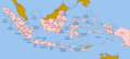
Ortographic projection map for State of Pasundan
-
 Description of first image
 -
Description of second image (if needed)
-
Description of third image (if needed; don't request too many at once, though)

Article(s): en:State of Pasundan
- Request
- Can someone draw an ortographic map for the State of Pasundan? Based on the map in the gallery and conventions:
- Subject's area: West Java
- Other areas part of the same political unity: Jakarta
- Claimed uncontrolled areas: Banten
--Jeromi Mikhael (talk) 17:00, 28 March 2020 (UTC)
- Graphist opinion(s)

Article(s): en:Finno-Ugric languages
- Request
- please remove unnecessary two-sided border, and unify typefaces and sizes… --Kintetsubuffalo (talk) 21:20, 4 April 2020 (UTC)
- Graphist opinion(s)
Update map for US withdrawal
-
 Signatories (light green) and parties (#6666ff) to the Paris Agreement

Article(s): Paris Agreement
- Request
- Please update the map to indicate the withdrawal of the US from the agreement.
- See United States withdrawal from the Paris Agreement. --Interstellarity (talk) 17:21, 5 November 2020 (UTC)
- Graphist opinion(s)
- @Interstellarity: To be clear, the United States should now be grey like Greenland and Antarctica? – BMacZero (🗩) 19:37, 5 November 2020 (UTC)
- @BMacZero: That's correct. Interstellarity (talk) 20:01, 5 November 2020 (UTC)
- @Interstellarity: Done, maybe require a browser cache purge. – BMacZero (🗩) 20:03, 5 November 2020 (UTC)
- @Interstellarity:
- @BMacZero: That's correct. Interstellarity (talk) 20:01, 5 November 2020 (UTC)
- This section was archived on a request by: – BMacZero (🗩) 20:03, 5 November 2020 (UTC)
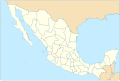
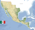
Municipalities of Mexico.svg
-
 Municipalities of Mexico.
 -
 USA Counties.


Article(s): w:es:Municipios de México
- Request
- Hello, this is a map of Mexico's municipalities (updated to 2015), but I would like to have it fixed. That the municipal boundaries are black lines. In a way, it looks like this map. Also this map is too heavy to edit in Inkscape, is there a way to decrease the weight? or should it be re-done again? I ask because this does not happen with the other map I linked in the example. As a clarification, this map would also be used to "color" it by adding the municipalities won by political parties, etc --Hispano76 (talk) 15:37, 27 September 2020 (UTC)
- Graphist opinion(s)
Hispano76 The file is very big in px and has extremely many nodes (drawing points) as this probably came from some data source. I have decreased the size and simplified the lines. This means that a very large amount of nodes has been thrown away so the lines are not as exact as they were before, incorrect when you really zoom in. This is a draft so check it and tell me if you think it's fine like this. The lines are sharp even though they don't look so, it's depending on the different libraries servers uses to display svg. Please always ping me, thanks. --Goran tek-en (talk) 18:08, 13 November 2020 (UTC)
- Hello @Goran tek-en: I'm fine with the improvements and haven't seen any problems so far. About the municipal boundaries, it doesn't seem to have much difference with the current map except for some imperceptible empty contours (for example in the southern end of the California peninsula) that could be solved later. For the rest, it's fine. Thank you very much and greetings. --Hispano76 (talk) 20:29, 13 November 2020 (UTC)
- Hispano76 As there is such a big difference between the two versions I would like to upload this as a New image so then I will need the following;
- Name of the file: Municipalities of México (black borders).svg
- Description (/language): the same as in caption?
- Captions/s (/language): Map of the municipaities of Mexico (english) / Mapa de los municipios de México (spanish)
- Category/ies at commons: Maps of municipalities of Mexico; SVG maps of Mexico
- Hispano76 As there is such a big difference between the two versions I would like to upload this as a New image so then I will need the following;
- Hello @Goran tek-en: I'm fine with the improvements and haven't seen any problems so far. About the municipal boundaries, it doesn't seem to have much difference with the current map except for some imperceptible empty contours (for example in the southern end of the California peninsula) that could be solved later. For the rest, it's fine. Thank you very much and greetings. --Hispano76 (talk) 20:29, 13 November 2020 (UTC)
to be able to upload it at commons. If you don'y know about Captions read here.--Goran tek-en (talk) 14:22, 14 November 2020 (UTC)
- @Goran tek-en: Done. --Hispano76 (talk) 15:12, 15 November 2020 (UTC)
- Hispano76 Now you can find it here file:Municipalities of México (black borders).svg. The normal process here is that the graphic worker puts out
{{done}}when she/he is ready with the work. Then if the requester is happy with this she/he puts the code{{section resolved|1=~~~~}}on the request so it can be archived, thanks. Done --Goran tek-en (talk) 17:34, 15 November 2020 (UTC)
- Hispano76 Now you can find it here file:Municipalities of México (black borders).svg. The normal process here is that the graphic worker puts out
- @Goran tek-en:
Correcting misleading color scheme for China COVID-19 map
![]() You are invited to join the discussion at w:Wikipedia:Graphics Lab/Map workshop#Correcting misleading color scheme for China COVID-19 map. Sdkb (talk) 10:05, 27 April 2020 (UTC)
You are invited to join the discussion at w:Wikipedia:Graphics Lab/Map workshop#Correcting misleading color scheme for China COVID-19 map. Sdkb (talk) 10:05, 27 April 2020 (UTC)
-
Description of first image
-
Description of second image (if needed)
-
Description of third image (if needed; don't request too many at once, though)
Article(s): [[]]
- Request
- Details of your request go here… --5.123.219.150 03:06, 25 May 2020 (UTC)
- Graphist opinion(s)
Plastic bag legislation
-
 Plastic bag legislation around the world

Article(s): en:Phase-out of lightweight plastic bags
- Request
- Please could someone remove the subnational boundaries on Pakistan? The whole country now has bans in place so the subnational boundaries are no longer required. Thanks DelUsion23 (talk) 15:48, 29 May 2020 (UTC)
- Graphist opinion(s)
Map of Indian Institutes of Technology
-
 Map of Indian Institutes of Technology

Article(s): Numerous articles in Wikipedia
- Request
- This widely used map of India created in 2006, is outdated and needs to be updated, because a new state and two union territories have been created, but have not been added to this map. The new state that is missing is Telangana, which was created in 2014; and the state of Jammu and Kashmir (state) which was abolished in 2019 and divided into the two new union territories of Jammu and Kashmir (union territory) and Ladakh the same year. In addition, the name of Bombay needs to be changed to Mumbai in the map, because this city was officially renamed in 1995. Also, the name of the region of Tibet needs to be removed from the map of China, because only country names are used for all of India's neighbors in this map, as a matter of consistency. --Karalainza (talk) 10:12, 3 June 2020 (UTC)
- Graphist opinion(s)
Karalainza The page w:Indian Institutes of Technology on English Wikipedia appears to suit all of your request. This image is using the most up-to-date India basemap and it includes all of the branch locations as annotations. Thus, I recommend copying the wikitext from this page and reusing it on other Wikipedia articles. You may trim some of the branch locations, by not only using the {{Location map~}} templates for the placemarker(s) you need. If this does not address your request, please provide more information about how it is different. - DutchTreat (talk) 11:04, 5 June 2020 (UTC)
Countries of europe's subdivisions

Article(s): most langages article concerning a langage spoken in europe
- Request
- Hi, I think this image as a svg could be really usefull
- I Tried to do it myself, but I fear I lack competences --D Cat laz (talk) 13:20, 18 November 2020 (UTC) .
- This is my work so far :

D Cat laz (talk) 20:59, 18 November 2020 (UTC)
- Graphist opinion(s)
- @D Cat laz: Hi, that subdivision is called NUTS2 (here you can have a reference: https://ec.europa.eu/eurostat/web/nuts/nuts-maps). Can you please check if that image has been already uploaded on Commons but with another name? Otherwise I can produce an SVG version from Eurostat data (https://ec.europa.eu/eurostat/web/gisco/geodata/reference-data/administrative-units-statistical-units/nuts). Sette-quattro (talk) 15:52, 19 November 2020 (UTC)
- Hi, thanks for the rapid answer. I had already done my research. I haven't found anything related to it (in svg format) and such a map is not in either : https://commons.wikimedia.org/wiki/Category:SVG_blank_maps_of_Europe or https://commons.wikimedia.org/wiki/Category:SVG_blank_political_maps_of_Europe
- The NUTS2 and NUTS3 are only available for the EU.
- It would be great to have it though ! Thanks in advance. D Cat laz (talk) 16:54, 19 November 2020 (UTC)
- @D Cat laz: NUTS2 are available for EU countries and candidates one (e.g. Turkey). There are some missing sudivisions, e.g. Bosnia. I've uploaded the new SVG version as new version of your work. If you prefer that I upload it as separate one, please let me know. Sette-quattro (talk) 08:17, 23 November 2020 (UTC)
- You are incredible. Thanks a thousand time, that's perfect. D Cat laz (talk) 11:51, 23 November 2020 (UTC)
- @D Cat laz: NUTS2 are available for EU countries and candidates one (e.g. Turkey). There are some missing sudivisions, e.g. Bosnia. I've uploaded the new SVG version as new version of your work. If you prefer that I upload it as separate one, please let me know. Sette-quattro (talk) 08:17, 23 November 2020 (UTC)
Morocco orthographic projection (update with centered version)
-
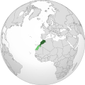 Noncentered original file, to be updated
 -
 A centered Orthographic map, for reference
.svg)

Article(s): en:Morocco and many others.
- Centered Orthographic map
- New update shall respect the current compromise of course (Dark green: Undisputed territory of Morocco; Lighter green: territory claimed and administred mostly by Morocco.). Thanks in advance. --Flaspec (talk) 19:43, 20 November 2020 (UTC)
- Graphist opinion(s)
-
- @Flaspec: Done --Mimauri (talk) 21:52, 20 November 2020 (UTC)
- Hi @Flaspec: , I've seen that the image has been reverted to the previous un-centered version by @Taha Khattabi: . Maybe you should have a chat on which is the better way to present such map. About boundaries: I've used as data source the en:Natural Earth database, which include disputed territories. The en:Western Sahara page also shows that the disputed part is not the whole Western Sahara but part of it, corresponding to the source I've used. Therefore I would keep the version I uploaded. --Mimauri (talk) 14:13, 21 November 2020 (UTC)
- Done Hello @Mimauri: I updated your Orthographic map to show similar boundaries to the previous version, this way it reflects the file description in Wikipedia articles (see en:Morocco for instance). As of @Taha Khattabi: he reverted to the previous un-centered version because he thought the new version was centered towards Europe, so I sent him a message explaining that the new version is in fact centered towards Morocco, not Europe. --Thank you so much! Flaspec (talk) 16:08, 21 November 2020 (UTC)
- Hi @Flaspec: , I've seen that the image has been reverted to the previous un-centered version by @Taha Khattabi: . Maybe you should have a chat on which is the better way to present such map. About boundaries: I've used as data source the en:Natural Earth database, which include disputed territories. The en:Western Sahara page also shows that the disputed part is not the whole Western Sahara but part of it, corresponding to the source I've used. Therefore I would keep the version I uploaded. --Mimauri (talk) 14:13, 21 November 2020 (UTC)
- @Flaspec:
Sudan/Chad/CAR locator maps
-
 Chad Sudan locator
 -
 Eritrea - Sudan Locator
 -
 Central African Republic - Sudan Locator
.svg)
.svg)
.svg)
Article(s): en:Eritrea–Sudan relations,
- Request
- Could someone create equivalent maps for Eritrea/Sudan and Central African Republic/Sudan? Hopefully this is an easy one... Thanks! Calliopejen1 (talk) 18:31, 19 October 2020 (UTC)
- Graphist opinion(s)
- @Calliopejen1: Done
Utah County, Utah

Article(s): en:Utah County, Utah
- Request
- the county and the state are not coterminous, please match with other counties only coloring one red, thanks… --Kintetsubuffalo (talk) 04:32, 24 November 2020 (UTC)
- Graphist opinion(s)
- Done – 4nn1l2 (talk) 05:05, 24 November 2020 (UTC)
Mexico 1865
-
 Map 1
Map 1 -
 Map 2
Map 2 -
 Map topographic
 -
 Map Example


_1821.PNG)
Article(s): es:Segundo Imperio Mexicano
- Request
- Hello, is it possible that maps 1 and 2 have the relief of the topographic map of Mexico? This would be useful and a similar example already exists with the map of the first Mexican empire.
- Details of your request go here… --Hispano76 (talk) 21:22, 10 June 2020 (UTC)
- Graphist opinion(s)
File:Freedom of Panorama world map.svg and png
-
 Freedom of panorama world map (svg version)
 -
 (png version)


Article(s): Commons:Freedom of panorama (png version) and w:Freedom of panorama (svg version)
- Request
- Updates and/or changes to coloring scheme, since some countries that are "unknown" (gray) are either OK for some (mostly light green) and not OK (red) for others.
KyrgyzstanNigeria should be OK (light green, for outdoors only), and Djibouti that is light green right now appears to be not OK (red). More details can be found at File talk:Freedom of Panorama world map.svg#Coloring scheme changes/updates. Thanks! --JWilz12345 (Talk|Contrib's.) 10:20, 27 October 2020 (UTC)
- Withdrawing my request: I already mentioned three of the most recent map contributors at File talk:Freedom of Panorama world map.svg#Coloring scheme changes/updates to act on my request. JWilz12345 (Talk|Contrib's.) 08:34, 14 December 2020 (UTC)
- This section was archived on a request by: 08:34, 14 December 2020 (UTC)
- Graphist opinion(s)
location maps of Tanzania
Article(s): [[]]
- Request
- Hi dear experts, the location maps of Tanzania are outdated. There is a bunch of new districts, resulting from splitting existing ones, even some new regions. Anybody around who can overwrite the old ones ?
- Details of your request go here… --Kipala (talk) 11:15, 25 June 2020 (UTC)
- Graphist opinion(s)
Kipala There might be, but first you have to provide information about what to add, sources, what, how etc. Graphic workers do graphic work not research or gathering information. Mostly we have zero knowledge of the topic but probably it is yours favorite one, thanks. --Goran tek-en (talk) 13:47, 1 July 2020 (UTC)
One small spelling correction request
-
 incorrect spelling of one township name

Article(s): en:List of townships in Ontario
- Request
- Please correct the spelling to the township shown as Stambord to Stamford. It is the one of the four immediately below the T of Townships in the image title. The first being Niagra and the next being Stambord which is the one needing the spelling correction. -- Ww2censor (talk) 17:48, 28 December 2020 (UTC)
- Graphist opinion(s)
![]() Done Ww2censor: I've uploaded a version with the updated spelling. Rcsprinter123 (talk) 23:28, 28 December 2020 (UTC)
Done Ww2censor: I've uploaded a version with the updated spelling. Rcsprinter123 (talk) 23:28, 28 December 2020 (UTC)
Horseshoe route airmail map during World War II
-
 1935 predecessor airmail route that might be developed into the one used during WWII
 -
 Suggested new map
 -
 additional new map on reserve routes


Article(s): Horseshoe route
- Request
- A map was recently added to the article with this edit but it is really not suitable and does not even show the actual airmail route that was flown and omits the ship portion between Durban and the UK that was an essential part of completing the mail delivery. This map, linked on this webpage, http://postalcensorship.com/examples/ww2dei/c_ww2dei.html, though small, shows the actual route plus several others used during WWII but the article is only interested in the solid black route shown plus the "steamer" route shown. New Zealand should be included as well as the TEAL route. For better locations I can provide a list of cities. The 1935 predecessor route is displayed about but does not show the exact WWII routing. I can also supply the wikigraphist offline with better quality more detailed images from other specialist publications I have in my library if needed. --Ww2censor (talk) 21:26, 28 May 2020 (UTC)
- Graphist opinion(s)
![]() Request taken by DutchTreat (talk) 10:56, 5 June 2020 (UTC)
Request taken by DutchTreat (talk) 10:56, 5 June 2020 (UTC)
Ww2censor - Let me summarize your request. The content of this map is to show three routes. First and mainly, Horseshoe route from Durban to Sydney. Second, the streamer route from Durban to London. Third, the TEAL route from Sydney to Auckland. All three are displayed in the image from postalcensorship.com. Please confirm that I understand the main parts. Also, I am not sure how the Imperial routes April 1935 image relates. Is this additional background information or is there parts of this map that are needed for your request. Thanks - DutchTreat (talk) 10:56, 5 June 2020 (UTC)
- DutchTreat: thank you for considering making this map. I'll try to explain better. So to Imperial Airways route map of 1935 was the development of the route to Australia and when the war interrupted it, when the route via Italy became unavailable it became: by steamer from the UK to Durban, then by air up Africa to Egypt and continuing the basic route as per 1935 onwards to Australia. The actual flown portion of "horseshoe route" was from Durban to Sydney. The TEAL route was basically an extension of that route to NZ. That was my reason for showing the 1925 map because it shows basically half the segment that continued during the war. The "postalcensorship.com" map show other routes that we are not concerned with and I happen to like that 1930s style but whatever you can make I am sure will be fine. As I said I have several other maps you could use a s reference but the one above is the only one on the commons that comes close. Just ask anything else if you need more clarity. I presume an svg file would be best. Thanks Ww2censor (talk) 11:46, 5 June 2020 (UTC)
- Ww2censor I agree that the 1935 map has an artistic and classic look. The Wikipedia Map Community uses a recommended style guide with color choices that is more bland and less unique. I am going to stay within these conventions for consistency. A few details:
- A. On the steamer route, shall Southampton or London be the terminal port?
- B. Is Lisbon needed as shown on the "Airmail Connections to and from the Dutch East Indies..." map from postalcensorship.com? This might have been a stop for the steamer, but it is not clear from the map.
- C. What does TEAL stand for? I believe this is an air route, not sea route. Should the route from Sydney to Auckland just say 'TEAL'?
Let me start with these maps, so no need to provide more at this time. I agree that SVG format will be best. - DutchTreat (talk) 12:44, 5 June 2020 (UTC)
- DutchTreat:
- A: I presume Southampton but I will confirm. I have been through most of my set of WWII weekly GPO mail branch reports and nowhere do they actually mention the port of departure. Phrases such as: dispatched from London, by steamer, by sea, by Union Castle steamer, etc, but neither Southampton, Plymouth or London are mentioned. I'll keep checking.
- B: I cannot confirm Lisbon was ever a port-of-call between England and Durban.
- C: Tasman Empire Airways Ltd. - indeed an airmail route. It could possibly be provided as a key on the map.
- Perhaps a small key would be good showing the steamer, horseshoe route and TEAL elements. Ww2censor (talk) 14:01, 5 June 2020 (UTC)
- Ww2censor I can add a key as you describe it. Need more of your expert knowledge. The source map includes several points which are not labelled:
- D: From Sydney to unknown. Is this w:Melbourne?
- E: North of this point, this is no red dot, but change in course. This could be a refueling point. The other author has the city of Darwin (-7.265278, 112.7425) on the current map for the WP article. This city is not close to this change in course from the source map.
- F: From Singapore, to an unknown in north Laos?
- G: From Rangoon to an unknown location. Is this w:Calcutta (4.86, 67.01)?
- H: From Allahabad to an unknown location. Is this w:Karachi (-12.438056, 130.841111)?
- All the other points are clear to me. Thanks for filling in the gaps! - DutchTreat (talk) 18:55, 5 June 2020 (UTC)
- Ww2censor My first draft map is available for your review and comment: File:Horseshoe Route 1940-en.svg. Please feel free to suggest any changes. I made some assumptions about the cities. I will not be able to address any changed for about one week. Will get back to as soon as I can. - DutchTreat (talk) 12:20, 7 June 2020 (UTC)
- DutchTreat: Thanks for your first draft. That’s a nice start based on the crappy little map I referenced.
- Here is a list of the cities: North from Durban, Laurenco Marques, Brira, Lumbo, Lindi, Mombasa, Kisumu, Port Bell, Laropi, Juba, Malakal, Khartoum, Wadi Halfa, Cairo, then East to: Tiberius, Baghdad, Basra, Bahrain, Dubai, Jiwani, Karachi, Rajsamand Lake, Gwaloir, Allahabad, Calcutta, Akyab, Rangoon, Bangkok, Panang, Singapore, Bangka, Batavia, Sourabaya, Darwin, Grotte Eyjandt, Karumba, Townsville, Gladstone, Brisbane and Sydney.
- Would you consider making a small note below the heading, or in the legend, something like: “Later in the war, Japanese advances caused several deviations of the route between Australia and India”.
- I’m not a map expert but the map seems to be based on an equirectangular projection or perhaps it is a cylindrical projection that makes the UK and Ireland look quite small and distorted. Of course this just a perception based on ones point of viewing. One thought on that; would it perhaps be better to base the map on a Marcator projection, such as File:Mercator Blank Map World.png? Ww2censor (talk) 15:20, 7 June 2020 (UTC)
- Ww2censor Thank you for the details on the waypoints. I will add them along with your note. The map projection is currently based on w:WGS-84 which will make the UK appear small, yet I think this Coordinate Reference System (CRS) still provides good accuracy. I will try Marcator for comparison but not sure this will be as accurate. Given me a few days to provide the next draft. - DutchTreat ( talk) 16:45, 9 June 2020 (UTC)
- Ww2censor Need your assistence Geo referencing some of the cities on the route:
- I. Brira (between Laurenco Marques Lumbo) could not be found. I found Bria at (lat 6.529, 21,988) but it is pretty far off the route in middle of Africa. Found w:Beira, Mozambique which looks like a good fit to the route.
- J. Panang? Is this w:Yala, Thailand? Found w:Penang from the Imperial routes April 1935 map.
- Thanks for the help - DutchTreat (talk) 11:12, 14 June 2020 (UTC)
- Updates to my request. Answer to J. no longer needed. Would like more information on I. - DutchTreat (talk) 10:15, 15 June 2020 (UTC)
- Updates to my request. Answered I. with a proposal - DutchTreat (talk) 12:22, 15 June 2020 (UTC)
- Ww2censor My first draft map is available for your review and comment: File:Horseshoe Route 1940-en.svg. Please feel free to suggest any changes. I made some assumptions about the cities. I will not be able to address any changed for about one week. Will get back to as soon as I can. - DutchTreat (talk) 12:20, 7 June 2020 (UTC)
Ww2censor New version of file File:Horseshoe Route 1940-en.svg for your review and comments. Please let me know if you have any additions or changes. - DutchTreat (talk) 13:10, 15 June 2020 (UTC)
- Brilliant work and you found my misspellings for Beira and Penang. Sorry about that but you figured them put. This looks really great. I had just one thought. Would it not be better to put the Japanese deviation note in the Indian Ocean as that was essentially where the route got pushed to? Otherwise are you finished or is there anything else you need to do? Ww2censor (talk) 13:45, 15 June 2020 (UTC)
- Ww2censor Good suggestion. I'll move the Japanese deviation note. It is getting closer, but I would like to polish it up a bit. Do you have a better title or any subtitle to add? How about a date range "Sep 1939? to Oct 1945?"? - DutchTreat (talk) 09:47, 16 June 2020 (UTC)
- Thanks for asking. Actually the complete route only lasted from June 1940-March 1942, so that can be the subtitle. Perhaps while moving the Japan note could be modified to state "In April 1942 Japanese advances and attacks caused deviations to the route between India and Australia breaking the full route." In the Legend you might add the dates 1940-43 to the TEAL details. The stopping point names seem a little too close to the dots and the route, and in some instance they overlap, while the Middle East to India section names are rather cluttered, maybe put Rajsamand Lake on two lines and space them out a bit better. Maybe this is a bit pedantic and super critical but it will probably look a bit better. BTW, I've added the map to the top of the post; hopefully that's ok with you. Thanks you are nearly there now. Ww2censor (talk) 10:34, 16 June 2020 (UTC)
- Ww2censor Good suggestions! I agree the labels look cluttered. This can be fixed. I am using the open source program QGIS which has the handy feature of automatically doing the label layout. However, sometimes the automatic method is not optimal and requires tweeking. This weekend, I will make the changes you suggest. I will ping you when it is ready. - DutchTreat (talk) 16:28, 17 June 2020 (UTC)
- Ww2censor Please find the updated version for review and comment. The labels are improved, but not perfect. I am thinking that it would also be good to have a map for the Reserve Routes. - DutchTreat (
talk) 21:02, 20 June 2020 (UTC)
- Ww2censor I added one more map File:Horseshoe Reserve Routes 1941-en.svg for the reserve routes. If you have any changes, please let me know. Otherwise, market with {{Section resolved}} - DutchTreat (talk) 12:29, 22 June 2020 (UTC)
- Ww2censor Please find the updated version for review and comment. The labels are improved, but not perfect. I am thinking that it would also be good to have a map for the Reserve Routes. - DutchTreat (
talk) 21:02, 20 June 2020 (UTC)
- Ww2censor Good suggestions! I agree the labels look cluttered. This can be fixed. I am using the open source program QGIS which has the handy feature of automatically doing the label layout. However, sometimes the automatic method is not optimal and requires tweeking. This weekend, I will make the changes you suggest. I will ping you when it is ready. - DutchTreat (talk) 16:28, 17 June 2020 (UTC)
- Thanks for asking. Actually the complete route only lasted from June 1940-March 1942, so that can be the subtitle. Perhaps while moving the Japan note could be modified to state "In April 1942 Japanese advances and attacks caused deviations to the route between India and Australia breaking the full route." In the Legend you might add the dates 1940-43 to the TEAL details. The stopping point names seem a little too close to the dots and the route, and in some instance they overlap, while the Middle East to India section names are rather cluttered, maybe put Rajsamand Lake on two lines and space them out a bit better. Maybe this is a bit pedantic and super critical but it will probably look a bit better. BTW, I've added the map to the top of the post; hopefully that's ok with you. Thanks you are nearly there now. Ww2censor (talk) 10:34, 16 June 2020 (UTC)
- Ww2censor Good suggestion. I'll move the Japanese deviation note. It is getting closer, but I would like to polish it up a bit. Do you have a better title or any subtitle to add? How about a date range "Sep 1939? to Oct 1945?"? - DutchTreat (talk) 09:47, 16 June 2020 (UTC)
![]() Done Ww2censor Any needed changes on these two maps? - DutchTreat (talk) 10:12, 28 June 2020 (UTC)
Done Ww2censor Any needed changes on these two maps? - DutchTreat (talk) 10:12, 28 June 2020 (UTC)
- DutchTreat: apologies, but I've not had time to review. The main map looks really fine but I have to carefully check the 2nd one. Give ma a few days. Ww2censor (talk) 21:50, 28 June 2020 (UTC)
- No worries. Please take your time to check them. I felt the text used to define the Reserve Routes was a bit confusing. I may have made some incorrect assumptions, so independent verification is important. - DutchTreat (talk) 09:25, 29 June 2020 (UTC)
- DutchTreat: My references give the following details:
- Route 1: Rangoon - Mergui - Penang - Singapore - Batavia
- Route 2: Rangoon - Port Blair (Andaman Islands) - Sabang - Penang - Singapore - Batavia
- Route 3: Rangoon - Port Blair (Andaman Islands) - Sabang - Padang - Batavia
- A 2nd source does show Bangka, as in the original route, that you show for all 3 routes. I still need to see if that was correct or not for the reserve routes. This webpage also the reserve routes. Did you just assume it from the original full route? Ww2censor (talk) 18:40, 1 July 2020 (UTC)
- Ww2censor Let me re-work the map using this more detailed waypoints and source map. I only included Bangka based on an assumption reading the Wikipedia article. Thus, my guess should not be trusted. - DutchTreat (talk) 12:04, 2 July 2020 (UTC)
- Ww2censor Changes complete. Ready for your review. - DutchTreat (talk) 11:58, 4 July 2020 (UTC)
- Ww2censor Let me re-work the map using this more detailed waypoints and source map. I only included Bangka based on an assumption reading the Wikipedia article. Thus, my guess should not be trusted. - DutchTreat (talk) 12:04, 2 July 2020 (UTC)
- No worries. Please take your time to check them. I felt the text used to define the Reserve Routes was a bit confusing. I may have made some incorrect assumptions, so independent verification is important. - DutchTreat (talk) 09:25, 29 June 2020 (UTC)
- DutchTreat: apologies, but I've not had time to review. The main map looks really fine but I have to carefully check the 2nd one. Give ma a few days. Ww2censor (talk) 21:50, 28 June 2020 (UTC)
India maps
- All files in category Category:SVG locator maps of states in India (red location map scheme)
- All files in category Category:SVG locator maps of states in India (orange location map scheme)
- All files in category Category:SVG locator maps of states in India (orange and grey location map scheme)
- Many files in Category:Location maps of India and more...

Article(s): Multiple use all around wiki preyects
- Request
- These is a lot of India maps files in Commons that are no longer up to date.
- In 2019, the state of Jammu and Kashmir was divided into two federal territories (en:Ladakh; en:Jammu and Kashmir).
- Also, in 2014 the Telangana state was separated from the northwestern part of en:Andhra Pradesh.
- The most recent change is from january 2020 when two teritories were merged into en:Dadra and Nagar Haveli and Daman and Diu
The current, actual boundary you can see on files in category Category:SVG locator maps of states in India (red and dark grey location map scheme) --Unpocoloco (talk) 19:49, 9 July 2020 (UTC)
- Graphist opinion(s)
Time zones of the world (update)

Article(s): Many uses across a variety of projects
- Request
- Copied from User talk:Odder by odder (talk) 11:19, 5 July 2020 (UTC)
Hello.
File:Standard time zones of the world.png needs to be updated and corrected.
Yukon switched from UTC -8 to UTC -7 when it abolished daylight saving in 2019, and needs to be colored in dark green.
Cyprus (including the breakaway Northern Cyprus which reverted from UTC +3 ("Turkey Time") to UTC +2, after ditching the one year long daylight saving experiment) is in UTC +2 and needs to be colored in brown.
Crimea which was annexed by Russia and the breakaway regions of Abkhazia and South Ossetia in Georgia are in UTC +4 ("Moscow Time"), need to be colored in light green. There should be no black country borders for these places, only the thin red time zone borders.
These are the only changes in time zones which occurred since 2016 (except for Crimea where the time zone change already occurred in 2014 and in the breakaway regions in Georgia before that).
Yours sincerely, 31.200.15.158 07:21, 25 June 2020 (UTC)
- Note: You can use the extensive website https://www.timeanddate.com for verification. 31.200.12.33 09:04, 26 June 2020 (UTC)
- Graphist opinion(s)
Odder I'm not sure if this is your request but if you want me to take this I need a requester to work with. Also would it not be better to make a new version of file:Standard Time Zones of the World (October 2015).svg as it's a svg file and easier to edit and better to use. If you want colors changed we can do that, Please always ping me, thanks. --Goran tek-en (talk) 15:45, 14 November 2020 (UTC)
- @Goran tek-en: Yes, it would probably be better to create a new SVG version of File:Standard Time Zones of the World (October 2015).svg with this new colour scheme and information updated as mentioned by the anonymous user on my talk page. Happy to work with you on this. odder (talk) 10:41, 15 November 2020 (UTC)
![]() Request taken by Goran tek-en (talk) 11:18, 15 November 2020 (UTC)
Request taken by Goran tek-en (talk) 11:18, 15 November 2020 (UTC)
- Odder I's not just coloring that is different.
- Should I always follow file:Standard time zones of the world.png even regarding red lines, islands that is in different zones etc?
- If you look down to left around French Polynesia and compare the two maps you can see what I mean, thanks. --Goran tek-en (talk) 18:08, 15 November 2020 (UTC)
- @Goran tek-en: I think it'd be nice to follow that scheme, so please do use red lines to indicate time zone differences or yellow shading for islands in different time zones, etc. Thank you so much for volunteering to do this! odder (talk) 10:04, 16 November 2020 (UTC)
- Odder What I also meant is that what belongs to a specific time zone is different between the two maps, should I always follow file:Standard time zones of the world.png? I have no knowledge of which is correct.--Goran tek-en (talk) 11:14, 16 November 2020 (UTC)
- @Goran tek-en: Yes, please follow File:Standard time zones of the world.png including the changes suggested by the anonymous user as quoted above. Thanks again, odder (talk) 10:41, 17 November 2020 (UTC)
- Odder I have to redo a lot in the svg I work from so it will take some time for me. If you think I forgot just ping me but I will be back in a while. --Goran tek-en (talk) 12:16, 17 November 2020 (UTC)
- Odder I just want you to know I haven't forgotten. I'm working on it but I have got to much going on, will be back. Thanks for your patience. --Goran tek-en (talk) 14:35, 5 December 2020 (UTC)
- Odder I have to redo a lot in the svg I work from so it will take some time for me. If you think I forgot just ping me but I will be back in a while. --Goran tek-en (talk) 12:16, 17 November 2020 (UTC)
- @Goran tek-en: Yes, please follow File:Standard time zones of the world.png including the changes suggested by the anonymous user as quoted above. Thanks again, odder (talk) 10:41, 17 November 2020 (UTC)
- Odder What I also meant is that what belongs to a specific time zone is different between the two maps, should I always follow file:Standard time zones of the world.png? I have no knowledge of which is correct.--Goran tek-en (talk) 11:14, 16 November 2020 (UTC)
- @Goran tek-en: I think it'd be nice to follow that scheme, so please do use red lines to indicate time zone differences or yellow shading for islands in different time zones, etc. Thank you so much for volunteering to do this! odder (talk) 10:04, 16 November 2020 (UTC)
- Should I always follow file:Standard time zones of the world.png even regarding red lines, islands that is in different zones etc?
Odder This has turned into something else than it was set out to but that is mainly on me. I want this map to be easy to edit and be drawn in a good way. So I have to redo most of it which takes time. I have a first draft for you now that contains the colors from this png but the information content comes from this svg which to my understanding is the latest version. So I have been working on both the 'technical' side as well as the content side.
- Right now I need your help to really really check the draft below which is a png version of the svg I work in. You have to help me to really check everything, time lines, borders, countries colors as from this svg without the asked updates. Once this is fine we will see how much of names and stuff that should be added. Draft-TZ-1. Please ping me when giving me feedback, thanks. --Goran tek-en (talk) 12:35, 9 December 2020 (UTC)
- Odder I do need your feedback to be able to continue, thanks. --Goran tek-en (talk) 11:15, 18 December 2020 (UTC)
Rob984, Keyacom, UnaitxuGV I have been working on this request with the intention of creating a svg version with the yellow-green color scheme, not so heavy in Mb as file:Standard Time Zones of the World (October 2015).svg and easier to edit and update as the present svg version is made automatically from date and therefore hard to work with. There are other versions also file:Standard time zones of the world.png and File:World_Time_Zones_Map.png which is where I found your names.
I have lost contact with the requester here who was to help me with feedback and check the map. So my question to you is if anyone of you please could help med with check and feedback as it seems you have knowledge about his, it would help me a lot, thanks. This is a png draft version of the svg. Thanks for your help. --Goran tek-en (talk) 18:39, 2 January 2021 (UTC)
odder Now you can find it here file:Time zones of the world-UTC.svg. As I have lost contact with you I will also mark this as resolved. If you are happy with this please put the code {{section resolved|1=~~~~}} on this request so it can be archived, thanks. ![]() Done --Goran tek-en (talk) 18:12, 6 January 2021 (UTC)
Done --Goran tek-en (talk) 18:12, 6 January 2021 (UTC)
- @Goran tek-en: Apologies for the belated response; I am indeed happy that this has been resolved. Thank you, odder (talk) 11:03, 10 January 2021 (UTC)
File:Map of South Atlantic Express submarine cable route.svg
-
 South Atlantic Express

Article(s):
- Request
- The Cabinda province (Angola) is mistakenly colored. (See talk page) --2A02:908:1464:B00:D5AF:3E5F:6AA1:E415 22:29, 9 July 2020 (UTC)
- The South Sudan border is missing, which also needs to be added. Maphobbyist (talk) 09:30, 16 July 2020 (UTC)
- Graphist opinion(s)
Extend map
-
 Original

Article(s): en:Fatimid Caliphate and other early Islamic states in North Africa and the Middle East
- Request
- a) fill in some missing features in the original map (Jordan river is entirely missing for some reason, as are the rivers of North Africa) and b) create a map like the original, at the same level of detail, but refocused or extended to the south and east to cover the entire Arabian peninsula (approx. up to 12th parallel). The area north of the 47th parallel is not required.
- --Constantine ✍ 07:24, 26 July 2020 (UTC)
- Graphist opinion(s)
Conversion of Afghanistan roadmap from PNG to SVG

Article(s): https://en.wikipedia.org/wiki/Template:Taliban_insurgency_detailed_map, https://en.wikipedia.org/wiki/Module:Taliban_insurgency_detailed_map/doc
- Request
- raster-to-vector conversion.
- I need to convert the file from PNG to SVG for use on the Taliban Insurgency detailed map template page. --TheMapLurker (talk) 03:44, 10 August 2020 (UTC)
- Request complete. I have converted the file to SVG, and even though you did all the work, I hereby give TheMapLurker permission to use his own file that I converted. ps: you should change your name to themapmaker or themapcontributor. What you do is much more then mere lurking. Nate Hooper (talk) 02:29, 12 August 2020 (UTC)
- TheMapLurker Nate Hooper It's great that you request and make graphic work here but there are some things both of you could do to improve Graphic lab overall.
- Please use the "Make a new request" at the top to insure that we get all the code needed for handling it.
- Please use the code to state which stage the request is at; I take, Done, section resolved so it can be handled after it is resolved.
- On any new file please read about how to state all the information needed in the "Summary". This is very very important so that anyone can search, find, use, and do what they should regarding which Permission it has.
- I have looked at this request and the one below in respect of the files created and please correct them so they meet the standards we use here. There are many places to read about this and you can learn a lot looking at other uploaded material. Commons:Community_portal, Commons:First_steps/Quality_and_description, Commons:Infobox_templates is just some things.
- Both the png and svg file is stated as own work but I'm pretty sure it's a derivative work Derivative_works because we have a lot of material to work from. This is all important and we have to state that according to permissions and to be fare to the other people working here.
- I do hope both of you appreciate this so we all can work together for the best of commons, thanks. --Goran tek-en (talk) 17:16, 12 August 2020 (UTC)
- TheMapLurker Nate Hooper It's great that you request and make graphic work here but there are some things both of you could do to improve Graphic lab overall.
- Request complete. I have converted the file to SVG, and even though you did all the work, I hereby give TheMapLurker permission to use his own file that I converted. ps: you should change your name to themapmaker or themapcontributor. What you do is much more then mere lurking. Nate Hooper (talk) 02:29, 12 August 2020 (UTC)
- @TheMapLurker: @Nate Hooper: hi it's not clear to me if this request is closed or not Sette-quattro (talk) 13:36, 3 December 2020 (UTC)
- @Sette-quattro: The request is closed, sorry for late reply and the general mess. TheMapLurker (talk) 03:21, 24 December 2020 (UTC)
![]() Done
Done
South Sudan border


Article(s): Many articles across Wikipedia.
- Request
- The border of South Sudan needs to be included in these maps which have the same graphics and the same dimensions (they were all created by the same user who is no longer active). --Maphobbyist (talk) 16:29, 6 July 2020 (UTC)
- Graphist opinion(s)
All ![]() Done apart from the PNG one Hogweard (talk) 19:16, 27 July 2020 (UTC)
Done apart from the PNG one Hogweard (talk) 19:16, 27 July 2020 (UTC)
The border of South Sudan needs to be added in these South Atlantic submarine cable route maps
-
 Map of South Atlantic Cable System route.svg
 -
 Map of South Atlantic Express submarine cable route 2011.svg
 -
 Map of South Atlantic Express submarine cable route 2012.svg
 -
Map of South Atlantic Express submarine cable route.svg
-
 WASACE submarine cable route map.svg


Article(s): Various articles across Wikipedia.
- Request
- The border of South Sudan needs to be added in these South Atlantic submarine cable route maps, which have the same graphics and the same dimensions. Maphobbyist (talk) 09:41, 16 July 2020 (UTC)
- Graphist opinion(s)
![]() Done Hogweard (talk) 23:09, 28 July 2020 (UTC)
Done Hogweard (talk) 23:09, 28 July 2020 (UTC)
OECD map
-
 Missing Colombia as full member

Article(s): many around wiki projekts
- Request
- Please make the map actual.
- Since 2020 Colombia is full member of OECD. --Unpocoloco (talk) 04:57, 22 July 2020 (UTC)
- The South Sudan border is missing, which also needs to be added (it is not a member of the OECD). Maphobbyist (talk) 08:25, 22 July 2020 (UTC)
- Graphist opinion(s)
![]() Done I hope so. It was my first work in Inkscape. --Unpocoloco (talk) 06:27, 28 July 2020 (UTC)
Done I hope so. It was my first work in Inkscape. --Unpocoloco (talk) 06:27, 28 July 2020 (UTC)
Partners of Rheinland Pfalz
-
 Original

Article(s): de:Rheinland-Pfalz
- Request
- Valencia has to be removed from this map. The best would be to create a now SVG map of this. Bigbossfarin (talk) 20:38, 30 July 2020 (UTC)
- Graphist opinion(s)
Translation of labels on 1937 linguistic map into English
-
 1937 linguistic map of Central Europe
.png)
Article(s): en:Causes of World War II, en:Germans of Romania, en:Munich Agreement, en:Pan-Germanism, en:Sudetenland
- Request
- Translation of map labels into English.
- I had to remove this map from 5 articles because the labels are not in English, and I haven't found any suitable replacement. -- Beland (talk) 23:05, 2 August 2020 (UTC)
- Graphist opinion(s)
Beland I can help you with this but before I take it I want to know that you will be here to help me with your knowledge and information. I think the most effective way to translate this, and make it easier in the future, is to make a new svg version and move the legend away from the map into the infobox. So if all of this is fine with you I will need a list of the translation
- present word-translated word
- do you really need all the cities that is present right now?
Please always ping me, thanks. --Goran tek-en (talk) 17:27, 11 November 2020 (UTC)
- @Goran tek-en: Unfortunately, I don't speak German. -- Beland (talk) 18:55, 11 November 2020 (UTC)
- Beland We (graphic workers) do graphic work, translations, research, sources etc is up to the requester to provide. So you will have to fix the translation some way, thanks. --Goran tek-en (talk) 10:27, 12 November 2020 (UTC)
- @Goran tek-en: I've posted a request at Commons:Translators' noticeboard. -- Beland (talk) 17:09, 12 November 2020 (UTC)
- @Goran tek-en: Success! Ameisenigel has helped us out with translations - see Commons:Translators'_noticeboard#German_translation_help_needed_for_map. -- Beland (talk) 23:19, 15 November 2020 (UTC)
- @Goran tek-en: I've posted a request at Commons:Translators' noticeboard. -- Beland (talk) 17:09, 12 November 2020 (UTC)
- Beland We (graphic workers) do graphic work, translations, research, sources etc is up to the requester to provide. So you will have to fix the translation some way, thanks. --Goran tek-en (talk) 10:27, 12 November 2020 (UTC)
![]() Request taken by Goran tek-en (talk) 11:10, 16 November 2020 (UTC)
Request taken by Goran tek-en (talk) 11:10, 16 November 2020 (UTC)
Beland I will start with this but meanwhile you could consider if you want the legend moved into the infobox instead. It's a quite large legend so I think it might be good. You can look at this page, there are some examples how it can be used in wikipedia. --Goran tek-en (talk) 11:10, 16 November 2020 (UTC)
- Great! Sure, the legend would be more readable if separated from the image, and perhaps the title box could be left out as well. Feel free to make whatever other choices you think are best. -- Beland (talk) 14:53, 16 November 2020 (UTC)
- Beland Please always ping me, thanks. --Goran tek-en (talk) 17:21, 16 November 2020 (UTC)
- Beland While I continue you can check all the names so they are correct on this draft. --Goran tek-en (talk) 18:10, 19 November 2020 (UTC)
- Beland As I said before I do need your help on this so please check as above and ping me, thanks. --Goran tek-en (talk) 18:53, 29 November 2020 (UTC)
- @Goran tek-en: Just eyeballing the map, I noticed it should be "North Sea", not "Nort Sea". It also looks like there are anachronistic names as pointed out by Tacsipacsi at the bottom of Commons:Translators'_noticeboard#German_translation_help_needed_for_map. Were you otherwise done with adding names and map colorization is next? -- Beland (talk) 17:49, 30 November 2020 (UTC)
- BelandTo me 'eyeballing' means 'a quick look', if so I want you to really check all the names for me, it would help me a lot. Changing at this stage is not a big thing but later on in the process it takes more and more work. Yes I'm working on the coloring and will pretty soon have a draft for you. --Goran tek-en (talk) 14:38, 1 December 2020 (UTC)
- Beland *Color draft. You really have to check this also, it's complicated.
- The red areas, down and to the right are areas which is not covered in the original map. This is due to that my new base map and the original map had different rotations. What shall I put there? --Goran tek-en (talk) 18:57, 1 December 2020 (UTC)
- @Goran tek-en: I would just crop the map to avoid those areas. BTW, is there a reason "BALTIC SEA" is in all caps but "North Sea" isn't? -- Beland (talk) 02:03, 2 December 2020 (UTC)
- Beland Just a mistake from my side, both in all caps.
- If I crop like that you will loose parts from the original map, look here, the all clear parts will be removed. Yes or no?
- Is everything else fine? --Goran tek-en (talk) 16:36, 2 December 2020 (UTC)
- Beland I do need your feedback to be able to continue, thanks. --Goran tek-en (talk) 11:14, 18 December 2020 (UTC)
- Beland Just a mistake from my side, both in all caps.
- @Goran tek-en: Just eyeballing the map, I noticed it should be "North Sea", not "Nort Sea". It also looks like there are anachronistic names as pointed out by Tacsipacsi at the bottom of Commons:Translators'_noticeboard#German_translation_help_needed_for_map. Were you otherwise done with adding names and map colorization is next? -- Beland (talk) 17:49, 30 November 2020 (UTC)
- Beland As I said before I do need your help on this so please check as above and ping me, thanks. --Goran tek-en (talk) 18:53, 29 November 2020 (UTC)
- Beland While I continue you can check all the names so they are correct on this draft. --Goran tek-en (talk) 18:10, 19 November 2020 (UTC)
- Beland Please always ping me, thanks. --Goran tek-en (talk) 17:21, 16 November 2020 (UTC)
Beland As I lost contact with you I have finished the map to the best of my knowledge but I really would need you to check it, thanks.
Now you can find it here file:1937 linguistic map of Central Europe-EN.svg. If you are happy with this please put the code {{section resolved|1=~~~~}} on this request so it can be archived, thanks. ![]() Done --Goran tek-en (talk) 16:33, 28 December 2020 (UTC)
Done --Goran tek-en (talk) 16:33, 28 December 2020 (UTC)
Requester has not been active here for long so I put out the resolved code
Christchurch
-
 Christchurch

Article(s): de:2019
- Request
- On closer inspection, you can see that the markers are badly copied. --Bigbossfarin (talk) 18:01, 27 July 2020 (UTC)
- Graphist opinion(s)
Bigbossfarin - I recommend using Template:Maplink if it is available to you. This provides a dynamic map with OSM data. Please see a version I created for you at w:User:DutchTreat/Projects/Maps#Christchurch mosque shootings - DutchTreat (talk) 13:57, 2 August 2020 (UTC)
Vectorization of a transparent roadmap for Afghanistan
-
 Transparent road map overlay for Afghanistan.

- Request
- Raster to vector conversion of this road map for Afghanistan for use on the Taliban Insurgency detailed map template page. --TheMapLurker (talk) 01:59, 11 August 2020 (UTC)
- Also complete. TheMapLurker also has permission to use the svg link for this file (I sent both files to him, outside of Wikipedia) Nate Hooper (talk) 02:33, 12 August 2020 (UTC)
Proposed Palestinian flags
-
 Description of first image

Article(s): en:Flag of Mandatory Palestine, en:List of Palestinian flags
- Request
- Can you please make the proposed flags of the Palestinian people in SVG format especially the "An Arab From Haifa" and Elias Hana Rantissi Proposal just like there's a gallery of proposed Australian flags. Source. Thank you
- Details of your request go here… --Sakiv (talk) 03:17, 31 August 2020 (UTC)
- Graphist opinion(s)
Regions on Somaliland map
-
 Togdheer region highlighted on Somaliland map
 -
 Maroodijeex region highlighted on Somaliland map
 -
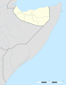 Map of Somaliland


Article(s): [[]]
- Request
- Show highlighted regions on zoomed out map showing neighbouring countries greyed out
- Hi all, can the regions of "Togdheer" and "Maroodijeex" please be highlighted on the (Somaliland location map.svg) map that includes the sea and greyed out neighbouring countries. Many thanks
- Graphist opinion(s)
-
Description of first image
-
Description of second image (if needed)
-
Description of third image (if needed; don't request too many at once, though)
Article(s): [[]]
- Request
- Details of your request go here… --89.151.178.4 09:58, 22 September 2020 (UTC)
- Graphist opinion(s)
Update Angola SVG locator maps


.svg)


.svg)


Article(s): Angola provinces articles, for example en:Bengo Province, etc.
- Request
- The SVG locator maps in the category SVG locator maps of provinces in Angola need to be updated as one two of the provinces, Bengo and Luanda have changed in 2011-2012. This has already been reflected in File:Angola location map.svg which was originally used to create those locator maps and was changed in 2019. File:Luanda in Angola (special marker).svg is probably not needed and could be replaced by File:Luanda in Angola.svg in the articles that use it, but that’s not in the scope of this request. --moyogo (talk) 16:04, 27 October 2020 (UTC)
- Actually File:Angola location map.svg needs to be updated too. The Malanje province and the Lunda Norte province are different. See for example the Malanje province map on page 2 of this May 2020 document by the Instituto Nacional de Estatística. The difference seems to be the municipality of Quitapa which used to be in Lunda Norte (at least on maps or this government website from 2013) and is now in Malanje (see for example this list of communes or the SHP files called "DPA Angola" on this website, both from the Ministério da Administração do Territorio). ---moyogo (talk) 00:23, 29 October 2020 (UTC)
- Graphist opinion(s)
Map of the MENA region in 1798
-
 Original version

Article(s): Alaouite dynasty, Kingdom of Jolof, Hausa Kingdoms,Ottoman empire, Yemeni Zaidi State, Qajar dynasty, Mughal Empire.
- Convert to SVG
- Can anyone please convert this map to SVG for better quality? Thanks in advance. --Flaspec (talk) 19:26, 20 November 2020 (UTC)
- Graphist opinion(s)
Flaspec If you will be there to help me with information/knowledge I will help you. --always ping me--Goran tek-en (talk) 13:01, 26 April 2021 (UTC)
- @Goran tek-en This map is covering the main political entities of the MENA region in 1798. It has a low graphic quality, so I recommend you work from this one [1] instead. I added the respective Wikipedia articles for reference, if you have any doubts feel free to ask! --Flaspec (talk) 22:58, 26 April 2021 (UTC)
![]() Request taken by Goran tek-en (talk) 16:00, 27 April 2021 (UTC)
Request taken by Goran tek-en (talk) 16:00, 27 April 2021 (UTC)
- Flaspec That linked image has copyright on it so I can only use it as information.
- In that image there is coloring, patterns for mountains and desert do you want that as well? --always ping me--Goran tek-en (talk) 13:05, 28 April 2021 (UTC)
- @Goran tek-en Patterns for rivers are important (sample: Alaouite dynasty of Morocco-en.svg) because they influence human settlements. Mountains provide natural barriers in case of war, so a pattern showing them would be appreciated. --Flaspec (talk) 13:40, 28 April 2021 (UTC)
- Flaspec We haven't talked about what language the map should be in. If it's English I would need a list of all names and other texts translated here, thanks. French, English. --always ping me--Goran tek-en (talk) 17:33, 28 April 2021 (UTC)
- @Goran tek-en English names to be used on this map (from west to east):
-
- Others (Sub-Saharan Africa)
- Others (Indian Ocean)
- Legend
-
- If you have any doubts, feel free to ask. --Flaspec (talk) 00:28, 29 April 2021 (UTC)
- @Goran tek-en English names to be used on this map (from west to east):
- Flaspec We haven't talked about what language the map should be in. If it's English I would need a list of all names and other texts translated here, thanks. French, English. --always ping me--Goran tek-en (talk) 17:33, 28 April 2021 (UTC)
- Flaspec That linked image has copyright on it so I can only use it as information.
- On the original map some areas has a kind of toning which I haven't added here. I think that all areas has a kind of toning to them in reality so why should only some have them?
- I haven't added the Bonaparte expedition as you didn't translate it.
- There are some areas which I don't really understand and in the legend it is X.
- Give me feedback on what to change, thanks.
- This draft is a PNG version of the original SVG file I'm working in and will upload to commons. Draft-1. --always ping me--Goran tek-en (talk) 18:26, 1 May 2021 (UTC)
- By toning I think you mean the dots referring to desertic areas? If so, there is no need to add them because the pattern for rivers is enough when representing these desertic areas.
- The new SVG map is meant to reflect only the political entities of the region. So there is no need do add neither the Bonaparte expedition nor the Russian campaigns.
- These areas are meant to reflect areas which where under Islamic influence over the past centuries before the Christian world took over. So there is no need to add them because the new SVG map is intended to reflect the political entities of the region in 1798 only.
- The new SVG map is good and faithful to the original. However, to make it better:
- Please remove the legend-key X along with the color representing it on the map.
- The second map-legend box is unnecessary: I suggest you put the compass along with the map scale in the bottom-right, then remove the legend-key Mountain areas along with the now-empty white box.
- In the first map-legend box, please sort the main political entities from west to east: Morocco (Alaouite dynasty), Jolof Empire, Hausa Kingdoms (Hausa and Kanem–Bornu), Ottoman Empire, Yemen (Zaidi Imamate), Persia (Qajar dynasty), Mughal Empire, Islamic Factories, British possessions, Other European colonies.
- In the first map-legend box, choose a bigger size for the font.
- Please change the color representing Islamic Factories because it could be easily mistaken with the color representing British possessions.
- Please make the color representing Persia (Qajar dynasty) more distinguishable from the color representing British possessions.
- When uploading the file to commons, I suggest you name it Map of the MENA region in 1798.svg. Thank you. --Flaspec (talk) 02:47, 2 May 2021 (UTC)
- Flaspec By toning I mean that some areas has a soft edge in expansions direction to show there is no solid border.
- The colors I have chosen are colors that should work for most people with color deficiency so I have moved them around and hope this is fine with you.
- Draft-2.
- If this is fine I will need the following;
- Name of the file
- Description (/language)
- Captions/s (/language)
- Category/ies at commons
- The colors I have chosen are colors that should work for most people with color deficiency so I have moved them around and hope this is fine with you.
- to be able to upload it at commons. If you don'y know about Captions read here. --always ping me--Goran tek-en (talk) 13:27, 2 May 2021 (UTC)
- @Goran tek-en
- Please fix Ceylon island color to British possessions.
- Filename shall be Map of the MENA region in 1798.svg
- Description: Map showing the political entities of the Middle East and North Africa in 1798.
- Captions: The MENA region in 1798
- Categories: Historical maps of the Middle East, Historical maps of Africa, Historical maps of Morocco, Maps of the Wolof Empire, Hausa people, Maps of the Ottoman Empire, Historical maps of Yemen, Maps of the history of Iran, Historical maps of India, Maps of the history of Sri Lanka, Maps of the British Empire, Maps showing the history of colonies, Alaouite dynasty, Ottoman Empire, Zaydi imams of Yemen, Qajar dynasty, Moghal Empire, Maps of the world showing history, 1798
- Thank you! --Flaspec (talk) 16:50, 2 May 2021 (UTC)
- @Goran tek-en
Flaspec Now you can find it here file:Map of the MENA region in 1798.svg. If you are happy with this please put the code {{section resolved|1=~~~~}} on this request so it can be archived, thanks. ![]() Done --always ping me--Goran tek-en (talk) 09:28, 3 May 2021 (UTC)
Done --always ping me--Goran tek-en (talk) 09:28, 3 May 2021 (UTC)
- @Goran tek-en one final request, could you please change Jolof Empire → Jolof Kingdom in the map legend? --Flaspec (talk) 15:44, 3 May 2021 (UTC)
- Flaspec Done --always ping me--Goran tek-en (talk) 10:05, 4 May 2021 (UTC)
- Goran tek-en Impressive work, many thanks! --Flaspec (talk) 16:52, 4 May 2021 (UTC)
- Flaspec
1908 Meclis-i Mebusân members by vilayet (or sanjak) and ethnicity
-
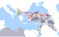 The map
_and_ethnicity.svg)
Article(s): en:1908 Ottoman general election
- Request
- Make the thickness of the squares smaller, so that the map looks clearer when opened in png.
- I created the map using Inkscape, but I don't know how to use it well. I want to ask if someone can make the thickness of the squares smaller (probably not one by one) and if it can fix the right black strip. Thank you a lot. --AT44 (talk) 23:40, 12 August 2020 (UTC)
- Graphist opinion(s)
AT44 I can help you with this but first I have to ask why you have made the map so large in pixels: 2,647 × 1,660. That is to big for most screens that people use or is it for a special reason?
When you make a map that large and then you have a thumbnail in an article of maybe 250 px wide it will be very hard to see anything. It is always difficult to get a thumbnail to work so to my understanding you have added difficulties by making it so big. Think about how big you want it to be on your screen when you view it in 100% and get back to me. Please always ping me, thanks. --Goran tek-en (talk) 16:48, 11 November 2020 (UTC)
UT of Ladakh
-
 Map showing average onset (monsoon arrival) dates and wind directions prevalent during India's southwest summer monsoon.
 -
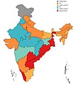 Ruling Parties in States and UT's of India as of December 2019
 -
 Area in red is Ladakh currently controlled by India. Area in pink is either Pakistan occupied Ladakh(Gilgit Baltistan) or China occupied Ladakh(Aksai Chin, Shaksgam Valley etc.)
 -
 Map showing the presence of the Bharatiya Janata Party by state. Uses File:State- and union territory-level parties.svg


Article(s): India Monsoon South India Climate of India Madden–Julian oscillation Thermal low Climate of Asia Monsoon of South Asia Seasonal tropical forest 2017 Sri Lanka floods 2018 Sri Lankan southwest monsoon floods
- Request
- Erstwhile state of J&K have been bifurcated into UT of Ladakh and UT of JK, Kindly update Map 1 and 2 to reflect the same, Map 3 and 4 provides for reference --श्रीमान २००२ (talk) 06:32, 26 October 2020 (UTC)
- Graphist opinion(s)
श्रीमान २००२ This File:Ruling_Parties_in_States_and_UT's_of_India_as_of_December_2019.jpg reflects the situation of December 2019 and should therefore not be updated due to things that happened after that. --Goran tek-en (talk) 16:35, 11 November 2020 (UTC)
Nepal new map
-
 Locator map of Nepal in orthographic projection
.svg)
- Article(s)
- Nepal
- Request
- Nepal had political map change in Indian controlled area. Add in light green the disputed area to the Nepal map. The color light green should be similar to India's orthographic projection see here https://commons.wikimedia.org/wiki/File:India_(orthographic_projection).svg . Reference this website for the updated map https://kathmandupost.com/national/2020/05/21/with-release-of-new-map-nepal-and-india-enter-a-state-of-cartographic-war-experts-say/
- Graphist opinion(s)
This request is not changed signed and I need a requester to check my work if I take this, please always ping me, thanks. --Goran tek-en (talk) 15:34, 14 November 2020 (UTC)
Update PNG map of AASM HAMMER operators
-
 Map with AASM HAMMER operators in blue
 -
 File:AASM operators.svg


Article(s): Armement Air-Sol Modulaire
- Request
- This map needs to be updated by including India as per this news report.— Vaibhavafro 💬 16:21, 5 November 2020 (UTC)
- Graphist opinion(s)
- @Vaibhav: Done Converting it to SVG was easier than trying to update the PNG. --AntiCompositeNumber (talk) 05:48, 16 November 2020 (UTC)
Climate emergency declaration map update

Article(s): [[]]
- Request
- Could someone update the map please? It would be great if you have any idea about what to do with the european declaration.
--Javiermes (talk) 15:39, 19 December 2020 (UTC)
- Graphist opinion(s)
Join map elements in one picture
- Request
This map was cut up and pasted on a textile support. I scanned the sections individualy, hoping to digitaly paste them together again. However the panorama photomerge from Photoshop (elements 10) refuses to merge unless there is a sustantial Common area. Is there a way (or tool) to manualy join them together?
-
 Western part
 -
 Middle part
 -
 Eastern part
 -
 Final join


Smiley.toerist (talk) 11:15, 22 June 2020 (UTC)
- Graphist opinion(s)
![]() Request taken by DutchTreat (talk) 10:16, 27 June 2020 (UTC)
Request taken by DutchTreat (talk) 10:16, 27 June 2020 (UTC)
Smiley.toerist - I can help you join these three images. Using w:GIMP I will create a canvas large enough to contain all three images. Then, each of your map images can be loaded as a layer. These layers can be adjusted manually to align the edges. I see that there are a few rough edges. Slight rotation of the Geraardsbergen 1922.jpg will be needed to get a pleasing result.
What should be result joined map image be called? - DutchTreat (talk) 10:16, 27 June 2020 (UTC)
- 'Flobecq - Geraardsbergen 1922.jpg', Thanks.Smiley.toerist (talk) 08:38, 1 July 2020 (UTC)
- Done Smiley.toerist Please find the joined version as File:Flobecq - Geraardsbergen 1922.png. It is a large file at over 60 MB. Since the files only aligned by making vertical adjustments and a slight rotation of the Eastern (Geraardsbergen) file, I decided to use PNG format with a transparent background. I hope this will be suitable for your needs. - DutchTreat (talk) 11:38, 2 July 2020 (UTC)
- Smiley.toerist Any additional feedback on the merged file? Please add {{Resolved}} if there are no changes needed. - DutchTreat (talk) 10:58, 16 July 2020 (UTC)
- @Smiley.toerist: Checking in to see if this merged map meets your needs. If not, please let me know. - DutchTreat (talk) 18:05, 23 December 2020 (UTC)
Left message on requestor's Talk page. Received confirmation.DutchTreat (talk) 12:09, 24 December 2020 (UTC)
- This section was archived on a request by: Donald Trung 『徵國單』 (No Fake News 💬) (WikiProject Numismatics 💴) (Articles 📚) 20:30, 17 June 2021 (UTC)
Maps for Climate Emergency in Australia Page
-
 Description of first image: Map of Australia with states that have declared a Climate Emergency in Green, Partial in Yellow, not declared in red see page for list https://en.wikipedia.org/wiki/Climate_Emergency_in_Australia
 -
Description of second image (if needed): Map of Victorian Local Government Areas that have declared a climate emergency see page for list https://en.wikipedia.org/wiki/Climate_Emergency_in_Australia
-
Description of third image (if needed; don't request too many at once, though)

en:Climate Emergency in Australia [[]]
- Request
- Maps for Climate Emergency in Australia Page
- Details of your request go here… Maps of Jurisdictions that have declared a climate emergency would really lift the quality of this article and help show the regional spread of climate emergency declarations across different states in Australia. This page already has a comprehensive and up to date list of locations that have declared a climate emergency which would aid in the creation of this map --Greenie2020 (talk) 08:48, 22 December 2020 (UTC)
- Graphist opinion(s)
![]() Done Created a map of Australia -- Krupadeluxe 9:42 am Monday, 10 May 2021 (UTC)
Done Created a map of Australia -- Krupadeluxe 9:42 am Monday, 10 May 2021 (UTC)
- Tagging as " Resolved".
Tagging as "Resolved" because the above map was being used in the English-language Wikipedia's article as of writint this, and no new developments have occurred here since its creation. I think that it's highly unlikely that this request isn't resolved. --Donald Trung 『徵國單』 (No Fake News 💬) (WikiProject Numismatics 💴) (Articles 📚) 20:33, 17 June 2021 (UTC)
- This section was archived on a request by: Donald Trung 『徵國單』 (No Fake News 💬) (WikiProject Numismatics 💴) (Articles 📚) 20:33, 17 June 2021 (UTC)
CSX Transportation
Article(s):en:CSX Transportation
- Request
- CSX Transportation has purchased Pan Am railways, please update the map. --164.52.225.30 19:36, 7 December 2020 (UTC)
- Graphist opinion(s)
It's more likely that someone will help if you sign your request.
Graphic workers do just that, we don't do research and stuff like that and we have zero knowledge of the subject. Please provide a good source so we can see what to add, how will we other know. Map is often better than text, thanks. --Goran tek-en (talk) 19:13, 15 January 2021 (UTC)
Chotanagpur Map
-
 Ecoregion IM0203: Chhota-Nagpur dry deciduous forests
 -
 This made of modern India was made by me, based on the Digital Chart of the World.
 -
 India. Area controlled by India in dark green; claimed but not controlled areas in light green.


.svg)
Article(s): en:Chota Nagpur Plateau and its translation in other wikis
- Request
- In Image 1 add dotted lines showing Pok, Gosthana, Chinese and Pakistani Claims as most maps do to maintain neutrality. Images 2 and 3 added for reference --श्रीमान २००२ (talk) 06:21, 26 October 2020 (UTC)
- Graphist opinion(s)
श्रीमान २००२ What is your request, what do you want to be done. We (graphic workers) have probably zero knowledge of this so you have to be specific when explaining what you want to be done. --Goran tek-en (talk) 16:48, 14 March 2021 (UTC)
Creating Maps of Gujarat Loksabha constituencies and Legislative assembly constituencies
For List of Loksabha and Legislative Assembly Constituencies: en:Demographics of districts of Gujarat#Demographics
Article(s): en:List of constituencies of the Lok Sabha#Gujarat (for creating Loksabha Constituencies)
- Request
- Making individual Gujarat Legislative Constituencies Maps from Gujarat Loksabha Constituency Map
-
 Gujarat Loksabha Map

Article(s): en:List of constituencies of the Gujarat Legislative Assembly (for creating Legislative Assembly Constituencies)
- Request
- Making individual Gujarat Legislative Assembly Constituencies Maps from Gujarat Legislative Constituency Map
-
 Gujarat Legislative Assembly Map

.svg)
.svg)
.svg)
![[1]](http://medias.sciences-po.fr/Lexpansion_europeenne_1798/medias/domain2/media0/133-0glgaklmem-whr.jpg)
.svg)
Example Maps of different Indian state for making Gujarat maps:
- en:List of constituencies of the Tamil Nadu Legislative Assembly#Current list of constituencies(making individual Legislative constituencies link this)
- en:Tiruvallur Lok Sabha constituency(making individual loksabha constituency like this)