Category:Utah State Route 124
Jump to navigation
Jump to search
 | number: | (one hundred twenty-four) |
|---|---|---|
| State highways in Utah: | 104 · 105 · 106 · 107 · 108 · 109 · 110 · 111 · 112 · 113 · 114 · 115 · 116 · 117 · 118 · 119 · 120 · 121 · 122 · 123 · 124 · 125 · 126 · 127 · 128 · 129 · 130 · 131 · 132 · 133 · 134 · 135 · 136 · 137 · 138 · 139 · 140 · 141 · 142 · 143 · 144 |
highway in Emery and Carbon counties in Utah, United States | |||||
| Upload media | |||||
| Instance of | |||||
|---|---|---|---|---|---|
| Location |
| ||||
| Transport network | |||||
| Owned by |
| ||||
| Maintained by |
| ||||
| Inception |
| ||||
| Length |
| ||||
| Terminus | |||||
| Different from | |||||
 | |||||
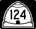
English: Media related to Utah State Route 124 (SR-124), a 7.9659-mile (12.8199 km) state highway in eastern Utah, United States, that runs along the base of the Book Cliffs and connects the mouth of Horse Canyon in northeastern Emery County (about 13 miles [21 km] north of Woodside) with Utah State Route 123 in East Carbon City (in Carbon County). From 1935 to 1945, the eastern terminus of SR-124 was at Columbia, before being extended south to Horse Canyon.
Subcategories
This category has the following 2 subcategories, out of 2 total.
Media in category "Utah State Route 124"
The following 2 files are in this category, out of 2 total.
-
 Utah 124.svg 750 × 600; 73 KB
-
 Utah SR 124.svg 385 × 385; 8 KB
