Category:Unidentified maps
Jump to navigation
Jump to search
Italiano: Carte geografiche non identificate
Português: Mapas não identificados
See also: at places where some authors like to put their unsorted maps, and please tidy up there as well. Such places are for example:
Category:Maps, Category:Old maps and Category:Maps of geographical features, Category:Architectural drawing sheets (--> a redirect from "Plan") and Category:Plans. Rarely also Category:Mappa.
Subcategories
This category has the following 24 subcategories, out of 24 total.
A
C
F
- Unidentified maps of Finland (empty)
- Unidentified maps of France (2 F)
G
- Unidentified maps of Germany (3 F)
- Unidentified maps in Georgian (empty)
- Unidentified maps in Greek (13 F)
I
- Unidentified maps of India (53 F)
- Unidentified maps of Indonesia (131 F)
J
K
- Unidentified maps in Korean (35 F)
O
P
T
- Unidentified maps in Thai (34 F)
- Unidentified maps in Turkish (empty)
U
- UB Basel Maps Uncategorized (99 F)
Y
- Maps with year missing (39 F)
Media in category "Unidentified maps"
The following 133 files are in this category, out of 133 total.
-
-
-
 Arcs of Fire for Casemated Coastal Defense Guns on Iwo Jima - NARA - 100307402.jpg 8,384 × 11,605; 2.73 MB
-
 Assault Map - Point du Hoe - DPLA - e4d5f7dc8076c622b772d12b1cbe312c (page 1).jpg 6,961 × 6,256; 1.77 MB
-
 Assault Map - Point du Hoe - DPLA - e4d5f7dc8076c622b772d12b1cbe312c (page 2).jpg 6,981 × 6,260; 4.19 MB
-
 Barrier Plan as of 12 1800 January 1945 - DPLA - 44913f3929939801fa1465036cbc90ee.jpg 8,720 × 6,959; 4.47 MB
-
 Barrier Plan as of 12 1800 January 1945 - DPLA - 4c06b7a5e086aa9d3532b9756a2ab6ac.jpg 8,692 × 6,930; 4.56 MB
-
 Barrier Plan as of 12 1800 January 1945 - DPLA - a8f0de167f9718cc56147c4bc2d7fe67.jpg 8,652 × 6,967; 4.47 MB
-
 Barrier Plan as of 12 1800 January 1945 - DPLA - e0b9e2f03727dcdedd19d12cb369a63a.jpg 8,720 × 6,627; 2.78 MB
-
 Barrier Plan as of 12 1800 January 1945 - DPLA - eecea34111c541fb551a3a8ac87a1f86.jpg 8,720 × 6,961; 4.8 MB
-
 Biologische waarderingskaart 2 fauna.gif 219 × 390; 35 KB
-
 Biologische waarderingskaart Kouterbroeken.png 207 × 341; 42 KB
-
 Blakenship and Burnet Islands, Carillon Atoll - NARA - 100359952.jpg 5,324 × 12,187; 4.36 MB
-

-
 Bridge Study of Wupper, Dhunn, Sulz, Ager and Sieg Rivers - NARA - 100385089.jpg 5,352 × 7,701; 2.8 MB
-
-
-
-

-

-

-
-
-

-
-
-

-

-

-
 D-3 (Enemy) Situation - NARA - 100359954 (page 1).jpg 4,987 × 3,591; 2.81 MB
-
 D-3 (Enemy) Situation - NARA - 100359954 (page 2).jpg 5,057 × 3,657; 1.45 MB
-

-

-

-

-
-

-

-
 Diagrama Mapa.png 799 × 366; 386 KB
-
-
 German Counteroffensive Revised Plan 24 December 1944 and Dec 1944 - NARA - 100384825.jpg 8,512 × 6,634; 2.45 MB
-
 Gewestplan Halle Vilvoored asse.gif 218 × 494; 55 KB
-
 Gewestplan kouterbroeken.png 113 × 205; 62 KB
-
 Group Engineer Areas of Responsibility for the Month of August - NARA - 100384823.jpg 8,499 × 6,616; 3.49 MB
-
 Gruzinskaya Ssr Map 15 - DPLA - 5d72b86782820dbc87fa7cbd3788df09.jpg 11,393 × 7,626; 10.65 MB
-
 Guerilla Situation Southeast Luzon - NARA - 100385233.jpg 5,992 × 6,598; 2 MB
-
 Irkutskaya Oblast Map 16A and 16B - DPLA - 42bee64cd04b99a3e99e3ec52920ee52 (page 1).jpg 11,447 × 7,560; 8.2 MB
-
 Irkutskaya Oblast Map 16A and 16B - DPLA - 42bee64cd04b99a3e99e3ec52920ee52 (page 2).jpg 11,435 × 7,623; 8.94 MB
-
 Kyshtym (55°42'N-60°32'E) - DPLA - dd53cf0c9f9571736bc4297d1ca66967.jpg 11,178 × 8,812; 13.21 MB
-
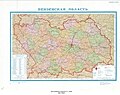
 Magadanskaya Oblast - DPLA - d0ddce4dd07bba5623aa161f850cd6c8 (page 2).jpg 7,195 × 9,978; 7.67 MB
-
 Map - DPLA - 045f8ccb6d68b3121a962d1e3110a2d7.jpg 8,898 × 9,180; 9.94 MB
-
 Map - DPLA - 1105d17b02e7c6894e8a682432c5f04d.jpg 8,747 × 7,890; 12.44 MB
-
 Map - DPLA - 4eef151dc8628485eb08bf942471fe02 (page 1).jpg 11,412 × 3,840; 4.59 MB
-
 Map - DPLA - 4eef151dc8628485eb08bf942471fe02 (page 2).jpg 11,473 × 4,011; 5.51 MB
-
 Map - DPLA - d22abf1b9952544e78c62a6db8e7b1db.jpg 8,473 × 10,124; 13.67 MB
-
 Map - DPLA - dc3efa9f828572e6fb538582d27702c0.jpg 10,052 × 7,387; 10.92 MB
-
 Map made by the Command of General Patch - NARA - 100384760 (page 1).jpg 5,824 × 7,298; 1.69 MB
-
 Map made by the Command of General Patch - NARA - 100384760 (page 2).jpg 5,824 × 7,301; 1.68 MB
-
 Map of the Landing of the Alligators - DPLA - b2f25aa80a874993cb19558abb0cd36d.jpg 2,412 × 3,125; 568 KB
-
 Mapa do Panorama.png 1,000 × 1,000; 104 KB
-
 Mimeographed Map of Busching Defensive Position OVERLAY - NARA - 100385231.jpg 5,337 × 3,545; 2.34 MB
-
 Moldavskaya Ssr Map 30 - DPLA - c5f25a5313968706a60eb589a0d653a9.jpg 7,317 × 11,973; 11.22 MB
-
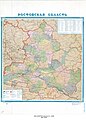
 Moskovskaya Oblast Map 32 - DPLA - 51c9afc6ff77f11a9a87847da3a6eecf.jpg 11,380 × 7,821; 11.42 MB
-
 Natura 2000 Habitatkaart.png 202 × 308; 36 KB
-
 Nikolaevskaya Oblast Map 34 - DPLA - 8199c4e0de693997c71c138c7bb5f1f3.jpg 11,419 × 7,736; 7.49 MB
-
 Odesskaya Oblast - DPLA - e163e41496d90061ae98075b3a77e905.jpg 7,147 × 10,010; 8.16 MB
-
 Orlovskaya Oblast Map 35 - DPLA - 115afc0e78ee416c5c859d7d085d3c8c.jpg 11,432 × 7,871; 8.06 MB
-

-

-
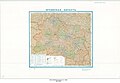
 Penzenskaya Oblast - DPLA - 06953ab62396cfaaa6d2588ff18f59f4.jpg 9,480 × 7,544; 9.66 MB
-
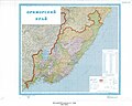 Primorskiy Kray - DPLA - 94b8719a27d4e5226c1befd03ffd813b.jpg 9,480 × 7,568; 8.22 MB
-

-

-

-
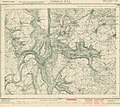
 Pursuit Across France - NARA - 100384821.jpg 10,816 × 6,613; 5.99 MB
-
 Rostovskaya Oblast - DPLA - 5c43d86b33bc63d6fef89e4e9f864632.jpg 7,163 × 10,001; 9.24 MB
-
 Ryazanskaya - DPLA - 23bd8cef0a7ad45a1b92e45e94d97d9f.jpg 9,510 × 7,577; 9.53 MB
-
 Situation Map 1 August 1944 Rennes - Le Mans - NARA - 100384787.jpg 8,704 × 6,632; 4.35 MB
-
 Situation Map 1 November 1944 Düren - Aachen - Luxembourg - NARA - 100384789.jpg 6,624 × 8,738; 6.71 MB
-
 Situation Map 1-31 October 1944 Aachen - Luxembourg - NARA - 100385141.jpg 6,604 × 8,749; 4.08 MB
-
-

-
-
 Stavropol'Skiy Kray Map 42 - DPLA - dd621cfd473965758b0c05b41a8bde77.jpg 11,456 × 7,655; 9.89 MB
-
 Suwalki-Kowno - DPLA - f43c0e33bd1e7caafaab1e45940a1e65.jpg 6,118 × 5,992; 6.95 MB
-
 Tatarskaya Assr - DPLA - 5dcb1c4644edd6a2694ff7a7df784110.jpg 9,486 × 7,568; 8.83 MB
-
 The story of some French refugees and their "Azilum," 1793-1800 (1903) (14775732781).jpg 2,886 × 1,880; 584 KB
-
 Thirty Second Army Troop Dispositions - NARA - 100307406.jpg 6,464 × 8,967; 2.08 MB
-
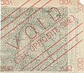
 Topographic Map of Bitche (SW) with Defense Overprint - NARA - 100384437 (page 1).jpg 6,600 × 8,690; 6.43 MB
-
 Topographic Map of Bitche (SW) with Defense Overprint - NARA - 100384437 (page 2).jpg 6,600 × 8,708; 6.91 MB
-
 Topographic Map of Bitche (SW) with Defense Overprint - NARA - 100384440 (page 1).jpg 6,600 × 8,725; 6.92 MB
-
 Topographic Map of Bitche (SW) with Defense Overprint - NARA - 100384440 (page 2).jpg 6,600 × 8,669; 6.29 MB
-
 Topographic Map of Bollendorf with Defense Overprint - NARA - 100384871.jpg 6,816 × 6,000; 4.76 MB
-
 Topographic Map of Boulay (NW) with Defense Overprint - NARA - 100384865.jpg 8,664 × 6,683; 5.59 MB
-
 Topographic Map of Boulay (SW) with Defense Overprint - NARA - 100384867.jpg 8,724 × 6,611; 5.94 MB
-
 Topographic Map of Boulay (SW) with Defense Overprint - NARA - 100384889.jpg 7,752 × 5,897; 4.58 MB
-
 Topographic Map of Freudenburg with Defense Overprint - NARA - 100384875.jpg 8,440 × 6,624; 5.97 MB
-
 Topographic Map of Heffingen - NARA - 100384869.jpg 6,812 × 6,088; 4.71 MB
-
 Topographic Map of Lembach (NE) with Defense Overprint - NARA - 100384458 (page 1).jpg 8,692 × 6,647; 5.12 MB
-
 Topographic Map of Lembach (NE) with Defense Overprint - NARA - 100384458 (page 2).jpg 8,668 × 6,600; 4.81 MB
-
 Topographic Map of Lembach (SE) with Defense Overprint - NARA - 100384461 (page 1).jpg 8,684 × 6,626; 6.69 MB
-
 Topographic Map of Sarreguemines (SW) with Defense Overprint - NARA - 100384449 (page 1).jpg 6,600 × 8,723; 6.33 MB
-
-
 Topographic Map of St. Avold (NW) - NARA - 100384881.jpg 8,688 × 6,662; 4.85 MB
-
 Topographic Map of St. Avold (SW) - NARA - 100384879.jpg 8,700 × 6,638; 10.91 MB
-
 Topographic Map of St. Avold with Defense Overprint - NARA - 100384877.jpg 8,688 × 6,641; 5.17 MB
-
 Topographic Map of Thionville - NARA - 100384855.jpg 8,684 × 6,632; 5.59 MB
-
 Topographic Map of Thionville with Defense Overprint - NARA - 100384859.jpg 6,756 × 5,996; 4.32 MB
-
 Topographic Map of Trier - NARA - 100384427 (page 2).jpg 6,924 × 6,079; 14.06 MB
-
 Topographic Map of Waldwisse (NW) with Defense Overprint - NARA - 100384861.jpg 8,648 × 6,651; 6.22 MB
-
 Topographic Map of Waldwisse (NW) with Defense Overprint - NARA - 100384883.jpg 8,704 × 6,566; 6.42 MB
-
 Topographic Map of Waldwisse (SW) with Defense Overprint - NARA - 100384863.jpg 8,704 × 6,556; 6.21 MB
-
 Topographic Map of Waldwisse (SW) with Defense Overprint - NARA - 100384885.jpg 6,976 × 5,880; 5.11 MB
-
 Tul'Skaya Oblast Map 48 - DPLA - 7c0da28265a715558cca5c6dca6b0dcc.jpg 7,210 × 11,918; 9.69 MB
-
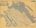
 Types of Soil Overlay Sheet 4 - NARA - 100384424 (page 1).jpg 7,344 × 5,866; 3.32 MB
-
 Types of Soil Overlay Sheet 4 - NARA - 100384424 (page 2).jpg 5,908 × 7,298; 3.81 MB
-
 Types of Soil Overlay Sheet 5 - NARA - 100384421 (page 1).jpg 7,356 × 5,826; 3.71 MB
-
 Types of Soil Overlay Sheet 5 - NARA - 100384421 (page 2).jpg 7,356 × 5,810; 2.39 MB
-
 Unidentified Map - C.C.C.P - DPLA - 437f1cac3927ab76674222e457fcdb74.jpg 5,710 × 7,882; 4.96 MB
-
 Unidentified Map - C.C.C.P - DPLA - 50889e8b0e729d8a42caaf637174ee7b.jpg 5,722 × 7,495; 4.32 MB
-
 Unidentified Map - C.C.C.P - DPLA - 980de42f3c4eae623dac37cded410beb.jpg 5,736 × 7,519; 3.75 MB
-
 Unidentified Map - C.C.C.P - DPLA - a720d2c10ac082db3eb73f3ce9ba69b8.jpg 5,722 × 7,510; 4.38 MB
-
 Unidentified Map - C.C.C.P - DPLA - bb559b49ae9610064ad45fcbd2ab0afd.jpg 5,734 × 7,453; 4.55 MB
-
 Unidentified Map - C.C.C.P - DPLA - da6c3766244bdc89d790e93c15128432.jpg 5,722 × 7,455; 4.77 MB
-
 Unidentified Map - C.C.C.P - DPLA - eeca2944c5ad85a519164ab78220c3ed.jpg 5,736 × 7,497; 4.09 MB
-
-
 Ville De Port-Au-Prince - DPLA - 46554c66aba0641c3554193fa5b90da1 (page 1).jpg 10,736 × 8,184; 7.06 MB
-
 Ville De Port-Au-Prince - DPLA - 46554c66aba0641c3554193fa5b90da1 (page 2).jpg 10,620 × 8,521; 6.32 MB
-
 Vinnitskiy Economic Administrative Region - DPLA - 660503b71544d570ee843d20ef2b765a.jpg 9,516 × 7,527; 7.7 MB
-
 Volynka.jpg 1,920 × 1,191; 130 KB
-
 Zamosc - DPLA - 50e1760ab65fb5359f60f4eb37ef4dbc.jpg 6,588 × 5,984; 7.23 MB
-
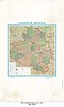
 Административное деление Фраландские острова.png 2,000 × 1,200; 145 KB
-
 Байдакі на нямецкай мапе 1941 г.jpg 624 × 386; 115 KB
.jpg)
.jpg)

.jpg)
.jpg)


.jpg)
.jpg)
_-_DPLA_-_f638d515a91728bff66e54a61946d522.jpg)

.jpg)
.jpg)
.jpg)
.jpg)
.jpg)
.jpg)
.jpg)
.jpg)
.jpg)
.jpg)
_Situation_-_NARA_-_100359954_(page_1).jpg)
_Situation_-_NARA_-_100359954_(page_2).jpg)
.jpg)
.jpg)
.jpg)
.jpg)
.jpg)
.jpg)
.jpg)


.jpg)
.jpg)
_-_DPLA_-_dd53cf0c9f9571736bc4297d1ca66967.jpg)
.jpg)


.jpg)
.jpg)


.jpg)
.jpg)
.jpg)


_(14775732781).jpg)

_with_Defense_Overprint_-_NARA_-_100384437_(page_1).jpg)
_with_Defense_Overprint_-_NARA_-_100384437_(page_2).jpg)
_with_Defense_Overprint_-_NARA_-_100384440_(page_1).jpg)
_with_Defense_Overprint_-_NARA_-_100384440_(page_2).jpg)

_with_Defense_Overprint_-_NARA_-_100384865.jpg)
_with_Defense_Overprint_-_NARA_-_100384867.jpg)
_with_Defense_Overprint_-_NARA_-_100384889.jpg)


_with_Defense_Overprint_-_NARA_-_100384458_(page_1).jpg)
_with_Defense_Overprint_-_NARA_-_100384458_(page_2).jpg)
_with_Defense_Overprint_-_NARA_-_100384461_(page_1).jpg)
_with_Defense_Overprint_-_NARA_-_100384449_(page_1).jpg)
_with_Defense_Overprint_-_NARA_-_100384449_(page_2).jpg)
_-_NARA_-_100384881.jpg)
_-_NARA_-_100384879.jpg)


.jpg)
_with_Defense_Overprint_-_NARA_-_100384861.jpg)
_with_Defense_Overprint_-_NARA_-_100384883.jpg)
_with_Defense_Overprint_-_NARA_-_100384863.jpg)
_with_Defense_Overprint_-_NARA_-_100384885.jpg)

.jpg)
.jpg)
.jpg)
.jpg)


.jpg)
.jpg)


.jpg)
.jpg)