Category:St Germans
Jump to navigation
Jump to search
Brezhoneg: Rummad:Kêrioù Kernev-Veur
English: St Germans (.
Kernowek: Lannalez yw gwig yn Howldrevel Kernow, ogas dhe Essa. Yma hanow sowsnek an wig, St Germans ow talleth gans hanow an eglos a usi ena, eglos Sancti Germani.
Norsk bokmål: Byen var opprinnelig en travel fiskelandsby på 1800-tallet. Kaianleggene i St Germans var hektisk opptatt i det siste århundret med å laste tømmer, kull og kalkstein. Inntil den andre verdenskrigen var vegstein viktig. I dag er kaien hjemstedet for byens seilingsklubb, Quay Sailing Club (QSC), som nå er godt etablert og del av byens liv.
village and civil parish in Cornwall, England  | |||||
| Upload media | |||||
| Instance of | |||||
|---|---|---|---|---|---|
| Location | Cornwall, South West England, England | ||||
 | |||||
Subcategories
This category has the following 12 subcategories, out of 12 total.
B
C
- Countryside around St Germans (237 F)
P
R
- River Tiddy at St Germans (23 F)
S
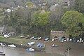
- St Germans Quay (29 F)
- St Germans viaduct (25 F)
- St Germans War Memorial (2 F)
- Streets in St Germans (19 F)
T
- Trerulefoot (32 F)
Media in category "St Germans"
The following 34 files are in this category, out of 34 total.
-
 A387 Road Signs - geograph.org.uk - 342927.jpg 640 × 456; 100 KB
-
 Allotments at St Germans - geograph.org.uk - 5706575.jpg 640 × 480; 88 KB
-
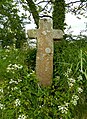
 Carracawn Cross - geograph.org.uk - 3774070.jpg 1,920 × 2,398; 1.04 MB
-
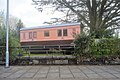
 Carriage accommodation at St Germans - geograph.org.uk - 5745687.jpg 1,024 × 768; 241 KB
-
 Carriage at St German Station - geograph.org.uk - 5634874.jpg 640 × 426; 95 KB
-
 Carriage at St Germans Station - geograph.org.uk - 5846095.jpg 1,024 × 681; 150 KB
-
 Carriage at St Germans Station - geograph.org.uk - 5851341.jpg 1,024 × 681; 226 KB
-
 Castle Motors - geograph.org.uk - 2832022.jpg 766 × 499; 264 KB
-
 Chimney, Heskyn Mill - geograph.org.uk - 3732973.jpg 2,900 × 3,724; 2.98 MB
-
 Cottage on the edge of St Germans - geograph.org.uk - 5563577.jpg 640 × 426; 74 KB
-
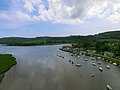 Devonport River - panoramio.jpg 3,648 × 2,736; 1.54 MB
-
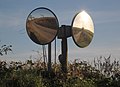 Dual traffic mirrors, South Bake - geograph.org.uk - 3774221.jpg 1,920 × 1,398; 359 KB
-
 Entrance to Bond Timber - geograph.org.uk - 3775362.jpg 1,920 × 1,329; 456 KB
-
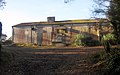 Farm building, The Granary - geograph.org.uk - 3769490.jpg 1,920 × 1,207; 429 KB
-
 Helicopters, Castle Air - geograph.org.uk - 4164394.jpg 1,920 × 1,281; 792 KB
-
 Kilna Cottage - geograph.org.uk - 5566768.jpg 640 × 425; 96 KB
-
 Lightning at Castle Air - geograph.org.uk - 4164293.jpg 1,920 × 1,440; 582 KB
-

-
 Lime Kiln - geograph.org.uk - 5018838.jpg 640 × 426; 72 KB
-
 Lime Kiln, St Germans Quay - geograph.org.uk - 5838123.jpg 1,024 × 681; 195 KB
-
 Lime kilns - geograph.org.uk - 5645396.jpg 640 × 426; 105 KB
-
 Old Boundary Marker - geograph.org.uk - 6051099.jpg 533 × 800; 274 KB
-

-
-
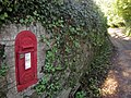 Postbox near Cutmere Bridge - geograph.org.uk - 3733218.jpg 1,920 × 1,440; 695 KB
-
 Ramsons - Allium Ursinum - geograph.org.uk - 168630.jpg 640 × 540; 113 KB
-
 St Germans , Grassy Field - geograph.org.uk - 5479950.jpg 4,608 × 3,456; 7.54 MB
-
 St Germans , Grassy Field - geograph.org.uk - 5479953.jpg 5,312 × 2,988; 3.09 MB
-
 St Germans station - geograph.org.uk - 6267456.jpg 640 × 480; 116 KB
-
 Stone coffin (empty^) - geograph.org.uk - 5706542.jpg 640 × 480; 74 KB
-
 Tollhouse by the A374, Trerulefoot - geograph.org.uk - 6076779.jpg 640 × 436; 116 KB
-
 Yard near Castle Air - geograph.org.uk - 4164286.jpg 1,915 × 1,363; 560 KB
-
 Yellow Digger by the A374 - geograph.org.uk - 5023486.jpg 640 × 517; 60 KB
-
 Yellow digger by the A374 - geograph.org.uk - 5645412.jpg 640 × 426; 60 KB


_-_geograph.org.uk_-_5706542.jpg)