Category:SVG maps of Florida
Jump to navigation
Jump to search
States of the United States: Alabama · Alaska · Arizona · Arkansas · California · Colorado · Connecticut · Delaware · Florida · Georgia · Hawaii · Idaho · Illinois · Indiana · Iowa · Kansas · Kentucky · Louisiana · Maine · Maryland · Massachusetts · Michigan · Minnesota · Mississippi · Missouri · Montana · Nebraska · Nevada · New Hampshire · New Jersey · New Mexico · New York · North Carolina · North Dakota · Ohio · Oklahoma · Oregon · Pennsylvania · Rhode Island · South Carolina · South Dakota · Tennessee · Texas · Utah · Vermont · Virginia · Washington · West Virginia · Wisconsin · Wyoming – Washington, D.C.
American Samoa · Guam · Northern Mariana Islands · Puerto Rico – Navassa Island · Palmyra Atoll
American Samoa · Guam · Northern Mariana Islands · Puerto Rico – Navassa Island · Palmyra Atoll
Subcategories
This category has only the following subcategory.
Media in category "SVG maps of Florida"
The following 44 files are in this category, out of 44 total.
-

-
 Chondrocera laticornis Distribution Map.svg 7,342 × 7,321; 371 KB
-
 Climate zones of florida.svg 612 × 792; 230 KB
-
 COVID-19 Cases in Florida by counties gradient map.svg 7,342 × 7,321; 372 KB
-
 COVID-19 Cases in Florida by counties.svg 7,342 × 7,321; 345 KB
-
 East and West Florida 1810-es.svg 731 × 505; 872 KB
-
 Epcot-karte.svg 744 × 1,052; 421 KB
-
 Epcot-map-1966-modern.svg 936 × 795; 26 KB
-
 FLMap-outline-green.svg 7,342 × 7,321; 560 KB
-
 Florida (1861) orthographic.svg 551 × 551; 2.3 MB
-
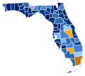
 Florida Counties by race (2020 census).svg 323 × 286; 28 KB
-
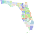
 Florida Counties with Names.svg 990 × 765; 260 KB
-
 Florida county map, cb 500k.svg 810 × 805; 44 KB
-
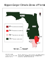
 Florida Köppen.svg 1,080 × 1,231; 766 KB
-
 Florida Panther Habitat.svg 990 × 765; 7.25 MB
-
 Florida racial and ethnic map.svg 323 × 287; 27 KB
-
-
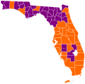
 Florida State Senate Districts (2017-present).svg 765 × 647; 387 KB
-
 Florida Timezones Map.svg 512 × 453; 39 KB
-
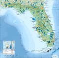
 Florida topographic map-en.svg 2,890 × 2,810; 2.51 MB
-
 Florida topographic map-fr.svg 2,890 × 2,810; 2.51 MB
-
 Florida topographic map-tr.svg 2,890 × 2,810; 2.5 MB
-
 Florida war 1837 - en.svg 1,153 × 1,500; 369 KB
-
 Florida war 1837 - ru.svg 1,153 × 1,500; 375 KB
-
 Forgotten Coast.svg 990 × 765; 259 KB
-
 LGBT flag map of Florida.svg 7,342 × 7,321; 229 KB
-
 Map of Florida counties numbered.svg 301 × 292; 123 KB
-
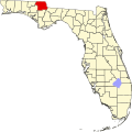 Map of Florida highlighting Jackson County.svg 7,342 × 7,321; 310 KB
-
 Map of Florida highlighting Marion County.svg 7,342 × 7,321; 310 KB
-
 Map of Florida highlighting Santa Rosa County.svg 7,342 × 7,321; 310 KB
-
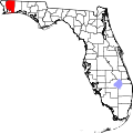
 Map-USA-Pensacola.svg 512 × 500; 774 KB
-
 Marion County Florida.svg 300 × 291; 223 KB
-
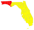
 North Florida Regions.svg 600 × 448; 94 KB
-
 Santa Rosa County Florida.svg 301 × 292; 112 KB
-
 Second Seminole War map-es.svg 800 × 1,115; 247 KB
-
 Second Seminole War map-fr.svg 800 × 1,115; 246 KB
-
 Spanish Florida Map 1803-es.svg 619 × 448; 837 KB
-
 Straits of Florida he.svg 4,220 × 2,429; 332 KB
-
 Tenth Judicial Circuit Court of Florida 1911.svg 301 × 292; 128 KB
-
 Tenth Judicial Circuit Court of Florida 1916.svg 301 × 292; 128 KB
-
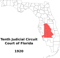 Tenth Judicial Circuit Court of Florida 1920.svg 301 × 292; 128 KB
-
 Tenth Judicial Circuit Court of Florida 1922-present.svg 301 × 292; 128 KB
-
 USA Florida location map without scale.svg 1,132 × 1,096; 574 KB
-
 USA Florida location map.svg 1,132 × 1,096; 578 KB


_orthographic.svg)
.svg)


.svg)


