Category:SVG labeled maps of administrative divisions (location map scheme) (german)
Jump to navigation
Jump to search


.svg)


_(Paris_zoom).svg)
.svg)
,_administrative_divisions_-_de_-_colored_(multizoom).svg)
_-_colored.svg)
.svg)
,_administrative_divisions_-_Nmbrs_(multizoom).svg)
,_administrative_divisions_-_de_-_colored.svg)
_-_de_-_colored.svg)

.svg)

.svg)
Subcategories
This category has the following 8 subcategories, out of 8 total.
A
E
N
O
Media in category "SVG labeled maps of administrative divisions (location map scheme) (german)"
The following 4 files are in this category, out of 4 total.
-
 World, administrative divisions - de - colored (all countries).svg 3,188 × 1,949; 5.82 MB
-
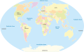 World, administrative divisions - de - colored.svg 3,188 × 1,958; 4.71 MB
-
 World, administrative divisions - de - monochrome (all countries).svg 3,188 × 1,949; 5.82 MB
-
 World, administrative divisions - de - monochrome.svg 3,188 × 1,957; 4.83 MB
.svg)
.svg)
