Category:SVG labeled maps of administrative divisions (location map scheme) (all)
Jump to navigation
Jump to search


.svg)


_(Paris_zoom).svg)
.svg)
,_administrative_divisions_-_de_-_colored_(multizoom).svg)
_-_colored.svg)
.svg)
,_administrative_divisions_-_Nmbrs_(multizoom).svg)
,_administrative_divisions_-_de_-_colored.svg)
_-_de_-_colored.svg)

.svg)

.svg)
Pages in category "SVG labeled maps of administrative divisions (location map scheme) (all)"
This category contains only the following page.
Media in category "SVG labeled maps of administrative divisions (location map scheme) (all)"
The following 200 files are in this category, out of 2,526 total.
(previous page) (next page)-
 Abai, administrative divisions - de - colored.svg 878 × 1,118; 243 KB
-
 Abkhazia (no secession), administrative divisions - de - colored.svg 3,058 × 2,552; 369 KB
-
 Abkhazia (no secession), administrative divisions - de.svg 3,058 × 2,552; 305 KB
-
 Abkhazia (no secession), administrative divisions - Nmbrs - colored.svg 3,058 × 2,552; 322 KB
-
 Abkhazia (no secession), administrative divisions - Nmbrs.svg 3,058 × 2,552; 259 KB
-
 Abkhazia (semi-secession), administrative divisions - de - colored.svg 3,058 × 2,552; 379 KB
-
 Abkhazia (semi-secession), administrative divisions - de.svg 3,058 × 2,552; 315 KB
-
 Abkhazia (semi-secession), administrative divisions - Nmbrs - colored.svg 3,058 × 2,552; 333 KB
-
 Abkhazia (semi-secession), administrative divisions - Nmbrs.svg 3,058 × 2,552; 268 KB
-
 Abkhazia, administrative divisions - de - colored.svg 3,058 × 2,552; 366 KB
-
 Abkhazia, administrative divisions - de.svg 3,058 × 2,552; 303 KB
-
 Abkhazia, administrative divisions - Nmbrs - colored.svg 3,058 × 2,552; 319 KB
-
 Abkhazia, administrative divisions - Nmbrs.svg 3,058 × 2,552; 257 KB
-
 Administrative divisions - Nmbrs - colored.svg 512 × 448; 506 KB
-
 Administrative divisions - Nmbrs.svg 512 × 448; 503 KB
-
 Afghanistan, administrative divisions - de - colored.svg 1,807 × 1,331; 605 KB
-
 Afghanistan, administrative divisions - de - monochrome.svg 1,807 × 1,331; 605 KB
-
 Afghanistan, administrative divisions - he - colored.svg 1,807 × 1,331; 531 KB
-
 Afghanistan, administrative divisions - Nmbrs - colored.svg 1,807 × 1,331; 605 KB
-
 Afghanistan, administrative divisions - Nmbrs - monochrome.svg 1,807 × 1,331; 606 KB
-
 Africa, administrative divisions - de - colored.svg 1,525 × 1,440; 1.21 MB
-
 Africa, administrative divisions - de - monochrome.svg 1,525 × 1,440; 1.19 MB
-
 Africa, administrative divisions - Nmbrs - colored.svg 1,525 × 1,440; 1.19 MB
-
 Africa, administrative divisions - Nmbrs - monochrome.svg 1,525 × 1,440; 1.19 MB
-
 Akmola, administrative divisions - de - colored.svg 896 × 572; 281 KB
-
 Aktobe, administrative divisions - de - colored.svg 889 × 770; 217 KB
-
 Albania, administrative divisions (counties+districts) - de - colored.svg 683 × 1,002; 527 KB
-
 Albania, administrative divisions (counties+districts) - de - monochrome.svg 683 × 1,002; 580 KB
-
 Albania, administrative divisions (counties+districts) - Nmbrs - colored.svg 683 × 1,002; 597 KB
-
 Albania, administrative divisions (counties+districts) - Nmbrs - monochrome.svg 683 × 1,002; 580 KB
-
 Albania, administrative divisions - de (districts) - colored.svg 688 × 1,002; 499 KB
-
 Albania, administrative divisions - de (districts).svg 688 × 1,002; 319 KB
-
 Albania, administrative divisions - de - colored.svg 688 × 1,002; 320 KB
-
 Albania, administrative divisions - de.svg 688 × 1,002; 270 KB
-
 Albania, administrative divisions - he - colored.svg 688 × 1,002; 265 KB
-
 Albania, administrative divisions - Nmbrs (districts) - colored.svg 688 × 1,002; 390 KB
-
 Albania, administrative divisions - Nmbrs (districts).svg 688 × 1,002; 344 KB
-
 Albania, administrative divisions - Nmbrs - colored.svg 688 × 1,002; 229 KB
-
 Albania, administrative divisions - Nmbrs.svg 685 × 1,002; 241 KB
-
 Algeria (northern), administrative divisions - de - colored.svg 638 × 228; 798 KB
-
 Algeria (northern), administrative divisions - de - monochrome.svg 638 × 228; 801 KB
-

-

-
 Algeria (northern), administrative divisions - Nmbrs - colored.svg 632 × 230; 884 KB
-
 Algeria (northern), administrative divisions - Nmbrs - monochrome.svg 632 × 230; 888 KB
-
 Algeria, administrative divisions - de - colored.svg 1,287 × 1,278; 884 KB
-
 Algeria, administrative divisions - de - monochrome.svg 1,287 × 1,278; 887 KB
-
 Algeria, administrative divisions - Nmbrs (geosort) - colored.svg 1,287 × 1,278; 889 KB
-
 Algeria, administrative divisions - Nmbrs (geosort) - monochrome.svg 1,287 × 1,278; 895 KB
-
 Algeria, administrative divisions - Nmbrs - colored.svg 1,287 × 1,278; 889 KB
-
 Algeria, administrative divisions - Nmbrs - monochrome.svg 1,287 × 1,278; 895 KB
-
 Algeria, administrative divisions 2019 - de - colored.svg 1,287 × 1,278; 987 KB
-
 Algeria, administrative divisions 2019 - Nmbrs (geosort) - colored.svg 1,287 × 1,278; 1,002 KB
-
 Algeria, administrative divisions 2019 - Nmbrs - colored.svg 1,287 × 1,278; 1,002 KB
-
 Almaty, administrative divisions - de - colored.svg 719 × 710; 257 KB
-
 Andorra, administrative divisions - de - colored.svg 1,161 × 1,019; 399 KB
-
 Andorra, administrative divisions - de.svg 1,161 × 1,019; 341 KB
-
 Andorra, administrative divisions - Nmbrs (geosort) - colored.svg 1,161 × 1,019; 354 KB
-
 Andorra, administrative divisions - Nmbrs (geosort).svg 1,161 × 1,019; 298 KB
-
 Andorra, administrative divisions - Nmbrs - colored.svg 1,161 × 1,019; 354 KB
-
 Andorra, administrative divisions - Nmbrs.svg 1,161 × 1,019; 298 KB
-
 Angola, administrative divisions - de - colored.svg 1,266 × 1,388; 612 KB
-
 Angola, administrative divisions - de - monochrome.svg 1,266 × 1,388; 612 KB
-
 Angola, administrative divisions - Nmbrs - colored.svg 1,266 × 1,388; 612 KB
-
 Angola, administrative divisions - Nmbrs - monochrome.svg 1,266 × 1,388; 613 KB
-
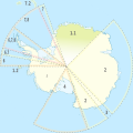
 Antarctica, administrative divisions - de - colored (explicit).svg 1,200 × 1,200; 787 KB
-
 Antarctica, administrative divisions - de - colored.svg 1,200 × 1,200; 743 KB
-
 Antarctica, administrative divisions - de - monochrome (explicit).svg 1,200 × 1,200; 800 KB
-
 Antarctica, administrative divisions - de - monochrome.svg 1,200 × 1,200; 741 KB
-
 Antarctica, administrative divisions - Nmbrs - colored.svg 1,200 × 1,200; 743 KB
-
 Antarctica, administrative divisions - Nmbrs - monochrome.svg 1,200 × 1,200; 742 KB
-
 Antarctica, administrative divisions - ru - colored (explicit).svg 1,200 × 1,200; 1.09 MB
-
 Antigua and Barbuda, administrative divisions - de - colored.svg 864 × 994; 346 KB
-
 Antigua and Barbuda, administrative divisions - de - monochrome.svg 864 × 994; 346 KB
-
 Antigua and Barbuda, administrative divisions - Nmbrs - colored.svg 864 × 994; 304 KB
-
 Antigua and Barbuda, administrative divisions - Nmbrs - monochrome.svg 864 × 994; 305 KB
-
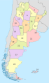
 Argentina (+Antarctica), administrative divisions - de - colored (-claims).svg 1,418 × 2,412; 2.26 MB
-
 Argentina (+Antartica), administrative divisions - de - colored (+claims).svg 1,418 × 2,412; 2.32 MB
-
 Argentina (+Antartica), administrative divisions - de - colored (claims hatched).svg 1,418 × 2,412; 2.35 MB
-
 Argentina (+Antartica), administrative divisions - de - monochrome (+claims).svg 1,418 × 2,412; 2.32 MB
-
 Argentina (+Antartica), administrative divisions - de - monochrome (-claims).svg 1,418 × 2,412; 2.27 MB
-
 Argentina (+Antartica), administrative divisions - de - monochrome (claims hatched).svg 1,418 × 2,412; 2.35 MB
-
 Argentina (+Antartica), administrative divisions - Nmbrs - colored (+claims).svg 1,418 × 2,412; 2.32 MB
-
 Argentina (+Antartica), administrative divisions - Nmbrs - colored (-claims).svg 1,418 × 2,412; 2.26 MB
-
 Argentina (+Antartica), administrative divisions - Nmbrs - colored (claims hatched).svg 1,418 × 2,412; 2.35 MB
-
 Argentina (+Antartica), administrative divisions - Nmbrs - monochrome (+claims).svg 1,418 × 2,412; 2.33 MB
-
 Argentina (+Antartica), administrative divisions - Nmbrs - monochrome (-claims).svg 1,418 × 2,412; 2.27 MB
-
 Argentina (+Antartica), administrative divisions - Nmbrs - monochrome (claims hatched).svg 1,418 × 2,412; 2.35 MB
-
 Argentina (+Antartica), administrative divisions - ru - colored (+claims).svg 1,418 × 2,412; 3.85 MB
-
 Argentina (full), administrative divisions - de - colored (+claims).svg 614 × 716; 3.81 MB
-
 Argentina (full), administrative divisions - de - colored (-claims).svg 614 × 716; 3.79 MB
-

-
 Argentina (full), administrative divisions - de - monochrome (+claims).svg 614 × 716; 3.81 MB
-
 Argentina (full), administrative divisions - de - monochrome (-claims).svg 614 × 716; 3.94 MB
-

-
 Argentina (full), administrative divisions - Nmbrs - colored (+claims).svg 614 × 716; 3.81 MB
-
 Argentina (full), administrative divisions - Nmbrs - colored (-claims).svg 614 × 716; 4.01 MB
-

-

-
-

-
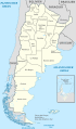
 Argentina, administrative divisions - de - colored (+claims).svg 1,418 × 2,412; 1.53 MB
-
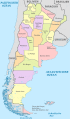
 Argentina, administrative divisions - de - colored (-claims).svg 1,418 × 2,412; 1.55 MB
-
 Argentina, administrative divisions - de - colored (claims hatched).svg 1,418 × 2,412; 1.5 MB
-
 Argentina, administrative divisions - de - monochrome (+claims).svg 1,418 × 2,412; 1.53 MB
-
 Argentina, administrative divisions - de - monochrome (-claims).svg 1,418 × 2,412; 1.55 MB
-
 Argentina, administrative divisions - de - monochrome (claims hatched).svg 1,418 × 2,412; 1.53 MB
-
 Argentina, administrative divisions - Nmbrs - colored (+claims).svg 1,418 × 2,412; 1.6 MB
-
 Argentina, administrative divisions - Nmbrs - colored (-claims).svg 1,418 × 2,412; 1.53 MB
-
 Argentina, administrative divisions - Nmbrs - colored (claims hatched).svg 1,418 × 2,412; 1.53 MB
-
 Argentina, administrative divisions - Nmbrs - monochrome (+claims).svg 1,418 × 2,412; 1.53 MB
-
 Argentina, administrative divisions - Nmbrs - monochrome (-claims).svg 1,418 × 2,412; 1.53 MB
-
 Argentina, administrative divisions - Nmbrs - monochrome (claims hatched).svg 1,418 × 2,412; 1.53 MB
-
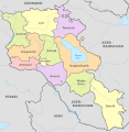 Armenia, administrative divisions - de - colored.svg 1,169 × 1,198; 249 KB
-
 Armenia, administrative divisions - de.svg 1,169 × 1,198; 281 KB
-
 Armenia, administrative divisions - mk - colored.svg 1,169 × 1,198; 198 KB
-
 Armenia, administrative divisions - mk.svg 1,169 × 1,198; 229 KB
-
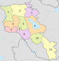 Armenia, administrative divisions - Nmbrs - colored.svg 1,169 × 1,198; 283 KB
-
 Armenia, administrative divisions - Nmbrs.svg 1,169 × 1,198; 225 KB
-
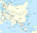
 Asia, administrative divisions - de - colored.svg 1,181 × 1,050; 7.46 MB
-
 Asia, administrative divisions - de - monochrome.svg 1,181 × 1,050; 7.1 MB
-
 Asia, administrative divisions - Nmbrs - colored.svg 1,181 × 1,050; 7.46 MB
-
 Asia, administrative divisions - Nmbrs - monochrome.svg 1,181 × 1,050; 7.1 MB
-
 Atyrau, administrative divisions - de - colored.svg 996 × 541; 155 KB
-
 Australia (+overseas +Antarctica), administrative divisions - de - colored (marker).svg 2,370 × 2,331; 4.5 MB
-
 Australia (+overseas +Antarctica), administrative divisions - de - colored (zoom).svg 2,370 × 2,331; 5.3 MB
-
 Australia (+overseas +Antarctica), administrative divisions - de - colored.svg 2,370 × 2,331; 4.59 MB
-

-
 Australia (+overseas +Antarctica), administrative divisions - de - monochrome (zoom).svg 2,370 × 2,331; 5.24 MB
-
 Australia (+overseas +Antarctica), administrative divisions - de - monochrome.svg 2,370 × 2,331; 4.59 MB
-
 Australia (+overseas +Antarctica), administrative divisions - Nmbrs - colored (marker).svg 2,370 × 2,331; 4.28 MB
-
 Australia (+overseas +Antarctica), administrative divisions - Nmbrs - colored (zoom).svg 2,370 × 2,331; 5.3 MB
-
 Australia (+overseas +Antarctica), administrative divisions - Nmbrs - colored.svg 2,370 × 2,331; 4.59 MB
-

-
 Australia (+overseas +Antarctica), administrative divisions - Nmbrs - monochrome (zoom).svg 2,370 × 2,331; 5.24 MB
-
 Australia (+overseas +Antarctica), administrative divisions - Nmbrs - monochrome.svg 2,370 × 2,331; 4.59 MB
-
 Australia (+overseas -Antarctica), administrative divisions - de - colored (marker).svg 2,104 × 1,439; 4.59 MB
-
 Australia (+overseas -Antarctica), administrative divisions - de - colored (zoom).svg 2,116 × 1,546; 5.3 MB
-
 Australia (+overseas -Antarctica), administrative divisions - de - colored.svg 2,104 × 1,440; 4.58 MB
-

-
 Australia (+overseas -Antarctica), administrative divisions - de - monochrome (zoom).svg 2,116 × 1,546; 5.3 MB
-
 Australia (+overseas -Antarctica), administrative divisions - de - monochrome.svg 2,104 × 1,440; 4.59 MB
-
 Australia (+overseas -Antarctica), administrative divisions - Nmbrs - colored (marker).svg 2,104 × 1,439; 4.52 MB
-
 Australia (+overseas -Antarctica), administrative divisions - Nmbrs - colored (zoom).svg 2,116 × 1,546; 5.3 MB
-
 Australia (+overseas -Antarctica), administrative divisions - Nmbrs - colored.svg 2,104 × 1,440; 4.58 MB
-

-

-
 Australia (+overseas -Antarctica), administrative divisions - Nmbrs - monochrome.svg 2,104 × 1,440; 4.59 MB
-
 Australia, administrative divisions - de - colored.svg 2,055 × 1,846; 685 KB
-
 Australia, administrative divisions - de - monochrome.svg 2,055 × 1,846; 688 KB
-
 Australia, administrative divisions - Nmbrs - colored.svg 2,055 × 1,846; 668 KB
-
 Australia, administrative divisions - Nmbrs - monochrome.svg 2,055 × 1,846; 671 KB
-
 Austria, administrative divisions - de - colored.svg 1,256 × 700; 653 KB
-
 Austria, administrative divisions - de.svg 1,256 × 700; 653 KB
-
 Austria, administrative divisions - en - colored.svg 1,256 × 700; 648 KB
-
 Austria, administrative divisions - en.svg 1,256 × 700; 648 KB
-
 Austria, administrative divisions - Nmbrs - colored.svg 1,256 × 700; 453 KB
-
 Austria, administrative divisions - Nmbrs.svg 1,256 × 700; 453 KB
-
 Azerbaijan (semi-secession), administrative divisions - de - colored.svg 1,200 × 919; 582 KB
-
 Azerbaijan (semi-secession), administrative divisions - de.svg 1,200 × 919; 512 KB
-
 Azerbaijan (semi-secession), administrative divisions - Nmbrs - colored.svg 1,200 × 919; 354 KB
-
 Azerbaijan (semi-secession), administrative divisions - Nmbrs.svg 1,200 × 919; 282 KB
-
 Azerbaijan, administrative divisions - de - colored.svg 1,200 × 919; 537 KB
-
 Azerbaijan, administrative divisions - de.svg 1,200 × 919; 477 KB
-
 Azerbaijan, administrative divisions - Nmbrs - colored.svg 1,200 × 919; 340 KB
-
 Azerbaijan, administrative divisions - Nmbrs.svg 1,200 × 919; 257 KB
-
 Azerbaijan, administrative divisions 2024 - de - colored.svg 1,200 × 919; 712 KB
-
 Azerbaijan, administrative divisions.svg 1,200 × 919; 185 KB
-
 Baden-Württemberg, administrative divisions (districts only) - de - colors.svg 1,075 × 1,215; 982 KB
-
 Baden-Württemberg, administrative divisions (districts only) - de - monochrome.svg 1,075 × 1,215; 986 KB
-
 Baden-Württemberg, administrative divisions (districts only) - Nmbrs (geosort) - colors.svg 1,075 × 1,215; 1.03 MB
-

-
 Baden-Württemberg, administrative divisions (districts only) - Nmbrs - colors.svg 1,075 × 1,215; 982 KB
-
 Baden-Württemberg, administrative divisions (districts only) - Nmbrs - monochrome.svg 1,075 × 1,215; 986 KB
-

-

-

-

-

-

-
 Baden-Württemberg, administrative divisions (government districts only) - de - colors.svg 1,075 × 1,215; 1,006 KB
-

-
 Baden-Württemberg, administrative divisions (government districts only) - Nmbrs - colors.svg 1,075 × 1,215; 1,005 KB
-
-
 Baden-Württemberg, administrative divisions - de - colored (less colors).svg 1,075 × 1,215; 995 KB
-
 Baden-Württemberg, administrative divisions - de - colored.svg 1,075 × 1,215; 999 KB
-
 Baden-Württemberg, administrative divisions - de - monochrome.svg 1,075 × 1,215; 985 KB
-
 Baden-Württemberg, administrative divisions - Nmbrs - colored (less colors).svg 1,075 × 1,215; 995 KB
-
 Baden-Württemberg, administrative divisions - Nmbrs - colored.svg 1,075 × 1,215; 1,007 KB
-
 Baden-Württemberg, administrative divisions - Nmbrs - monochrome.svg 1,075 × 1,215; 985 KB
-
 Bahamas, administrative divisions - de - colored.svg 1,559 × 1,124; 1.1 MB
-
 Bahamas, administrative divisions - de - monochrome.svg 1,559 × 1,124; 1.11 MB
-
 Bahamas, administrative divisions - Nmbrs - colored.svg 1,559 × 1,124; 1.1 MB
-
 Bahamas, administrative divisions - Nmbrs - monochrome.svg 1,559 × 1,124; 1.11 MB
-
 Bahrain, administrative divisions - de - colored.svg 1,246 × 1,607; 452 KB
-
 Bahrain, administrative divisions - de - monochrome.svg 1,246 × 1,607; 453 KB
-
 Bahrain, administrative divisions - Nmbrs - colored.svg 1,246 × 1,607; 452 KB
-
 Bahrain, administrative divisions - Nmbrs - monochrome.svg 1,246 × 1,607; 453 KB
-
 Bahrain, administrative divisions 2014 - de - colored.svg 1,246 × 1,808; 542 KB
-
 Bangladesh, administrative divisions - de - colored.svg 1,205 × 1,637; 785 KB

,_administrative_divisions_-_de_-_colored.svg)
,_administrative_divisions_-_de.svg)
,_administrative_divisions_-_Nmbrs_-_colored.svg)
,_administrative_divisions_-_Nmbrs.svg)
,_administrative_divisions_-_de_-_colored.svg)
,_administrative_divisions_-_de.svg)
,_administrative_divisions_-_Nmbrs_-_colored.svg)
,_administrative_divisions_-_Nmbrs.svg)


_-_de_-_colored.svg)
_-_de_-_monochrome.svg)
_-_Nmbrs_-_colored.svg)
_-_Nmbrs_-_monochrome.svg)
_-_colored.svg)
.svg)


_-_colored.svg)
.svg)


_-_colored.svg)
_-_monochrome.svg)


_-_colored.svg)


_-_colored.svg)
.svg)


.svg)


.svg)


,_administrative_divisions_-_de_-_colored_(-claims).svg)
,_administrative_divisions_-_de_-_colored_(%2Bclaims).svg)
,_administrative_divisions_-_de_-_colored_(claims_hatched).svg)
,_administrative_divisions_-_de_-_monochrome_(%2Bclaims).svg)
,_administrative_divisions_-_de_-_monochrome_(-claims).svg)
,_administrative_divisions_-_de_-_monochrome_(claims_hatched).svg)
,_administrative_divisions_-_Nmbrs_-_colored_(%2Bclaims).svg)
,_administrative_divisions_-_Nmbrs_-_colored_(-claims).svg)
,_administrative_divisions_-_Nmbrs_-_colored_(claims_hatched).svg)
,_administrative_divisions_-_Nmbrs_-_monochrome_(%2Bclaims).svg)
,_administrative_divisions_-_Nmbrs_-_monochrome_(-claims).svg)
,_administrative_divisions_-_Nmbrs_-_monochrome_(claims_hatched).svg)
,_administrative_divisions_-_ru_-_colored_(%2Bclaims).svg)
,_administrative_divisions_-_de_-_colored_(%2Bclaims).svg)
,_administrative_divisions_-_de_-_colored_(-claims).svg)
,_administrative_divisions_-_de_-_colored_(claims_hatched).svg)
,_administrative_divisions_-_de_-_monochrome_(%2Bclaims).svg)
,_administrative_divisions_-_de_-_monochrome_(-claims).svg)
,_administrative_divisions_-_de_-_monochrome_(claims_hatched).svg)
,_administrative_divisions_-_Nmbrs_-_colored_(%2Bclaims).svg)
,_administrative_divisions_-_Nmbrs_-_colored_(-claims).svg)
,_administrative_divisions_-_Nmbrs_-_colored_(claims_hatched).svg)
,_administrative_divisions_-_Nmbrs_-_monochrome_(%2Bclaims).svg)
,_administrative_divisions_-_Nmbrs_-_monochrome_(-claims).svg)
,_administrative_divisions_-_Nmbrs_-_monochrome_(claims_hatched).svg)
.svg)
.svg)
.svg)
.svg)
.svg)
.svg)
.svg)
.svg)
.svg)
.svg)
.svg)
.svg)


,_administrative_divisions_-_de_-_colored_(marker).svg)
,_administrative_divisions_-_de_-_colored_(zoom).svg)
,_administrative_divisions_-_de_-_colored.svg)
,_administrative_divisions_-_de_-_monochrome_(marker).svg)
,_administrative_divisions_-_de_-_monochrome_(zoom).svg)
,_administrative_divisions_-_de_-_monochrome.svg)
,_administrative_divisions_-_Nmbrs_-_colored_(marker).svg)
,_administrative_divisions_-_Nmbrs_-_colored_(zoom).svg)
,_administrative_divisions_-_Nmbrs_-_colored.svg)
,_administrative_divisions_-_Nmbrs_-_monochrome_(marker).svg)
,_administrative_divisions_-_Nmbrs_-_monochrome_(zoom).svg)
,_administrative_divisions_-_Nmbrs_-_monochrome.svg)


,_administrative_divisions_-_de_-_colored.svg)
,_administrative_divisions_-_de.svg)
,_administrative_divisions_-_Nmbrs_-_colored.svg)
,_administrative_divisions_-_Nmbrs.svg)


_-_de_-_colors.svg)
_-_de_-_monochrome.svg)
_-_Nmbrs_(geosort)_-_colors.svg)
_-_Nmbrs_(geosort)_-_monochrome.svg)
_-_Nmbrs_-_colors.svg)
_-_Nmbrs_-_monochrome.svg)
_-_de_-_colors_(more_colors).svg)
_-_de_-_colors.svg)
_-_de_-_monochrome.svg)
_-_Nmbrs_-_colors_(more_colors).svg)
_-_Nmbrs_-_colors.svg)
_-_Nmbrs_-_monochrome.svg)
_-_de_-_colors.svg)
_-_de_-_monochrome.svg)
_-_Nmbrs_-_colors.svg)
_-_Nmbrs_-_monochrome.svg)
.svg)


.svg)


_(all)&filefrom=Bangladesh%2C+administrative+divisions+-+de+-+monochrome.svg#mw-category-media)
,_administrative_divisions_-_de_-_colored.svg)
,_administrative_divisions_-_de_-_monochrome.svg)
,_administrative_divisions_-_Nmbrs_(geosort)_-_colored.svg)
,_administrative_divisions_-_Nmbrs_(geosort)_-_monochrome.svg)
,_administrative_divisions_-_Nmbrs_-_colored.svg)
,_administrative_divisions_-_Nmbrs_-_monochrome.svg)