Category:Public footpaths in the London Borough of Richmond upon Thames
Jump to navigation
Jump to search

Subcategories
This category has the following 2 subcategories, out of 2 total.
A
F
Media in category "Public footpaths in the London Borough of Richmond upon Thames"
The following 200 files are in this category, out of 539 total.
(previous page) (next page)-

-
 'Thames Path' National Trail - geograph.org.uk - 3453530.jpg 640 × 480; 151 KB
-
 A busy path in Richmond Park - geograph.org.uk - 1273578.jpg 640 × 480; 77 KB
-
 A collection of signs near the Thames Path - geograph.org.uk - 2163893.jpg 3,391 × 2,391; 3.93 MB
-
 A leafy Thames Path - geograph.org.uk - 2110945.jpg 640 × 430; 175 KB
-
 A no cycling path in Richmond Park - geograph.org.uk - 2415561.jpg 3,872 × 2,592; 3.68 MB
-
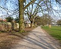
 A path across Lawn Field, in January - geograph.org.uk - 4809820.jpg 1,024 × 765; 186 KB
-
 A very wet Thames Path - geograph.org.uk - 2142466.jpg 640 × 430; 126 KB
-
 A way to the river (1) - geograph.org.uk - 5266987.jpg 4,320 × 3,240; 3.88 MB
-

-
 All weather path in Richmond Park - geograph.org.uk - 1110240.jpg 640 × 480; 111 KB
-
-
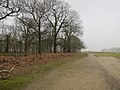
 Along the Pen Pond causeway in February - geograph.org.uk - 4830031.jpg 1,024 × 768; 165 KB
-
 Along the Pen Ponds causeway, October 2018 - geograph.org.uk - 5959671.jpg 1,024 × 768; 287 KB
-
 An avenue of lime trees, Kew Green - geograph.org.uk - 2283923.jpg 768 × 1,024; 305 KB
-
 Approaching Barnes station from Barnes Common - geograph.org.uk - 2391148.jpg 1,280 × 960; 620 KB
-

-
 Approaching the Banqueting House, Hampton Court - geograph.org.uk - 5171000.jpg 3,072 × 2,048; 1.38 MB
-
 Approaching the Shot Tower in Crane Park - geograph.org.uk - 2871945.jpg 4,000 × 3,000; 4.06 MB
-
 Autumn in Bushy Park, 1 - geograph.org.uk - 5199602.jpg 1,600 × 901; 743 KB
-
 Autumn in Bushy Park, 2 - geograph.org.uk - 5202279.jpg 1,600 × 901; 769 KB
-
 Autumn in London (4030333674).jpg 3,168 × 4,752; 7.89 MB
-
 Avenue of hornbeams - geograph.org.uk - 5427433.jpg 1,125 × 1,500; 357 KB
-

-
 Avenue of trees, Bushy Park - geograph.org.uk - 5840879.jpg 640 × 480; 134 KB
-
 Avenue through Winter Garden - geograph.org.uk - 3018307.jpg 1,500 × 2,000; 291 KB
-
 Avenue, Ham riverside, early November - geograph.org.uk - 5186916.jpg 1,024 × 768; 341 KB
-
 Barge Walk - geograph.org.uk - 2655904.jpg 480 × 640; 65 KB
-
 Barge Walk - Thames Path - geograph.org.uk - 5169339.jpg 3,072 × 2,048; 1.45 MB
-
 Barge Walk - Thames Path - geograph.org.uk - 5169345.jpg 3,072 × 2,048; 1.49 MB
-
 Barge Walk - Thames Path - geograph.org.uk - 5169943.jpg 3,072 × 2,048; 1.9 MB
-
 Barge Walk by Privy Garden - geograph.org.uk - 5170592.jpg 3,072 × 2,048; 1.11 MB
-
 Barge Walk, Hampton Court Park - geograph.org.uk - 2655844.jpg 640 × 480; 128 KB
-
 Barge Walk-Thames Path - geograph.org.uk - 2656186.jpg 640 × 480; 103 KB
-
 Barnes Common (3) - geograph.org.uk - 2880885.jpg 480 × 640; 299 KB
-
 Barnes Common - geograph.org.uk - 2391153.jpg 1,280 × 960; 645 KB
-
 Barrier across the Thames Path - geograph.org.uk - 2144706.jpg 640 × 430; 129 KB
-
 Barrier on the Thames Path - geograph.org.uk - 2142471.jpg 640 × 430; 113 KB
-
 Bench by The Thames Path - geograph.org.uk - 2121581.jpg 640 × 430; 192 KB
-
 Bend in the Thames Path - geograph.org.uk - 2121602.jpg 640 × 430; 182 KB
-
 Boathouses at Richmond - geograph.org.uk - 2137098.jpg 640 × 480; 77 KB
-

-
 Boathouses, Richmond - geograph.org.uk - 2123039.jpg 640 × 394; 79 KB
-
 Boathouses, Richmond - geograph.org.uk - 2123132.jpg 640 × 430; 127 KB
-
 Bridleway in Richmond Park - geograph.org.uk - 5426057.jpg 2,304 × 1,728; 810 KB
-
 Bushy Park (3018397847).jpg 2,816 × 1,584; 2.08 MB
-
 Bushy Park (3018457177).jpg 2,816 × 1,584; 3.17 MB
-
 Bushy Park (3018486779).jpg 2,816 × 2,112; 3.96 MB
-
 Bushy Park (3019320034).jpg 2,816 × 2,112; 3.38 MB
-
 Bushy Park (3019322552).jpg 2,816 × 1,584; 3.04 MB
-
 Bushy Park (3019324806).jpg 2,816 × 1,584; 2.74 MB
-
 Bushy Park - Cobbler's Walk - geograph.org.uk - 4959820.jpg 2,048 × 1,142; 1.09 MB
-

-
 Bushy Park - Footpath from High Street Hampton Hill - geograph.org.uk - 4959795.jpg 4,608 × 3,456; 6.62 MB
-
 Bushy Park - geograph.org.uk - 151493.jpg 640 × 480; 85 KB
-
 Bushy Park - geograph.org.uk - 4959800.jpg 4,608 × 3,456; 6.66 MB
-
 Bushy Park - Public Footpath - geograph.org.uk - 4959798.jpg 4,608 × 3,456; 6.03 MB
-
 Bushy Park, way out to Cricket Lane - geograph.org.uk - 4124202.jpg 640 × 480; 138 KB
-
 Capital Ring between Pen Ponds - geograph.org.uk - 2581426.jpg 640 × 430; 95 KB
-
 Capital Ring in Richmond Park - geograph.org.uk - 4106204.jpg 640 × 480; 119 KB
-
 Capital Ring path at Pen Ponds, Richmond Park - geograph.org.uk - 5283521.jpg 1,600 × 1,200; 566 KB
-
 Capital Ring path towards Spankers Hill Wood - geograph.org.uk - 5283510.jpg 1,600 × 1,200; 434 KB
-
 Capital Ring to Pen Ponds - geograph.org.uk - 2588479.jpg 640 × 430; 48 KB
-
 Cherry Walk - geograph.org.uk - 6144380.jpg 1,024 × 683; 578 KB
-
 Church Walk, Hampton Wick - geograph.org.uk - 5693306.jpg 1,024 × 576; 246 KB
-
 Climb into Richmond - geograph.org.uk - 3453597.jpg 640 × 480; 109 KB
-
 Cottages by the Thames at Kew - geograph.org.uk - 2318389.jpg 1,024 × 768; 303 KB
-
 Crane Park - geograph.org.uk - 2872202.jpg 4,000 × 3,000; 4.37 MB
-
 Crane Park at dusk, January - geograph.org.uk - 2768704.jpg 750 × 1,000; 1.23 MB
-
 Crane Park at sunset, January - geograph.org.uk - 2768483.jpg 1,024 × 768; 304 KB
-
 Crane Park Island – near the entrance - geograph.org.uk - 4789498.jpg 4,608 × 3,456; 5.29 MB
-
 Cycle route through Richmond Park - geograph.org.uk - 5038442.jpg 640 × 480; 62 KB
-
 Cycle route through Richmond Park - geograph.org.uk - 5038462.jpg 640 × 480; 80 KB
-
 Cycle route through Richmond Park - geograph.org.uk - 5038473.jpg 640 × 480; 62 KB
-
 East Sheen common - geograph.org.uk - 2267132.jpg 1,600 × 1,200; 583 KB
-
 East Sheen Common - geograph.org.uk - 4110631.jpg 640 × 480; 138 KB
-
 East Sheen Common - geograph.org.uk - 4110635.jpg 640 × 480; 133 KB
-

-
 Flood wall by the Thames Path, Barnes - geograph.org.uk - 2112910.jpg 640 × 430; 158 KB
-
 Footpath across Ham Common - geograph.org.uk - 2547313.jpg 3,000 × 4,000; 4.31 MB
-
 Footpath across Petersham Common - geograph.org.uk - 2600192.jpg 640 × 430; 62 KB
-
 Footpath at Teddington Lock - geograph.org.uk - 376550.jpg 640 × 428; 110 KB
-
 Footpath by Sawyer's Hill Road - geograph.org.uk - 879603.jpg 640 × 480; 87 KB
-
 Footpath by Spankers Hill Wood - geograph.org.uk - 879631.jpg 640 × 480; 71 KB
-
 Footpath heading to the Cambrian Gate - geograph.org.uk - 879580.jpg 640 × 480; 97 KB
-
 Footpath in Richmond Park - geograph.org.uk - 2026172.jpg 3,872 × 2,592; 4.72 MB
-
 Footpath in Richmond Park - geograph.org.uk - 2026180.jpg 3,872 × 2,592; 5.38 MB
-
 Footpath in Richmond Park - geograph.org.uk - 3304335.jpg 4,288 × 3,216; 5.25 MB
-
 Footpath in Richmond Park - geograph.org.uk - 507369.jpg 640 × 480; 154 KB
-
 Footpath in Richmond, Surrey - UK.jpg 3,264 × 2,448; 3.61 MB
-
 Footpath on Barnes Common - geograph.org.uk - 3287605.jpg 4,288 × 3,216; 7.34 MB
-
 Footpath on Barnes Common - geograph.org.uk - 3287610.jpg 4,288 × 3,216; 6.58 MB
-
 Footpath on Barnes Common - geograph.org.uk - 3804113.jpg 640 × 482; 109 KB
-
 Footpath on Ham Common, Surrey - geograph.org.uk - 2042113.jpg 3,872 × 2,592; 5.88 MB
-
 Footpath on Priory Road, Hampton - geograph.org.uk - 2662897.jpg 1,600 × 1,200; 548 KB
-
 Footpath signpost south of Richmond - geograph.org.uk - 2600194.jpg 640 × 430; 133 KB
-
 Footpath to Spankers Hill Wood - geograph.org.uk - 3302987.jpg 4,288 × 3,216; 6.34 MB
-
 Footpath towards Beverley Bridge, Richmond Park - geograph.org.uk - 3302828.jpg 4,288 × 3,216; 4.94 MB
-
 Footpath, Richmond - geograph.org.uk - 2479221.jpg 640 × 468; 114 KB
-
 Footpath, Richmond - geograph.org.uk - 2479224.jpg 640 × 480; 119 KB
-
 Formal area in The Wilderness - geograph.org.uk - 3073678.jpg 640 × 480; 138 KB
-
 Formal Gardens and Fountain, Hampton Court - geograph.org.uk - 4661556.jpg 4,000 × 3,000; 4.63 MB
-
 Fountain Garden View of Palace.jpg 3,032 × 4,548; 2.55 MB
-
 Gorse on Barnes Common - geograph.org.uk - 2391150.jpg 1,280 × 960; 645 KB
-
 Ham Cross - geograph.org.uk - 1921692.jpg 640 × 466; 73 KB
-
 Ham House as view from the east - geograph.org.uk - 3358659.jpg 640 × 480; 125 KB
-
 Hampton Court 03.jpg 3,263 × 1,633; 797 KB
-
 Hampton Court Green - geograph.org.uk - 3281046.jpg 800 × 503; 63 KB
-
 Hampton Court on a quieter day - geograph.org.uk - 6022731.jpg 1,224 × 1,632; 654 KB
-
 Hampton Court Palace (3026627097).jpg 2,816 × 1,584; 3.19 MB
-
 Hampton Court Palace (3027469586).jpg 2,816 × 1,584; 2.36 MB
-
 Hampton Court Palace (3036991321).jpg 2,816 × 1,584; 2.88 MB
-
 Hampton Court Palace (3037804262).jpg 2,112 × 2,816; 4.22 MB
-
 Hampton Court Palace (3037829548).jpg 2,816 × 2,112; 3.11 MB
-
 Hampton Court Palace - east facade - geograph.org.uk - 2656613.jpg 640 × 480; 76 KB
-
 Hampton Court Palace - geograph.org.uk - 2376376.jpg 1,024 × 588; 223 KB
-
 Hampton Court Palace - geograph.org.uk - 3465435.jpg 1,600 × 1,200; 523 KB
-
 Hampton Court Palace - geograph.org.uk - 5627470.jpg 640 × 426; 65 KB
-
 Hampton Court Palace from the Privy Garden.jpg 3,698 × 2,218; 2.92 MB
-
 Hampton Court Palace Gardens (255681420).jpg 1,600 × 1,200; 354 KB
-
 Hampton Court Palace gardens - geograph.org.uk - 2951917.jpg 640 × 480; 62 KB
-
 Hampton Court Palace gardens - geograph.org.uk - 2951922.jpg 639 × 448; 93 KB
-
 Heading off into Richmond Park - geograph.org.uk - 2362060.jpg 1,280 × 960; 616 KB
-
 High tide mark on towpath at Richmond - geograph.org.uk - 1086392.jpg 480 × 640; 101 KB
-
 Hornbeam Walk in Richmond Park - geograph.org.uk - 5293804.jpg 1,500 × 1,125; 354 KB
-
 Hornbeam Walk in Richmond Park - geograph.org.uk - 5293816.jpg 1,125 × 1,500; 232 KB
-
 In Richmond Park - geograph.org.uk - 4074411.jpg 1,600 × 1,200; 270 KB
-
 In the Isabella Plantation - geograph.org.uk - 2435476.jpg 1,280 × 960; 643 KB
-
 In the Isabella Plantation, Richmond Park - geograph.org.uk - 2402658.jpg 1,280 × 960; 638 KB
-
 Isabella plantation, Richmond Park - geograph.org.uk - 2279182.jpg 1,600 × 1,200; 616 KB
-
 Kew Arboretum.jpg 2,304 × 3,072; 492 KB
-
 Kew Gardens - geograph.org.uk - 4137374.jpg 4,000 × 2,666; 7.6 MB
-
 Kew Gardens - London - September 2008 (2958671501).jpg 2,816 × 1,584; 2.32 MB
-
 Kew Gardens - London - September 2008 (2959607898).jpg 2,816 × 1,584; 2.44 MB
-
 Kew Gardens - London - September 2008 (2959611294).jpg 2,816 × 1,584; 2.88 MB
-
 Kew Gardens 0299.JPG 2,048 × 1,536; 1.39 MB
-
 Kew Gardens 0503.JPG 2,048 × 1,536; 2.48 MB
-
 Kew Gardens 0506.JPG 2,048 × 1,536; 2.46 MB
-
 Kew Gardens 0508.JPG 1,536 × 2,048; 2.34 MB
-
 Kew Gardens 0511.JPG 2,048 × 1,536; 2.52 MB
-
 Kew Gardens Broad Walk with daffodils - geograph.org.uk - 362308.jpg 640 × 480; 84 KB
-
 Kew Gardens in springtime, Broad Walk - geograph.org.uk - 4181817.jpg 2,348 × 1,350; 4.11 MB
-
 Kew Gardens P1170546.JPG 4,000 × 3,000; 4.51 MB
-
 Kew Gardens, London - geograph.org.uk - 2492704.jpg 1,024 × 683; 266 KB
-
 Kew Gardens, London, near Main Entrance - geograph.org.uk - 2493715.jpg 1,024 × 683; 359 KB
-
 Kew Green - geograph.org.uk - 3592823.jpg 1,600 × 1,200; 565 KB
-
 Kew Palm House - geograph.org.uk - 3847627.jpg 640 × 478; 107 KB
-
 King Henry's Mound on Richmond Park - geograph.org.uk - 3954253.jpg 1,728 × 2,304; 762 KB
-
 Kitchen Garden, Ham House - geograph.org.uk - 2998254.jpg 1,024 × 680; 316 KB
-
 London - April 2009 (3497401284).jpg 1,584 × 2,816; 3.39 MB
-
 London - Kew Gardens - View East towards Pavilion Restaurant.jpg 3,024 × 2,016; 4.1 MB
-

-
 London Loop in Crane Park - geograph.org.uk - 2692777.jpg 1,600 × 1,328; 1.04 MB
-
 Looking down the Thames from Richmond - geograph.org.uk - 615560.jpg 640 × 520; 77 KB
-
 Marble Hill Park - geograph.org.uk - 4852757.jpg 993 × 745; 116 KB
-
 Mortlake Cemetery (3) - geograph.org.uk - 5269776.jpg 4,320 × 3,240; 3.66 MB
-
 Mortlake Green - geograph.org.uk - 2263972.jpg 4,320 × 3,240; 4.36 MB
-
 Mortlake Green - geograph.org.uk - 3826409.jpg 2,304 × 1,728; 811 KB
-
 Muddy path on Ham Common - geograph.org.uk - 4240192.jpg 2,304 × 1,728; 833 KB
-
 Muddy Thameside path - geograph.org.uk - 3804133.jpg 640 × 482; 135 KB
-
 New decking by Peg's Pond - geograph.org.uk - 4870304.jpg 1,600 × 1,200; 696 KB
-
 No access to the Temperate House, Kew Gardens - geograph.org.uk - 4852652.jpg 1,024 × 768; 161 KB
-
 North Sheen Cemetery (2) - geograph.org.uk - 5269773.jpg 4,320 × 3,240; 3.77 MB
-
 Old and new path - geograph.org.uk - 148811.jpg 640 × 480; 152 KB
-
 Old boathouses by Richmond Bridge - geograph.org.uk - 3526493.jpg 1,024 × 768; 193 KB
-
 Old Deer Park - geograph.org.uk - 5367545.jpg 1,280 × 851; 491 KB
-
 Old Deer Park - geograph.org.uk - 5367585.jpg 1,280 × 851; 361 KB
-
 On Barnes Common - geograph.org.uk - 6131528.jpg 4,000 × 3,000; 4.87 MB
-
 On the Beat, Thames Tow Path, Kew, London - geograph.org.uk - 2492697.jpg 1,024 × 683; 471 KB
-
 Park wall, Hampton Court - geograph.org.uk - 5035151.jpg 2,000 × 1,333; 2.99 MB
-
 Parkland, Kew Gardens - geograph.org.uk - 5426425.jpg 640 × 426; 70 KB
-
 Path across Lawn Field - geograph.org.uk - 4158665.jpg 1,024 × 768; 115 KB
-
 Path across Pond Slade - geograph.org.uk - 4923886.jpg 1,024 × 768; 163 KB
-
 Path along the edge of Bushy Park - geograph.org.uk - 3886123.jpg 3,632 × 2,907; 2 MB
-
 Path alongside Pen Pond Plantation - geograph.org.uk - 4351888.jpg 1,024 × 768; 189 KB
-
 Path and bench - geograph.org.uk - 3084618.jpg 640 × 427; 185 KB
-

-
 Path around edge of Richmond Park - geograph.org.uk - 4870280.jpg 1,600 × 1,200; 925 KB
-
 Path around Pond Plantation - geograph.org.uk - 4870353.jpg 1,600 × 1,200; 547 KB
-
 Path around Sidmouth Wood - geograph.org.uk - 4870397.jpg 1,600 × 1,200; 806 KB
-
 Path around the lake - geograph.org.uk - 6145162.jpg 1,024 × 683; 551 KB
-
 Path at Ham Bottom - geograph.org.uk - 2874512.jpg 1,600 × 1,200; 446 KB
-
 Path at Ham Bottom - geograph.org.uk - 3003770.jpg 680 × 1,024; 201 KB
-
 Path at the London Wetland Centre - geograph.org.uk - 5213621.jpg 4,000 × 3,000; 4.86 MB
-
 Path beside Rocks Lane - geograph.org.uk - 3417020.jpg 4,288 × 3,216; 6.78 MB
-

-
 Path between the trees, Ham Lands - geograph.org.uk - 3595946.jpg 1,600 × 1,200; 604 KB
-

-
 Path by River Crane - geograph.org.uk - 4120011.jpg 640 × 480; 129 KB
-
 Path by Southern End of Barnes Common (01).jpg 4,463 × 3,310; 18.34 MB
-
 Path by Southern End of Barnes Common (02).jpg 4,592 × 3,448; 18.92 MB
-
 Path from Bartons Cottage - geograph.org.uk - 5840757.jpg 640 × 480; 43 KB
-
 Path from Bartons Cottage - geograph.org.uk - 5840874.jpg 640 × 480; 41 KB
-
 Path from Dukes Avenue to Teddington - geograph.org.uk - 3595945.jpg 1,600 × 1,200; 571 KB
-
 Path from Pembroke - geograph.org.uk - 6133819.jpg 4,096 × 3,072; 2.96 MB
-
 Path from Teddington on Ham Lands - geograph.org.uk - 4048615.jpg 2,304 × 1,728; 758 KB
-
 Path in Bushy Park - geograph.org.uk - 2753425.jpg 1,600 × 1,200; 736 KB
-
 Path in Bushy Park - geograph.org.uk - 362729.jpg 640 × 431; 82 KB
-
 Path in Home Park - geograph.org.uk - 2182428.jpg 1,600 × 1,200; 1.68 MB
-
 Path in Kew Gardens - geograph.org.uk - 3087185.jpg 640 × 478; 178 KB


_-_geograph.org.uk_-_5266987.jpg)


.jpg)


_-_geograph.org.uk_-_2880885.jpg)


.jpg)
.jpg)
.jpg)
.jpg)
.jpg)
.jpg)


.jpg)
.jpg)
.jpg)
.jpg)
.jpg)


.jpg)


.jpg)
.jpg)
.jpg)


.jpg)


_-_geograph.org.uk_-_5269776.jpg)


_-_geograph.org.uk_-_5269773.jpg)


.jpg)
.jpg)


