Category:Public footpaths in the London Borough of Harrow
Jump to navigation
Jump to search

Subcategories
This category has the following 2 subcategories, out of 2 total.
Media in category "Public footpaths in the London Borough of Harrow"
The following 23 files are in this category, out of 23 total.
-
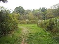
 Bentley Priory Footpaths - geograph.org.uk - 4420589.jpg 1,600 × 1,067; 623 KB
-
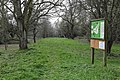
 Bentley Priory from the Masefield Avenue entrance - geograph.org.uk - 4151093.jpg 2,304 × 1,728; 1.71 MB
-
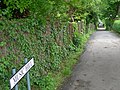
 British Rail sign abandoned footpath near Harrow & Wealdstone.jpg 2,592 × 1,944; 1.16 MB
-
 Canons Park (1) - geograph.org.uk - 5976853.jpg 1,024 × 768; 359 KB
-
 Canons Park (2) - geograph.org.uk - 5976863.jpg 1,024 × 768; 381 KB
-
 Canons Park - geograph.org.uk - 5210356.jpg 1,280 × 960; 864 KB
-
 Canons Park - geograph.org.uk - 5210372.jpg 1,280 × 960; 819 KB
-
 Footpath on Harrow Weald Common - geograph.org.uk - 4424988.jpg 1,600 × 1,067; 905 KB
-
 Harrow Weald Common - geograph.org.uk - 1280841.jpg 640 × 427; 148 KB
-
 Harrow Weald Common - geograph.org.uk - 2454564.jpg 640 × 480; 124 KB
-
 Harrow Weald Common - geograph.org.uk - 2456261.jpg 640 × 480; 121 KB
-
 Harrow Weald Recreation Ground - geograph.org.uk - 5544215.jpg 4,000 × 3,000; 4.89 MB
-
 Hartsbourne Golf Course - geograph.org.uk - 1280945.jpg 640 × 427; 54 KB
-

-
 Music Hill, Harrow - geograph.org.uk - 175015.jpg 640 × 480; 169 KB
-
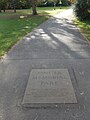
 North-west corner, Pinner Memorial Park - geograph.org.uk - 4856612.jpg 1,024 × 768; 163 KB
-
 Path in Stanmore Common - geograph.org.uk - 5527809.jpg 2,304 × 1,728; 817 KB
-
 Path into Harrow Weald Recreation Ground - geograph.org.uk - 5544223.jpg 4,000 × 3,000; 4.84 MB
-
 Pinner Memorial Park - geograph.org.uk - 5961884.jpg 960 × 1,280; 467 KB
-
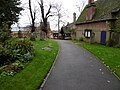
 St Mary's Churchyard, Harrow on the Hill - geograph.org.uk - 4730471.jpg 4,608 × 3,456; 3.39 MB
-
 St Mary's Churchyard, Harrow on the Hill - geograph.org.uk - 4730475.jpg 4,608 × 3,456; 3.37 MB
-
 The London Loop on Harrow Weald Common - geograph.org.uk - 2410326.jpg 1,600 × 991; 603 KB
-


_-_geograph.org.uk_-_5976853.jpg)
_-_geograph.org.uk_-_5976863.jpg)


