Category:OpenStreetMap maps of the canton of Geneva
Jump to navigation
Jump to search
Subcategories
This category has only the following subcategory.
O
- OpenStreetMap maps of Geneva (35 F)
Media in category "OpenStreetMap maps of the canton of Geneva"
The following 17 files are in this category, out of 17 total.
-
 A1 Bernex, map OSM 2022.png 487 × 1,231; 300 KB
-
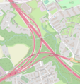
 A1 Genève Aéroport, map OSM 2022.png 1,400 × 1,368; 1.21 MB
-
 A1 Grand-Saconnex, map OSM 2022.png 679 × 692; 312 KB
-
 A1 Meyrin, map OSM 2022.png 375 × 593; 175 KB
-
 A1 Perly, map OSM 2022.png 610 × 865; 314 KB
-
 A1 Vernier, map OSM 2022.png 721 × 1,124; 661 KB
-
 A1 Versoix, map OSM 2022.png 800 × 349; 185 KB
-
 A1a Etoile, map OSM 2022.png 161 × 538; 77 KB
-
 A1a Genève-Lac, map OSM 2022.png 332 × 769; 134 KB
-
 A1a La Praille, map OSM 2022.png 165 × 413; 76 KB
-
 A1a Lancy-Sud, map OSM 2022.png 213 × 603; 94 KB
-
 CH GE WLM2018.png 1,108 × 771; 784 KB
-
 CH-Hauptstrasse1-OSM.png 570 × 390; 397 KB
-

-
-

-
 Geneve-Annemasse Railway Map.png 4,785 × 2,568; 4.67 MB


_A41(S-France)_-_detail_map_by_OpenStreetMap_contributors,_2022.png)
_A1(N)_A1a(E)_-_detail_map_by_OpenStreetMap_contributors,_2022.png)
_A1a(E)_A1(S)_-_detail_map_by_OpenStreetMap_contributors,_2022.png)
