Category:Maps of the canton of Geneva
Jump to navigation
Jump to search
Cantons of Switzerland: Aargau (AG) · Appenzell Ausserrhoden (AR) · Appenzell Innerrhoden (AI) · Basel-Stadt (BS) · Basel-Landschaft (BL) · Bern (BE) · Fribourg (FR) · Geneva (GE) · Glarus (GL) · Graubünden (GR) · Jura (JU) · Luzern (LU) · Neuchâtel (NE) · Nidwalden (NW) · Obwalden (OW) · Schaffhausen (SH) · Schwyz (SZ) · Solothurn (SO) · St. Gallen (SG) · Thurgau (TG) · Ticino (TI) · Uri (UR) · Valais (VS) · Vaud (VD) · Zug (ZG) · Zürich (ZH)
Subcategories
This category has the following 15 subcategories, out of 15 total.
Media in category "Maps of the canton of Geneva"
The following 34 files are in this category, out of 34 total.
-
 Karte Kanton Genf 2010.png 2,066 × 1,883; 663 KB
-
 1261 Nyon.jpg 14,000 × 9,600; 82.02 MB
-
 1300 Chancy.jpg 14,000 × 9,600; 99.04 MB
-
 1301 Genève.jpg 14,000 × 9,600; 104.05 MB
-
 Canton of Geneva empty map-fr small.png 960 × 647; 199 KB
-
 Canton of Geneva empty map-fr.png 1,033 × 1,012; 285 KB
-
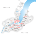
 Canton of Geneva Municipalities map-fr.png 1,033 × 1,012; 336 KB
-
 Carte CO Genève.png 944 × 926; 270 KB
-
 Ch wh ge.png 320 × 214; 4 KB
-

-
 Genève relief location map.jpg 144 × 131; 34 KB
-
 Genève-Communes-1815-1816.jpg 1,033 × 1,012; 146 KB
-
 GenèveCommunes-1815-1816-clr.jpg 1,033 × 1,012; 203 KB
-
 Karte Gemeinden des Kantons Genf 1931.png 1,476 × 1,364; 429 KB
-
 Karte Gemeinden des Kantons Genf 2007.png 1,476 × 1,446; 691 KB
-
 Karte Gemeinden des Kantons Genf.png 944 × 926; 259 KB
-
 Karte Jagdrecht Schweiz 2019.png 4,133 × 2,848; 2.8 MB
-
 Karte Jagdrecht Schweiz 2020.png 4,133 × 2,848; 2.8 MB
-
 Karte Jagdrecht Schweiz 2021.png 4,133 × 2,848; 3.45 MB
-
 Karte Jagdrecht Schweiz 2024.png 4,133 × 2,848; 3.44 MB
-
 Karte Kanton Genf 2010 clair.png 2,066 × 1,883; 453 KB
-
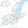
 Karte Kanton Genf.png 1,062 × 968; 119 KB
-
 LeFeuillu-Communes Genève-2011.png 961 × 769; 281 KB
-
 LeFeuillu-Communes Genève.png 961 × 769; 281 KB
-
 Locator Map Kanton Genf-crop.png 634 × 598; 87 KB
-
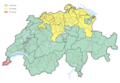
 Locator Map Kanton Genf.png 751 × 688; 87 KB
-
 Périmètre RNN Haute-chaîne du Jura rnn112.png 1,038 × 1,483; 1.74 MB
-
 Reliefkarte Genf blank-crop.png 843 × 795; 421 KB
-
 Reliefkarte Genf blank.png 1,001 × 918; 786 KB
-
 Reliefkarte Genf.png 1,848 × 1,798; 2.2 MB
-
 Swiss national map, 40 Le Léman.jpg 14,000 × 9,600; 111.37 MB
-
 Switzerland Locator Map GE.svg 1,052 × 744; 237 KB
-
 Trois-Chêne-Communes.png 313 × 206; 48 KB
-
 Trois-Chêne-Communes2.png 960 × 751; 316 KB


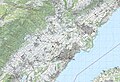
_A41(S-France)_-_detail_map_by_OpenStreetMap_contributors,_2022.png)


