Category:Old maps of Haut-Rhin
Jump to navigation
Jump to search
Departments of Metropolitan France: Ain [01] · Aisne [02] · Allier [03] · Alpes-de-Haute-Provence [04] · Hautes-Alpes [05] · Alpes-Maritimes [06] · Ardèche [07] · Ardennes [08] · Ariège [09] · Aube [10] · Aude [11] · Aveyron [12] · Bouches-du-Rhône [13] · Calvados [14] · Cantal [15] · Charente [16] · Charente-Maritime [17] · Cher [18] · Corrèze [19] · Corse-du-Sud [2A]† · Haute-Corse [2B]† · Côte-d’Or [21] · Côtes-d'Armor [22] · Creuse [23] · Dordogne [24] · Doubs [25] · Drôme [26] · Eure [27] · Eure-et-Loir [28] · Finistère [29] · Gard [30] · Haute-Garonne [31] · Gers [32] · Gironde [33] · Hérault [34] · Ille-et-Vilaine [35] · Indre [36] · Indre-et-Loire [37] · Isère [38] · Jura [39] · Landes [40] · Loir-et-Cher [41] · Loire [42] · Haute-Loire [43] · Loire-Atlantique [44] · Loiret [45] · Lot [46] · Lot-et-Garonne [47] · Lozère [48] · Maine-et-Loire [49] · Manche [50] · Marne [51] · Haute-Marne [52] · Mayenne [53] · Meurthe-et-Moselle [54] · Meuse [55] · Morbihan [56] · Moselle [57] · Nièvre [58] · Nord [59] · Oise [60] · Orne [61] · Pas-de-Calais [62] · Puy-de-Dôme [63] · Pyrénées-Atlantiques [64] · Hautes-Pyrénées [65] · Pyrénées-Orientales [66] · Bas-Rhin [67] · Haut-Rhin [68] · departmental district of the Rhône [69] · Haute-Saône [70] · Saône-et-Loire [71] · Sarthe [72] · Savoie [73] · Haute-Savoie [74] · Paris [75] · Seine-Maritime [76] · Seine-et-Marne [77] · Yvelines [78] · Deux-Sèvres [79] · Somme [80] · Tarn [81] · Tarn-et-Garonne [82] · Var [83] · Vaucluse [84] · Vendée [85] · Vienne [86] · Haute-Vienne [87] · Vosges [88] · Yonne [89] · Territoire de Belfort [90] · Essonne [91] · Hauts-de-Seine [92] · Seine-Saint-Denis [93] · Val-de-Marne [94] · Val-d'Oise [95]
Overseas departments and regions: Guadeloupe [971] · Martinique [972] · French Guiana [973] · Réunion [974] · Mayotte [976]
Overseas collectivities: Saint Pierre and Miquelon [975] · Saint Barthélemy [977] · Saint-Martin [978] · Wallis and Futuna [986] · French Polynesia [987] · French Southern and Antarctic Lands [984]+
Sui generis territories: New Caledonia [988] · Clipperton Island [989]+
Use the appropriate category for maps showing all or a large part of Haut-Rhin. See subcategories for smaller areas:
| If the map shows | Category to use |
|---|---|
| Haut-Rhin on a recently created map | Category:Maps of Haut-Rhin or its subcategories |
| Haut-Rhin on a map created more than 70 years ago | Category:Old maps of Haut-Rhin or its subcategories |
| the history of Haut-Rhin on a recently created map | Category:Maps of the history of Haut-Rhin or its subcategories |
| the history of Haut-Rhin on a map created more than 70 years ago | Category:Old maps of the history of Haut-Rhin or its subcategories |
Subcategories
This category has the following 5 subcategories, out of 5 total.
Media in category "Old maps of Haut-Rhin"
The following 26 files are in this category, out of 26 total.
-
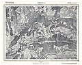
 Thann - btv1b102236919.jpg 7,305 × 5,902; 6.91 MB
-
 Ferrette - btv1b10223374p.jpg 7,377 × 5,823; 12.54 MB
-
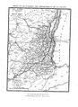
 204. I.D. 1917 Oberelsass.jpg 384 × 480; 91 KB
-
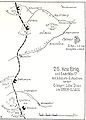
 26. I.D. Januar 1917.jpg 677 × 910; 187 KB
-
 26. Kav.Brig. Mai 1917.jpg 656 × 912; 202 KB
-

-
 Altkirch - btv1b10111200b (1 of 2).jpg 7,186 × 5,952; 13.01 MB
-
 Altkirch - btv1b10111200b (2 of 2).jpg 7,186 × 5,969; 12.44 MB
-
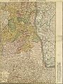 Carte Alsatia superior.jpg 5,017 × 6,727; 11.17 MB
-
 Carte du département du Haut-Rhin - 1800.tif 11,704 × 7,297; 244.4 MB
-
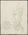
 Carte du département du Haut-Rhin 1790-1793.tiff 4,879 × 6,035; 84.29 MB
-

-
 Guide pittoresque 030 carte Haut Rhin cropped.png 1,524 × 2,079; 169 KB
-
 Guide pittoresque 030 carte Haut Rhin.pdf 1,629 × 2,239; 1.79 MB
-
 Herrschaft Landser im Elsaß.jpg 5,397 × 6,747; 3.57 MB
-
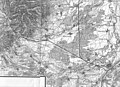
 Map of Lerchenholz - NARA - 140696098.jpg 10,480 × 7,339; 4.45 MB
-
 Markung Rosenau.jpg 6,156 × 7,923; 5.61 MB
-
 Michelin nr 66, 1940 Mulhouse.jpg 5,889 × 5,017; 9.87 MB
-
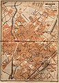 Mülhausen.jpg 1,574 × 2,197; 741 KB
-

-

-

-
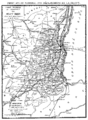
 Reilly 753.jpg 500 × 399; 48 KB
-
 Strasbourg-Bâle plan de la ligne à Mulhouse.jpg 2,336 × 1,698; 966 KB
-
 Swisstopo Dufourkarte BLATT II. BELFORT BASEL LT TK 002 1846.tiff 15,394 × 11,212; 164.61 MB
-
 TW Mulhouse 1928.jpg 2,394 × 2,332; 1.39 MB


.jpg)
.jpg)


_-_Dress%C3%A9_et_grav%C3%A9_par_MM._Charle_%26_Dumortier_;_Ecrit_par_Arnoul_-_btv1b84947718.jpg)


