Category:Old maps of Alsace
Jump to navigation
Jump to search
Administrative regions and territorial collectivity of Metropolitan France (‡ since start of 2016):
Auvergne-Rhône-Alpes‡ · Bourgogne-Franche-Comté‡ · Brittany · Centre-Val de Loire · Corsica · Grand Est‡ · Hauts-de-France‡ · Île-de-France · Normandy‡ · New Aquitaine‡ · Occitania‡ · Pays de la Loire · Provence-Alpes-Côte d'Azur
Former administrative regions of Metropolitan France (until end of 2015):
Alsace · Aquitaine · Auvergne · Burgundy · Champagne-Ardenne · Franche-Comté · Languedoc-Roussillon · Limousin · Lorraine · Midi-Pyrénées · Nord-Pas-de-Calais · Lower Normandy · Upper Normandy · Picardy · Poitou-Charentes · Rhône-Alpes
Overseas departments and regions: Guadeloupe · Martinique · French Guiana · Réunion · Mayotte
Overseas collectivities: Saint Barthélemy · Saint-Martin · Saint Pierre and Miquelon · French Polynesia · Wallis and Futuna · French Southern and Antarctic Lands+
Sui generis territories: New Caledonia · Clipperton Island+
Use the appropriate category for maps showing all or a large part of Alsace. See subcategories for smaller areas:
| If the map shows | Category to use |
|---|---|
| Alsace on a recently created map | Category:Maps of Alsace or its subcategories |
| Alsace on a map created more than 70 years ago | Category:Old maps of Alsace or its subcategories |
| the history of Alsace on a recently created map | Category:Maps of the history of Alsace or its subcategories |
| the history of Alsace on a map created more than 70 years ago | Category:Old maps of the history of Alsace or its subcategories |
Subcategories
This category has the following 9 subcategories, out of 9 total.
.
M
S
Media in category "Old maps of Alsace"
The following 50 files are in this category, out of 50 total.
-
 "Alsatia Landgraviatus cum Suntgoia et Birsgoia - Ger. Mercatore auctore" (22070535369).jpg 6,903 × 2,576; 4.02 MB
-

-
-

-
-

-
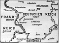
 7. Armee August 1914.jpg 1,072 × 1,104; 439 KB
-
-

-
 Alsace (province).jpg 1,938 × 1,847; 1.3 MB
-
 Alsace map mallet vol4 plate45 thumb.png 300 × 452; 264 KB
-
 Alsatia superior cum Suntgoia et Brisgoia - CBT 5876014.jpg 5,118 × 3,956; 4.51 MB
-

-
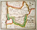
 Ban-de-la-Roche old map.jpg 2,400 × 1,977; 1.75 MB
-
 Carte de Haute-Alsace, Basse-Alsace et Palatinat du Rhin.jpg 20,570 × 5,385; 22.82 MB
-
 Carte du Ban-de-la-Roche-Musée Oberlin (1).jpg 2,499 × 1,953; 1.52 MB
-
 Carte du Ban-de-la-Roche-Musée Oberlin (2).jpg 2,393 × 1,928; 1.68 MB
-
 Carte générale des voies romaines (...)Jollois Jean-Baptiste-Prosper btv1b84389667 1.jpg 2,714 × 1,276; 716 KB
-
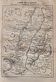
 Carte wasselonne1885.jpg 3,296 × 2,472; 8.78 MB
-
 Cassini map - Ochsenstein detail.jpg 472 × 308; 132 KB
-
 Charte von der Grafschaft Hanau Lichtenberg.jpg 5,553 × 7,582; 12.02 MB
-
 Château de Wasselonne 1674 détail.jpg 1,585 × 1,055; 826 KB
-
 Comte de Hanau Lichtenberg partie alsacienne en XVIIe siecle.jpg 1,848 × 2,052; 3.42 MB
-
 Cosmographia (Sebastian Münster) p 072.jpg 2,000 × 1,531; 595 KB
-
 Dep-basrhin.jpg 512 × 647; 239 KB
-
 Dep-hautrhin.jpg 647 × 512; 255 KB
-
 Deutsche Kriegszeitung (1914) 01 02 3.png 542 × 397; 239 KB
-
 Dräi Bistümer.png 393 × 432; 386 KB
-

-

-

-
 Haute Alsace 1734 Map.png 3,154 × 2,293; 17.36 MB
-

-
 Heiliges Römisches Reich 1000-Alsatia.png 294 × 433; 89 KB
-
 Histoire de Turenne-Armagnac-1883 chez Mame-17.jpg 1,909 × 2,805; 1.48 MB
-
-
 Karta över del av Elsass med Brisgau samt staden Brisach, med floden Then - Skoklosters slott - 99037.tif 4,557 × 3,469, 2 pages; 45.25 MB
-
 Landgraviatus Alsatiae inferioris novissima tabula - CBT 5876073.jpg 5,566 × 4,657; 6.95 MB
-
 Landgraviatus Alsatiae superioris et inferioris novissima tabula - CBT 5876351.jpg 5,566 × 4,772; 6.57 MB
-

-
 Plan cadastral Bitschhoffen (1893).jpg 6,015 × 7,957; 5.05 MB
-
 SudAlsace1900.jpg 1,437 × 378; 137 KB
-
 Superioris Alsatiae nec non Brisigaviae et Suntgaviae - CBT 5876044.jpg 5,842 × 4,796; 7.03 MB
-
 Topographia Alsatiae (Merian) p 002.JPG 3,240 × 2,433; 2.27 MB
-
 Totius Alsatiae Nicolas Visscher map - Ochsenstein detail.jpg 521 × 318; 176 KB
-

-
 Trois-Évêchés.png 393 × 432; 359 KB
-

-

-

.jpg)
.jpg)
.jpg)
.jpg)
.jpg)

.jpg)
.jpg)
.jpg)


.jpg)
.jpg)
Jollois_Jean-Baptiste-Prosper_btv1b84389667_1.jpg)


_p_072.jpg)


_01_02_3.png)


.jpg)


.jpg)

_p_002.JPG)

.jpg)


.jpg)
.jpg)
.jpg)