Category:October 2008 Ireland photographs
Jump to navigation
Jump to search
Countries of Europe: Albania · Armenia‡ · Austria · Belarus · Belgium · Bosnia and Herzegovina · Bulgaria · Croatia · Cyprus‡ · Czech Republic · Denmark · Estonia · Finland · France‡ · Georgia‡ · Germany · Greece · Hungary · Republic of Ireland · Italy · Kazakhstan‡ · Latvia · Liechtenstein · Lithuania · Malta · Monaco · Montenegro · Netherlands‡ · North Macedonia · Norway · Poland · Portugal‡ · Romania · Russia‡ · Serbia · Slovakia · Slovenia · Spain‡ · Sweden · Switzerland · Turkey‡ · Ukraine · United Kingdom · Vatican City
Specific status: Jersey – Limited recognition: Kosovo
‡: partly located in Europe
Specific status: Jersey – Limited recognition: Kosovo
‡: partly located in Europe
English: Images taken in Ireland during this month of 2008 (not the date of the upload). With CatScan, this allows one to browse any Ireland-related category by year or month. Images should be placed directly in this category, not in subcategories. Note: Images from 2008 should be also added into the appropriate province, territory or city category of Category:2008 photographs of Ireland.
| Jan | Feb | Mar | Apr | May | Jun | Jul | Aug | Sep | Oct | Nov | Dec | ||
| ← | 61 | 129 | 107 | 117 | 406 | 98 | 328 | 929 | 120 | 127 | 55 | 92 | → |
|---|
Media in category "October 2008 Ireland photographs"
The following 127 files are in this category, out of 127 total.
-
 St. Patrick's Cathedral, Dublin Choir.jpg 2,358 × 3,144; 2.27 MB
-
 Trinity College, Dublin, Ireland (Campanile and Graduate Memorial Building).jpg 2,592 × 2,592; 3.05 MB
-
 'Securus' by Tony O'Malley - geograph.org.uk - 1096781.jpg 640 × 480; 89 KB
-
 Leixlip (Louisa Bridge) Railway Station - geograph.ie - 1007942.jpg 640 × 480; 57 KB
-
 The Wonderful Barn, Leixlip - geograph.org.uk - 1011705.jpg 481 × 640; 85 KB
-
 Jewishmuseum.jpg 440 × 343; 99 KB
-
 Moravian.jpg 600 × 450; 117 KB
-
 Sculpture of George Salmon at Trinity College, Dublin.jpg 1,634 × 3,092; 1.23 MB
-
 St. Patrick's Cathedral, Dublin, West Window.jpg 1,715 × 2,178; 1.68 MB
-
 Statue in Iveagh Gardens.jpg 2,380 × 2,173; 1.56 MB
-
 Thomas M. Kettle memorial in St. Stephen's Green park, Dublin, Ireland.jpg 2,448 × 3,264; 2.82 MB
-
 Trinity College (1).jpg 3,261 × 2,156; 2.16 MB
-
 Trinity College B.jpg 1,975 × 1,390; 2.74 MB
-
 Trinity College.jpg 2,015 × 1,452; 556 KB
-
 Waterfall in Iveagh Gardens.jpg 3,176 × 2,257; 2.79 MB
-
 William Edward Hartpole Lecky Trinity College Dublin.jpg 2,098 × 3,109; 1.94 MB
-
 Aghlehard Townland - geograph.org.uk - 1007119.jpg 640 × 479; 61 KB
-
 Aghlehard Townland - geograph.org.uk - 1007120.jpg 640 × 479; 52 KB
-
 Aldi store opening soon - geograph.org.uk - 1030741.jpg 640 × 480; 68 KB
-
 Ardagh Townland - geograph.org.uk - 1006971.jpg 640 × 479; 79 KB
-
 Ardnamoyle Townland - geograph.org.uk - 1030599.jpg 640 × 479; 69 KB
-
 Ardnamoyle Townland - geograph.org.uk - 1030600.jpg 640 × 479; 80 KB
-
 Ardnamoyle Townland - geograph.org.uk - 1030601.jpg 640 × 479; 64 KB
-
 Ardnamoyle Townland - geograph.org.uk - 1030695.jpg 640 × 478; 48 KB
-
 Ashford Castle 640x480.jpg 640 × 425; 330 KB
-
 Avenue in Autumn - geograph.org.uk - 1008054.jpg 640 × 480; 152 KB
-
 Ballina Bridge - geograph.org.uk - 1017771.jpg 640 × 480; 97 KB
-
 Ballymagroarty Townland - geograph.org.uk - 1030707.jpg 640 × 479; 81 KB
-
 Ballymagroarty Townland - geograph.org.uk - 1030711.jpg 640 × 479; 76 KB
-
 Bridge over Owenator River - geograph.org.uk - 1030290.jpg 640 × 480; 112 KB
-
 Bridge Over the River Liffey, Celbridge - geograph.org.uk - 1008061.jpg 640 × 480; 106 KB
-
 Burnside Townland - geograph.org.uk - 1007216.jpg 640 × 479; 55 KB
-
 Burnside Townland - geograph.org.uk - 1007220.jpg 640 × 479; 68 KB
-
 Burnside Townland - geograph.org.uk - 998526.jpg 640 × 479; 70 KB
-
 Canal Bridge - geograph.org.uk - 1029212.jpg 640 × 480; 137 KB
-
-
 Carnowen Townland - geograph.org.uk - 993337.jpg 640 × 479; 66 KB
-
 Cemetery and post box - Cruit Island - geograph.org.uk - 1031338.jpg 640 × 480; 77 KB
-
 Christ Church Cathedral - Dublin.jpg 3,264 × 2,448; 1.87 MB
-
 Christ Church Cathedral, Dublin 5.jpg 1,734 × 3,260; 1.49 MB
-
 Christ Church Cathedral, Dublin 6.jpg 2,801 × 2,179; 1.72 MB
-
 Clonmore bullan stone - geograph.org.uk - 1023930.jpg 640 × 480; 305 KB
-
 Clonmore castle - geograph.org.uk - 1023685.jpg 640 × 480; 115 KB
-
 Clonmore castle 2 - geograph.org.uk - 1023960.jpg 640 × 480; 196 KB
-
 Clonmore Church and graveyard - geograph.org.uk - 1023894.jpg 640 × 480; 212 KB
-
 Clonmore graveyard - geograph.org.uk - 1023917.jpg 640 × 480; 320 KB
-
 Connolly Books.jpg 3,637 × 3,637; 2.68 MB
-
 Cows at Ardnamoyle - geograph.org.uk - 1030687.jpg 640 × 479; 79 KB
-
 Craft shop Church St Portlaoise - geograph.org.uk - 1049368.jpg 640 × 480; 79 KB
-
 Crolly from the north - geograph.org.uk - 1030305.jpg 640 × 480; 76 KB
-
 Crolly Water Treatment Works - geograph.org.uk - 1030301.jpg 640 × 480; 83 KB
-
 Donegal Shore House - geograph.org.uk - 1031340.jpg 640 × 480; 70 KB
-
 Donegal Thatched Cottages - geograph.org.uk - 1031343.jpg 640 × 480; 73 KB
-
 Farm at Ardagh - geograph.org.uk - 1006987.jpg 640 × 479; 53 KB
-
 Farm at Cloghfin - geograph.org.uk - 993745.jpg 640 × 479; 60 KB
-
 First Ray Presbyterian Church - geograph.org.uk - 1007202.jpg 640 × 479; 48 KB
-
 Front Elevation, Castletown House - geograph.org.uk - 1008011.jpg 640 × 480; 69 KB
-
 Galway Sportsgrounds - 1.jpg 1,024 × 768; 398 KB
-
 Galway Sportsgrounds - 2.jpg 1,024 × 768; 305 KB
-
 Galway Sportsgrounds - 3.jpg 1,024 × 768; 380 KB
-
 Grazing land - geograph.org.uk - 1032569.jpg 640 × 480; 75 KB
-
 Gweebarra Bridge - geograph.org.uk - 1032601.jpg 640 × 480; 65 KB
-
 Halla Mhuire at Belcruit - geograph.org.uk - 1031336.jpg 640 × 480; 61 KB
-
 Kenmare House.PNG 638 × 464; 606 KB
-
 Killed by English Forces - geograph.org.uk - 991153.jpg 480 × 640; 123 KB
-
 Kiln Top, Ardagh - geograph.org.uk - 1006982.jpg 640 × 479; 82 KB
-
 Lidl Supermarket - geograph.org.uk - 1030744.jpg 640 × 480; 72 KB
-
 Liefear roundabout - geograph.org.uk - 993817.jpg 640 × 479; 72 KB
-
 Lime kiln at Ardagh - geograph.org.uk - 1006980.jpg 640 × 479; 98 KB
-
 Maghera Beg - geograph.org.uk - 1017835.jpg 640 × 479; 54 KB
-
 Main Street, St Johnston - geograph.org.uk - 1030774.jpg 640 × 479; 46 KB
-
 Manorcunningham, County Donegal - geograph.org.uk - 1007196.jpg 640 × 479; 51 KB
-
 Milltown Townland - geograph.org.uk - 993332.jpg 640 × 479; 68 KB
-
 Monk fishhouse 640x480.jpg 640 × 425; 488 KB
-
 More cows at Ardnamoyle - geograph.org.uk - 1030691.jpg 640 × 479; 76 KB
-
 Old and new cottages - geograph.org.uk - 1032594.jpg 640 × 480; 103 KB
-
 Over Inniscarra Bridge - geograph.org.uk - 994241.jpg 640 × 480; 75 KB
-
 Pier at Gweedore Bay - geograph.org.uk - 1030315.jpg 640 × 480; 93 KB
-
 Pier at Nesbit's Bay - geograph.org.uk - 1030747.jpg 640 × 480; 95 KB
-
 Pier near Cruit Island Golf Club - geograph.org.uk - 1031339.jpg 640 × 480; 80 KB
-
 Plaque, St Johnston Orange Hall - geograph.org.uk - 1030749.jpg 542 × 640; 74 KB
-
 Poulnabrone Portal Tomb 640x480.jpg 640 × 425; 447 KB
-
-
-
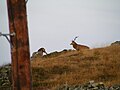 Red deer - geograph.org.uk - 1031888.jpg 640 × 480; 49 KB
-
 River Liffey at Night - geograph.org.uk - 1006818.jpg 640 × 480; 73 KB
-
 Road at Aghlehard - geograph.org.uk - 1007117.jpg 640 × 268; 23 KB
-
 Road at Ardagh - geograph.org.uk - 1006978.jpg 640 × 479; 75 KB
-
 Road at Ballymagroarty - geograph.org.uk - 1030709.jpg 640 × 479; 51 KB
-
 Road at Ballymagroarty - geograph.org.uk - 1030712.jpg 640 × 479; 54 KB
-
 Road at Beltany - geograph.org.uk - 993335.jpg 640 × 479; 82 KB
-
 Road at Bunnamayne - geograph.org.uk - 1030715.jpg 640 × 479; 61 KB
-
 Road at Carrickballydooey - geograph.org.uk - 1007181.jpg 640 × 479; 60 KB
-
 Road at Manorcunningham - geograph.org.uk - 1007189.jpg 640 × 479; 44 KB
-
 Road at Manorcunningham - geograph.org.uk - 1007192.jpg 640 × 267; 27 KB
-
 Road at Manorcunningham - geograph.org.uk - 1007194.jpg 640 × 479; 49 KB
-
 Road Junction - geograph.org.uk - 1017789.jpg 640 × 422; 63 KB
-
 Rocky cove - Gweebarra Bay - geograph.org.uk - 1031902.jpg 640 × 480; 99 KB
-
 Rowan tree 20081002b.jpg 1,600 × 1,200; 1.49 MB
-
 Ruined Dwelling - geograph.org.uk - 1031909.jpg 640 × 480; 92 KB
-
 Rural dwellings - geograph.org.uk - 1030291.jpg 640 × 480; 101 KB
-
 Saint Marys, Ballyconnell - geograph.org.uk - 1023674.jpg 640 × 480; 56 KB
-
 Second Ray Presbyterian Church - geograph.org.uk - 1007206.jpg 640 × 479; 55 KB
-
 Sign to Ballincollig Gunpowder Mills - geograph.org.uk - 994249.jpg 480 × 640; 67 KB
-
 Sign, St Johnston - geograph.org.uk - 1030772.jpg 640 × 479; 56 KB
-

-
 Slipway on north shore Gweebarra Bay - geograph.org.uk - 1031901.jpg 640 × 480; 112 KB
-
 Small quarry above Lough Aghnish - geograph.org.uk - 1031894.jpg 640 × 480; 86 KB
-
 Southcircular.jpg 500 × 346; 104 KB
-
 St Conall's National School - Mural - geograph.org.uk - 1032598.jpg 640 × 480; 106 KB
-
 St Conall's National School 1987 - geograph.org.uk - 1032596.jpg 640 × 480; 126 KB
-
 St Johnston Orange Hall.jpg 640 × 479; 37 KB
-
 St Johnston Post Office - geograph.org.uk - 1030736.jpg 640 × 479; 52 KB
-
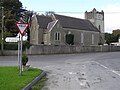
 St Ninian's Church of Ireland, Convoy - geograph.org.uk - 993056.jpg 640 × 479; 45 KB
-
 St Patrick's Cathedral Choir School.jpg 1,903 × 2,845; 1.79 MB
-
 St. Patrick's Cathedral, Dublin 3.jpg 2,414 × 2,897; 2.09 MB
-
 St. Patrick's Cathedral, Dublin 4.jpg 3,264 × 2,448; 1.79 MB
-
 SuperValu Supermarket - geograph.org.uk - 1030742.jpg 640 × 480; 68 KB
-
 The Abbey Hotel, The Diamond - geograph.org.uk - 1016168.jpg 640 × 427; 112 KB
-
 Thorr National School - geograph.org.uk - 1030292.jpg 640 × 480; 86 KB
-
 Town Bridge.JPG 640 × 464; 53 KB
-
 Trinity College Dublin 3.jpg 2,444 × 2,400; 1.53 MB
-
-
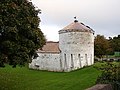
 Windmill at Carrivetragh, Co. Monaghan - geograph.org.uk - 1021209.jpg 640 × 480; 110 KB
-
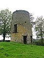 Windmill at Carrivetragh, Co. Monaghan - geograph.org.uk - 1021395.jpg 480 × 640; 104 KB
-
 Wizzy Brown, St Johnston - geograph.org.uk - 1030738.jpg 640 × 479; 51 KB
-
 Yellow Cab - geograph.org.uk - 1010271.jpg 640 × 480; 89 KB

.jpg)

_Railway_Station_-_geograph.ie_-_1007942.jpg)


.jpg)


