Category:Mountains of New Zealand
Jump to navigation
Jump to search
Countries of Oceania: Australia · Fiji · New Zealand · Palau · Papua New Guinea · Samoa · Vanuatu
Other areas: American Samoa · French Polynesia · Guam · Hawaii · New Caledonia · Northern Mariana Islands – Partly: Indonesia
Other areas: American Samoa · French Polynesia · Guam · Hawaii · New Caledonia · Northern Mariana Islands – Partly: Indonesia
Wikimedia category | |||||
| Upload media | |||||
| Instance of | |||||
|---|---|---|---|---|---|
| Category combines topics |
| ||||
| |||||
Subcategories
This category has the following 129 subcategories, out of 129 total.
*
+
A
- The Acolyte (4 F)
- Ōwairaka / Mount Albert (12 F)
- Mount Alfred / Ari (4 F)
- Mount D'Archiac (1 F)
- The Armchair (1 F)
- Mount Aspiring / Tititea (4 F)
- Mount Aubrey (3 F)
- Mount Augustus (New Zealand) (1 F)
- Mount Awful (6 F)
B
- Barren Peak (4 F)
- Barrier Peak (New Zealand) (3 F)
- De la Beche (3 F)
- Mount Belle (New Zealand) (7 F)
- Ben Nevis (New Zealand) (3 F)
- Mount Biretta (2 F)
- Mount Blackburn, New Zealand (3 F)
- Mount Bradley (New Zealand) (4 F)
- Mount Burnett (Tasman) (3 F)
C
- Cass Peak (16 F)
- Cecil Peak (28 F)
- Mount Cheeseman (3 F)
- Mount Christina (4 F)
- Mount Creighton (6 F)
- Mount Crosscut (13 F)
D
- Mount Dampier (6 F)
E
- Mount Earnslaw / Pikirakatahi (19 F)
- Mount Eglinton (2 F)
- Mount Elie de Beaumont (3 F)
F
- Fanthams Peak (10 F)
- The Footstool (24 F)
H
- Mount Hicks (6 F)
- Mount Hikurangi (1 P, 5 F)
- Mount Hutt (30 F)
I
- Mount Isobel (14 F)
J
- Jumble Top (1 F)
K
- Kakepuku (10 F)
- Key Summit (13 F)
- Mount Kruse (16 F)
M
- Malte Brun (3 F)
- Mount Manaia (7 F)
- Mount Manakau (4 F)
- Matukutūreia (4 F)
- The Minarets (5 F)
- Mount Cambria (Auckland) (2 F)
- Mount George, West Coast (3 F)
- Mount Maude (Otago) (3 F)
- Mount Rochfort (4 F)
N
- Mount Norma (4 F)
- The Nuns Veil (2 F)
O
- Ōhinerau / Mount Hobson (13 F)
- Mount Olympus Ski Area (4 F)
P
- Mount Pembroke (5 F)
- Peninsula Hill (18 F)
- Mount Pirongia (5 F)
- Mount Pohaturoa (6 F)
- Mount Potts (8 F)
- Putauaki (11 F)
Q
- Queenstown Hill (15 F)
R
- Rahotia (1 F)
- Mount Robert (9 F)
- Mount Rolleston (16 F)
- Rotopaunga (5 F)
- Roys Peak (12 F)
S
- Sebastopol (mountain) (5 F)
- Sentinel Peak (Otago) (1 F)
- Mount Stokes (3 F)
- Mount Sunday (22 F)
T
- Mount Talbot, New Zealand (4 F)
- Mount Tapuaenuku (5 F)
- Mount Tauhara (9 F)
- Taurere / Taylor Hill (2 F)
- Te Mata Peak (23 F)
- Mount Technical (8 F)
- Mount Teichelmann (2 F)
- Mount Titiroa (2 F)
- Treble Cone, New Zealand (11 F)
- Mount Tūtoko (2 F)
V
- Mount Vancouver, New Zealand (6 F)
W
- Waitomokia (4 F)
- Mount Wakefield (4 F)
- Mount Winterslow (4 F)
X
- Mount Xenicus (9 F)
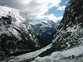
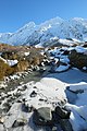
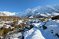
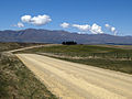
Media in category "Mountains of New Zealand"
The following 200 files are in this category, out of 338 total.
(previous page) (next page)-
 00 0368 Milford Sound - The Lion.jpg 3,300 × 2,200; 5.9 MB
-
 20091207HackfallsPan01s.jpg 2,932 × 908; 527 KB
-
 A Beautiful Day Today... (51369876400).jpg 6,144 × 4,096; 24.76 MB
-
 A high country landscape (cropped).jpg 2,400 × 823; 2.59 MB
-
 A high country landscape.jpg 2,400 × 1,413; 2.98 MB
-
 A photo taken while on the Lake Matheson Walk 2021-04-28 25.jpg 4,608 × 2,592; 3.07 MB
-
 Adams Range.jpg 429 × 640; 68 KB
-
 Alpes du Sud (New Zealand).jpg 2,000 × 565; 109 KB
-
 Alpine Fault SRTM (vertical).jpg 1,746 × 5,342; 4.16 MB
-
 Alpine scene ATLIB 314173.png 3,948 × 3,174; 7.75 MB
-
 Alpine tarn on Lewis Pass in front of Spenser Mountains.jpg 4,896 × 3,264; 6.59 MB
-
 AMI Stadium and Mount Pleasant, 2007.jpg 2,592 × 3,872; 6.58 MB
-
 Aoraki Mount Cook National Park - Tasman Glacier - aerial view.jpg 1,425 × 2,100; 1.08 MB
-
 Aorangi Range over Lake Wairarapa.jpg 2,272 × 1,704; 360 KB
-
 ArthurPass-3.jpg 1,124 × 1,400; 732 KB
-
 ArthurPass-4.jpg 1,400 × 1,050; 721 KB
-
 ArthursPass.jpg 1,539 × 2,052; 930 KB
-
 ArthursPassBridge.JPG 1,488 × 1,984; 628 KB
-
 Aspiring01LB.jpg 2,288 × 1,712; 798 KB
-
 Aspring02LB.jpg 3,648 × 2,736; 4.16 MB
-
 Autumn in the Awatere Valley.jpg 3,872 × 2,592; 7.11 MB
-
 Baird Range in Westland Tai Poutini National Park.jpg 4,023 × 2,682; 8.91 MB
-
 Banded kokopu fish from Wainui stream, Mount Karioi.JPG 2,157 × 2,012; 1.49 MB
-
 Bay near Rarangi - Marlborough.jpg 3,264 × 2,176; 6.66 MB
-
 Bealey River valley.JPG 1,280 × 960; 321 KB
-
 Bowen Peak.tif 3,214 × 1,841; 16.95 MB
-
 Bream Islands.JPG 2,592 × 1,728; 1.38 MB
-
 Bridge On The Road To The Hermitage.jpg 1,600 × 1,200; 1.21 MB
-
 Buller River near Berlins.jpg 673 × 462; 386 KB
-
 CairnmuirMountains.jpg 1,920 × 547; 448 KB
-
 Cape Campbell sunrise.jpg 2,984 × 1,964; 6.32 MB
-
 CardronaValleyNewZealand.jpg 2,112 × 2,816; 1.33 MB
-
 Cascade Peak in Fiordland National Park 01.jpg 3,970 × 2,647; 7.63 MB
-
 Castle Rock, Waikato.jpg 4,000 × 3,000; 3.1 MB
-
 Central Otago, New Zealand, 22 July 2005.jpg 3,264 × 2,176; 5.44 MB
-
 ChaosPeaks.jpg 1,944 × 1,296; 724 KB
-
 Chemin de crête (24018751302).jpg 5,472 × 3,351; 3.3 MB
-
 Clarence River mouth.jpg 2,864 × 1,924; 5.24 MB
-
 Clarence River New Zealand 1.jpg 2,048 × 1,024; 2.15 MB
-
 Cloudy Bay - Marlborough.jpg 3,450 × 2,348; 7.17 MB
-
 Cragieburn in the frost looking NE - panoramio.jpg 2,816 × 1,880; 2.19 MB
-
 Cromwell from lookout.tif 5,211 × 1,648; 18.2 MB
-
 Cruise through New Zealand (3423393269).jpg 3,054 × 2,036; 818 KB
-
 Cutting On The Otago Rail Trail, Downhill.jpg 1,600 × 1,200; 470 KB
-
 Cycle tourist, Island Saddle, New Zealand.JPG 2,816 × 2,112; 2.58 MB
-
 Dark Clouds over the Hill (31324654710).jpg 5,184 × 3,456; 11.19 MB
-
 Deadmans Point Bridge Lake Dunstan Cromwell.jpg 2,592 × 1,944; 2.91 MB
-
 Distant Hills In The Gloom... (51271580589).jpg 6,144 × 2,783; 11.93 MB
-
 DSG 3251 Port Chalmers Branch Blanket Bay.jpg 1,356 × 920; 198 KB
-
 Dun Mountain Maitai Terrane Geology New Zealand.jpg 600 × 450; 65 KB
-
 Dunstan Mountains Schist TZ Terranes.png 2,481 × 4,033; 4.22 MB
-
 Dunstan Mountains.png 2,481 × 3,506; 5.88 MB
-
 Earnslaw Wharf of Queenstown.jpg 2,288 × 1,712; 1.96 MB
-
 East Coast erosion, Poverty Bay, New Zealand, 13th. Dec. 2010 - Flickr - PhillipC.jpg 4,288 × 2,848; 4.48 MB
-
 Eglinton Valley Fiordland.jpg 640 × 480; 87 KB
-
 Eglinton Valley Viewpoint (31441564792).jpg 5,184 × 3,456; 9.36 MB
-
 Erosion in the Upper Awatere Valley.jpg 3,872 × 2,592; 6.41 MB
-
 Evening clouds over mt Kahuranaki hawkes bay.jpg 2,272 × 1,704; 472 KB
-
 Falling Mountain, Arthur's Pass National Park, New Zealand 04.jpg 9,776 × 3,183; 21.78 MB
-
 Fiordland - Te Anau - New Zealand in 2012.jpg 2,038 × 1,493; 2.6 MB
-
 Fiordland National Park, New Zealand.jpg 2,592 × 1,944; 1.54 MB
-
 Flickr - JennyHuang - blue ^ white in New Zealand-1.jpg 3,872 × 2,592; 4.61 MB
-
 Flickr - JennyHuang - blue ^ white in New Zealand-2.jpg 3,872 × 2,592; 3.98 MB
-
 Flickr - JennyHuang - blue ^ white in New Zealand-4.jpg 2,592 × 3,872; 5.06 MB
-
 Flickr - JennyHuang - the country of clounds (New Zealand).jpg 3,872 × 2,592; 4.33 MB
-
 Flickr - JennyHuang - the country of mountains (New Zealand) (1).jpg 2,592 × 3,872; 5.09 MB
-
 Flickr - JennyHuang - the country of mountains (New Zealand).jpg 3,872 × 2,592; 6.32 MB
-
 Flying over a river valley 2 (31195730211).jpg 5,184 × 3,456; 8.37 MB
-
 Flying over a river valley 3 (30942474880).jpg 5,184 × 3,456; 14.54 MB
-
 Fog clearing, South Canterbury, New Zealand, 5 August 2005.jpg 3,188 × 1,680; 3.47 MB
-
 Fox Glacier descend into a rainforest.jpg 1,476 × 987; 1.12 MB
-
 Franz Josef Glacier and mountains from Rata Lookout in spring 2014.jpg 4,896 × 3,264; 6.27 MB
-
 Franz Josef-New Zealand.JPG 2,560 × 1,706; 697 KB
-
 From TranzAlpine train 01.jpg 2,700 × 1,800; 576 KB
-
 George Moodie - Mount De La Beche from the Tasman Glacier - Google Art Project.jpg 4,771 × 3,433; 3.16 MB
-
 Golden Downs plantation forest, Nelson 1978 - Flickr - PhillipC.jpg 804 × 525; 532 KB
-
 Gordons Pyramid, Kahurangi National Park.jpg 4,928 × 3,264; 2.11 MB
-
 Gorge Hill.jpg 4,032 × 3,024; 968 KB
-
 Great Place For a Walk... (53219410027).jpg 6,129 × 2,252; 14.57 MB
-
 Haast River 2003.jpg 879 × 579; 452 KB
-
 Haast River panorama.jpg 6,130 × 1,555; 1.6 MB
-
 Hall Arm of Doubtful Sound with Mt Danae in the background.jpg 4,896 × 3,240; 5 MB
-
 Harihari.jpg 2,237 × 1,428; 329 KB
-
 Hawdon River, Arthur's Pass National Park, New Zealand 03.jpg 5,123 × 3,415; 16.34 MB
-
 Helicopter over the Mountains (31261862782).jpg 4,273 × 2,882; 8.94 MB
-
 Henry Creek Beach.jpg 712 × 533; 83 KB
-
 Henry Creek.jpg 712 × 533; 93 KB
-
 HigherPointHeaphy.jpg 2,048 × 1,536; 541 KB
-
 Hillside (31532026882).jpg 5,184 × 3,456; 13.58 MB
-
 Homer Saddle LookingWest.jpg 1,600 × 1,200; 282 KB
-
 Icy Stocking Stream in front of Mt Sefton.jpg 3,264 × 4,896; 6.19 MB
-
 Icy Stocking Stream with Mt Sefton in the background.jpg 4,896 × 3,264; 6.66 MB
-
 IFjordland NP, NZL.JPG 3,072 × 2,304; 2.04 MB
-
 IMG 5592-Wakatipu Basin.jpg 640 × 123; 38 KB
-
 Kahurangi National Park, New Zealand.jpg 4,928 × 3,264; 1.5 MB
-
 Kakanui Mountains, Otago, New Zealand.jpg 2,048 × 1,536; 1.37 MB
-
 Kepler track alpine ridgeline.jpg 1,500 × 1,000; 1.39 MB
-
 Kepler Track Hut 1 Wide (266320334).jpg 1,600 × 371; 120 KB
-
 Knobs Flat sgn.jpg 947 × 506; 79 KB
-
 Kokonga Maniototo 0562.JPG 3,648 × 2,736; 3.28 MB
-
 Kurow House and Hills.JPG 3,688 × 2,540; 3.03 MB
-
 Lake Angelus, New Zealand.jpg 600 × 600; 51 KB
-
 Lake Hawea, New Zealand.jpg 1,600 × 1,200; 594 KB
-
 Lake Hawea.jpg 640 × 480; 96 KB
-
 Lake Hayes Otago NZ (10412676105).jpg 2,292 × 1,428; 1.54 MB
-
 Lake manapouri and cathedral peaks.jpg 922 × 607; 90 KB
-
 Lake Manapouri Mountains 001.JPG 6,016 × 4,000; 7.96 MB
-
 Lake Manapouri Mountains 002.JPG 6,016 × 4,000; 7.48 MB
-
 Lake Manapouri October 2013 001.JPG 6,016 × 4,000; 6.79 MB
-
 Lake Pukaki with Aorangi in the distance, as seen in November 2015.jpg 4,896 × 3,264; 11.68 MB
-
 Lake Rotoiti and St Arnaud in 1969.jpg 2,195 × 1,457; 279 KB
-
 Lake Taupo.jpg 800 × 551; 100 KB
-
 Lake Tekapo in New Zealand with foreground.jpg 500 × 334; 90 KB
-
 Lake Wakatipu water.jpg 1,704 × 2,272; 3.23 MB
-
 Lake Wakatipu, South Island, New Zealand (6924537390).jpg 2,592 × 1,944; 864 KB
-
 Lake-Tekapo.jpg 1,024 × 768; 174 KB
-
 LakeHawea.jpg 1,150 × 863; 97 KB
-
 Leptospermum scoparium - Manuka bush flowers.jpg 4,918 × 2,766; 3.41 MB
-
 Lewis tops with Mt Technical (31760369360).jpg 3,456 × 5,184; 10.04 MB
-
 Lion Peak in Fiordland National Park 01.jpg 4,005 × 2,670; 5.83 MB
-
 Lion Peak in Fiordland National Park 02.jpg 3,828 × 2,552; 5.3 MB
-
 Lion Peak in Fiordland National Park 03.jpg 2,543 × 3,210; 5.07 MB
-
 Little Huia Village, Waitakere Ranges.jpg 1,600 × 1,200; 1.08 MB
-
 Little Matterhorn in Fiordland National Park.jpg 4,005 × 2,670; 5.27 MB
-
 Looking Over Eastern Abel Tasman Park.jpg 1,600 × 1,200; 1.13 MB
-
 Looking West from Coronet Peak.jpg 2,848 × 2,136; 2.93 MB
-
 Lupin field, New Zealand.jpg 3,072 × 2,304; 1.24 MB
-
 Luxmore.jpg 1,280 × 960; 1.2 MB
-
 Mackenzie Country Typical Colour.jpg 1,600 × 1,200; 367 KB
-
 MackenzieHut.jpg 3,165 × 4,775; 16.79 MB
-
 Manapouri Street and Mountains.JPG 5,360 × 3,800; 5.86 MB
-
 Maniototo Plain and Ida Range.jpg 2,048 × 1,154; 989 KB
-
 Marko Gravel Road In The McKenzie Basin.jpg 1,800 × 1,200; 1.07 MB
-
 Marlborough - Port Underwood.jpg 3,264 × 2,176; 5.31 MB
-
 Marlborough Sounds From Ferry.jpg 1,020 × 800; 94 KB
-
 Marokopa and Herangi Range.jpg 3,577 × 2,417; 2.89 MB
-
 MatukitukiValleyNZ.JPG 1,536 × 1,024; 759 KB
-
 Matukutureia - Part Removal.jpg 2,304 × 1,728; 832 KB
-
 Mc snow (6580983361).jpg 960 × 1,280; 184 KB
-
 Medway Bridge, Awatere Valley.jpg 3,872 × 2,592; 5.41 MB
-
 Milford Sheerdown Peak.jpg 1,000 × 678; 561 KB
-
 Milford Sound - Bowen Falls 4.jpg 2,304 × 3,072; 2.35 MB
-
 Milford Sound Cliffs Towering Above.jpg 1,200 × 1,600; 234 KB
-
 Milford Sound foreshore with snow-dusted Mitre Peak in the background.jpg 4,896 × 3,264; 5.19 MB
-
 Milford-sound-nz.jpg 1,024 × 768; 284 KB
-
 Mirror Pool (31472097991).jpg 3,456 × 5,184; 10.74 MB
-
 Mist Mighty.jpg 1,920 × 1,080; 574 KB
-

-
 Monkey Creek in winter.jpg 4,896 × 3,264; 6.58 MB
-
 Mont Pisa.JPG 4,752 × 2,676; 2.92 MB
-
 Morning view, Wanaka.jpg 2,048 × 1,536; 3.22 MB
-
 Mount Albert Southern Alps NZ.jpg 3,094 × 1,921; 2.64 MB
-
 Mount Brewster and the glacier on sunset (crop).jpg 1,166 × 710; 703 KB
-
 Mount Cambria Devonport Auckland.jpg 1,645 × 1,098; 494 KB
-
 Mount Doom (52299850350).jpg 6,144 × 3,269; 22.27 MB
-
 Mount Doom (52901080709).jpg 6,144 × 3,299; 7.22 MB
-
 Mount Hobson Great Barrier Island.jpg 1,600 × 1,200; 417 KB
-
 Mount Hobson Top In The Clouds.jpg 1,600 × 1,200; 1.06 MB
-
 Mount Kuri NZ 01.jpg 3,840 × 2,560; 4.79 MB
-
 Mount Ngauruhoe (52395949910).jpg 6,144 × 3,329; 21.73 MB
-
 Mount Ngauruhoe (53241602751).jpg 6,144 × 3,890; 27.35 MB
-
 Mount Phillips in Fiordland National Park 01.jpg 3,810 × 2,391; 7.08 MB
-
 Mount Phillips in Fiordland National Park 04.jpg 3,001 × 2,001; 5.12 MB
-
 Mount Ruapehu (52397956503).jpg 6,144 × 3,321; 21.7 MB
-
 Mount Ruapehu (52696522797).jpg 6,144 × 3,276; 24.17 MB
-
 Mount Ruapehu (53246839206).jpg 6,144 × 3,935; 27.86 MB
-
 Mount Ruapehu (53262489357).jpg 6,144 × 3,291; 17.51 MB
-
 Mount Turner and Mount Broome Southern Alps NZ.jpg 2,907 × 1,938; 4.28 MB
-
 Mount Turner Southern Alps NZ 01.jpg 4,080 × 2,720; 5.28 MB
-
 Mount Turner Southern Alps NZ 02.jpg 4,080 × 2,720; 6.45 MB
-
 Mount Turner Southern Alps NZ 03.jpg 3,840 × 2,560; 4.13 MB
-
 Mount-Cardrona.jpg 2,848 × 3,488; 1.88 MB
-
 Mountain 1a (31581679351).jpg 4,911 × 3,287; 9.6 MB
-
 Mountain 1b (31581675831).jpg 3,423 × 2,566; 4.04 MB
-
 Mountain seen over Lake Wakatipu.JPG 6,016 × 4,000; 9.23 MB
-
 Mountains 1 (31369970096).jpg 4,951 × 3,106; 9.51 MB
-
 Mountains 10 (31291345401).jpg 5,002 × 3,372; 14.62 MB
-
 Mountains 11 (30584915784).jpg 5,184 × 3,456; 10.12 MB
-
 Mountains 12 (31037225790).jpg 5,091 × 3,316; 12.59 MB
-
 Mountains 13 (30585009134).jpg 5,184 × 3,231; 12.03 MB
-
 Mountains 1a (31037208650).jpg 3,456 × 5,184; 8.57 MB
-
 Mountains 2 (31291483241).jpg 5,184 × 3,456; 10.4 MB
-
 Mountains 4 (31291382461).jpg 5,184 × 3,456; 12.24 MB
-
 Mountains 5 (31037228270).jpg 5,062 × 3,226; 7.42 MB
-
 Mountains 5a (31261989902).jpg 5,184 × 3,028; 6.02 MB
-
 Mountains 6 (31291467531).jpg 5,184 × 3,456; 10.01 MB
-
 Mountains 7 (31406115095).jpg 5,184 × 3,456; 8.03 MB
-
 Mountains 8 (30584900254).jpg 5,184 × 2,746; 6.5 MB
-
 Mountains in Westland Tai Poutini National Park.jpg 2,800 × 4,200; 9.96 MB
-
 Mountains of New Zealand (50096638401).png 12,040 × 7,700; 167.93 MB
-
 Mountains on the western side of Lake Wanaka 01.jpg 4,140 × 2,760; 5.58 MB
-
 Mountains on the western side of Lake Wanaka 02.jpg 4,140 × 2,760; 6.81 MB
-
 Mountains on the western side of Lake Wanaka 03.jpg 3,900 × 2,600; 4.76 MB
-
 Mountains on the western side of Lake Wanaka 05.jpg 3,900 × 1,051; 1.92 MB
-
 Mountains on the western side of Lake Wanaka 06.jpg 3,541 × 2,170; 3.9 MB
-
 Mountains seen over Lake Wakatipu 001.JPG 5,648 × 3,648; 8.59 MB
-
 MountTe ArohaNZ.jpg 505 × 700; 92 KB
-
 Mpr Corner.JPG 1,973 × 1,318; 532 KB
-
 Mpr ZedVill.JPG 1,924 × 1,285; 530 KB
-
 Mt Adams from SE.jpg 463 × 350; 233 KB

.jpg)


.jpg)


.jpg)


.jpg)

.jpg)


.jpg)


.jpg)
_(1).jpg)
.jpg)
.jpg)
.jpg)


.jpg)


.jpg)


.jpg)


.jpg)


.jpg)


.jpg)


.jpg)


.jpg)

.jpg)
.jpg)


.jpg)
.jpg)


.jpg)
.jpg)
.jpg)
.jpg)


.jpg)
.jpg)

.jpg)
.jpg)
.jpg)
.jpg)
.jpg)
.jpg)
.jpg)
.jpg)
.jpg)
.jpg)
.jpg)
.jpg)
.jpg)

.png)


.jpg)
.jpg)
.jpg)
.jpg)
.jpg)