Category:Maps showing 1939
Jump to navigation
Jump to search
| ← 1930 1931 1932 1933 1934 1935 1936 1937 1938 1939→ |
English: Maps showing the year 1939 (i.e. history maps)
See also category: 1939 maps. and 1930s maps for old maps created in this time.
See also category: 1939 maps. and 1930s maps for old maps created in this time.
Subcategories
This category has only the following subcategory.
Media in category "Maps showing 1939"
The following 25 files are in this category, out of 25 total.
-
 1939 Europe Map Flag.png 7,500 × 7,600; 25.25 MB
-
 Africa 1939.png 356 × 340; 16 KB
-
 Africa colonization 1939.PNG 322 × 568; 24 KB
-
 Flag map of Colonial Africa (1939).png 1,969 × 2,098; 526 KB
-
 Albanian Kingdom (1939).svg 450 × 456; 452 KB
-
 Alberta Highway 034 in 1939.png 624 × 384; 22 KB
-
 Baltic Sea Borderlines 1939 blank.png 1,516 × 1,178; 35 KB
-
 Blank map of Europe March - September 1939.svg 450 × 456; 472 KB
-
 BlankMap-World-1939.png 1,425 × 625; 48 KB
-
 CA Route 152 Realignment 1939.png 1,447 × 579; 347 KB
-
Evolution of United States standard time zone boundaries.webm 29 s, 3,507 × 2,480; 4.58 MB
-
 French Republic 1939.svg 450 × 456; 446 KB
-
 German Reich (1939).svg 450 × 456; 453 KB
-
 Germany March - September 1939.svg 450 × 456; 518 KB
-

-
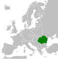 Kingdom of Romania (1939).svg 450 × 456; 454 KB
-
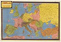 L'Europe en 1939 - Dessinée par Jacques Mercier - btv1b531214931.jpg 11,586 × 7,890; 12.55 MB
-
 Map of Africa in 1939.svg 365 × 365; 1.53 MB
-
 Mapa del África colonial (1939).svg 1,525 × 1,440; 912 KB
-
 Poland in 1939.jpg 503 × 550; 121 KB
-
 SS Winnipeg journey (1939).svg 714 × 842; 708 KB
-
 United States Coast Guard Auxiliary Organization.gif 695 × 403; 42 KB
-
 WW2 Map.png 1,094 × 1,117; 513 KB
-
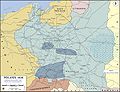 WWII-Poland-1939-communications and industry.jpg 1,280 × 984; 1.15 MB
-
 Карта Карпатської України (1939).png 980 × 985; 68 KB


.png)
.svg)


.svg)

._Summer_1939._26,_5_kms_-_btv1b531969802.jpg)
.svg)


.svg)

.svg)


.png)