Category:Maps of the Tel Aviv District
Jump to navigation
Jump to search
Subcategories
This category has the following 8 subcategories, out of 8 total.
B
- Maps of Bat Yam (4 F)
- Old maps of Bnei Brak (7 F)
G
- Maps of Givatayim (3 F)
H
- Maps of Herzliya (13 F)
- Maps of Holon (4 F)
R
- Maps of Ramat Gan (13 F)
T
Media in category "Maps of the Tel Aviv District"
The following 22 files are in this category, out of 22 total.
-
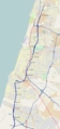 Ayalon Highway.PNG 1,258 × 2,665; 2.16 MB
-
 Gush Dan 1.jpg 722 × 1,110; 289 KB
-
 Israel telaviv dist.png 262 × 727; 43 KB
-
 Israel telaviv dist.svg 540 × 990; 76 KB
-
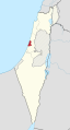
 Israel-Tel Aviv.png 100 × 301; 3 KB
-
 Location azor.png 408 × 710; 36 KB
-
 Location bneibrak.png 408 × 710; 36 KB
-
 Location kfarshmaryahu.png 408 × 710; 35 KB
-
 Location kiryatono.png 408 × 710; 36 KB
-
 Location oryehuda.png 408 × 710; 36 KB
-
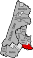
 Location ramatgan.png 408 × 710; 36 KB
-
 Location ramathasharon.png 408 × 710; 36 KB
-
 Location telaviv.png 400 × 696; 35 KB
-
 Septem-Israel location Tel Aviv.svg 200 × 510; 82 KB
-
 Tadistrict telaviv heb.png 816 × 1,420; 77 KB
-
 Tel Aviv District in Israel (semi-Israel areas hatched).svg 614 × 1,141; 337 KB
-
 Tel Aviv District in Israel he.svg 614 × 1,141; 356 KB
-
 Tel Aviv District in Israel.svg 614 × 1,141; 280 KB
-
 Tel Aviv district in Israel.svg 361 × 1,000; 2.33 MB
-
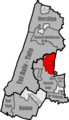
 Tel Aviv District.png 408 × 710; 41 KB
-
 Tel Aviv location map.png 271 × 475; 136 KB
-
 מחוז תל אביב.JPG 111 × 99; 13 KB


.svg)


