<nowiki>Category:Maps of Ben Gurion International Airport; categoría de Wikimedia; kategori Wikimedia; Wikimedia category; د ويکيمېډيا وېشنيزه; Vikimedya kategorisi; ویکیمیڈیا زمرہ; kategória projektov Wikimedia; категорія проєкту Вікімедіа; 维基媒体分类; Wikimedia-Kategorie; Викимедиина категорија; kategorija na Wikimediji; विकिपीडिया:श्रेणी; page de catégorie de Wikimedia; kategorija na Wikimediji; विकिपीडिया वर्ग; категорија на Викимедији; Wikimedia-Kategorie; Wikimedia-kategori; kategori Wikimédia; تصنيف ويكيميديا; pajenn rummata eus Wikimedia; Wikimedia:ကဏ္ဍခွဲခြင်း; 維基媒體分類; Wikimedia категориясы; categoría de Wikimedia; Wikimedia-Kategorie; Wikimedia-Kategorie; tudalen categori Wikimedia; Viciméid catagóir; Վիքիմեդիայի նախագծի կատեգորիա; 维基媒体分类; Wikimedia-kategori; ვიკიპედია:კატეგორიზაცია; ウィキメディアのカテゴリ; categoria Wikimedia; تصنيف بتاع ويكيميديا; විකිමීඩියා ප්රභේද පිටුව; categoria Vicimediorum; Vikipidiya:Shopni; Wikimedia-luokka; Wikimedia category; guruhi Vikimedia; катэгорыя ў праекце Вікімэдыя; Викимедиа проектындагы төркем; catigurìa di nu pruggettu Wikimedia; หน้าหมวดหมู่วิกิมีเดีย; Wikimedia:Kategorija; Wikimedia-Kategorie; Wikimedia:Klassys; категория на Уикимедия; categorie a unui proiect Wikimedia; 維基媒體分類; Wikimedia-kategori; kawan Wikimèdia; 維基媒體分類; 위키미디어 분류; Wikimedia-bólkur; kategorio en Vikimedio; kategori Wikimedia; Wikimedia:Ronnaghys; উইকিমিডিয়া বিষয়শ্রেণী; kategori Wikimedia; 维基媒体分类; וויקימעדיע קאַטעגאָריע; kategorija w projektach Wikimedije; thể loại Wikimedia; Wikimedia projekta kategorija; kategoria ti Wikimedia; categoria de um projeto da Wikimedia; 维基媒体分类; категорияд Ангилал; Wikimedia-kategori; kategori Wikimedia; پۆلی ویکیمیدیا; Wikimedia category; Vikimédia ñemohenda; Wikimédia-kategória; વિકિપીડિયા શ્રેણી; Wikimediako kategoria; категория в проекте Викимедиа; Wikimedia-Kategorie; катэгорыя ў праекце Вікімедыя; Wikimedia-kategorie; Wîkîmediya:Kategorî; विकिमिडिया श्रेणी; Wikimedia-Kategorie; קטגוריה במיזמי ויקימדיה; Викимедиа проектындагы төркем; Wikimedia-categorie; विकिमिडिया श्रेणी; κατηγορία εγχειρημάτων Wikimedia; Wikimedia-kategoriija; гурӯҳи Викимедиа; categoria de Wikimedia; categoría de Wikimedia; kategoria w projekcie Wikimedia; categoria di un progetto Wikimedia; Wikimedia-categorie; Wikimedia category; categurìa 'e nu pruggette Wikimedia; Wikimedia kategooria; 維基媒體分類; ردهٔ ویکیپدیا; Wikimedia proyektındağı törkem; гурӯҳи Викимедиа; ẹ̀ka Wikimedia; kategorie na projektech Wikimedia; categoria de um projeto da Wikimedia; Wikimedia-Kategorie; Wikimedia-categorie; tumbung Wikimedia; Wikimedia-kategorie; kategorija Wikimedije; kategorya ng Wikimedia; Викимедиа категорияһы; விக்கிமீடியப் பகுப்பு; kategori Wikimedia; jamii ya Wikimedia; വിക്കിമീഡിയ വർഗ്ഗം; 維基媒體分類; kategori Wikimedia; kategori e Wikimedias; زمرو:وڪيپيڊيا زمرا بندي; Wikimedia-kategory; categoría de Wikimedia; विकिमीडिया श्रेणी; 维基媒体分类; Kategoriya ning Wikimedia</nowiki>
Subcategories
This category has only the following subcategory.


 Ben Gurion Osm Map.png 1,358 × 924; 855 KB
 BenGurionAerodromeChart-2004.jpg 1,627 × 2,450; 1.17 MB
 BenGurionAerodromeChart-Red.jpg 3,282 × 2,192; 1.09 MB
 BenGurionAirportParking-Red.jpg 1,627 × 2,450; 1 MB
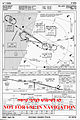 BenGurionInstruments-Red.jpg 1,627 × 2,450; 1.18 MB
 BenGurionTMA.jpg 3,396 × 2,499; 2.92 MB
 LyddaAirport.jpg 3,795 × 3,282; 6.23 MB
 NatbagGPLAN.PNG 640 × 400; 22 KB
 Plan of Lydda Air landing ground LOC matpc.03419.jpg 5,841 × 4,273; 2.52 MB
 Plan of Lydda Air landing ground LOC matpc.03419.tif 5,841 × 4,273; 23.8 MB
 TLV Map Ter 1.png 1,075 × 1,031; 321 KB
 TLV Map Ter 1a.png 938 × 720; 486 KB
 TLV Map Ter 3.png 1,224 × 1,114; 503 KB
 TLV Map Ter 3a.png 1,044 × 888; 530 KB
 WW2 British RAF diagram of the airport from an army pamphlet issued to the base staff.jpg 3,005 × 2,367; 1.59 MB


