Category:Maps of the Sinai Peninsula
Jump to navigation
Jump to search
See also:
Subcategories
This category has the following 3 subcategories, out of 3 total.
G
O
Media in category "Maps of the Sinai Peninsula"
The following 111 files are in this category, out of 111 total.
-
 Sinai map.PNG 327 × 350; 30 KB
-
 1822 Rüppell map of Arabia Petrea.jpg 4,164 × 2,809; 11.01 MB
-
 1826 Rüppell map of Arabia Petrea (Sinai).jpg 7,058 × 6,553; 6.21 MB
-
 1869 Ordnance Survey of the Peninsula of Sinai.jpg 8,429 × 6,117; 5.19 MB
-
 1956 Suez war - conquest of Sinai-ar.png 740 × 918; 1 MB
-
 1956 Suez war - conquest of Sinai.jpg 740 × 918; 132 KB
-
 1967 Six Day War - conquest of Sinai 5-6 June.jpg 740 × 918; 105 KB
-
 1967 Six Day War - conquest of Sinai 7-8 June He.jpg 740 × 918; 504 KB
-
 1967 Six Day War - conquest of Sinai 7-8 June.jpg 740 × 918; 117 KB
-
 1979 Sinai lines (30848925546).jpg 2,520 × 3,301; 1.21 MB
-
 1979 Sinai zones (30583778400).jpg 2,550 × 3,225; 586 KB
-

-

-
 Aegyptus Et Arabia Petraea (2).jpg 3,927 × 5,136; 5.19 MB
-
 Camp davideko hitzarmenak (1979).jpg 564 × 848; 92 KB
-
 D075-Péninsule du Sinaï.-L2-Ch5.png 1,501 × 1,902; 490 KB
-
 Dahab-location.png 144 × 167; 6 KB
-
 Duguid map opp p.48Arish.jpeg 687 × 887; 143 KB
-
 Dynamap suez.png 450 × 415; 33 KB
-
 Egypt - 1 .jpg 290 × 317; 26 KB
-
 Egypt - Great Bitter Lake - contoured by Lieut. Pratt ; War Office - btv1b101043081.jpg 12,960 × 17,797; 42.19 MB
-
 Egypt and Sinai peninsula - Port Said - War Office - btv1b10104309g.jpg 13,086 × 15,139; 26.84 MB
-
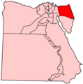
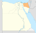 Egypt North Sinai locator map.svg 1,055 × 956; 355 KB
-
 Egypt Sinai location map.svg 499 × 796; 219 KB
-
 Egypt Sinai locator map.png 856 × 920; 157 KB
-
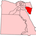
 Egypt South Sinai locator map.svg 1,055 × 956; 359 KB
-
 Egypt, Sinai Peninsula. LOC 91681412.tif 2,140 × 2,821; 17.27 MB
-
 Egypt-Janub Sina.png 200 × 201; 22 KB
-
 Egypt-region-map-cities-2.gif 310 × 373; 14 KB
-
 Egypt-Shamal Sina.png 200 × 201; 5 KB
-
 Egypt–Israel Peace Treaty - es.svg 1,060 × 1,766; 2.47 MB
-
 Egypt–Israel Peace Treaty - ru.svg 1,060 × 1,766; 1.92 MB
-
 Falls SkBEasternDesert.jpeg 2,917 × 2,250; 1.21 MB
-
 Falls SkBEasternDesertDet.jpeg 1,079 × 888; 203 KB
-
 Flag Map of South Sinai.png 1,630 × 1,807; 162 KB
-
 Jebel Musa in the 1869 Ordnance Survey of the Peninsula of Sinai (cropped).jpg 1,331 × 1,091; 351 KB
-
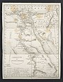
 Karte des peträischen Arabien und des Südlichen Theiles Von Sirien.jpg 6,930 × 9,229; 16.86 MB
-
 Karte Sinai Exodus.png 1,975 × 1,877; 4.77 MB
-
 Map 3 Sinai detail Keogh p.26.jpeg 591 × 445; 125 KB
-
 Map 5 Romani-Katia 5MB.jpeg 1,112 × 704; 250 KB
-
 Map 5 Romani-Katia.jpeg 1,175 × 729; 288 KB
-
 Map of the Sinai campaign.png 406 × 622; 477 KB
-
 Map of the Sinai peninsula to illustrate the Turco-Egyptian frontier dispute.jpg 818 × 1,104; 111 KB
-
 Map showing Turco-Egyptian Boundrary of 1st October 1906.jpg 859 × 1,567; 162 KB
-
 Mapa C.png 3,157 × 1,990; 386 KB
-
 MapBattleOfRomaniHebrew.png 800 × 346; 50 KB
-
 Mappa Esodo.jpg 451 × 457; 252 KB
-
 Mapromani67.jpg 640 × 591; 59 KB
-
 MapSinaiWWI.jpg 1,400 × 806; 276 KB
-
 Mountseirsinaiwe00hull Page 214.png 1,365 × 1,920; 370 KB
-
 Mountseirsinaiwe00hull Page 236.png 1,848 × 2,546; 3.64 MB
-
 Multinational Peacekeeping Force on the Sinai Peninsula.png 526 × 629; 60 KB
-
 New-state solution.webp 4,722 × 2,180; 225 KB
-
 Northern Sinai and southern Palestine.jpg 1,184 × 712; 99 KB
-

-
 Philip's Strategical map of Palestine, Syria and the Sinai peninsula - btv1b53209966f.jpg 9,411 × 11,949; 25.55 MB
-
 Political arrangements in Sinai.svg 512 × 816; 193 KB
-
 Chet-route01.jpg 956 × 1,196; 367 KB
-
 Samaritans, Shechem, Har Beracha, Shomron, Palestine 27.jpg 1,880 × 2,816; 858 KB
-
 Samaritans, Shechem, Har Beracha, Shomron, Palestine 28.jpg 1,880 × 2,816; 984 KB
-
-
 Sharm el Sheikh map OSM.png 1,673 × 1,427; 234 KB
-
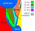
 Sinai - Camp David Treaty Zones - ar.svg 1,060 × 1,766; 1.92 MB
-
 Sinai Campaign - Opening Phase - Hebrew.jpg 908 × 1,127; 614 KB
-
 Sinai insurgency map.png 750 × 1,196; 149 KB
-
 Sinai insurgency.svg 499 × 796; 246 KB
-
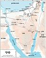
 Sinai location map.png 460 × 669; 60 KB
-
 Sinai Locator map.png 1,055 × 973; 101 KB
-
 Sinai MFO-HE.png 289 × 256; 21 KB
-
 Sinai MFO.PNG 289 × 256; 11 KB
-
 Sinai Peninsula - Akaba - War Office - btv1b10104288z.jpg 17,472 × 14,737; 37.41 MB
-

-
 Sinai Peninsula - Bodhia - War Office - btv1b10104303s.jpg 13,158 × 15,753; 40.11 MB
-
 Sinai Peninsula - El Kossaima - War Office - btv1b101043153.jpg 13,074 × 15,273; 36.42 MB
-
 Sinai Peninsula - El Mayein - War Office - btv1b10104299t.jpg 13,092 × 15,692; 39.89 MB
-
 Sinai Peninsula - El Themed - War Office - btv1b10104305p.jpg 13,110 × 15,739; 35.98 MB
-
 Sinai Peninsula - en.svg 1,060 × 1,766; 1.89 MB
-
 Sinai Peninsula - es-2.svg 1,060 × 1,766; 2.25 MB
-

-
 Sinai Peninsula - Giddi - War Office - btv1b10104297x.jpg 13,098 × 15,710; 36.47 MB
-
 Sinai Peninsula - Little Bitter Lake - War Office - btv1b10104294k.jpg 13,080 × 15,127; 34.82 MB
-
 Sinai Peninsula - mk.svg 1,060 × 1,766; 2.25 MB
-
 Sinai Peninsula - Nekhl - War Office - btv1b101043047.jpg 13,248 × 15,259; 34.1 MB
-

-
 Sinai Peninsula - Rafa - War Office - btv1b101043208.jpg 17,286 × 14,487; 50.01 MB
-
 Sinai Peninsula - ru.svg 1,060 × 1,766; 1.85 MB
-
 Sinai Peninsula - Sabkhet El Bardawil - War Office - btv1b101042951.jpg 13,836 × 20,889; 51.39 MB
-
 Sinai Peninsula - Suez - War Office - btv1b10104287h.jpg 17,658 × 14,797; 47.82 MB
-
 Sinai Peninsula - Suez - War Office - btv1b10104302b.jpg 13,044 × 15,169; 35.44 MB
-
 Sinai Peninsula - uk.svg 1,060 × 1,766; 1.86 MB
-

-
 Sinai Peninsula - Wadi Geraia - War Office - btv1b10104442c.jpg 14,400 × 15,662; 22.72 MB
-
 Sinai Peninsula - Wadi Jerafi - War Office - btv1b101043064.jpg 13,092 × 15,750; 40 MB
-
 Sinai Peninsula - Yelleg East - War Office - btv1b10104314n.jpg 13,446 × 15,834; 39.77 MB
-
 Sinai relief location map.svg 1,060 × 1,766; 1.73 MB
-
 Sinai-Airbases.png 1,066 × 1,226; 789 KB
-
 Sinai-Flugplätze.png 1,066 × 1,226; 791 KB
-
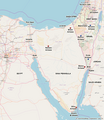
 Sinai-peninsula-map He.jpg 941 × 1,168; 651 KB
-
 Sinai-peninsula-map-ar.jpg 941 × 1,168; 624 KB
-
 Sinai-peninsula-map.jpg 941 × 1,168; 665 KB
-
 Sinai-WW1-1.jpg 860 × 732; 83 KB
-
 Sinai.blank.jpg 902 × 1,129; 286 KB
-
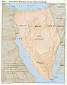
 SinaiPeninsulaTopography.jpg 417 × 799; 41 KB
-
 Strait tiran 83-ar.jpg 996 × 1,264; 370 KB
-
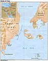 Strait tiran 83.jpg 996 × 1,264; 198 KB
-
 Strait tiran he.svg 1,594 × 1,964; 563 KB
-
 Strait tiran-HE.jpg 981 × 1,209; 262 KB
-
 STS-107 Sinai peninsula.jpg 2,048 × 3,072; 2.13 MB
-

-
 מבצע קדש- מפה.jpg 250 × 310; 74 KB
-
 רמת א-תיה.jpg 941 × 1,168; 645 KB


.jpg)


.jpg)
.jpg)
.jpg)
%27_(11191615164).jpg)
.jpg)
.jpg)


.jpg)


_(14781471581).jpg)


.jpg)


_(14762414554).jpg)

