Category:Maps of the Kingdom of Odoacer
Jump to navigation
Jump to search
Media in category "Maps of the Kingdom of Odoacer"
The following 16 files are in this category, out of 16 total.
-
 4KLEONID.png 3,840 × 2,160; 505 KB
-
 Central Europe 5th Century.jpg 1,088 × 763; 457 KB
-
 Kingdom of Odoacer - 476 AD.png 3,711 × 3,908; 905 KB
-
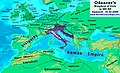 Odoacer 480ad.jpg 900 × 545; 701 KB
-
 Odoacer Kingdom.jpg 286 × 305; 22 KB
-
 Roman-Empire 477ad-es.svg 512 × 287; 36 KB
-
 Roman-Empire 477ad-hu.svg 512 × 287; 37 KB
-
 Roman-Empire 477ad-pt.svg 512 × 287; 28 KB
-
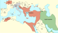
 Roman-Empire 477ad.jpg 1,405 × 954; 372 KB
-
 Spruner-Menke Handatlas 1880 Karte 01.jpg 10,401 × 8,722; 16.44 MB
-
 Vandali.jpg 1,477 × 2,032; 2.56 MB
-
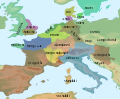
 Western Europe 5th Century ang.svg 700 × 575; 2.3 MB
-
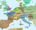
 Western Europe 5th Century en.svg 700 × 575; 2.3 MB
-
 Western Europe 5th Century es.svg 700 × 575; 2.3 MB
-
 Western Europe 5th Century la.svg 700 × 575; 2.3 MB
-
 Western Europe 5th Century pt.svg 700 × 575; 2.3 MB


