Category:Maps of 5th-century Europe
Jump to navigation
Jump to search
| Preceded by: Maps of 4th-century Europe |
5th century maps of Europe 401 AD-500 AD |
Succeeded by: Maps of 6th-century Europe |
Subcategories
This category has the following 5 subcategories, out of 5 total.
F
M
- Maps of Gauls in the 5th-century (10 F)
- Maps of the Kingdom of Odoacer (16 F)
S
- Siagrius kingdom (486) (12 F)
Media in category "Maps of 5th-century Europe"
The following 117 files are in this category, out of 117 total.
-
 A history of Rome (1917) (14761644194).jpg 2,058 × 2,922; 1.26 MB
-
 A history of Rome (1917) (14783871183).jpg 2,020 × 2,928; 844 KB
-
 2022 10 16 - Westgermanisch – um 476 - END.png 2,752 × 2,811; 3.75 MB
-
 2022 11 13 - Map West Germanic – cc. 476 CE - final.png 2,752 × 2,811; 3.73 MB
-
 Europe en 400.pdf 1,752 × 1,239; 444 KB
-
 Europa BV042512114.jpg 1,171 × 1,197; 204 KB
-
 406 CE, Europe.svg 512 × 438; 1.76 MB
-
 420 CE, Europe.svg 512 × 438; 1.76 MB
-
 Europe en 450.pdf 1,752 × 1,239; 457 KB
-
 450 roman-hunnic-empire-es.svg 1,648 × 1,049; 2.25 MB
-
 450 roman-hunnic-empire-fr.svg 1,648 × 1,049; 1.69 MB
-
 450 roman-hunnic-empire-pt.svg 1,648 × 1,049; 3.11 MB
-
 451 CE, Europe.svg 512 × 438; 1.5 MB
-
 Map of Europe, 459 CE.png 2,602 × 1,393; 540 KB
-
 Atlas of European history (1909) (14597297739).jpg 2,170 × 1,600; 832 KB
-
 476 CE, Europe.svg 512 × 438; 1.48 MB
-
 476eur.jpg 620 × 411; 221 KB
-
 38 of '(Italy and her Invaders, Vol. 1-4.)' (11217687916).jpg 2,995 × 2,485; 1.53 MB
-
 500 fall-roman-empire-fr.svg 1,648 × 1,049; 1.83 MB
-
 558 of '(Italy and her Invaders, Vol. 1-4.)' (11218598665).jpg 2,336 × 1,469; 1,019 KB
-

-
 Ahdofour1.jpg 2,977 × 2,273; 4.26 MB
-
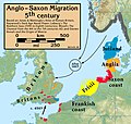 Anglo.Saxon.migration.5th.cen.jpg 1,800 × 1,703; 875 KB
-
 Central Europe End 5th Century German.jpg 1,088 × 763; 519 KB
-
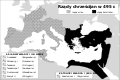
 Christian states 495 AD (en).png 2,436 × 1,372; 358 KB
-
 Christian states 495 AD (en).svg 2,436 × 1,372; 3.61 MB
-
 Christian states 495 AD (pl).svg 946 × 631; 122 KB
-
 Christian states 495 AD (ru).svg 946 × 631; 123 KB
-
 Christian states 495 AD (tr).svg 946 × 631; 122 KB
-
 Christian states 495 AD-hu.svg 946 × 631; 132 KB
-
 Crossing of the Rhine map.jpg 5,476 × 3,310; 7.07 MB
-
 Detailed Domain of Soissons.svg 1,052 × 744; 663 KB
-
 East-Hem 476ad (cropped).jpg 1,042 × 685; 167 KB
-
 Empire of Attila.png 1,333 × 841; 644 KB
-
 Europa anno 469.png 1,500 × 897; 438 KB
-
 Europa BV042518417 (cropped).jpg 1,132 × 1,066; 192 KB
-
 Europa BV042518459.jpg 1,954 × 1,337; 308 KB
-
 Europa BV043417545.jpg 1,954 × 1,337; 311 KB
-
 Europe and the Near East at 476 AD.png 2,830 × 1,967; 1.58 MB
-
 Europe at the fall of the Western Roman Empire in 476.jpg 5,491 × 3,506; 4.35 MB
-
 Europe en 401.pdf 1,752 × 1,239; 444 KB
-
 Europe en 451.pdf 1,752 × 1,239; 456 KB
-
 Europe in the Migration Period in the 4th and 5th centuries.jpg 5,476 × 3,310; 4.33 MB
-
 Europe map 450 PL.PNG 800 × 580; 158 KB
-
 Europe map 450-ar.png 800 × 580; 158 KB
-
 Europe map 450.PNG 800 × 580; 145 KB
-
 Európa 450 körül.png 801 × 580; 143 KB
-
 Európa 454.svg 512 × 542; 11.51 MB
-
 Európa 500-es.svg 1,042 × 1,100; 4.07 MB
-
 Európa 500.svg 512 × 542; 4.91 MB
-
 Franken Expansion bis 6Jhdt.png 2,102 × 1,674; 856 KB
-
 Gothic Kingdoms.png 608 × 342; 59 KB
-
 Großbritannien BV042518600.jpg 1,954 × 1,337; 302 KB
-

-
 Illyricum & Dacia - AD 400.png 971 × 673; 972 KB
-
 Impero d'Occidente 410.PNG 900 × 595; 123 KB
-
 Impero d'Occidente 421.PNG 900 × 595; 122 KB
-
 Impero d'Occidente 445.PNG 900 × 595; 124 KB
-
 Indo-Sassanid.jpg 762 × 545; 581 KB
-
 Invasionsbarbares.PNG 624 × 575; 107 KB
-
 Karta pereseleniya.jpg 1,000 × 707; 121 KB
-
 Karte völkerwanderung.jpg 1,000 × 663; 116 KB
-
 Khazars498.jpg 402 × 480; 115 KB
-
 Kingdom of the Suebi Map c.455.png 2,000 × 1,701; 159 KB
-
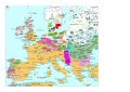
 Los reinos germánicos en el siglo V.png 1,016 × 774; 734 KB
-
 MajorianEmpire.png 1,220 × 1,385; 1.51 MB
-
 Map Gaul divisions 481-es.svg 755 × 784; 646 KB
-
 Map Gaul divisions 481-fr.svg 755 × 784; 283 KB
-
 Map Gaul divisions 481-nl.svg 755 × 784; 144 KB
-
 Map Gaul divisions 481-pl.svg 1,968 × 1,776; 1.09 MB
-
 Map Gaul divisions 481-pt.svg 755 × 784; 116 KB
-
 Map of the Christian world around the mediterranean in the 5th century AD.png 1,117 × 653; 206 KB
-
 Maps, and tables of chronology and genealogy; (1831) (14759314116).jpg 3,216 × 2,504; 1.31 MB
-

-
 NE 475ad.jpg 1,406 × 1,028; 233 KB
-
 NE 500ad.jpg 1,424 × 1,049; 238 KB
-
 Near East480ad.jpg 1,402 × 1,023; 226 KB
-
 North.Sea.Periphery.250.500.jpg 2,031 × 2,463; 820 KB
-
 Odoacer 480ad.jpg 900 × 545; 701 KB
-
 OldMapKent.jpg 410 × 324; 90 KB
-
 Ostmitteleuropa BV042518454.jpg 1,954 × 1,337; 307 KB
-
 Public Schools Historical Atlas - Europe 476-493.jpg 1,579 × 1,239; 610 KB
-
 Putz22.jpg 2,535 × 2,001; 976 KB
-
 Regne visigot de Tolosa 490-507.svg 653 × 678; 38 KB
-
 Reino de los visigodos-cs.svg 653 × 670; 35 KB
-
 Reino de los visigodos-de.svg 653 × 670; 124 KB
-
 Reino de los visigodos-en.svg 653 × 670; 38 KB
-
 Reino de los visigodos-gl.png 1,000 × 1,025; 142 KB
-
 Reino de los visigodos-it.svg 653 × 670; 35 KB
-
 Reino de los visigodos-pl.svg 653 × 670; 35 KB
-
 Reino de los visigodos-pt.svg 649 × 663; 18 KB
-
 Reino de los visigodos-sh.svg 653 × 670; 35 KB
-
 Reino de los visigodos-sr.svg 653 × 670; 35 KB
-
 Reino de los visigodos-zh.svg 653 × 670; 35 KB
-
 Reino de los visigodos.svg 653 × 678; 59 KB
-
 Roman Empire 460.png 1,131 × 808; 162 KB
-
 Rome - its rise and fall; a text-book for high schools and colleges (1900) (14598102770).jpg 2,660 × 3,860; 1.17 MB
-
 Royaume des Wisigoths.jpg 599 × 611; 348 KB
-
 Saxon.emigration.5th.cen.jpg 2,301 × 2,140; 1,000 KB
-
 South-east Sicily Citites of V century.jpg 558 × 325; 18 KB
-
 Vandali.jpg 1,477 × 2,032; 2.56 MB
-
 Vandals Migration 406-418.png 905 × 881; 133 KB
-
 Vandals Migration it.PNG 1,725 × 1,739; 527 KB
-
 Vandals Migration pt.gif 1,725 × 1,739; 236 KB
-
 Vandals Migration ua.PNG 1,725 × 1,739; 536 KB
-
 Vatra.jpg 2,128 × 1,515; 203 KB
-
 Visigoth Kingdom-de.png 599 × 611; 205 KB
-
 Visigoth Kingdom.jpg 599 × 611; 81 KB
-
 Visigothic Kingdom Map c.500.png 1,985 × 1,686; 230 KB
-
 Western Europe 5th Century ang.svg 700 × 575; 2.3 MB
-
 Western Europe 5th Century en.svg 700 × 575; 2.3 MB
-
 Western Europe 5th Century la.svg 700 × 575; 2.3 MB
-
 Western Europe in 481 AD According to Heinz Ritter-Schaumburg.png 730 × 630; 168 KB
-
 Western Europe in 500 AD According to Heinz Ritter-Schaumburg.png 730 × 630; 159 KB
-
 Historical atlas of modern Europe 1903 (135895337).jpg 9,181 × 6,734; 53.44 MB
-
 Гунны 2.jpg 696 × 435; 57 KB
-
 הממלכה הוויזיגותית.svg 653 × 670; 56 KB
_(14761644194).jpg)
_(14783871183).jpg)


_(14597297739).jpg)


%27_(11217687916).jpg)

%27_(11218598665).jpg)
.jpg)


.png)
.svg)
.svg)
.svg)
.svg)


.jpg)


.jpg)


_(14759314116).jpg)
_(14782974695).jpg)


_(14598102770).jpg)


.jpg)

