Category:Maps of the Bronx, New York City
Jump to navigation
Jump to search
Boroughs of New York City: Bronx · Brooklyn · Manhattan · Queens · Staten Island
Counties of New York City: Bronx · Kings (Brooklyn) · New York (Manhattan) · Queens · Richmond (Staten Island)
Counties of New York City: Bronx · Kings (Brooklyn) · New York (Manhattan) · Queens · Richmond (Staten Island)
Wikimedia category | |||||
| Upload media | |||||
| Instance of | |||||
|---|---|---|---|---|---|
| Category combines topics | |||||
| The Bronx | |||||
borough of New York City, New York, United States     | |||||
| Instance of | |||||
| Named after | |||||
| Location | New York City, New York | ||||
| Located in or next to body of water |
| ||||
| Head of government |
| ||||
| Inception |
| ||||
| Population |
| ||||
| Area |
| ||||
| Elevation above sea level |
| ||||
| official website | |||||
 | |||||
Subcategories
This category has the following 20 subcategories, out of 20 total.
1
M
- Maps of Bedford Park, Bronx (33 F)
- Maps of Belmont, Bronx (11 F)
- Maps of Bronx Park (16 F)
- Maps of City Island, Bronx (24 F)
- Maps of Fordham, Bronx (23 F)
- Maps of Jerome Park, Bronx (27 F)
- Maps of Kingsbridge, Bronx (19 F)
- Maps of Norwood, Bronx (64 F)
- Maps of Pelham Bay Park (17 F)
- Maps of Spuyten Duyvil, Bronx (13 F)
- Maps of Van Cortlandt Park (17 F)
- Maps of West Farms, Bronx (8 F)
- Maps of Woodlawn, Bronx (29 F)
O
Media in category "Maps of the Bronx, New York City"
The following 57 files are in this category, out of 57 total.
-
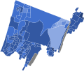
 2020 New York State Assembly District 77 election by precint.svg 800 × 1,396; 45 KB
-
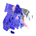
 2020 New York State Assembly District 81 election by precint.svg 800 × 679; 91 KB
-
 2020 New York State Assembly District 82 election by precint.svg 800 × 1,005; 177 KB
-
 2020 New York State Assembly District 83 election by precint.svg 800 × 873; 48 KB
-

-
 30 years of progress, 1934-1964 - Sheridan Expressway 01.jpg 1,504 × 1,108; 370 KB
-
 30 years of progress, 1934-1964 - Sheridan Expressway 02.jpg 609 × 533; 102 KB
-
 34th St Hudson Yards td 23 - R211 Open House.jpg 3,864 × 5,152; 7.58 MB
-

-

-
 Bronx Borough President 2021.svg 744 × 744; 804 KB
-
 Bronx Highlight New York City Map Julius Schorzman.png 2,652 × 2,582; 4.67 MB
-
 Bronx Plate 35 OSM Overlay with Fleetwood Outline.jpg 5,996 × 4,052; 16.33 MB
-
 Bronx Plate 35 OSM Overlay.jpg 5,996 × 4,052; 16.38 MB
-
 Bronx-NY-Landuse-Parks.png 2,480 × 2,480; 3.38 MB
-
 Bronxpoverty.JPG 550 × 595; 212 KB
-
 Bronxrace.PNG 745 × 549; 416 KB
-
 Claremont and Crotona Parks Topo Map 1956.png 2,360 × 2,168; 10.75 MB
-
 Claremont and Crotona Parks Topo Map 2019.png 2,580 × 2,240; 7.79 MB
-
 Claremont Park 1912 Map.jpg 2,468 × 3,165; 3.25 MB
-
 Crotona Park 1894 map.jpg 9,702 × 5,963; 13.59 MB
-
 Crotona Park 1912 Map.jpg 2,792 × 3,465; 10.3 MB
-
 E233rdSt map.png 1,688 × 984; 88 KB
-

-

-
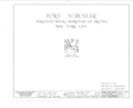 Fort Schuyler, Throgg's Neck, Bronx, Bronx County, NY HABS NY,3-BRONX,3- (sheet 0 of 12).png 9,312 × 7,584; 1.23 MB
-

-
 Fort Schuyler, Throgg's Neck, Bronx, Bronx County, NY HABS NY,3-BRONX,3- (sheet 1 of 12).png 9,308 × 7,584; 2.11 MB
-

-
 Green Flats from USGS Flushing Quad 1966.png 1,101 × 902; 540 KB
-
 Gun Hill Road (Bronx) map.png 1,688 × 984; 99 KB
-
 Hurricane Sandy Hazardous Waste Pickup Sites - Bronx County (8211192699).jpg 4,608 × 3,456; 7.47 MB
-
 Map of New York highlighting Bronx County.svg 6,599 × 5,030; 112 KB
-
 New York City - Bronx.PNG 1,326 × 1,291; 54 KB
-
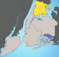
 New York City location Bronx.svg 2,000 × 1,978; 137 KB
-
 NOAA Chart 12366 (2008).jpg 9,398 × 8,843; 12.63 MB
-
 NYC Parks Bronx Aqueduct Walk IMG 3905 HLG.jpg 3,024 × 4,032; 3.13 MB
-
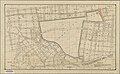
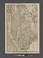
 Part of ward 24, city of New York 1893.jpg 10,981 × 7,242; 9.97 MB
-
 Philipsburg manor map.png 1,000 × 1,392; 525 KB
-
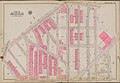 Plate 27, Part of Section 10, Borough of the Bronx 1911.jpg 6,588 × 4,582; 6.1 MB
-
 Plate 27, Part of Section 10, Borough of the Bronx 1921.jpg 6,351 × 4,486; 5.23 MB
-
 RiverdaleBronxNY.jpg 227 × 230; 13 KB
-
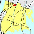
 New York State Senate District 29.png 2,917 × 2,480; 547 KB
-
 New York State Senate District 32 (2012).png 2,740 × 2,480; 537 KB
-
 New York State Senate District 33 (2012).png 2,740 × 2,480; 537 KB
-
 New York State Senate District 34 (2012).png 2,740 × 2,480; 547 KB
-
 New York State Senate District 36 (2012).png 2,740 × 2,480; 537 KB
-
 Simcoe map.jpg 475 × 401; 58 KB
-
 Southern part of the borough of the Bronx, from the Bronx Kills to Kingsbridge (1912).jpg 8,706 × 11,605; 35.16 MB
-
 Spuyten Duyvil derailment site map.svg 599 × 594; 163 KB
-

-
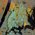 US-NY-Bronx-Landsat-2022-05-26-Bands564-parks.png 2,480 × 2,480; 1.75 MB
-
 US-NY-Bronx-Landsat-2022-05-26-Bands652-parks.png 2,480 × 2,480; 1.76 MB
-
 USCGS Chart number 361 (1884).jpg 10,400 × 13,200; 11.86 MB
-
 Wakefield.JPG 226 × 230; 13 KB
-
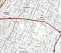
 Walking directions to Crotona Park Wiki Picnic Area.png 3,172 × 2,348; 1.26 MB
-
 WoodlawnBronxNYC.JPG 227 × 230; 13 KB


_(16664170311).jpg)


.png)


.png)
.png)
.png)

_map.png)
.jpg)


.jpg)


.png)
.png)
.png)
.png)

.jpg)

_Sheet_11.jpg)


.jpg)


