Category:Maps of City Island, Bronx
Jump to navigation
Jump to search
Media in category "Maps of City Island, Bronx"
The following 24 files are in this category, out of 24 total.
-
-
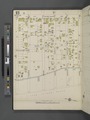
 Bronx, V. 18, Plate No. 88 (Map bounded by Elizabeth St., Minnieford Ave., Bowne St.) NYPL2001692.tiff 6,648 × 8,871, 2 pages; 168.79 MB
-
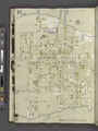
 Bronx, V. 18, Plate No. 89 (Map bounded by Elizabeth St., Bowne St., Minnieford Ave.) NYPL2001693.tiff 6,719 × 8,967, 2 pages; 172.44 MB
-
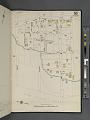 Bronx, V. 18, Plate No. 90 (Map bounded by City Island Ave., Bay St., Bowne St.) NYPL2001694.tiff 6,696 × 8,936, 2 pages; 171.25 MB
-
 Bronx, V. 18, Plate No. 91 (Map bounded by Long Island Sound, Fordham St., City Island Ave., Bowne St.) NYPL2001695.tiff 6,719 × 8,967, 2 pages; 172.44 MB
-
 Bronx, V. 18, Plate No. 92 (Map bounded by Long Island Sound, Centre St., City Island Ave., Bay St.) NYPL2001696.tiff 6,696 × 8,936, 2 pages; 171.25 MB
-
 Bronx, V. 18, Plate No. 93 (Map bounded by City Island Ave., Centre St., Long Island Sound, Bay St.) NYPL2001697.tiff 6,719 × 8,967, 2 pages; 172.44 MB
-
 Bronx, V. 18, Plate No. 94 (Map bounded by Centre St., City Island Ave., Horton St., Long Island Sound) NYPL2001698.tiff 6,687 × 8,924, 2 pages; 170.79 MB
-
 Bronx, V. 18, Plate No. 95 (Map bounded by Centre St., Long Island Sound, Horton St., City Island Ave.) NYPL2001699.tiff 6,719 × 8,967, 2 pages; 172.44 MB
-
 Bronx, V. 18, Plate No. 96 (Map bounded by Long Island Sound, Horton St.) NYPL2001700.tiff 6,710 × 8,955, 2 pages; 171.97 MB
-
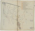
 Bronx, V. 3, Double Page Plate No. 45 (Map bounded by Long Island Sound, Belden Point, Bridge St.) NYPL2021344.tiff 7,144 × 5,358, 2 pages; 109.57 MB
-
 Bronx, V. B, Plate Letter. A (Map bounded by Eastchester Bay, Beach St., Long Island Sound) NYPL2001779.tiff 6,639 × 8,859, 2 pages; 168.33 MB
-
 Bronx, V. B, Plate Letter. B (Map bounded by Long Island Sound, Bay Ave., Adams St., Easterchester Bay) NYPL2001780.tiff 6,720 × 8,968, 2 pages; 172.48 MB
-

-
 Bronx, V. B, Plate Letter. D (Map bounded by Duryea Pl., Long Island Sound, Eastchester Bay) NYPL2001782.tiff 6,720 × 8,968, 2 pages; 172.48 MB
-
 Bronx, V. B, Plate No. 51 (Map bounded by Eastchester Bay, Terrace Place, Long Island Sound, Beach St.) NYPL2021188.tiff 5,345 × 7,126, 2 pages; 109.03 MB
-
 Bronx, V. B, Plate No. 52 (Map bounded by Long Island Sound, Bay St., Beach St.) NYPL2021189.tiff 5,380 × 7,174, 2 pages; 110.48 MB
-
 Bronx, V. B, Plate No. 53 (Map bounded by Long Island Sound, Centre St., Eastchester Bay, Bay St., Tier St.) NYPL2021190.tiff 5,350 × 7,133, 2 pages; 109.24 MB
-
 Bronx, V. B, Plate No. 54 (Map bounded by Long Island Sound, Eastchester Bay) NYPL2021191.tiff 5,380 × 7,174, 2 pages; 110.48 MB
-
 Green Flats from USGS Flushing Quad 1966.png 1,101 × 902; 540 KB
-
 Plate 35- City Island, Pelham Township, Westchester Co. N.Y. NYPL1516823.tiff 5,248 × 6,043; 91.39 MB
-

-

-
 USCGS Chart number 361 (1884).jpg 10,400 × 13,200; 11.86 MB
_-_Bronx_County_-_Bronx_County_-_ED_3-1_to_2101_-_NARA_-_24066691_(page_1).jpg)

.jpg)