Category:Maps of territories in the Burgundian Circle
Jump to navigation
Jump to search
The Burgundian Circle" was created in 1512 and comprised the following states:
- Artois, Bergh, Brabant, Flandres/Flandern, Franche-Comté, Groningen, Guelders, Hainault/Hennegau, Luxemburg, Mechlin, Namur, Tournai
- until 1588: Jever
- until 1648: Breda, Egmond and Ijsselstein, Friesland, Holland, Hoorn, Overijssel with Drenthe, Utrecht, Zeeland/Seeland
Subcategories
This category has the following 13 subcategories, out of 13 total.
B
D
L
M
N
R
V
Media in category "Maps of territories in the Burgundian Circle"
The following 41 files are in this category, out of 41 total.
-
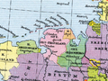
 Burgundian Circle-2005-10-15-fr.png 727 × 714; 68 KB
-
 Blaeu 1645 - Novus XVII Inferioris Germaniæ Provinciarum typus.jpg 3,614 × 3,040; 1.97 MB
-
 Locator Duchy of Guelders and County of Zutphen (1350).svg 2,818 × 3,608; 431 KB
-
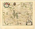
 Atlas Cosmographicae (Mercator) 153.jpg 2,653 × 1,934; 1.68 MB
-
 Atlas Cosmographicae (Mercator) 155.jpg 2,655 × 2,065; 2.09 MB
-
 Blaeu 1645 - Prima pars Brabantæ cuius caput Lovanium.jpg 3,620 × 3,020; 1.32 MB
-
 Blaeu 1645 - Secunda pars Brabantiæ cuius urbs primaria Bruxellæ.jpg 3,614 × 3,025; 1.5 MB
-

-

-
 Burgundian Circle-2005-10-14-en.png 727 × 714; 67 KB
-
 Burgundian Circle-hu.PNG 610 × 599; 207 KB
-
 Duchy of Brabant and Duchy of Guelders (1350) locator map.svg 2,813 × 3,602; 384 KB
-
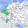
 Flandern 1400.png 454 × 365; 483 KB
-
 Friesische Seelande.png 1,191 × 666; 255 KB
-
 Jever Ostfriesland 1500.png 800 × 600; 1.13 MB
-
 Karte geldern.jpg 800 × 1,054; 198 KB
-
 Herrschaft Jever (1789).jpg 407 × 470; 99 KB
-
 Holland 1400.png 378 × 429; 447 KB
-
 Image-Map Bavaria-Straubing - Karte Straubing-Holland empty.png 1,000 × 984; 140 KB
-
 Locator County of Artois (1350).svg 2,818 × 3,608; 422 KB
-
 Locator County of Flanders (1350).svg 2,818 × 3,608; 422 KB
-
 Locator County of Holland (1350).svg 2,818 × 3,608; 427 KB
-
 Locator County of Loon (1350).svg 2,818 × 3,608; 427 KB
-
 Locator County of Luxembourg (1350).svg 2,818 × 3,608; 422 KB
-
 Locator County of Zeeland (1350).svg 2,818 × 3,608; 427 KB
-
 Locator County of Zutphen (1350).svg 2,818 × 3,608; 431 KB
-
 Locator Duchy of Brabant (1350).svg 2,818 × 3,608; 427 KB
-
 Locator Duchy of Brabant and Limburg (1350).svg 2,818 × 3,608; 427 KB
-
 Locator Duchy of Guelders (1350).svg 2,818 × 3,608; 427 KB
-
 Locator Lordship of Cuijk (1350).svg 2,818 × 3,608; 427 KB
-
 Locator Lordship of Kessel (1350).svg 2,818 × 3,608; 427 KB
-
 Locator Prince-Bishopric of Tournai (1350).svg 2,818 × 3,608; 427 KB
-
 Locator Prince-Bishopric of Utrecht (1350).svg 2,818 × 3,608; 427 KB
-
 Low Countries Locator Luxembourg.svg 1,550 × 2,000; 381 KB
-
 Luxemburg1477.png 295 × 351; 191 KB
-
 Map Bavaria-Straubing - Karte Straubing-Holland.png 1,000 × 984; 256 KB
-
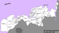
 Map of the Imperial Circles (1560)-NL cropped.svg 613 × 558; 341 KB
-
 Namur 1400.png 279 × 232; 196 KB
-
 Reiseroute von Johanna von Bayern 1370.png 1,000 × 983; 263 KB
-
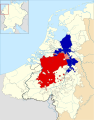
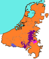 Spanish Netherlands.svg 750 × 900; 232 KB
-
 War of the Brabantian Succession (1355–1357) locator map.svg 2,813 × 3,602; 388 KB


.svg)
_153.jpg)
_155.jpg)


_locator_map.svg)


.jpg)

.svg)
.svg)
.svg)
.svg)
.svg)
.svg)
.svg)
.svg)
.svg)
.svg)
.svg)
.svg)
.svg)
.svg)


-NL_cropped.svg)


_locator_map.svg)