Category:Maps of ethnic groups in Germany
Jump to navigation
Jump to search
Countries of Europe: Albania · Armenia‡ · Austria · Azerbaijan‡ · Belarus · Bosnia and Herzegovina · Bulgaria · Croatia · Cyprus‡ · Czech Republic · Estonia · Georgia‡ · Germany · Greece · Hungary · Italy · Kazakhstan‡ · Latvia · Lithuania · Moldova · Montenegro · Netherlands‡ · North Macedonia · Norway · Poland · Romania · Russia‡ · Serbia · Slovakia · Slovenia · Sweden · Turkey‡ · Ukraine · United Kingdom
Limited recognition: Abkhazia‡ · Kosovo · Transnistria
‡: partly located in Europe
Limited recognition: Abkhazia‡ · Kosovo · Transnistria
‡: partly located in Europe
Subcategories
This category has the following 6 subcategories, out of 6 total.
2
S
- Spaniards in Germany (33 F)
Media in category "Maps of ethnic groups in Germany"
The following 13 files are in this category, out of 13 total.
-
 AuslaenderanteileMuenchen1997.png 650 × 969; 67 KB
-
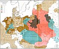
 Deutsche Stämme im Frühmittelalter.jpg 596 × 720; 153 KB
-
 Eritrean population in Germany by state.svg 1,073 × 1,272; 610 KB
-
 Foreign pop.png 1,320 × 1,020; 80 KB
-
 Juden 1881.JPG 4,782 × 3,936; 3.96 MB
-
 Migrationshintergrund Kreise Zensus 2011.png 2,000 × 2,655; 1.56 MB
-
 Personen mit Migrationshintergrund 2012.svg 510 × 709; 682 KB
-
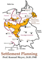 Planning Map for Ethnic German Settlement of Warthegau (annexed from Poland).png 1,040 × 1,438; 993 KB
-
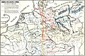
 Polabian Slavs.png 550 × 664; 141 KB
-
 Polen BV042512252.jpg 5,047 × 4,393; 2.25 MB
-
 Polen BV042513852.jpg 9,346 × 9,146; 6.46 MB
-
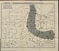
 Slavs west territory Limes Sorabicus.jpg 4,000 × 2,637; 7.69 MB
-


.png)


._LOC_2004628224.jpg)