Category:Maps of census statistical areas in Oklahoma
Jump to navigation
Jump to search
States of the United States: Alabama · Alaska · Arizona · Arkansas · California · Colorado · Connecticut · Delaware · Florida · Georgia · Idaho · Illinois · Indiana · Iowa · Kansas · Kentucky · Louisiana · Maine · Maryland · Massachusetts · Michigan · Minnesota · Mississippi · Missouri · Montana · Nebraska · Nevada · New Hampshire · New Jersey · New Mexico · New York · North Carolina · North Dakota · Ohio · Oklahoma · Oregon · Pennsylvania · Rhode Island · South Carolina · South Dakota · Tennessee · Texas · Utah · Vermont · Virginia · Washington · West Virginia · Wisconsin
Puerto Rico
Puerto Rico
Media in category "Maps of census statistical areas in Oklahoma"
The following 14 files are in this category, out of 14 total.
-
 Ardmore Micropolitan Area.png 574 × 293; 20 KB
-
 CherokeeOSTA.svg 800 × 395; 2.49 MB
-
 ChickasawOSTA.svg 800 × 395; 2.49 MB
-
 ChoctawOSTA.svg 800 × 395; 2.49 MB
-
 MuscogeeOSTA.svg 800 × 395; 2.49 MB
-
 Oklahoma CBSAs 2020.png 6,024 × 2,872; 1.1 MB
-
 Oklahoma City Metro.svg 7,784 × 3,886; 70 KB
-
 Oklahoma City Metropolitan Area and Oklahoma City-Shawnee CSA.png 574 × 293; 20 KB
-
 Oklahoma Tribal Areas.svg 800 × 395; 2.49 MB
-
 SeminoleOSTA.svg 800 × 395; 2.49 MB
-
 Tulsa Metro.svg 7,784 × 3,886; 71 KB
-
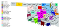
 Tulsametroarea2.PNG 558 × 297; 12 KB
-
 Tulsa Metropolitan Area and Tulsa-Bartlesville CSA.png 574 × 293; 20 KB
-
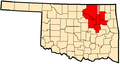
 TulsaMSA.PNG 633 × 384; 13 KB


